Met1985
-
Posts
16,564 -
Joined
-
Last visited
Content Type
Profiles
Blogs
Forums
American Weather
Media Demo
Store
Gallery
Everything posted by Met1985
-

2023-2024 Fall/Winter Mountain Thread
Met1985 replied to The Alchemist's topic in Southeastern States
NAM says congrats piedmont. -
2023-2024 Fall/Winter Mountain Thread
Met1985 replied to The Alchemist's topic in Southeastern States
The models are picking up on the cold air being delayed behind the moisture. -
2023-2024 Fall/Winter Mountain Thread
Met1985 replied to The Alchemist's topic in Southeastern States
Oh yeah especially currently. -
2023-2024 Fall/Winter Mountain Thread
Met1985 replied to The Alchemist's topic in Southeastern States
Euro still just token flakes. Sent from my SM-G998U using Tapatalk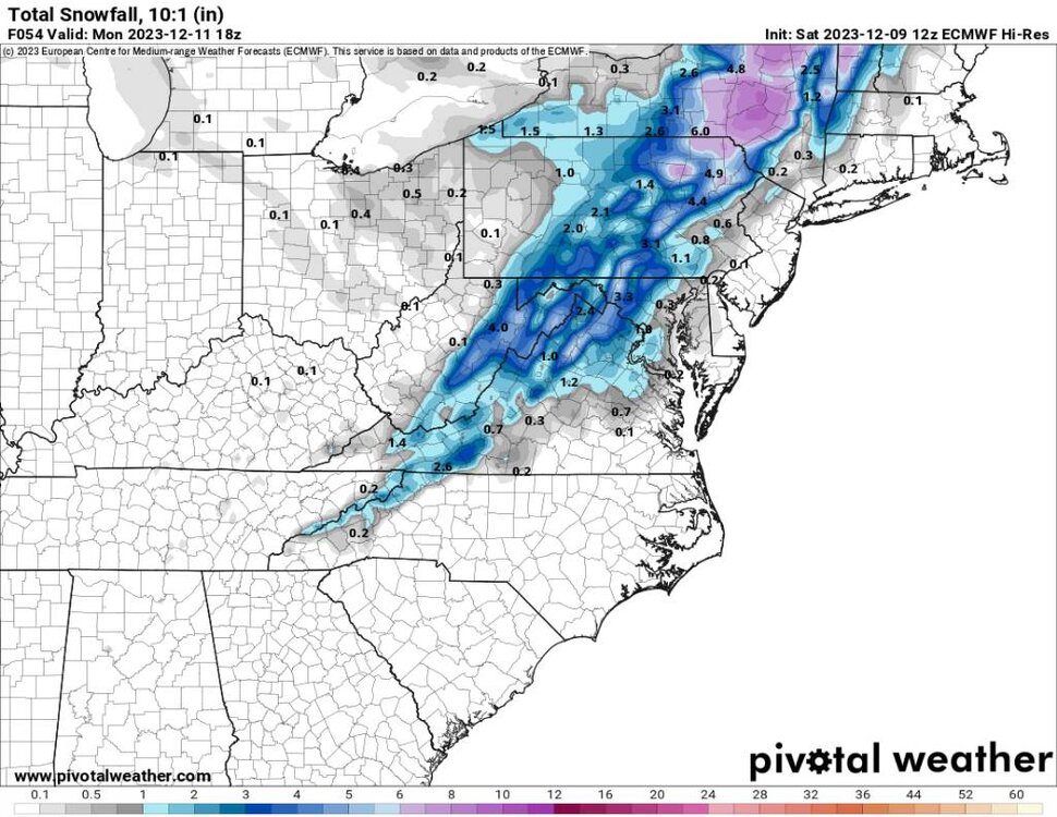
-
2023-2024 Fall/Winter Mountain Thread
Met1985 replied to The Alchemist's topic in Southeastern States
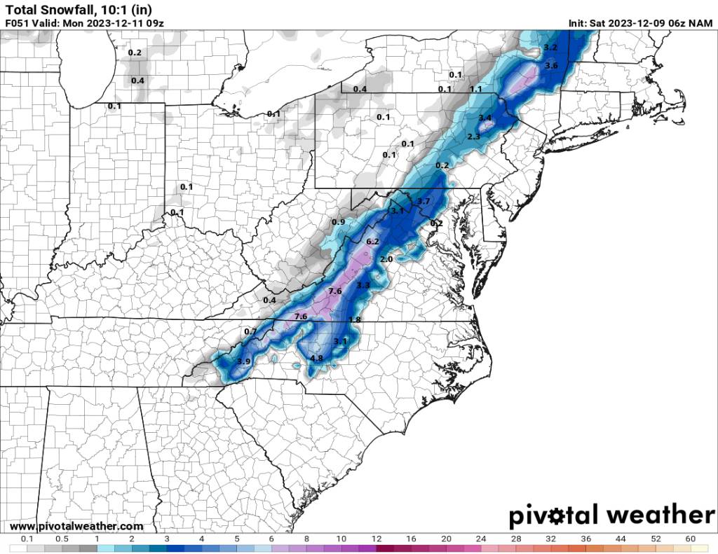
06z NAM shifts just a bit east. Again run to run shifts will be normal. Still more adjustments to come. Sent from my SM-G998U using Tapatalk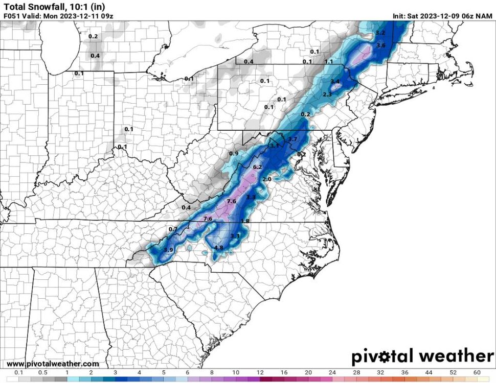
-
2023-2024 Fall/Winter Mountain Thread
Met1985 replied to The Alchemist's topic in Southeastern States
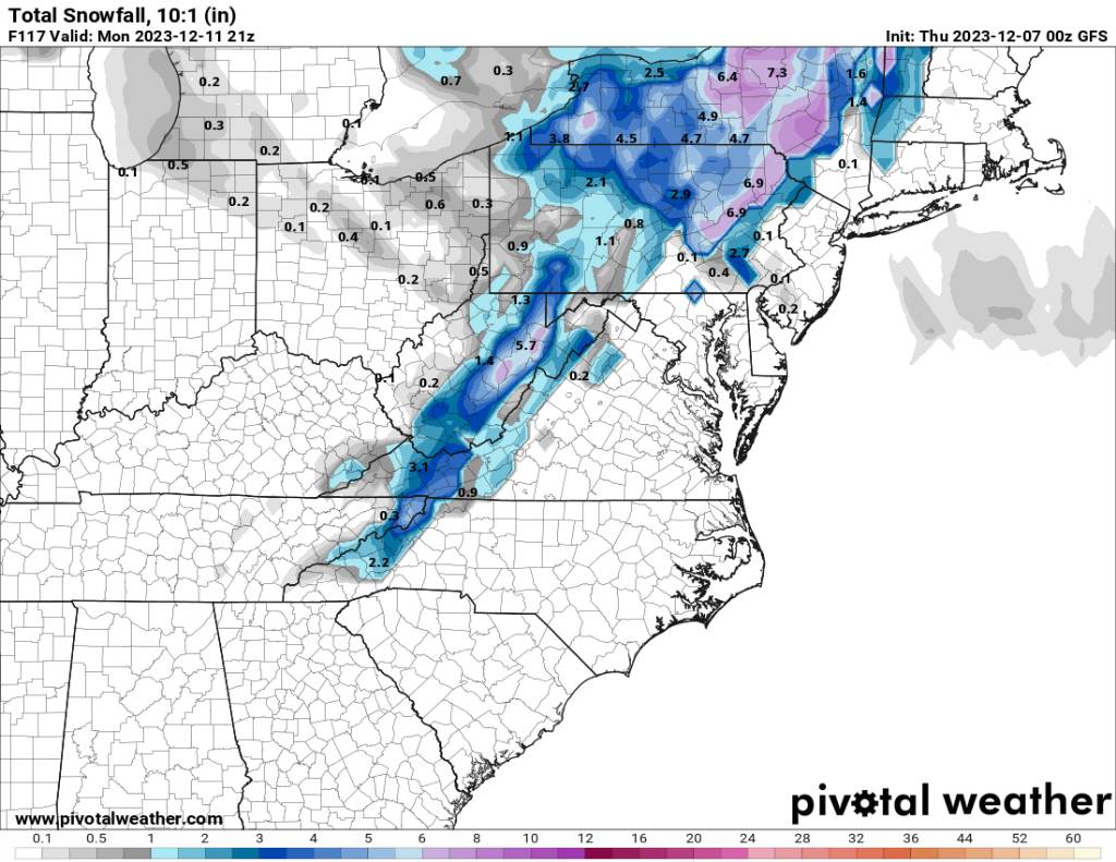
So we have the Euro against the NAM, CMC, and the GFS... Sent from my SM-G998U using Tapatalk.thumb.jpg.24fb293c283de8360cb014d8740406f5.jpg)
-
2023-2024 Fall/Winter Mountain Thread
Met1985 replied to The Alchemist's topic in Southeastern States
All within 2.5 days so I'm getting more and more excited. -
2023-2024 Fall/Winter Mountain Thread
Met1985 replied to The Alchemist's topic in Southeastern States
00z gfs looks way better than before. Great trends. Sent from my SM-G998U using Tapatalk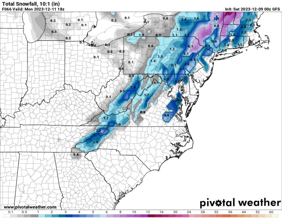
-
2023-2024 Fall/Winter Mountain Thread
Met1985 replied to The Alchemist's topic in Southeastern States
Yeah I've been saying a little more tilt and we are in business. -
2023-2024 Fall/Winter Mountain Thread
Met1985 replied to The Alchemist's topic in Southeastern States
Even the 3k NAM doesn't look bad. Sent from my SM-G998U using Tapatalk.thumb.jpg.1fd0bedf265925b62a9fea252e7162a9.jpg)
-
2023-2024 Fall/Winter Mountain Thread
Met1985 replied to The Alchemist's topic in Southeastern States
Was just going to post this. I hope the NAM is onto something. -
2023-2024 Fall/Winter Mountain Thread
Met1985 replied to The Alchemist's topic in Southeastern States
Not a bad look from the gfs. Sent from my SM-G998U using Tapatalk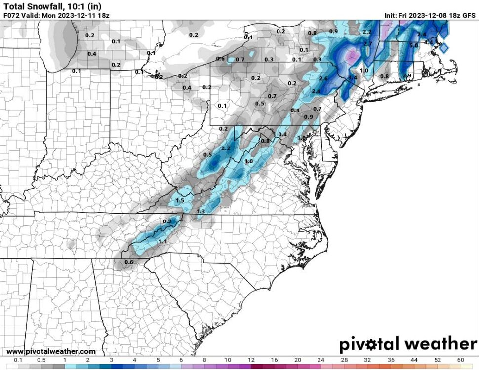
-
2023-2024 Fall/Winter Mountain Thread
Met1985 replied to The Alchemist's topic in Southeastern States
Euro not handling the virtual correctly in my opinion. -
2023-2024 Fall/Winter Mountain Thread
Met1985 replied to The Alchemist's topic in Southeastern States
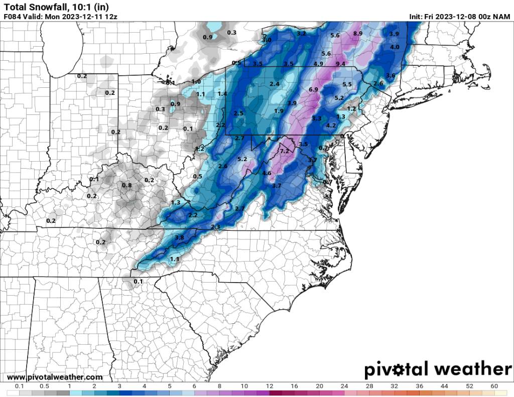
NAM back at it! There will be swings. -
2023-2024 Fall/Winter Mountain Thread
Met1985 replied to The Alchemist's topic in Southeastern States
Gfs still looks great. Sent from my SM-G998U using Tapatalk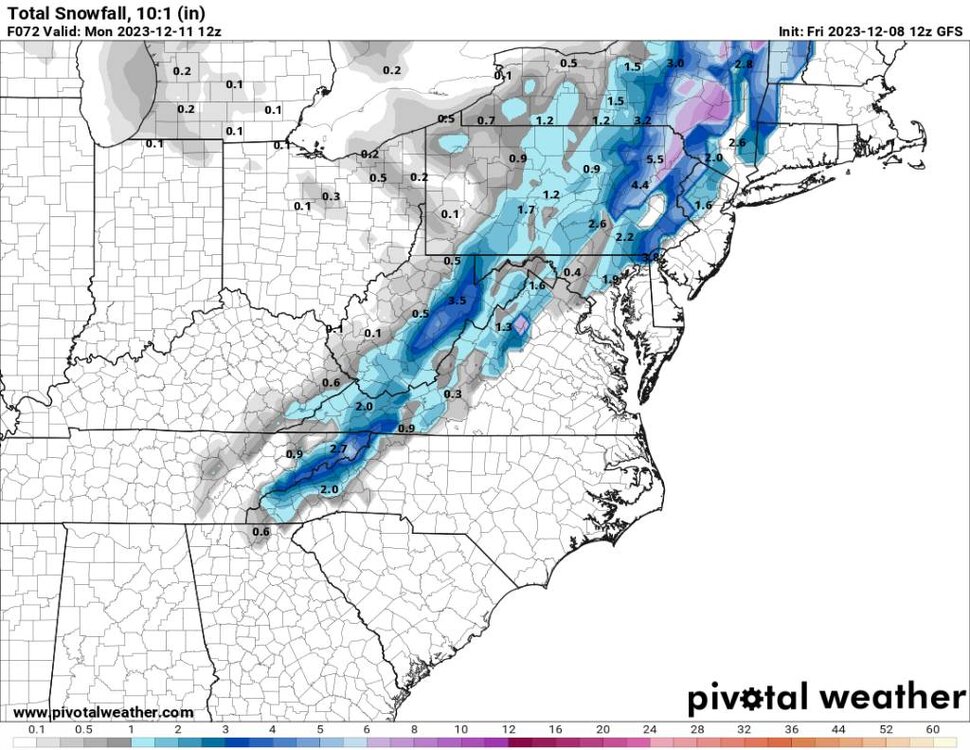
-
2023-2024 Fall/Winter Mountain Thread
Met1985 replied to The Alchemist's topic in Southeastern States
This mornings runs of the gfs and NAM are looking good. Sent from my SM-G998U using Tapatalk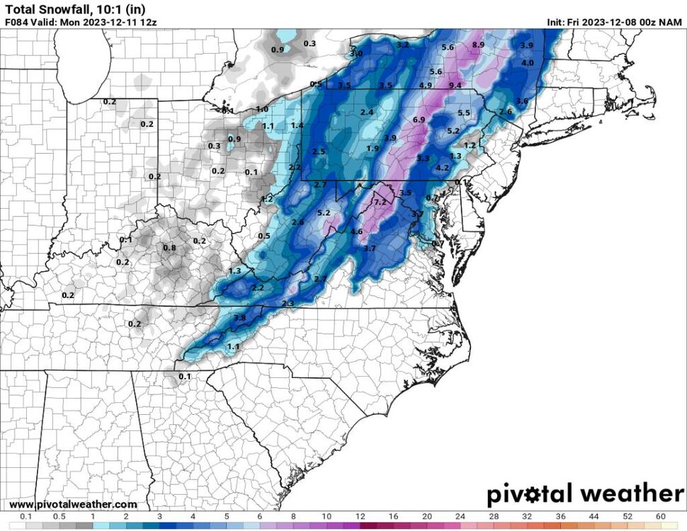
.thumb.jpg.e1cf078353695c425c2c215bb960fe0e.jpg)
-
2023-2024 Fall/Winter Mountain Thread
Met1985 replied to The Alchemist's topic in Southeastern States
NAM and GFS Sent from my SM-G998U using Tapatalk
.thumb.jpg.97751737df1f4dca561b970ee4b33d68.jpg)
-
2023-2024 Fall/Winter Mountain Thread
Met1985 replied to The Alchemist's topic in Southeastern States
A little more coverage on the 6 gfs. Sent from my SM-G998U using Tapatalk.thumb.jpg.732349d9c6a28f6fd8b3d6c047321744.jpg)
-
2023-2024 Fall/Winter Mountain Thread
Met1985 replied to The Alchemist's topic in Southeastern States
Yeah there has been a trend on the GFS/euro towards the cold outrunning the moisture a bit and a switchover to snow before precip ends. Interesting look I'm curious to see where it goes. Yeah I am as well. A bit more tweaking and we could be talking warning criteria snows.
-
2023-2024 Fall/Winter Mountain Thread
Met1985 replied to The Alchemist's topic in Southeastern States
Our next threat. Sent from my SM-G998U using Tapatalk
-
December 2023 Mid/Long Term Pattern Discussion: Let it Snow!
Met1985 replied to John1122's topic in Tennessee Valley
Originally this system was buried in the SW on the GFS and the Euro and we warmed way up. Now it's going to barrel through here as a pretty stout front and set up a different type pattern. -
2023-2024 Fall/Winter Mountain Thread
Met1985 replied to The Alchemist's topic in Southeastern States
It's underwhelming but I'll take it. It's December 6th. This is a win. -
384 hour map?
-
2023-2024 Fall/Winter Mountain Thread
Met1985 replied to The Alchemist's topic in Southeastern States
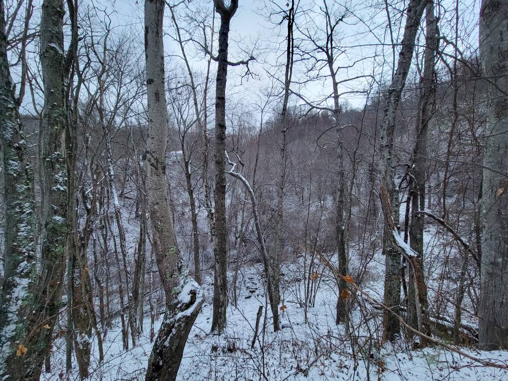
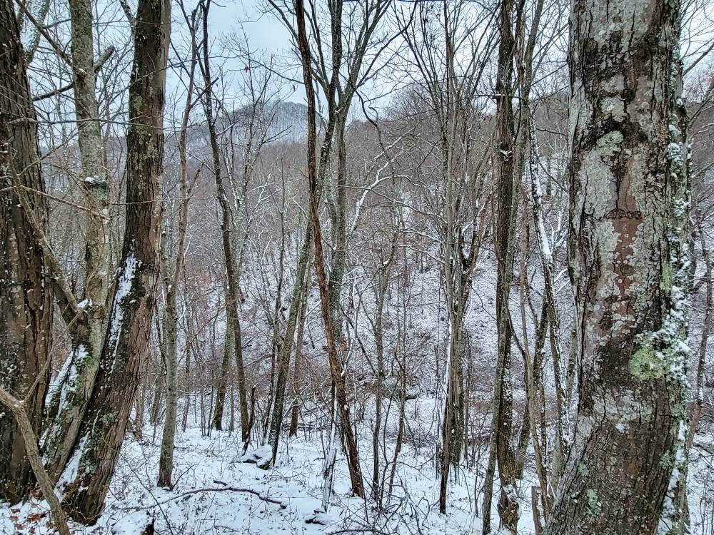
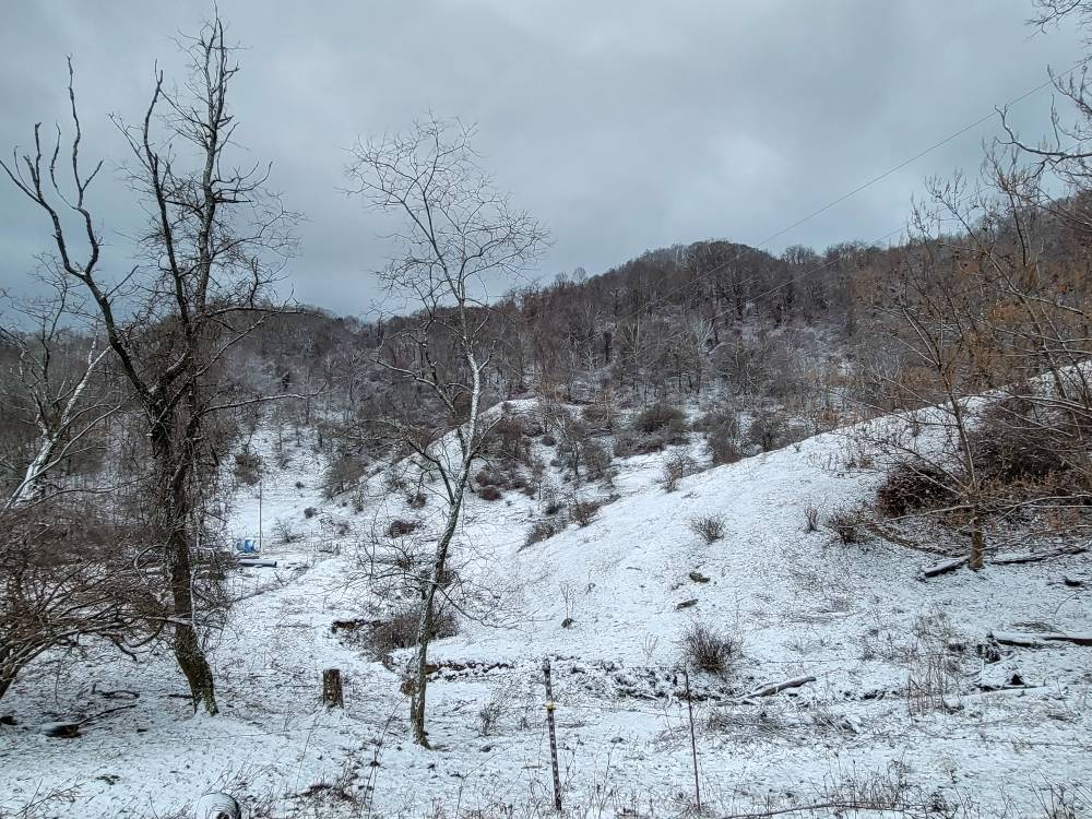
A half inch at the house. Sent from my SM-G998U using Tapatalk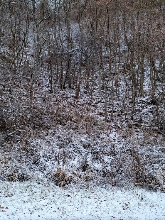
-
2023-2024 Fall/Winter Mountain Thread
Met1985 replied to The Alchemist's topic in Southeastern States
The 6z is one way to ruin a warm first half of December.

.jpg.bde7f29ef71f8ca3b99acf783f8b92a9.jpg)


.jpg.a7d81455929526e881406e2e9734c244.jpg)


.jpg.169d40ee2ff8df6ed2c1a41f4b2ed34c.jpg)
.jpg.2bfb5099069cc3513e10b3d02a356ff3.jpg)
.jpg.1dbc53f21a08a454dafef6a995dddcc8.jpg)