

Met1985
-
Posts
16,909 -
Joined
-
Last visited
Content Type
Profiles
Blogs
Forums
American Weather
Media Demo
Store
Gallery
Everything posted by Met1985
-
Yeah clouds have only thickened through the day...
-

2023-2024 Fall/Winter Mountain Thread
Met1985 replied to The Alchemist's topic in Southeastern States
I had received 10 inches. My rough estimate on average is about 35 to 45 inches. -
2023-2024 Fall/Winter Mountain Thread
Met1985 replied to The Alchemist's topic in Southeastern States
I give this winter a D. Some cold weather but too little snow. -
A cold morning this morning with a low of 25 degrees.
-
Getting some light snow as clouds worked there way back in tonight.
-
Had about an inch of snow with moderate snow at 4:30 this morning. It Snowed from Haywood all the way to Asheville this morning.
-
I've seen everything at Biltmore today. I've seen sleet, snow, and rain.
-
4/2-4/3 Significant Late-Season Snowstorm (WI/MI)
Met1985 replied to Geoboy645's topic in Lakes/Ohio Valley
Hope you rake it in tonight! -
Looks like the snow line is around 4k feet in Haywood.
-
4/2-4/3 Significant Late-Season Snowstorm (WI/MI)
Met1985 replied to Geoboy645's topic in Lakes/Ohio Valley
Post lots of pics. Would love to find a good webcam up there. -
I think the higher elevations may do very well. This is late in the season but not unheard of.
-
Hope the beat the hell out of Purdue.
-
Significant Miller B Nor'easter watch, Apr 3rd-4th
Met1985 replied to Typhoon Tip's topic in New England
I live vicariously through you guts sometimes. These setups are fascinating to me up here. -
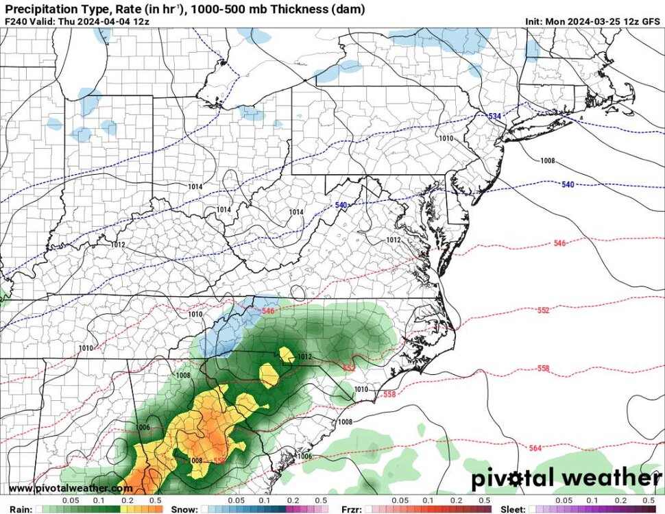
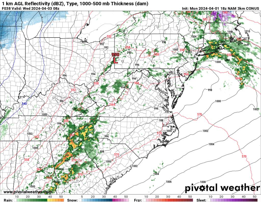
The NAM 3k really blows up storms across the area. Also an early snapshot of the snow. The snow looks convective early on. Sent from my SM-G998U using Tapatalk
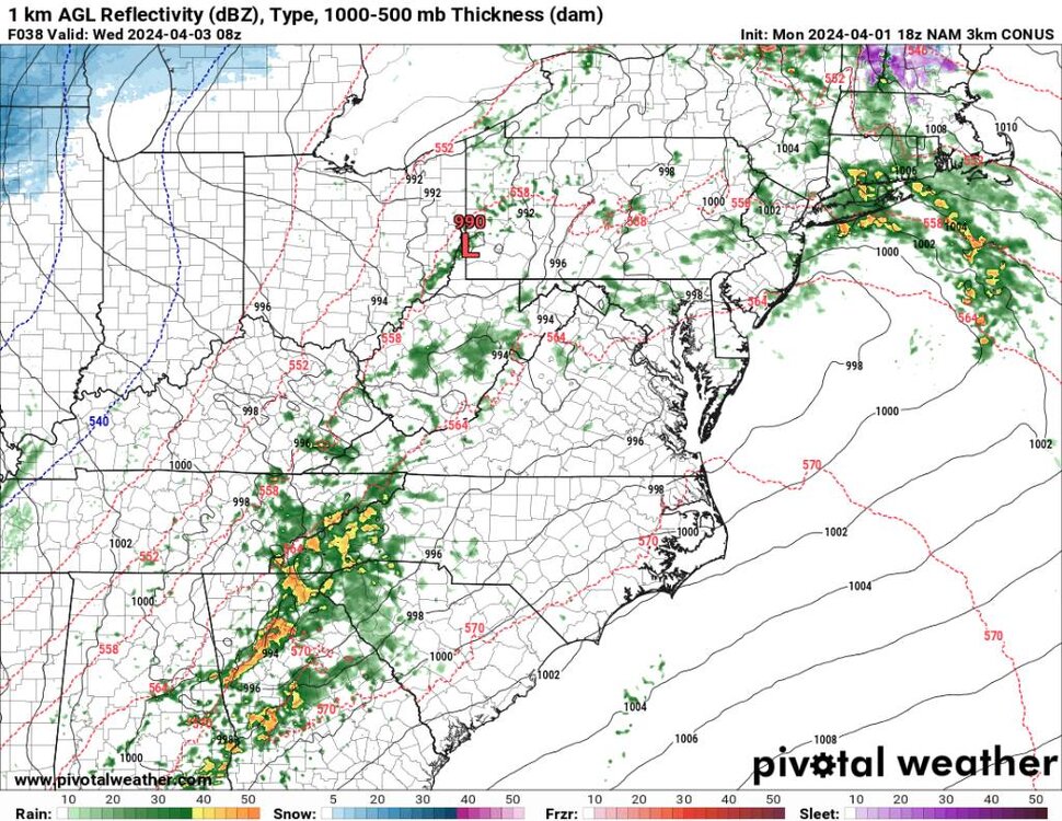
.thumb.jpg.02d48e745e8429118d422b6cea9f6c31.jpg)

-
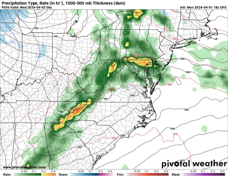
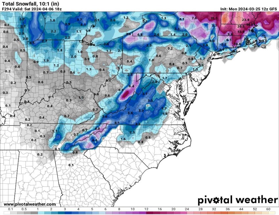
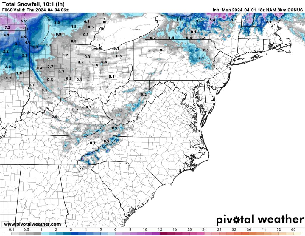
As for some snow it looks like we get several impulses from Wednesday through Friday... I'm saying 2 to 4 inches above 4000'... Sent from my SM-G998U using Tapatalk
.thumb.jpg.697f2bd424e4187f15a299b9f44f08fa.jpg)
.thumb.jpg.56f9fa57137d3768091b2f4f58225228.jpg)
.thumb.jpg.f38a9222a9a588c5adcce9e43292f293.jpg)
.thumb.jpg.17cda1074ac9ef38885b2588d9da90d1.jpg)
.thumb.jpg.c164535ff5efb25fed8a46a6423a0207.jpg)
-
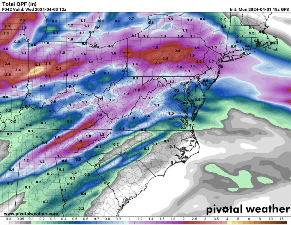
First it looks like we could get a significant line of storms blowing through here and putting down a lot of rainfall along the border. Sent from my SM-G998U using Tapatalk
-
Significant Miller B Nor'easter watch, Apr 3rd-4th
Met1985 replied to Typhoon Tip's topic in New England
Hope you get freaking smoked man. We are even going to get some snow down here in WNC. -
4/2-4/3 Significant Late-Season Snowstorm (WI/MI)
Met1985 replied to Geoboy645's topic in Lakes/Ohio Valley
Seems like these late seasons snows always produce some very heavy wet snows in feet. -
Thank you! It looks promising. Maybe 2 to 4 inches in the higher elevations.
-
@buckeyefan1, can you pin this thread and unpin the winter thread. Thank you.
-
Yep severe to snow all in a day. Thought we'd see this last month but we will do this in April...
-
Crazy is that we actually get an SSW. A major one at that and that doesn't change the weather pattern at all. Especially with it rotating backwards.... Strange to read.
-
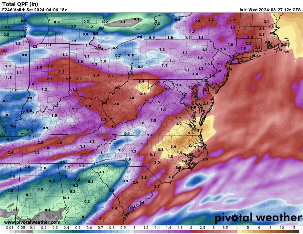
That's a ton of rainfall for the Eastern parts. Sent from my SM-G998U using Tapatalk

-
I thought middle and Eastern NC was supposed to be extremely dry? Must have missed something.... Sent from my SM-G998U using Tapatalk

-
Probably Sent from my SM-G998U using Tapatalk
.thumb.jpg.3cb93ce7daebb5dfb3e9e9e921368b9a.jpg)
.thumb.jpg.06397e41892929c7e4294240c1c6a19b.jpg)

.jpg.874fe741e9cb5f57c145d58c3ea9f0d5.jpg)
.jpg.e52d02eff1ce5ddbe02d16ee4dd9b161.jpg)
.jpg.1d38f6d87b55d859083769a64db59d95.jpg)
.jpg.9e1864a5b208a6499db607c5fad41862.jpg)
.jpg.975781a178ccb13259f7edf8214cbf7e.jpg)
.jpg.f5ff4a2f4850bbb6d0da3f5b85771412.jpg)


.jpg.05a6000b64ea56cb550499ac3f907b75.jpg)

.jpg.23bd162f0dd76c70b32ed4e0c3ead9f4.jpg)

