Met1985
-
Posts
16,970 -
Joined
-
Last visited
Content Type
Profiles
Blogs
Forums
American Weather
Media Demo
Store
Gallery
Everything posted by Met1985
-

Spring/Summer 2026 Pattern Discussion Thread
Met1985 replied to Carvers Gap's topic in Tennessee Valley
Yeah this has been a snap back for sure. 32 degrees yesterday morning and 33 degrees this morning. Ill take it. -
There sure is. Especially this week coming up.
-
12z gfs looking great still. Sent from my SM-G998U using Tapatalk
.thumb.jpg.05bb360a740e8f928f716b0b327cee3b.jpg)
-
Beggers can't be choosers. The ground is so dry that even last weeks rainfall the ground just soaked up super quick but either way we need rain.
-
Spring/Summer 2026 Pattern Discussion Thread
Met1985 replied to Carvers Gap's topic in Tennessee Valley
Yeah going to be a stout cold front again this week after some great beneficial rainfall. -
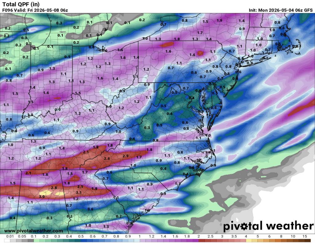
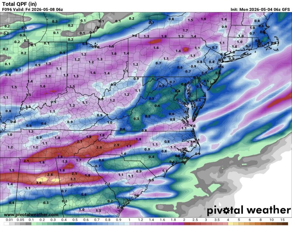
This mornings 6z GFS looks freaking amazing starting Wednesday through Friday. 2 to 3 inches of rainfall? Yes please. Sent from my SM-G998U using Tapatalk
-
Another frosty morning with a current temp and low of 33 degrees.
-
Hopefully Sent from my SM-G998U using Tapatalk
-
This is exactly what we need. Looks like we get going this Wednesday and Thursday. Sent from my SM-G998U using Tapatalk

-
Low right at 32 this morning. Cold out.
-
Down to 46 degrees already.
-
Expected this. This is a stout cold front. 20 degrees below normal is impressive anytime of the year.
-
A nice cold morning so far with a current temp of 46 degrees
-
A beautiful afternoon with a current high of 63 degrees.
-
A nice cold morning out with a low of 40 degrees.
-
The NW flow will have to let up which is just starting...
-
Temp down to 49 degrees already
-
A beautiful afternoon with a current temp of 59 degrees.
-
That's pretty cool for May.
-
At least it's going to be cool. Should be a strong CAD Saturday.
-
Too much NW flow. Going to be cold and dry.
-
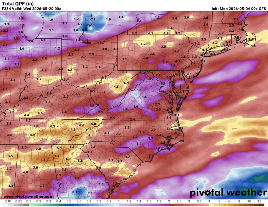
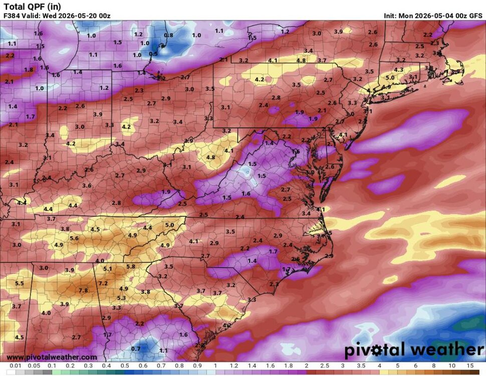
Today's euro is showing multiple shots of well below normal air coming in the next 10 days.
-
A chance for more freezing temps this weekend.
-
Crazy weather.
-
It seems like everything is being pushed south all of a sudden with the high pressure coming in stouter. You'd know north trend in the winter and south trend in the spring.

.jpg.9044e02deb335385823436be91ce48c1.jpg)