Met1985
-
Posts
16,961 -
Joined
-
Last visited
Content Type
Profiles
Blogs
Forums
American Weather
Media Demo
Store
Gallery
Everything posted by Met1985
-
We dry out a few days before we get back into more rainfall. This is a drought buster pattern. Asheville has nearly 9 inches This month and Raleigh has nearly 13 inches which is more rainfall in 1 month than the past 6 months combined.
-
I knew if we could get some sun we'd be cooked. From west to east. Some crazy cells popped up and extremely heavy rainfall.
-
Lake Fontana?
-
I took down the funnel cloud picture because a lot of people are saying it AI so we will see.
-
Tornado warned cell near Robbinsville currently.
-
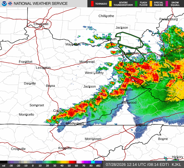
things are going downhill in Asheville currently.
-
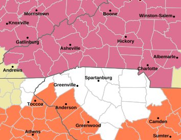
Tornado warning for Asheville!
-
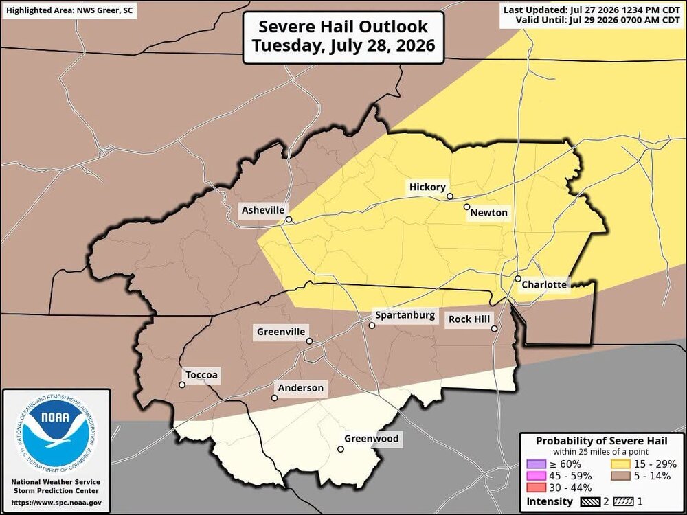
Graham County looking to get smacked good with large hail.
-
Already some big storms popping up in TN. Obviously the sun is making things unstable.
-
Game on! Sent from my SM-G998U using Tapatalk
-
Fresh off the press! Sent from my SM-G998U using Tapatalk

-
Sun is completely out here. Should be doing it's job with the atmosphere. It's sticky all of a sudden.
-
Temps jumped to 80 degrees in no time.
-
Yeah sun is coming out here as well. Heating up in no time. Actually clear skies over me now.
-
Yeah skies are clearing here on airport rd as well. A good sign for destabilizing the atmosphere.
-
Skies to the north look ominous.
-
It's an unstable environment. You can definitely tell that from the storms firing this morning.
-
This could get interesting later on. Sent from my SM-G998U using Tapatalk
-
Looks like this will weaken and by this afternoon around 2 things should start heating up.
-
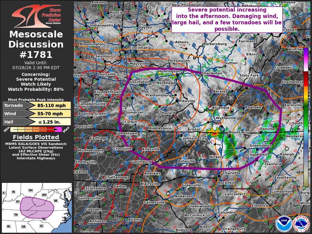
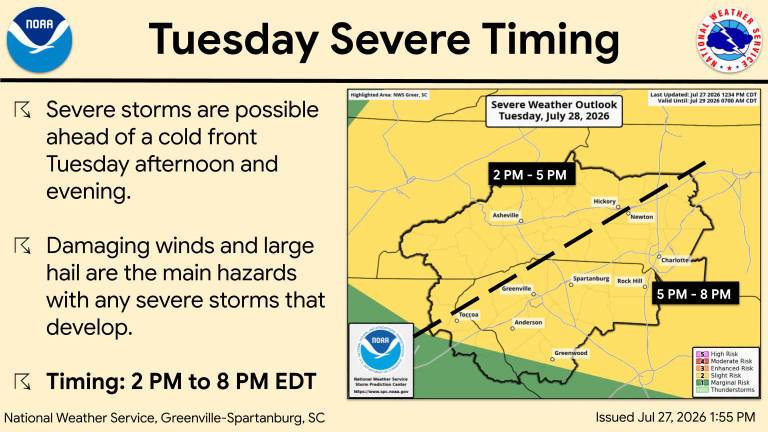
Brad Panovich just put out a great video about today's storms. The models or the model he was showing actually shows two waves of storms moving through. One wave starts around 2 to 3 today then another wave around 8 or 9 tonight. Looks like we could see some discreet cells developing as well. Fun times.
-
Hopefully we see some big storms today. After today we have several days of beautiful weather for August with highs in the 70s and lows in the 50s.
-
Hopefully some big time storms tomorrow. Sent from my SM-G998U using Tapatalk
-
Models do look dry for yall. It's either west or east of yall.
-
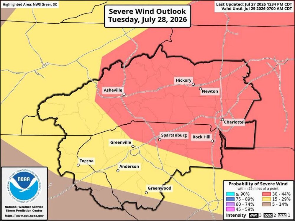
Jason Boyer says the latest data is looking a bit windy bro.
-
Had more rainfall this morning. I can tell the ground has gotten saturated really well because this is the first time since Winter the ground had remained very wet even with the sun coming through.