Met1985
-
Posts
16,911 -
Joined
-
Last visited
Content Type
Profiles
Blogs
Forums
American Weather
Media Demo
Store
Gallery
Everything posted by Met1985
-
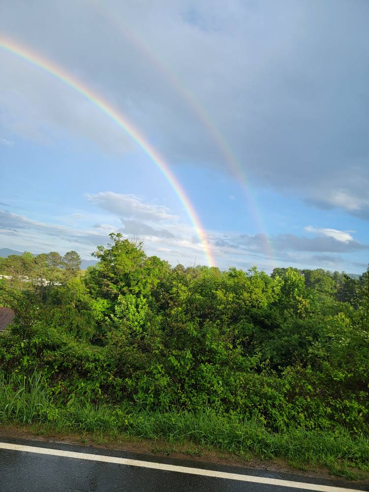
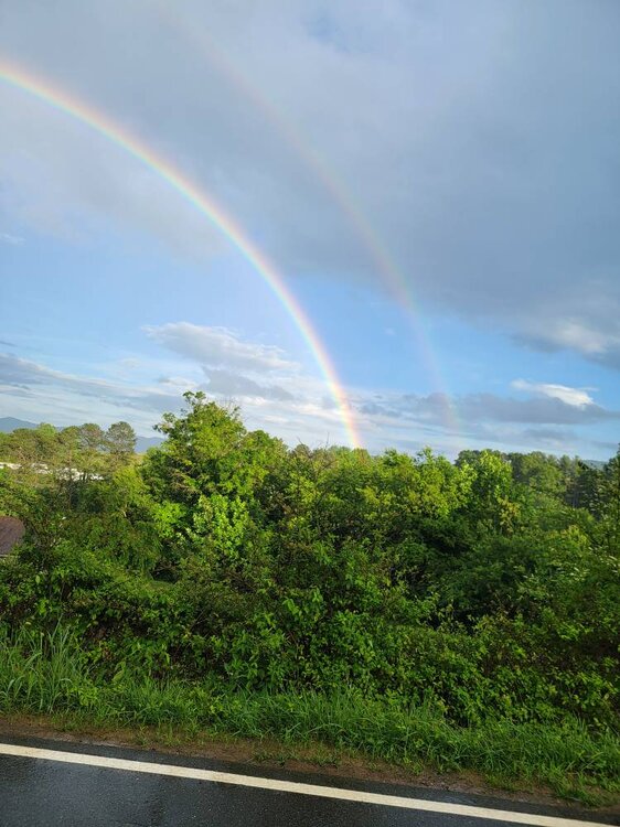
Double rainbow Sent from my SM-G998U using Tapatalk
-
Getting some rain this evening again. 7 days in a row of Getting measurable rainfall.
-
Some more beneficial rainfall overnight.
-
Going to be another busy night if this makes it way north. Sent from my SM-G998U using Tapatalk
-
Pouring again here in West Asheville.
-
More moisture building. Rain moving back in.
-
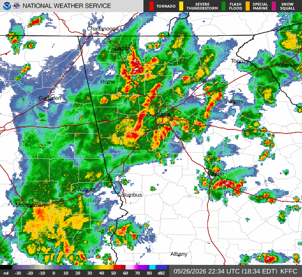
Big time totals.
-
Good Lord! That's the Rainforrest we are used to.
-
That's what Steve and I have been talking about recently. This could go from drought to too much real quick.
-
Yup heavy rain and these storms are just training also.
-
Heck yeah!
-
Moderate to heavy rainfall tonight.
-
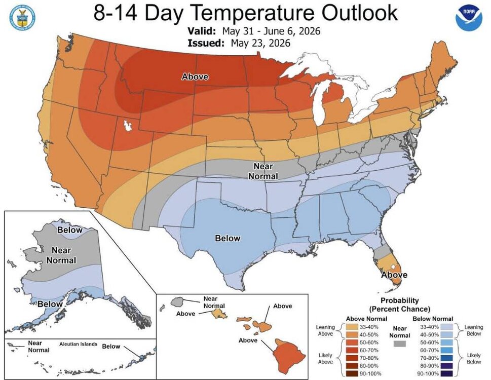
You don't see this usually in late May. Saturday’s high temp of 58° is the coldest high temp on record for May 23rd in Greensboro
-
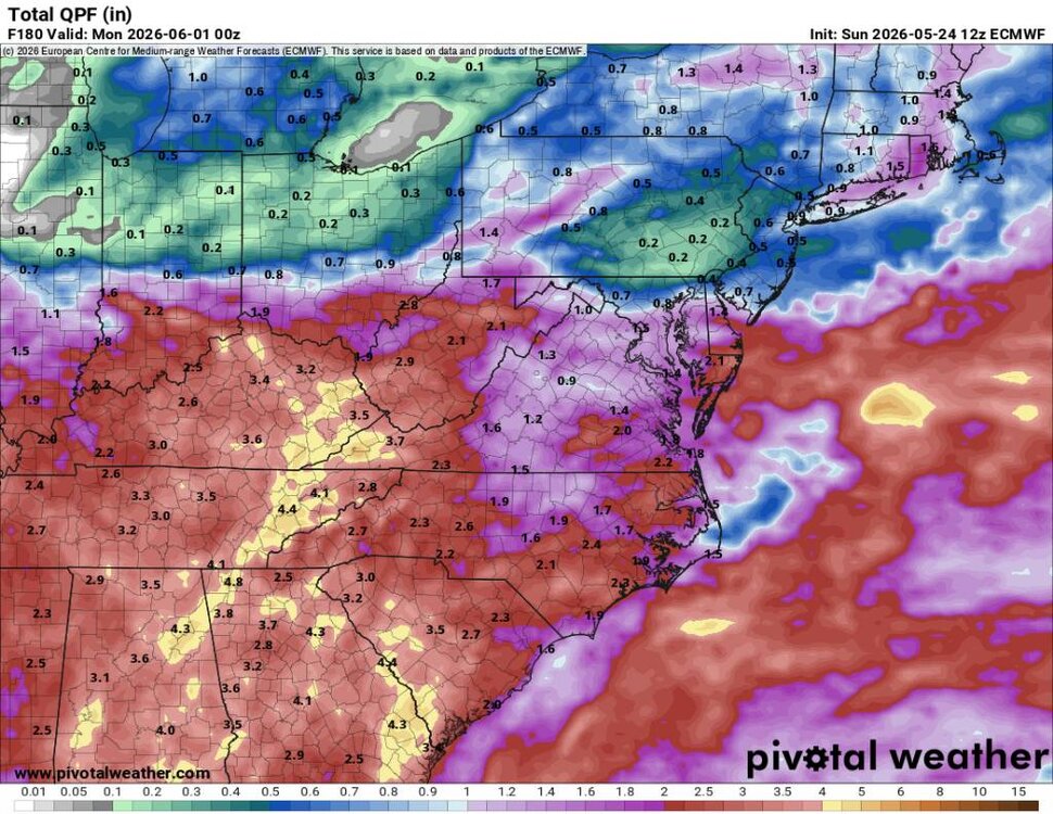
If that happens then we COULD go from drought to excessive rainfall in just a few weeks.
-
This looks amazing from the Euro. Keep that moisture transport coming. Sent from my SM-G998U using Tapatalk
-
Yes sir! And a lot more to come.
-
Looks like heavy rain and storms coming in this evening.
-
This is spectacular. Sent from my SM-G998U using Tapatalk
-
This is a big surprise. Sent from my SM-G998U using Tapatalk
-
This coming week should bring in more rain.
-
Yeah some rather robust amounts to the south and west of you. Anywhere from 2 to 4 plus inches around here.
-
What is this? Day number 3 of steady rainfall?!
-
A beautiful rainy evening.
-
The biggest precipitation maker according to the Euro isn't supposed to start until around Sunday anyways.
-
Pea size hail now with this cell near Enka Candler.