
.jpeg.88e30b1573920286ceacf89f239564d2.jpeg)
wolfie09
-
Posts
17,315 -
Joined
-
Last visited
Content Type
Profiles
Blogs
Forums
American Weather
Media Demo
Store
Gallery
Everything posted by wolfie09
-
.thumb.jpeg.b9e232a6b43e01b7eeee3144246db864.jpeg)
Upstate/Eastern New York-Into Winter!
wolfie09 replied to BuffaloWeather's topic in Upstate New York/Pennsylvania
New 4pm map..Not much difference, just added an inch to kbuf lol Looks like they are riding the RGEM for the most part.. -
Upstate/Eastern New York-Into Winter!
wolfie09 replied to BuffaloWeather's topic in Upstate New York/Pennsylvania
Nice steady snow has developed.. Sticking to the colder surfaces, not so much the pavement..Temp is 30° but flakes are small and wet.. -
Upstate/Eastern New York-Into Winter!
wolfie09 replied to BuffaloWeather's topic in Upstate New York/Pennsylvania
This storm was the worst driving conditions I can remember being involved in..I was never happier to see snow as I traveled west from Albany to Herkimer lol -
Upstate/Eastern New York-Into Winter!
wolfie09 replied to BuffaloWeather's topic in Upstate New York/Pennsylvania
Good point.. Obviously NWS does not take this into account..I read several sources that claim over 1k fatalities a year from winter related car accidents.. More than 150,000 (156,164) auto crashes occur annually due to icy roads, federal data shows. (FHWA) Ohio consistently ranks as the state with the most winter driving fatalities, averaging 86 deaths per year. (ValuePenguin) Driving on snowy roads can take your car 10 times longer to stop completely. (AAA) Over 1,800 people die per year in a car crash due to driving in snowy and icy conditions. (FHWA) 35% of all respondents claim that the ice scraper is the most valuable tool to keep in a winter driving safety kit. (The Zebra) Slushy or snowy pavement causes a 30% to 40% speed reduction on major roads. (The Weather Channel) Around 70% of the population in the United States lives in places that have snowy and icy conditions during the winter. (FHWA) About 17% of vehicle crashes occur in snowy conditions. (NHTSA) 70% of roads in the United States are in snowy areas, which increases the threat of an accident significantly. (FHWA -
Upstate/Eastern New York-Into Winter!
wolfie09 replied to BuffaloWeather's topic in Upstate New York/Pennsylvania
While nature can be scary it's the sizzle sizzle that takes the cake..Wind fatalities aren't much different than Cold/winter weather, when combined.. Either way all types of weather can be dangerous.. 80years_2020 (1).pdf -
Upstate/Eastern New York-Into Winter!
wolfie09 replied to BuffaloWeather's topic in Upstate New York/Pennsylvania
Behind the system this afternoon, SW flow turns W east of Lake Erie. As this occurs, synoptic moisture peels off, however cold advection brings the dendritic growth layer down toward and below the lake-induced equilibrium level. While we are only talking about 5-6 kft of saturated lake-induced instability, it should be enough to yield 3-4" totals east of Lake Erie from southern Erie County into Chautauqua and NW Cattaraugus counties. This puts them just below advisory criteria, so this will require some watching. East of Lake Ontario, a well-defined lake band currently along the upper St. Lawrence River will likely linger there much of the day. However, as the system crossing the area pushes eastward this evening, flow rapidly turns WNW and NW. This will drag this band southward toward central Oswego County. Inversion heights are a bit higher east of Lake Ontario at roughly 8 kft, which yields a much better intersection of the dendritic growth layer and thus even with a meandering band to the south, it would seem resident time over Oswego County will secondarily yield another area of 3-6" of snow farther south overnight tonight in addition to the one over the St. Lawrence River Valley today. Models showing great continuity with dynamic system approaching the area Friday night and Saturday. High confidence exists that the area will remain in the warm sector, as the deepening surface low tracks by to our northwest. Plume of Gulf moisture will stream northward ahead of system cold front Friday night into Saturday morning. Some elevated instability showing up on model soundings late Friday night and Saturday morning could bring a few thunderstorms. A 50-60 knot low level jet impinging on the area will bring some the potential for strong winds to favorable south-southeast downslope area off the Chautauqua Ridge and off the north slopes of the Tug Hill and western Dacks, potentially exceeding 45 mph. Strong warm air advection also allowing for rising overnight temperatures with far western New York into the lower 50s by Saturday morning. The first part of the day Saturday will see the warmest temperatures ahead of the front with many areas getting into the lower to mid 60s, with temperatures falling behind the front some 15-20 degrees by late in the day. Concern for Saturday will be the potential for strong post-frontal winds in the typical southwest flow areas from Lake Erie shore across the Niagara Frontier from Buffalo and Niagara Falls to Rochester. BUFKIT momentum transfer profiles showing a several hour period of 45+ knots mixing down, so certainly could be looking at the potential for gusts reaching 60 mph for a time Saturday afternoon. Will continue to mention in the HWO product. -
Upstate NY Banter and General Discussion..
wolfie09 replied to wolfie09's topic in Upstate New York/Pennsylvania
Speaking of hockey, how bout them rangers lol Off to a good start this year.. -
Upstate/Eastern New York-Into Winter!
wolfie09 replied to BuffaloWeather's topic in Upstate New York/Pennsylvania
Yeah but it's been somewhat hit or miss..So probably not much more here..Not really a "classic" band but hey we'll take what we can get lol -
Upstate/Eastern New York-Into Winter!
wolfie09 replied to BuffaloWeather's topic in Upstate New York/Pennsylvania
Pounding out once again, we continue to in go in and out of heavy snow.. Actually "yellow" has formed several times in the same spot, to bad we can't sustain it lol.. -
Upstate/Eastern New York-Into Winter!
wolfie09 replied to BuffaloWeather's topic in Upstate New York/Pennsylvania
Much of what the rgem shows here is for tomorrow/night.. We'll see lol -
Upstate/Eastern New York-Into Winter!
wolfie09 replied to BuffaloWeather's topic in Upstate New York/Pennsylvania
Yeah a little enhancement tomorrow before the band pushes south +synoptic snow showers.. -
Upstate/Eastern New York-Into Winter!
wolfie09 replied to BuffaloWeather's topic in Upstate New York/Pennsylvania
Just under 3" here which means expect T-1/2" from the COOP.. Still snowing pretty good out.. -
Upstate/Eastern New York-Into Winter!
wolfie09 replied to BuffaloWeather's topic in Upstate New York/Pennsylvania
Everytime I think it's over, more"back builds".. Easily the heaviest snow of the year right now, flakes are like half dollars lol -
Upstate/Eastern New York-Into Winter!
wolfie09 replied to BuffaloWeather's topic in Upstate New York/Pennsylvania
Lake snows continue east of the lakes tonight. Expect at least a few more inches in the most persistent snow showers with localized higher amounts across southern portions of Erie county. Otherwise will be a chilly night with low temperatures dropping into the 20s. -
Upstate/Eastern New York-Into Winter!
wolfie09 replied to BuffaloWeather's topic in Upstate New York/Pennsylvania
Ripping pretty good out right now on the southern edge of this band..NWS has 5"-10" through this evening (p&C) which isn't happening lol Temp has dropped to 27°.. NWS for Wednesday Weak lake snows northeast of both lakes Wednesday morning will give way to a general light snowfall during the midday and afternoon... courtesy of weak forcing ahead of a digging mid level shortwave. Fresh snowfall accums will be under an inch in most areas...and up to 3 inches in lake enhanced snows over northern Jefferson county. In the wake of the shortwave...more organized lake snows will redevelop east of the lakes Wednesday night. Several inches of snow will be possible...esp in the vcnty of the Tug Hill where a +10kft cap will be accompanied by a 5kft thick DGZ. -
Upstate/Eastern New York-Into Winter!
wolfie09 replied to BuffaloWeather's topic in Upstate New York/Pennsylvania
Nice loss power lol -
Upstate/Eastern New York-Into Winter!
wolfie09 replied to BuffaloWeather's topic in Upstate New York/Pennsylvania
Looking at the rgem and 3k 18z, it seems they don't have much organization overnight, not till the approach of another SW enhances the band..(tomorrow morning)..So I probably shouldn't expect much overnight especially with the expected winds lol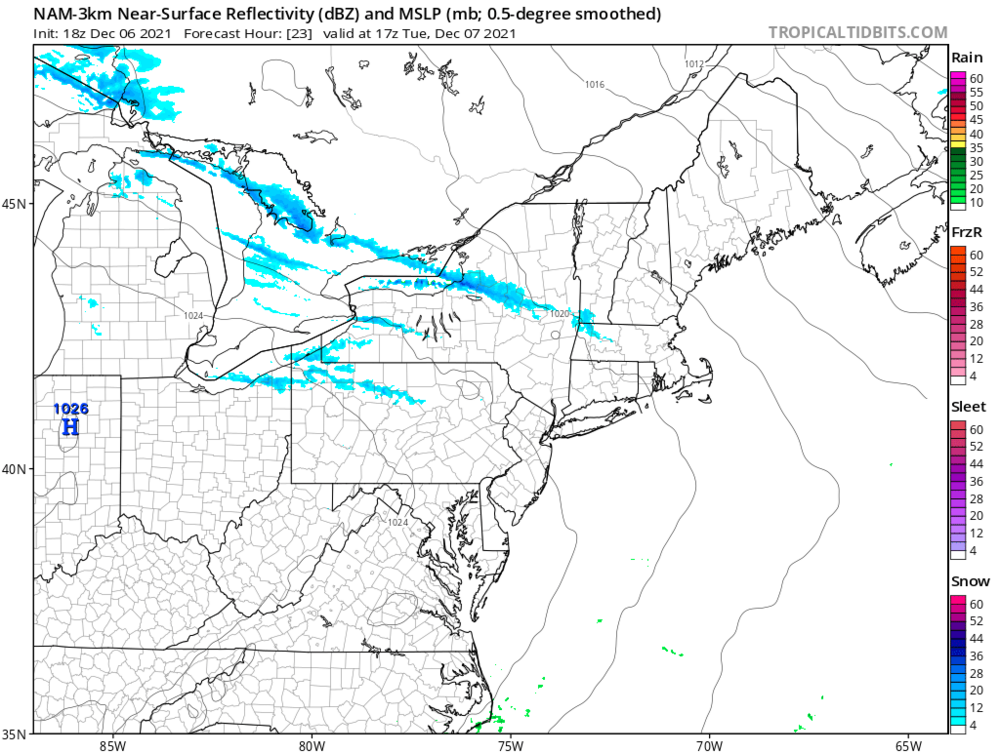
-
Upstate/Eastern New York-Into Winter!
wolfie09 replied to BuffaloWeather's topic in Upstate New York/Pennsylvania
Was just coming to post this.. Here is Kbuf which seems to be going farther north which probably explains why northern Cayuga has no headlines.. In regards to pcpn...the widespread rain showers ahead of/near the sfc front will completely move out of the FA by early evening. During this process...there will be a transition to lake driven pcpn that will initially start as a mix of rain and snow. The lake effect will be focused on areas east of both lakes. As we push into the night and the cold air deepens to the tune of -12c at H85...the pcpn will change over to accumulating lake snows. A general 2 to 4 inch snowfall will be found east of both lakes...with areas near and just east of the Chautauqua ridge and near the Tug Hill as being sites with the highest amounts. On Tuesday...fairly well aligned 280-290 flow will direct lake snows at the Srn Tier and across OSwego county/Srn Tug. Several more inches of snow will fall over the latter with an inch or two in the Srn Tier. Otherwise...it will be brisk and cold Tuesday with temps struggling to reach the freezing mark. Most areas will stay in the 20s. West winds gusting to 25 mph will generally keep wind chill values in the teens. The lake snows will persists east of the lakes Tuesday night. A lack of moisture in the DGZ will limit snowfall...although pops will remain relatively high -
Upstate/Eastern New York-Into Winter!
wolfie09 replied to BuffaloWeather's topic in Upstate New York/Pennsylvania
It has been raining pretty good all day with over and inch of rain so far..We made it to 50°.. -
Upstate/Eastern New York-Into Winter!
wolfie09 replied to BuffaloWeather's topic in Upstate New York/Pennsylvania
Probably not updated yet.. Map from this morning.. -
Upstate/Eastern New York-Into Winter!
wolfie09 replied to BuffaloWeather's topic in Upstate New York/Pennsylvania
Kbgm issued some advisories.. WINTER WEATHER ADVISORY IN EFFECT FROM 8 PM THIS EVENING TO 3 PM EST TUESDAY... * WHAT...Lake effect snow expected. Total snow accumulations of up to 5 inches. Winds gusting as high as 45 mph. * WHERE...Onondaga, Madison and Southern Oneida counties. * WHEN...From 8 PM this evening to 3 PM EST Tuesday. * IMPACTS...Plan on slippery road conditions. The hazardous conditions could impact the morning commute. * ADDITIONAL DETAILS...Gusty west winds this evening could cause areas of blowing snow into the overnight period. Winds then diminish to under 10 mph on Tuesday. -
Upstate/Eastern New York-Into Winter!
wolfie09 replied to BuffaloWeather's topic in Upstate New York/Pennsylvania
It definitely will be cold enough to keep any lake effect snows going with H850 temperatures down in the -12C/-13C range Tuesday morning. However, there is concern with residence time in any given location and also how intense will the lake effect snow be as drier air works in across the Lower Lakes from the west. Off lake Erie, lake effect snows will likely be muted the most due to the shorter fetch (mean 270-280 flow) and the above mentioned drier air working in from the west Tuesday morning. Still could be some minor accumulations (an inch or so) but for the most part not expecting anything of significance through midday. Tuesday afternoon/evening, a shortwave approaching from the west will back flow to 250-260. Added moisture and now the longer fetch of the lake coming into play may lead to a brief uptick in activity or a band forming. If this comes to fruition, the band would impact N. Chautauqua, S. Erie, and to a lesser extent western Wyoming county. Could see some localized areas that potentially could receive 1 to 2 inch from the band as we head into and through the evening hours. Off Lake Ontario, a bit of a different story will unfold with 270- 280 flow making good use of the longer fetch and upstream connections. Still drier air working in will hinder lake snows keeping them for the most part in check and below warning criteria. Guidance suggest that there will be a LES band ESE of the Lake which could produce several inches across far northern Cayuga and into Oswego counties through midday Tuesday. Winds then quickly shift to more of a 250-260 direction Tuesday afternoon. This will then shift LES back north across the Tug Hill and the southern Half of Jefferson County where a couple inches will be possible into Tuesday evening. Due to residence time issues and the above mentioned limitations have sided with a Winter Weather Advisory. Localized snowfall totals of 4-8 inches seems reasonable in the most persistent snows. -
Upstate/Eastern New York-Into Winter!
wolfie09 replied to BuffaloWeather's topic in Upstate New York/Pennsylvania
Obviously I have mentioned that they "low ball" the small amounts.. This was called a trace.. Obviously not a big snowfall but also not a trace lol But those are the"official" numbers . -
Upstate/Eastern New York-Into Winter!
wolfie09 replied to BuffaloWeather's topic in Upstate New York/Pennsylvania
It's in the village which is 5 miles inland. Pulaski is in the town of Richland, next nearest site in SSE lacona which is 2-3 miles to the NE.. -
Upstate/Eastern New York-Into Winter!
wolfie09 replied to BuffaloWeather's topic in Upstate New York/Pennsylvania
According to the COOP pulaski had 0.5" of snow in November on nearly 6" of precipitation and the month was slightly below average wrt temp.. Something like 8-10 traces which don't get added into the total..


