HighStakes
-
Posts
4,528 -
Joined
-
Last visited
Content Type
Profiles
Blogs
Forums
American Weather
Media Demo
Store
Gallery
Everything posted by HighStakes
-
Jan Medium/Long Range Disco 2: Total Obliteration is Coming
HighStakes replied to Jebman's topic in Mid Atlantic
@psuhoffmanThe 1/22/87 was one of my favorites. I think you're few years younger than me so I'm not sure how much you remember about the storm and the forecast leading up to it. My best recollection was that it was poorly forecasted. I believe there was a lot of uncertainty right up to game time. Most calls for the Baltimore area was for 2-4 with some 3-6 with a change to rain. Pretty sure schools started out with a 2 hour delay then changed to closed. By mid-morning light snow transitioned into heavy snow. By noon temperatures began falling making it evident there would be no changeover. Snow remained heavy hour after hour. Rates were at least 2 inches an hour at times. There was thunder snow during the afternoon. NWS played catch up all day. 3-6 became 4-8 then 6-12 and finally 12-18. Snow tapered off by evening with totals where I lived 1 mile north of the beltway in Pikesville/Owings Mills in the 16-18 range. BWI was officially 12. Phenomenal storm which for me had scaled down similarities to the 83 storm. 83 was colder and of course had much higher totals but 87 was similar in duration and sustained snowfall intensity rates. Also heck of an arctic shot behind the storm which led to perhaps one of the driest snows I've ever experienced just 3 days later on Superbowl Sunday. That follow-up storm gave me about 6 of cold smoke powder. Our current area was probably fringed a bit lol. with 4 or so. Just to the south and southeast got much heavier amounts. Great little stretch of intense winter that would essentially be it for the winter other than the Feb. 87 wet snow paste job. -
Jan Medium/Long Range Disco 2: Total Obliteration is Coming
HighStakes replied to Jebman's topic in Mid Atlantic
Our first real chance since Feb. 2015 at sustained "deep winter" if everything comes together with the caveat of it occurring in the heart of winter and extending into our best climo period. -
Jan Medium/Long Range Disco 2: Total Obliteration is Coming
HighStakes replied to Jebman's topic in Mid Atlantic
How about the early Feb. 96 storm. Maybe some similarities with that one also. Regardless I'm just happy to see legit cold across the region. -
Jan Medium/Long Range Disco 2: Total Obliteration is Coming
HighStakes replied to Jebman's topic in Mid Atlantic
Also reminds me of a scaled down version of 1/25-26/87. That was a cold storm as well. -
Jan Medium/Long Range Disco 2: Total Obliteration is Coming
HighStakes replied to Jebman's topic in Mid Atlantic
Nice to finally see that cold will not be the problem if the event materializes. -
Jan Medium/Long Range Disco 2: Total Obliteration is Coming
HighStakes replied to Jebman's topic in Mid Atlantic
Definitely a cold run. -
Jan Medium/Long Range Disco 2: Total Obliteration is Coming
HighStakes replied to Jebman's topic in Mid Atlantic
Sounds like Feb. 1978. Baltimore north gets crushed! DC gets a dusting. -
Mid-Atlantic Snow Totals Thread - Winter 2023-2024
HighStakes replied to mattie g's topic in Mid Atlantic
12/11: 3.0 1/6: .8 Total: 3.8 -
Jan Medium/Long Range Disco: Winter is coming
HighStakes replied to stormtracker's topic in Mid Atlantic
Just under an inch. Never could get any decent rates sustained. -
Goop point! I was think about that game against Pittsburgh from 2019 earlier. Hopefully the bye will be handled better this go round. Lamar is much more experienced and seems laser focused. Also we have Roquan now. I think the preparation for whoever we face will be much better than 2019. For me personally this loss stung. I made a pre-season bet the Ravens would win over 3.5 games within the division.
-
Nobody would believe before the season that we would get the number 1 seed but finish 3-3 in the division and lose to Pittsburgh twice!
-
Very annoying. Also would be nice to not let 10 yards every run play despite some key players sitting out
-
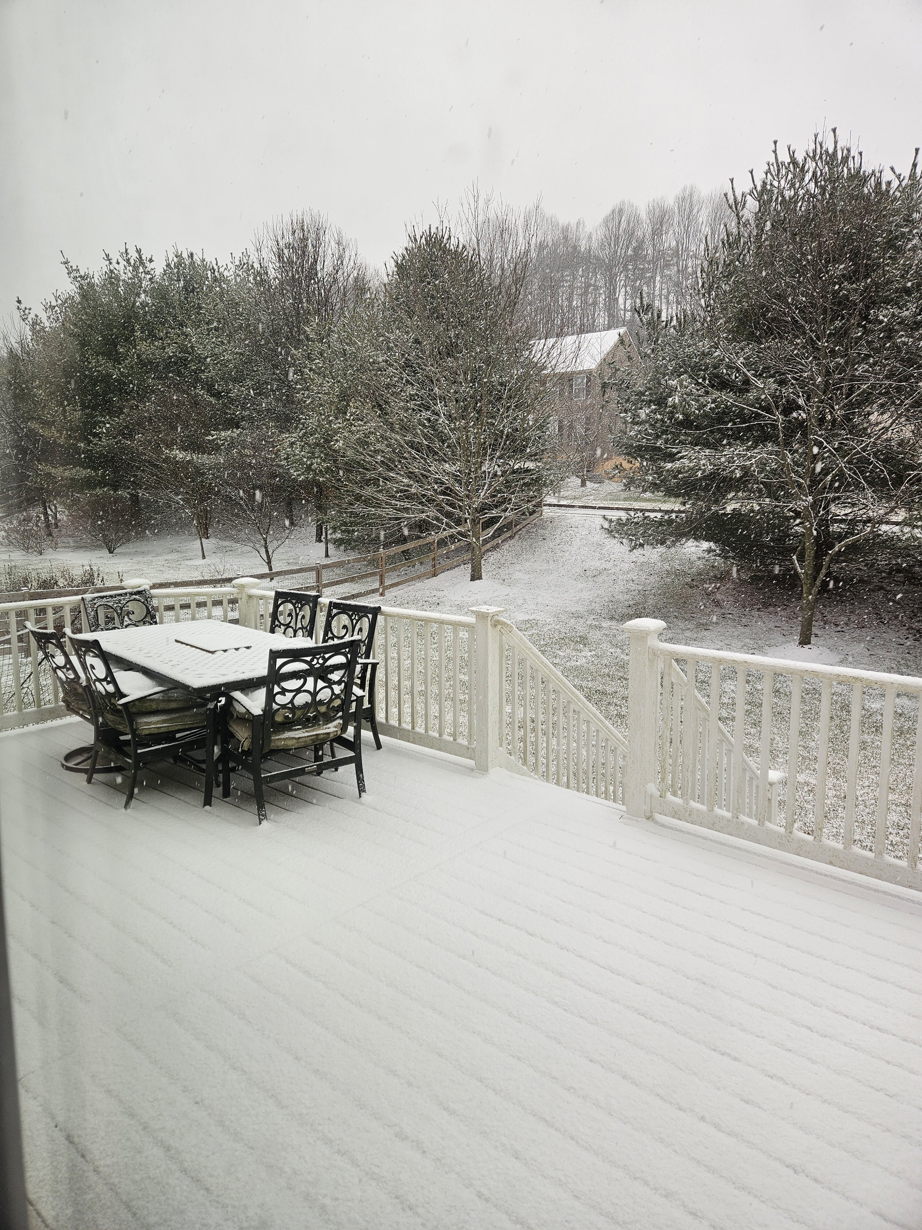
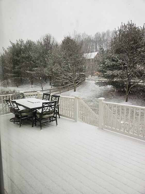
Some snow is mixing back in.
-
Nice! Good to see some are getting a decent event.
-
Absolutely amazing how the models haven't waffled at all on Tuesday's storm from over a week ago. A rainstorm of course!
-
Closing in on an inch.
-
All snow still. Tries to become moderate at times.
-
Light snow. Heavy dusting.
-
Jan Medium/Long Range Disco: Winter is coming
HighStakes replied to stormtracker's topic in Mid Atlantic
If we are to believe all the top analogs for this year one wouldn't expect a sustained winter pattern to set in until around the 18th. If we can rival 66,87 and a couple others thrown out which I think is still very much on the table then anything before the 18th is gravy. If we get to that date and it's delayed again then we have a problem. All the big teleconnections are lining up nicely in about a week. Hopefully they stay on course. -
I thought this was a joke so I had to check it out myself. I can't believe he has 80k followers. Unreal!! I guess in this era of social media everyone has a platform. Lol.
-
Few flurries at the moment.
-
I went to my friends birthday party in Cockeysville/Hunt Valley the night after the storm and the snow depth was about the same as in Reisterstown.
-
Lol. How do you think I feel. I can sit on back on my deck at 870 ft. and look up at Mount PSU at almost 1100 ft. Sometimes in marginal ZR events I will have little or no ice on my trees but look up on the ridge and see heavy ice accretion.
-
That was a really nice storm for the suburbs especially for so early in the season. I got a storm total of 12 in Reisterstown. 7 with the initial wave and about 5 from the coastal. I'm pretty sure areas just west of the beltway from Randallstown over to Ellicott City did the best with the first round with some 8-10 inch amounts.
-
You really need to stop this manic behavior. What is the point of posting this? I'm not trying to attack you so don't take it personally. Everyone knows there's potential things could go wrong. Posting an operational map 16 days away is ridiculous.