

andyhb
-
Posts
18,509 -
Joined
-
Last visited
Content Type
Profiles
Blogs
Forums
American Weather
Media Demo
Store
Gallery
Posts posted by andyhb
-
-
HGX had quite the discussion for Mon/Tues in their most recent AFD.
THE PATTERN WILL BEGIN CHANGE SUNDAY INTO MONDAY AS A DEEP PACIFIC
NORTHWEST TROUGH DIGS SOUTH INTO THE GREAT BASIN...SURFACE PRESSURE
GRADIENT TO ORIENT MORE ONSHORE EARLY NEXT WORK WEEK. STRENGTHENING
SOUTHERLIES THROUGH MID NEXT WEEK AHEAD OF WHAT IS PROGGED TO BE
A FAIRLY PROGRESSIVE STORM SYSTEM. THIS SYSTEM IS CURRENTLY MODELED
TO BE QUITE IMPRESSIVE...ESPECIALLY FROM A DYNAMIC STANDPOINT. THE
TROUGH IS FORECAST TO EVOLVE INTO A DEEP CLOSED-OFF LOW THAT WILL
BARREL OUT OF THE LOWER ROCKIES EARLY TUESDAY AND BE EAST OF US
BY MID TO LATE WEDNESDAY. UNLIKE RECENT SYSTEMS WHOSE ENERGY
TRAVELED OFF TO THE NORTHEAST...THIS LATEST TROUGH IS FORECAST TO
DIG WELL INTO NORTH CENTRAL TEXAS AND PROVIDE VERY ROBUST MID TO
UPPER LEVEL SUPPORT FOR VERY ACTIVE WEATHER. A 40-60 PLUS KNOT LOW
LEVEL JET WILL COME ACROSS THE FORECAST AREA EARLY TUESDAY...GENERATING
AN HIGHLY-SHEARED WIND PROFILE (RIGHT CURVED HODOGRAPH WITH 0-1KM
PLUS 200 SRH) THAT...IF THESE DETERMINISTIC MODELS GET IT RIGHT...
EQUATE TO A SEVERE WEATHER OUTBREAK MID-MONDAY THROUGH TUESDAY.
OTHER INGREDIENTS THAT ARE WORTH MENTIONING ARE COLUMN MOISTURE
AT...OR SLIGHTLY UNDER...2 INCH PWATS THAT IS NEAR MAXIMUM CLIMO
VALUES FOR MID- NOVEMBER...NEAR 1K TO 1.5K J/KG SB CAPE VALUES
(MID-UPPER 30 K INDICES)...AND A SIGNIFICANT SPLIT JET STRUCTURE
TUESDAY MORNING TO PROVIDE THE NEEDED UPPER LEVEL EXHAUST. ALL
TOLD...IF RUN-TO- RUN NWP CONSISTENCY HOLDS UP THROUGH THE WEEKEND
...THIS WILL BE ANOTHER IN A STRING OF SEVERE WEATHER OUTBREAKS
FOR US HERE IN SE TX. OF COURSE...WE ARE DISCUSSING DAYS 5 AND 6
SO CERTAINLY THERE IS MUCH TIME TO TUNE THE FINER DETAILS.
CONSIDERING WHAT THE 12/12Z DETERMINISTIC MODELS ARE OUTPUTTING...
THIS SYSTEM WOULD POSE A MORE OF A DAMAGING STORM WIND AND TORNADO
THREAT...VERSUS THAT OF FLASH FLOODING...STRICTLY DUE TO ITS VERY
PROGRESSIVE NATURE. -
FWIW, the message I'm getting from basically every AFD I've read (OAX, EAX, TOP, LSX, SGF, ILX, DMX, etc.) is concern for just how dynamically impressive this system is, as I've stressed from the beginning with this thing. Troughs like this can and often do pull a lot out of very little thermodynamic wise. Then you start concerning with areas that actually have appreciable buoyancy like closer to the 500 mb low. I also noticed that the Euro was showing some better 700-500 mb lapse rates further south on Wed, although still very little CAPE.
-
I wouldn't be surprised if this thing peaks severe wise on Wed from 12-18z over the E Plains and Lower MO Valley. Both the Euro and GFS are showing some appreciable instability there closer to the triple point where colder 500 mb temps will result in steeper mid level lapse rates on the nose of the LLJ.
-
So, the last few ECMWF runs have looked interesting about 6 days out.
Instability looks rather low, what was once looking like a solid warm sector has shrunk into almost nothing.
-
A lot of tornadoes only reach their peak strength briefly. Moore 2013 was rated EF5 based on the damage to (IIRC) Briarwood Elementary School alone.
This was changed upon further survey. Several homes that were bolted down to their foundations were swept away and these received an EF5 rating. Briarwood was discovered to have had multiple construction flaws and was downgraded.
-
Lol 2015, like friggin clockwork.
-
Expecting a 2013-like fall any year would be a tall order, considering that year had not one but two really significant severe events (10/4 and 11/17). However, I would lean more on the active side this fall given that previous ones heading into Ninos have featured some substantial fireworks and especially if this new regime that has taken over the E Pacific continues deeper into October/November (i.e. Gulf of Alaska/western N. America trough).
-
Was there actually 200+ MPH winds? I heard it was widespread 150 MPH winds, maybe 190 MPH tops. Early reports said EF-4. But because the tornado was so expansive, might as well make it a cat 5. Conspiracy!
The EF5 rating was at least partly based (haven't read the survey in awhile) on manhole covers that were thrown from their locations and also concrete parking stops.
-
The threat on the weekend over the N Plains towards the Upper MS Valley might be thread worthy as we get closer. Seems like another anomalously strong trough (00z Euro had an 80 kt 500 mb max with this thing) will be traversing that area come Sat-Sun with potentially a sub 1000 mb surface low and a strong LLJ response. Moisture will have recovered in all likelihood over a large area by that time too.
-
Seems to be the suggestion of a rather strong shortwave trough dropping SE out of the Gulf of Alaska towards the early part of next week via the deterministic guidance (supported a pronounced lowering of the heights across the Prairie Provinces and N Plains on the ensembles in this same timeframe). Northern stream has been quite active this summer so this doesn't seem to be too farfetched. Does seem that there may be some low latitude troughing that could cause problems with moisture availability though.
-
Is Quincy Kelly Williamson on TVN? They are reporting TOG as well, and they are usually really reliable with confirmed TOG.
No.
-
TOG SW of Auburn, NE per chaser. Not TW'd yet.
Quincy is on that storm and he said nothing confirmed yet, did have a funnel cloud/rotating wall cloud though.
Edit: Nvm, just confirmed it.
-
Looks like a cluster of cells trying to consolidate near Tecumseh, NE.
-
91/76 at TOP right now, pretty juicy to say the least.
-
These types of events with subtle waves cresting a ridge and neutral/even rising heights during the day are always tricky. I'd lean more towards the messy idea although the dryline does seem to be available for convective initiation this time, which is often the downfall of these kinds of setups where everything south of the warm front is capped.
-
BTW, good on whoever got the MBX radar up and running, offering much better looks at this supercell than using the Canadian radars in the area.
-
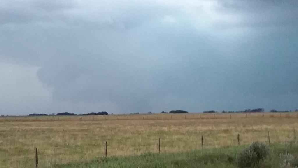
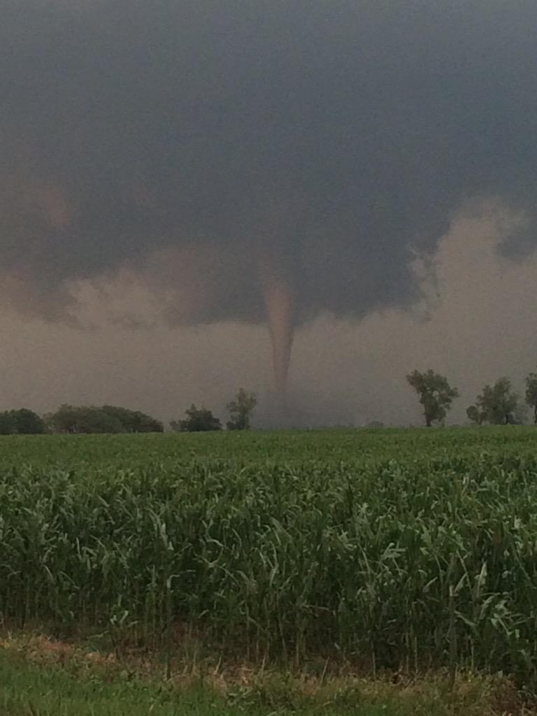
Large, multiple vortex tornado in progress in SW Manitoba near Melita currently.
-
Supercell developing near Long Lake, SD might be able to do something if it can right turn and interact with the OFB to its south.
Edit:
AT 448 PM CDT...A CONFIRMED TORNADO WAS LOCATED NEAR LEOLA...OR 22
MILES NORTH OF IPSWICH...MOVING EAST AT 20 MPH.
HAZARD...DAMAGING TORNADO AND GOLF BALL SIZE HAIL.
SOURCE...WEATHER SPOTTERS CONFIRMED TORNADO. AT 444 PM...A STORM
CHASER REPORTED TORNADO ABOUT 5 MILES NORTHWEST OF LEOLA.
-
Environment is pretty nasty INVOF this cell.
Cone tornado near Artesian recently.

-
SD proving why it is the best again...

-
Models seem to be toying with the idea (particularly the latest 12z Euro) of ejecting a very impressive upper trough and associated anomalously deep surface low (sub 1000 mb) across the N Plains/S Prairie provinces early next week (looks to be around the 27th) with a seasonably moist warm sector out ahead of it. Would have to think there would be at least a half-decent severe weather threat with that, given you really don't see systems that vigorous this time of year at all.
-
Looks like a pretty strong book-end vortex NE of Hill City, KS presently, although it's difficult to see from any of the radars.
-
Looks like the outflow is surging out ahead of that storm. Tornado potential should be low for now.
-
All of this going on with no tornado risk area in the 20z outlook. I am having an increasingly difficult time believing many of Dial's outlooks. They have been weird for a long time now.
Central/Western Medium-Long Range Discussion
in Central/Western States
Posted
Continued strong signal from the EPS and GEFS for a large western trough developing later next week, thanks to a very impressive jet over the Pacific and a lack of a blocking ridge along the W Coast. Favorable teleconnections with troughing in the Gulf of Alaska (+EPO and -PNA) look to be in place to get this moving into the CONUS.
Wouldn't be surprised if 2015 has at least one last go of it in the severe department should this end up verifying, especially considering the location of the SE ridge axis out ahead and what may be quite a moist warm sector (especially by December's standards) by the time the upper level jet pushes eastward of the Rockies. Deep moisture trajectories on the Euro look pretty prototypical for what you would want to see in a cold season event, coming right through the Caribbean. Then it comes down to what character the trough ejection assumes, and whether it will be sheared out if the ridge amplifies too much ahead of it, or whether it amplifies too much and becomes too meridional.
This is of course barring any complications from the active southern stream, i.e. shortwaves disrupting the return flow. The more reliable Euro has not been showing this to the extent that the NA models have though, thus has more instability. Regardless, as usual this time of year, the biggest question is always moisture quality and from what I'm seeing, this system does have a reasonably good chance of achieving that. With a very potent jet like this moving onto the W Coast, that is definitely an eyebrow raiser.