-
Posts
20,420 -
Joined
-
Last visited
Content Type
Profiles
Blogs
Forums
American Weather
Media Demo
Store
Gallery
Posts posted by andyhb
-
-
1 hour ago, RCNYILWX said:
For the big trough later next week, concerned that it'll be tough to avoid any rain with that setup. The until that point persistent west based NAO block is progged to rotate eastward, which would enable a larger height spike ahead of the deep western trough. There being plenty of time to get to a better outcome is the fortunate part of this and the GFS shows one possible way out.
It's been a while since I peeked at the long range with the more active pattern of late. No complaints in what they're showing, with solid agreement in a -EPO with much better cold, another plunge of the PNA, and continued -AO/-NAO. The NAO block is forecast to trend from west based to over or just east of Greenland. Meanwhile the MJO is forecast to go into phase 7 with enough amplitude to eventually go into phase 8. The phase 7 composite looks like the canonical Nina base state with southeast ridging.So with the other favorable teleconnection industries, that pattern could be wintry and active if it works out.
That trough/pattern in late March/April for lack of a better term... yikes.

-
 2
2
-
-
2 hours ago, kayman said:
I agree that maybe those areas of the Upland South should be included such as Birmingham, Atlanta. We could rename the subforum could be renamed "Tennessee Valley and Upland South". These areas are typically undeserved by the Southeastern subforum.
Tennessee Valley and Southern Appalachians.
-
 2
2
-
-
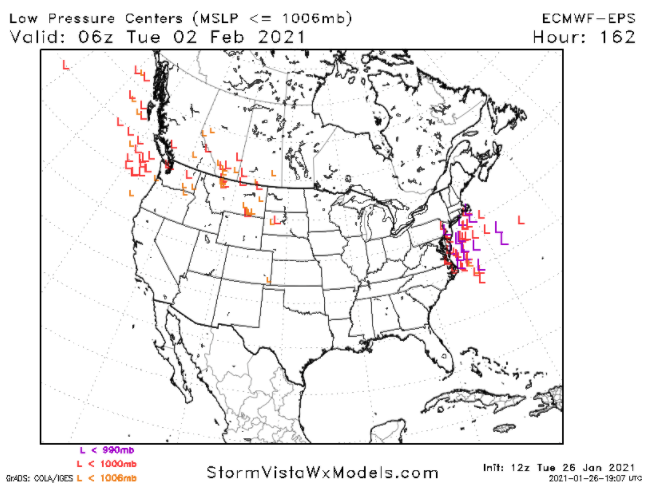
Some absolute monsters on that 12z EPS.
-
 8
8
-
 2
2
-
-
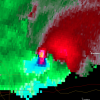
Not a single mention of the destructive, likely significant tornado in the northern suburbs of Birmingham (Fultondale/Center Point) tonight?
-
 1
1
-
 2
2
-
-
Also can a moderator change the title of this thread, considering it is certainly no longer 2019?
-
 3
3
-
-
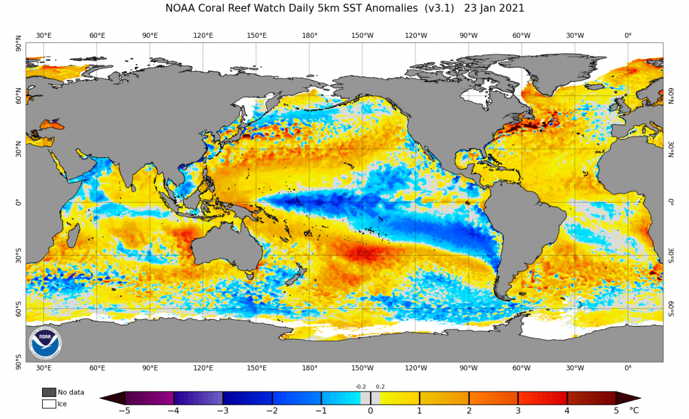
Did some skimming of SSTA data tonight and I'm intrigued by that warm pool centered at ~150˚W and 30˚S to the south of the cold SSTAs with the Nina. Based on looking into some previous analogs around this time, it seems like that strong meridional dipole is not present in years such as 2006, 2009, 2012, 2017, and 2018 (generally quieter severe seasons especially late season). It is more prevalent in several big Nina springs though, including 1974, 1976, and 2011.
It's probably to some degree why this CDAS-derived SSTA analog product from Tropical Tidbits is essentially grouping a who's who of Nina springs with a lot of tornadoes/severe weather, including some with very large outbreaks.
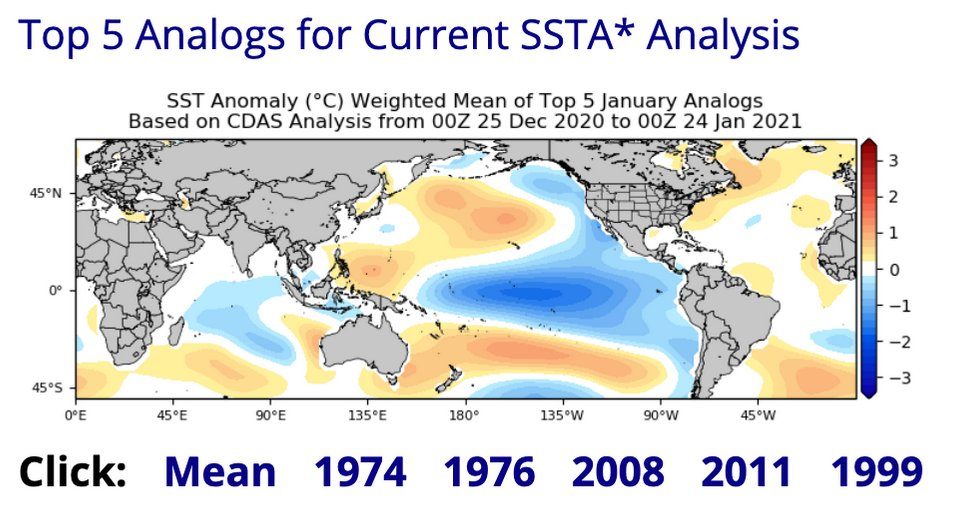
You can see the SSTA dipole present in the Southern Hemisphere in the mean here.
-
 2
2
-
-
Quote
"It is like atmospheric magic. A meteorologist could not have co-located everything at once at the same time over one area. Tanking mid level heights with the incoming PV max, the most divergent portion of that upper jet coupling, strong 600-800 frontal forcing, strong low level moist theta-e advection into the frontal circulation, and extreme convergence into the low level cyclone. I am thinking this is going to be ripping heavy TSSN over N IL like nothing before."
This quote from TSSN12's sig via baro from GHD I.
-
 3
3
-
-
9 minutes ago, McHenrySnow said:
I’m really over your constant harassment.
8 minutes ago, mimillman said:I’m not harassing you, I’m disagreeing with you. If you’re going to continue to post unsubstantiated garbage, expect the disagreement to continue.
2 minutes ago, McHenrySnow said:Nothing I said was unsubstantiated.
Can you both take your crap to DMs?
-
 5
5
-
 1
1
-
-
1 minute ago, Stevo6899 said:
Is the interaction with the confluence to the north causing this shearing?
Yes. This is exactly it. The confluence between the TPV dipping southeastward into Ontario and the SE ridge downstream.
-
 1
1
-
-
The reason for lower totals further east is because of the shearing of the parent shortwave and resultant partial loss of dynamic support with time. This has nothing to do with temperatures.
-
 1
1
-
-
2 minutes ago, Angrysummons said:
Dude, you don't get it. What occurred during that storm???? Got it yet???
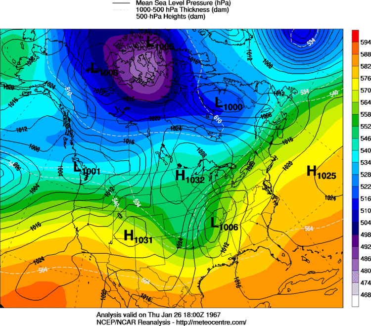
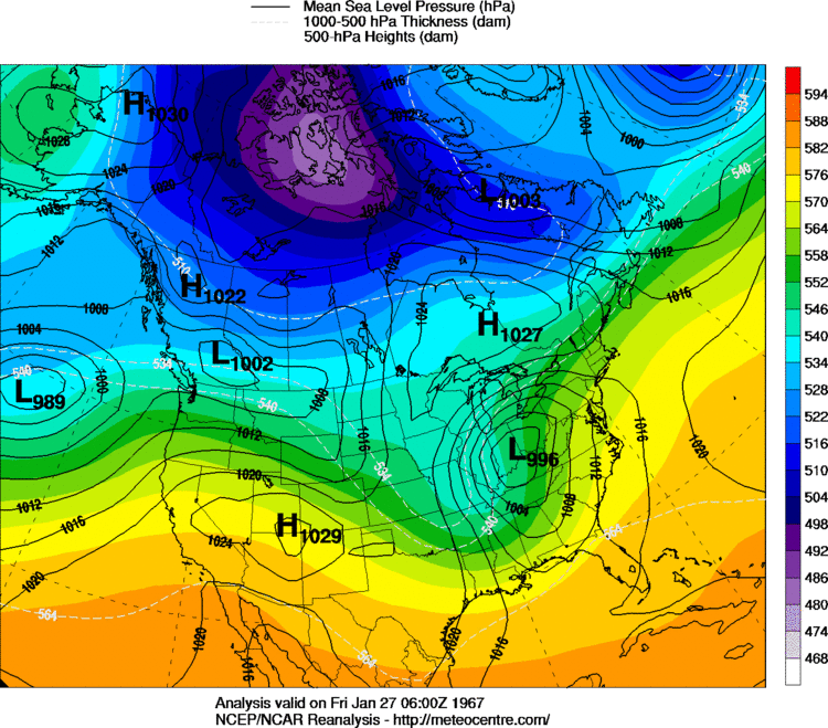
The January 67 blizzard was not a phaser. It was one shortwave (more amplified than this one, but it was not a Jan 1978 type scenario).
-
 1
1
-
-
1 minute ago, Angrysummons said:
Yeah, it does. Show me the phasing. That is the key for this system. Without it, it ends up a strung out turd with modest wet snow. You need the phase to ring out the wash cloth.
No, it isn't. Stop clogging up the thread.
This system has never been a "phaser" and it doesn't need to be for foot plus totals. The reasons why have been discussed ad nauseam over the past few days, but you continue with this borderline trolling nonsense.
-
 1
1
-
 4
4
-
 3
3
-
-
9 minutes ago, StormfanaticInd said:
This storm has some similarities to the GHD storm
2015? Sure.
2011? Not a chance in hell.
-
 3
3
-
 3
3
-
-
2 minutes ago, Chicago Storm said:
Exactly.
Additionally...In an alternate universe where the storm system was suppressed far enough south where IND ended up in the heart of the snow swath, it would be a sub-par event.
This.
That would mean there's barely a shortwave left due to confluence from the ULL/TPV and the SE ridge, there would barely be a "brunt".
-
27 minutes ago, StormfanaticInd said:
This storm is not done trending south folks
I don't really see how one can establish a "trend" when models keep flip-flopping back and forth, nor can I see a solution where Indianapolis gets the brunt of this.
-
 3
3
-
-
This thread is a ****ing trainwreck right now.
-
 2
2
-
 1
1
-
 3
3
-
-
5 minutes ago, Baum said:
I actually did follow these guys for a bit. Problem is they don't really provide a uniform forecast rather a variety of forecasts and than hype themselves as correct if one of their six scenarios pan out. Worse, they inundate social media with these various mets who push these conflicting/contradicting scenarios. Most of it geared I suspect to give the impression of accuracy and lure unwitting energy traders/clients.
They've been quackier than a duck farm for ages.
-
 11
11
-
-
Crush job incoming.
-
 1
1
-
-
2 minutes ago, RCNYILWX said:
The 12z GEFS is mostly duds because it's too non-dispersive of an ensemble system.
IIRC didn't some of this get fixed in the most recent update of the GEFS? Or is that still associated with the v16 testing?
-
 2
2
-
-
-
Going to be a lot of precip with this thing if the trough has any degree of amplitude upon reaching the OV/Lakes. Gulf is wide open.
-
 6
6
-
-
It's almost as if @RCNYILWX knew what he was talking about or something...
-
 5
5
-
-
1 hour ago, McHenrySnow said:
Can't imagine the desire for an above normal spring. it's already going to be 80 + for three months straight, minimum. Move to Florida!
I doubt a lot of people want winter to continue into April either.
-
20 hours ago, raindancewx said:
Spring 2021 on the Jamstec also looks a lot like Spring 2001, 2012, 2014.
 re: Spring tornado chances. 2008/2017 would be more promising though.



January 30-February 1 Winter Storm
in Lakes/Ohio Valley
Posted
Lol @ McHenrySnow reacting with a weenie emoji to this. You're not acting like a degreed meteorologist, man.