Radtechwxman
-
Posts
2,477 -
Joined
-
Last visited
Content Type
Profiles
Blogs
Forums
American Weather
Media Demo
Store
Gallery
Everything posted by Radtechwxman
-
Wouldn't quite call it dead days out. Lol. I do agree west looks more likely but can't completely discount anything yet.
-
That is true because it is a more robust system in the southern stream instead of northern stream. Closed low. But I still like to see what model handled this best. Gives me a good ground basis.
-
Yea models did depict dry slot well. It just seems like this moved out so fast. Maybe I'm wrong. Curious to see what model did best so we know which one to watch closer for 2nd storm.
-
Is it just me or did this move much faster than models had it? Looking like much less ice now with the substantial dry slot that advected in ahead of that last trailing band
-
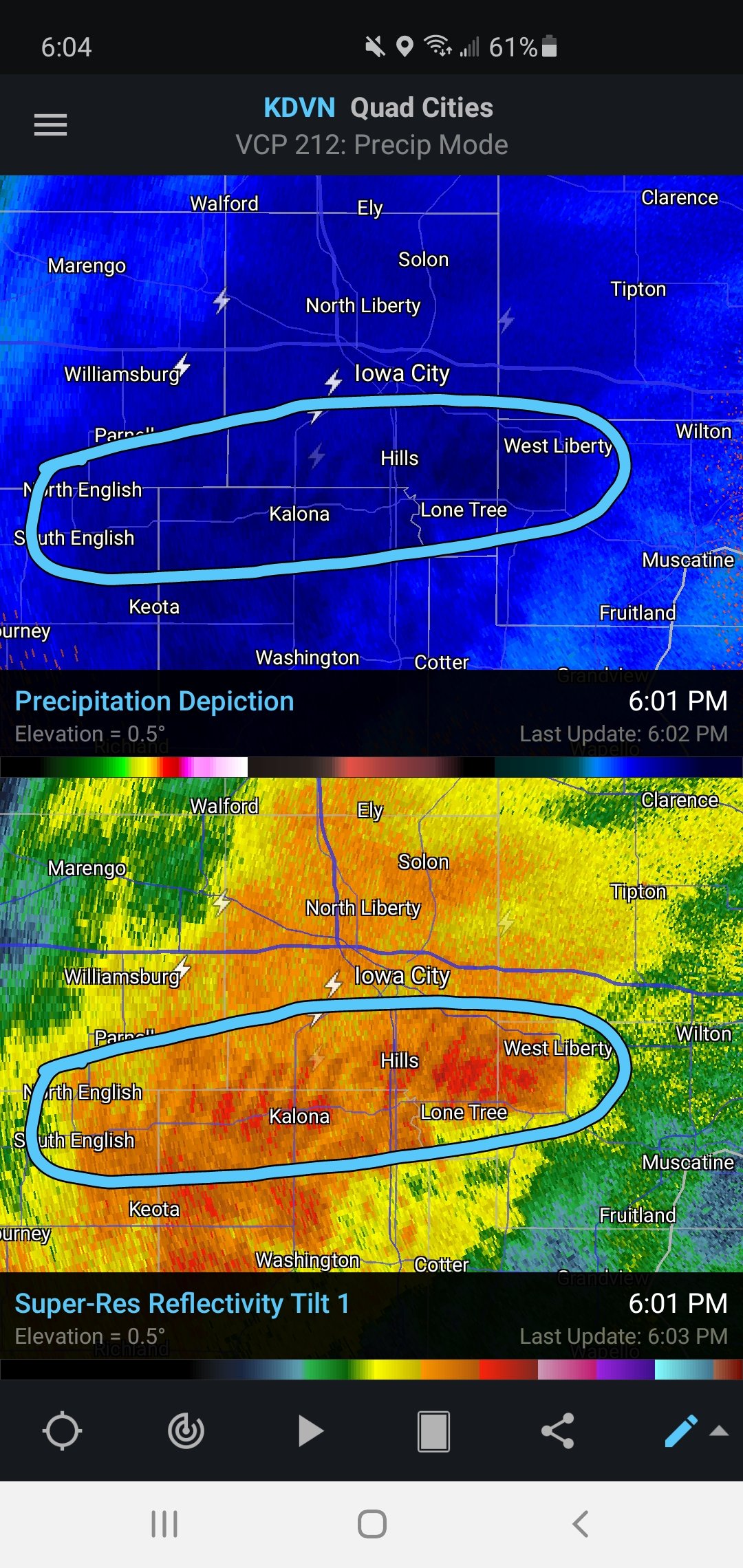
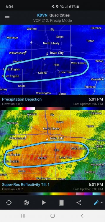
The convective nature of the snow in Iowa was very impressive. Tons of lightning strikes showing up near and north of the transition line. You can see gravity waves on reflectivity. Pretty awesome.
-
Nice band training along I74 corridor here. Snow is a little more granular at times with periods of big flakes. Hrrr increased icing potential here. I like that dews are much lower than temp now. May help keep temps from surging too quick above freezing later.
-
Light snow here now in KPIA. It saturated pretty quickly.
-
I knew it was going to be bad but wow that's brutal. However WAA is strong so I feel it will still occur decently quick after stronger returns get overhead.
-
Wish I could lock that sfc low track from the 0z GDPS. GFS continues to be wagons west with low and gives mostly rain to a good chunk of the sub-forum.
-
Man look at that hodo. Cue the snow wedges
-
Perfect way to end 2020. With cold rain. Neat
-
Nam has the low for 2nd storm in SW Missouri. Wagons west. Lol
-
Lol. 0z nam. Sums up my analysis. I'm pretty much out for snow but hoping for some decent icing.
-
I feel both of these. Heck I'm in north central IL and still waiting on my first 1in snow of the season. Storm track hasn't been good in any direction for me this year. Lots of cold rain. I was holding hope this 2nd wave would be east enough to help us out but latest trends not promising. Naturally this 1st wave is bleeding south more but not enough to benefit me. Sharp southern gradient.
-
Man need that 500mb low to nudge se. It tracks almost due north from TX. Crazy. That track brings in WAA rapidly and would give most of this thread rain with some icing overnight Thurs into early Fri.
-
18z nam has that wagons west look with surface pattern. Could be a good front end thump of ice before cold rain. Impressive look at 500mb with closed low. A stout ridge to the east could force this almost due north. Would like to see that ridge deamplify a bit so it could move more northeast than due north.
-
Good ol' DGEX. I miss that whack model. I can tell that this 2nd wave is going to be held back from fully taking off because of the confluence downstream. 0z gfs definitely se more with sfc low. It did close off a 500mb contour and even has some residual energy after Fri. I wish gem had more model support but it seems to be a stand alone on 1st wave being that south.
-
Long range nam so take it with a grain of salt but it's way south with the 500mb low. Has sfc low at 84hrs just off shore from Houston. Crazy
-
If it were to ever happen it would be this year on the last day of 2020. Lololololol
-
Classic IL River sharp cutoff. Never fails. Lol
-
18z gfs step in right direction for me. I'm literally on the gradient from warning criteria to like nothing. Lol. What's new. Hopefully can see a few more nudges se.
-
Going to be a nail biter here in Peoria. 1st wave on most guidance minus UKMET/GEM misses me largely north and 2nd wave has the low nearly on me on most guidance. I'm expecting more ice than anything now and some plain rain. Unsure on snow potential.
-
Man if only I could lock in that run of Canadian. Great front end thump and decent 2nd hit from the secondary low
-
That would be a very 2020 track and perfect scenario to end this whack year
-
Watch this secondary low follow the same path the Christmas Eve/Christmas day storm followed. That ridging to the east will be critical in determining if this is more of a GL cutter or an App runner. Definitely will be interesting to see what evolves as this trough is impressive.