cyclone77
-
Posts
18,643 -
Joined
-
Last visited
Content Type
Profiles
Blogs
Forums
American Weather
Media Demo
Store
Gallery
Everything posted by cyclone77
-
81 here today, 80 at MLI. A few lazy showers popping up just to the southwest.
-
DVN confirmed 9 tornadoes from Sunday evening. Picked up 0.65" this morning. Up to 3.46" now for April.
-
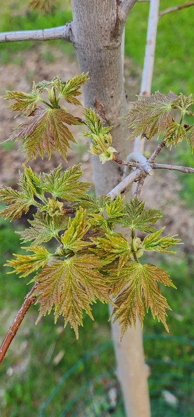
Always nice to see everything get reborn again every spring. New leaves on one of the Celebration maples starting to open up today.

-
Nice. How much do you have for the month now? Sitting at 2.80" here so far.
-
Had a few tors pass southwest and southeast of here earlier. Made for an exciting evening. Picked up 0.74" rain today.
-
Good luck! Post some pics when u can.
-
^Looks like typical northern Illinois potholes to me.
-
Same here. Iowa storms crapped the bed before reaching the MS river. Towers going up overhead now as the cold front is passing by atm. Should fire up some storms about 15-30 miles east of here in a bit.
-
Nice soaker today with 0.81".
-
Looking forward to watching the cumulonimbus boil upward on the eastern horizon Fri afternoon.
-
40-45mph winds much of the day again today.
-

Fall/Winter '24 Banter and Complaints Go Here
cyclone77 replied to IWXwx's topic in Lakes/Ohio Valley
F- final grade here. No need to go into the deets, everyone is well aware of them by now lol. -
I'm ready for some boomers. Been a very quiet spring so far here for storms.
-
Spring 2025 Medium/Long Range Discussion
cyclone77 replied to Chicago Storm's topic in Lakes/Ohio Valley
^ Poor timing again for the DVN cwa -
30mph winds today, 40-45mph winds tomorrow and Tuesday.
-
Models are snowless through late April for this area, so looks like the all-time futility record will in fact happen. Cause for celebration I guess lol.
-
A few sprinkles here.
-
Man that sounds like a blast. If I was retired I'd be down for something like that. Maybe in 10yrs lol.
-
Can't believe it's already been a year since the total eclipse.
-
0.14" here yesterday/overnight.
-
I probably started back in January lol. More than just being sarcastic and pissy really. Never really thought it'd actually happen lol.
-
Yeah it would be nice if they had that as well.
-
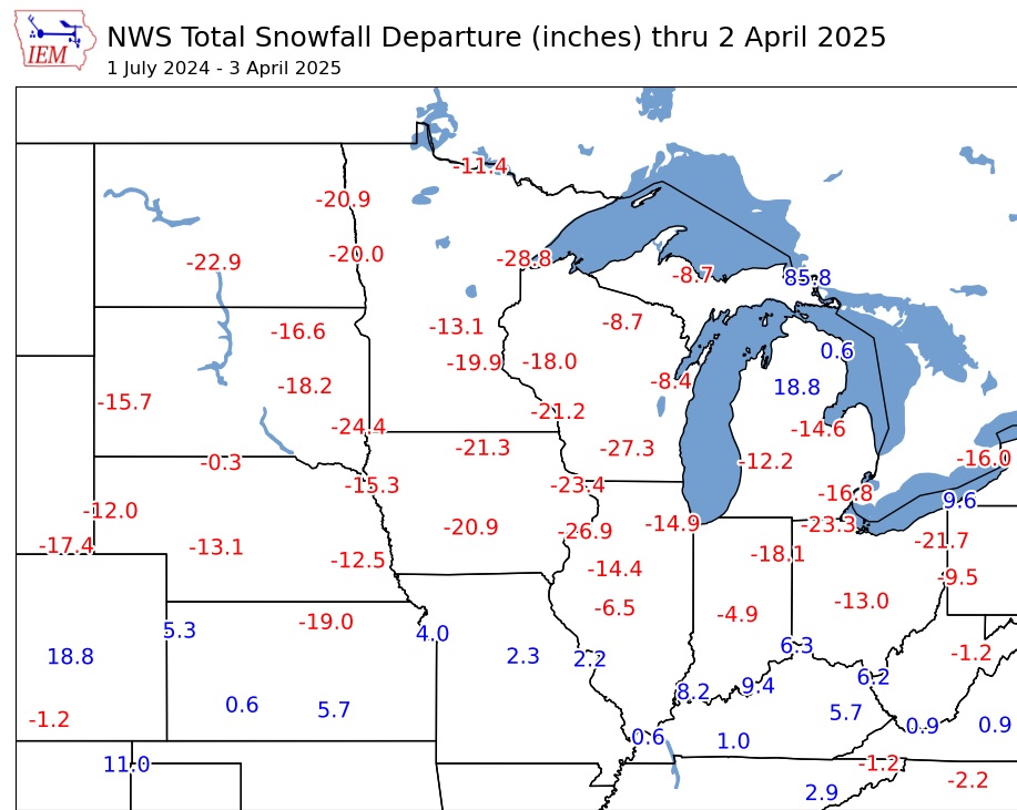
Pretty terrible winter for most of the sub as the map below shows. Definitely an F- for here. Heaviest single event will go down as 3" lol. Now that we've hit rock bottom it can only get better right?
-
May get grazed by a little rain tomorrow, but mostly looking pretty quiet for the next 7-10 days for this area. Unless something crazy happens at the end of April MLI should have the futility seasonal snowfall record in the bag.
-
The co ck-blocked dryline is moving through here right now with some nice towers trying their best to make something of themselves. A futile endeavor however.