Allsnow
-
Posts
26,462 -
Joined
-
Last visited
Content Type
Profiles
Blogs
Forums
American Weather
Media Demo
Store
Gallery
Everything posted by Allsnow
-
-
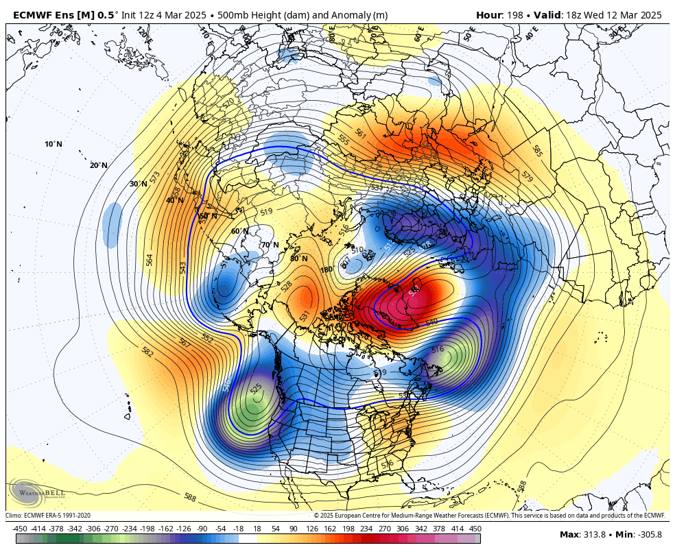
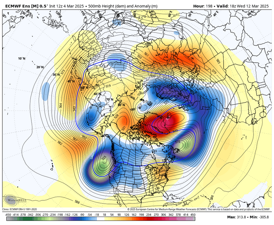
Negative nao trending stronger for next week
-
EPS cooled off for next week haha
-
Yeah, 85% of the other storm tracks happen more… Amazing stuff haha
-
If the euro AI doesn’t have it, we don’t do it
-
The -nao is going to screw us after one day near 70
-
No reason to use any other model other then the AI
-
All the models follow the AI no reason to look at anything else inside 7 days
-
Save the days for the beautiful weather we have 8 months out of the year @MJO812
-
AI has been locked in for days now
-
My guess is it’s seeing what the AI and Euro had days ago with the souther stream. Now both those models have trended flatter and holding more energy back
-
Don’t do it
-
-
The rest of the models have followed the AI leads on every storm so far since the update
-
-nao spring misery after the 12th
-
12z AI says don’t ever look at the gfs for anything
-
AI has nothing along with the euro just a phantom storm by the gfs
-
-
Yup, congrats dca on the warmth
-
Good luck getting 70 On that eps run
-
Can’t believe people are calling for 70’s and March 2012 on Twitter… going to fail miserably
-
We done
-
Shocking models backing off on the warmth
-
AI still has nothing