Allsnow
-
Posts
26,462 -
Joined
-
Last visited
Content Type
Profiles
Blogs
Forums
American Weather
Media Demo
Store
Gallery
Everything posted by Allsnow
-
December 2020 General Discussions & Observations Thread
Allsnow replied to bluewave's topic in New York City Metro
-
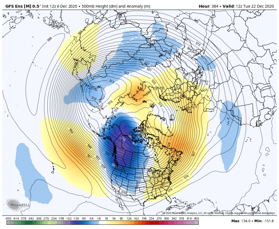
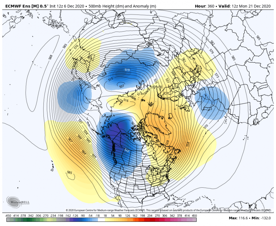
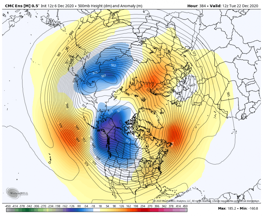
Christmas looks toasty
-
December 2020 General Discussions & Observations Thread
Allsnow replied to bluewave's topic in New York City Metro
-
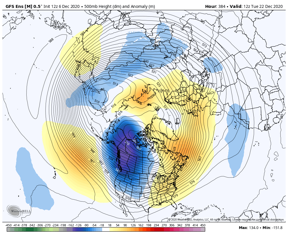
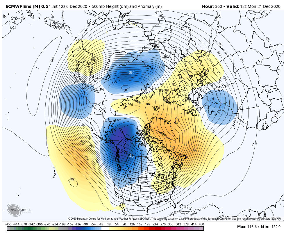
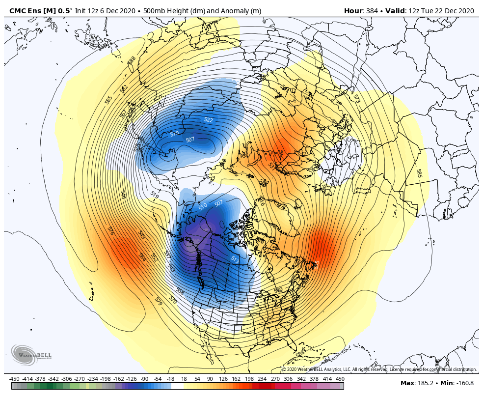
The GEFS were the first to back away from the better look mid month. The eps continues to show a good pattern in the 11-15 until it went towards the GEFS yesterday. The models have been chasing this -epo/blocking pattern for a while now. In reality we just end up with more of the same. We really need something to shake things up.
-
December 2020 General Discussions & Observations Thread
Allsnow replied to bluewave's topic in New York City Metro
The MJO is croaking in 4/5 that’s not good for sustainable cold. We need something to shake the pattern up or it’s very meh. Lots of 40/50’s with rain -
December 2020 General Discussions & Observations Thread
Allsnow replied to bluewave's topic in New York City Metro
Yep. That ULL really produced at night for the 2nd part -
December 2020 General Discussions & Observations Thread
Allsnow replied to bluewave's topic in New York City Metro
The eps and geps have a big -nao after the 18th that keeps the pattern serviceable. Is that true? Probably not lol. Only positive I see is that fact that the TPV remains in Canada/Ak, it will keep cold in Canada. If that area starts to go above normal then yeah it would be close the shades time -
December 2020 General Discussions & Observations Thread
Allsnow replied to bluewave's topic in New York City Metro
We have a opportunity between the 13-20th. The eps snow mean was pretty high due that timeframe. After that is when it will get ugly -
December 2020 General Discussions & Observations Thread
Allsnow replied to bluewave's topic in New York City Metro
Still think we have a opportunity at something mid month before the pattern goes to trash -
December 2020 General Discussions & Observations Thread
Allsnow replied to bluewave's topic in New York City Metro
-
December 2020 General Discussions & Observations Thread
Allsnow replied to bluewave's topic in New York City Metro
Yep, we completely lost the -epo look from a few days ago. Canada will be cold so any ridge out west before the 20th can tap colder air then what we have now. -
December 2020 General Discussions & Observations Thread
Allsnow replied to bluewave's topic in New York City Metro
Some concerning ensemble guidance today for any potential cold air after next weekend. Guidance moving the TPV quickly into Ak -
December 2020 General Discussions & Observations Thread
Allsnow replied to bluewave's topic in New York City Metro
No two patterns are the same. If it was that easy then we could just set the forecast to whatever happen in that month a year ago. This h5 look is different then the one we had last December. Earlier this week none of us thought this would produce for sne, yourself included. -
December 2020 General Discussions & Observations Thread
Allsnow replied to bluewave's topic in New York City Metro
Persistent forecasting can go bad quickly. I’m happy to see the costal storms are back. -
December 2020 General Discussions & Observations Thread
Allsnow replied to bluewave's topic in New York City Metro
@bluewave looks like Hartford is going to get another early season snowstorm like last year. I know you were skeptical of that happening again -
December 2020 General Discussions & Observations Thread
Allsnow replied to bluewave's topic in New York City Metro
Yep. That’s why New England avg so much more then us. Looks like another early season storm for BDL -
December 2020 General Discussions & Observations Thread
Allsnow replied to bluewave's topic in New York City Metro
The one behind it was our best shot but tomorrow’s storm is going to kill that chance -
December 2020 General Discussions & Observations Thread
Allsnow replied to bluewave's topic in New York City Metro
The single most important piece to east coast storms is a good Pna. This is probably the best the pac has looked since March 2018. Just some bad luck that we are not snowing in this pattern. The storms tracks are there -
December 2020 General Discussions & Observations Thread
Allsnow replied to bluewave's topic in New York City Metro
Lol. It’s definitely a possible outcome. Or the costal steals from the ULL and we get nothing. -
December 2020 General Discussions & Observations Thread
Allsnow replied to bluewave's topic in New York City Metro
Need to root for the first system to get out of the way quickly. The h5 has improved tremendously today -
December 2020 General Discussions & Observations Thread
Allsnow replied to bluewave's topic in New York City Metro
Happy hour euro trying to make wave two a thing -
Yeah, around jan 18th we start seeing change back to a better look. I know that is way out there but it would fit the script on some of stuff going on with the strat/mjo
-
December 2020 General Discussions & Observations Thread
Allsnow replied to bluewave's topic in New York City Metro
I remember saying after the 10th things will get better. It’s up in the air on how long that lasts. As of now, it looks like Niña pattern will return towards the 20th. -
December 2020 General Discussions & Observations Thread
Allsnow replied to bluewave's topic in New York City Metro
Is that from the op run? The GEFS are +3. A lot of that is from the warm up next weekend as the pac reshuffles. -
December 2020 General Discussions & Observations Thread
Allsnow replied to bluewave's topic in New York City Metro
We will have a shot a something the week of the 13th. The pattern looks to get more hostile/Niña like by the 20th