wdrag
-
Posts
5,613 -
Joined
-
Last visited
Content Type
Profiles
Blogs
Forums
American Weather
Media Demo
Store
Gallery
Everything posted by wdrag
-
Wantage NJ (this southern part at 740' MSL). 1.8" final-wet clingy snow. Less on driveway and virtually none on paved roads now... temp rising to 32.4F.
-
Wantage NJ (this southern part): 410 PM 1.2". The 3/4" or less driveway and 0.3" on salted road in front of our rural home, occasionally wet road there. 32.0F
-
Wantage 0.3" at 240P since SB around 150PM. 32.4aF down from a high of 35.2. We had sprinkles at 1025 AM. Driveway snow covered but treated roads just wet.
-
Nor did the observer at CP where 0.02 liquid occurring virtually as all snow and only T. Guessing the snow total was rounded down to a T (below 0.5"). That might be a future question mark for detail oriented minor climo checkers.
-
Who knows what goes on... I'll be interested in their 445P climates for LGA, EWR and CP and how a TV station got info before entire community regarding official amounts. That was always something that bothered me in offices, the TV station calls for info before the entire community. Competition.
-
Thank you Don. Clarification will eventually be needed.
-
Is there a message out on CP NON 0.1" snowfall this morning. I heard on CH4 it's a T? I can benefit from downsizing justification. Thanks.
-
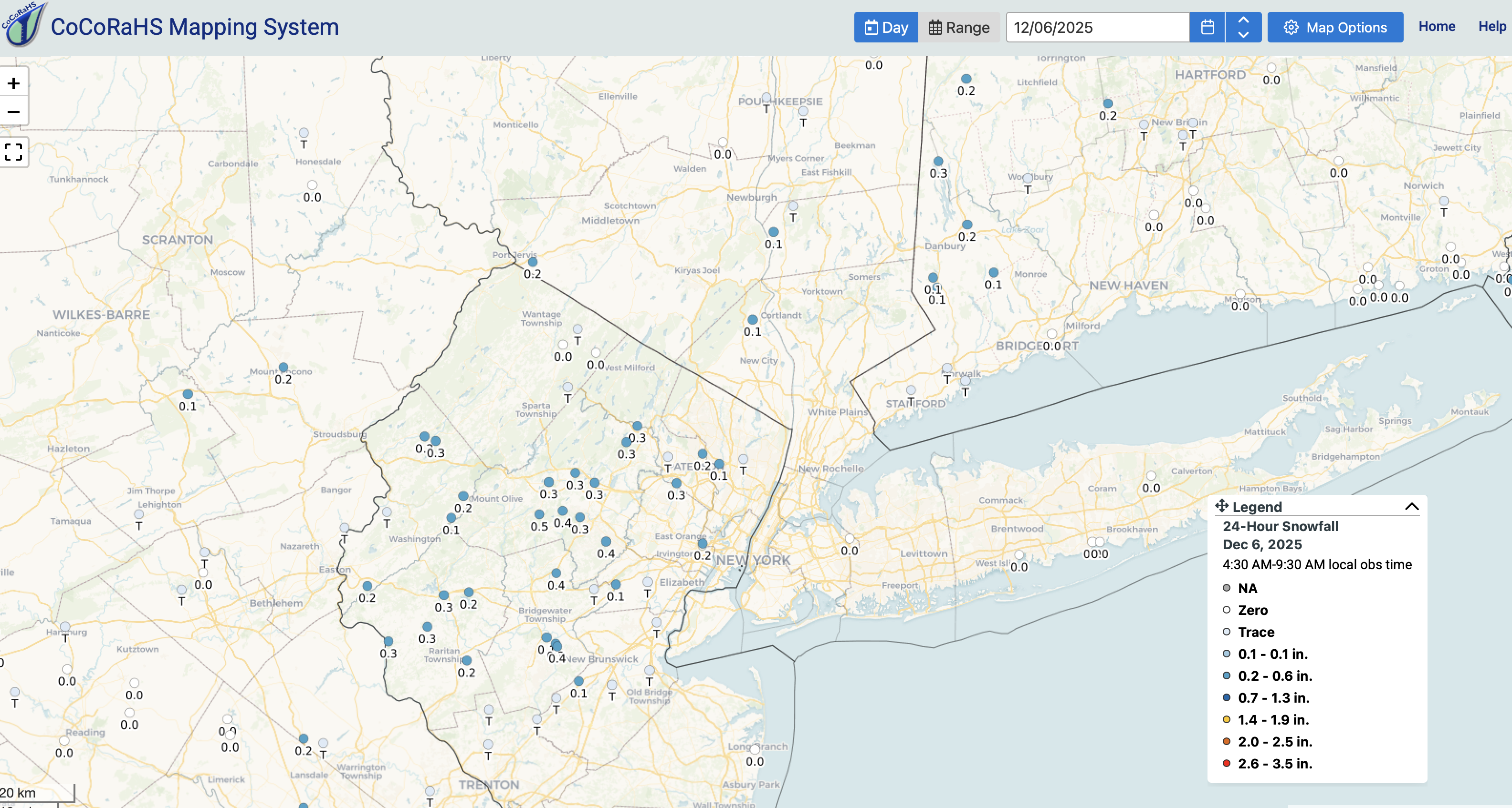
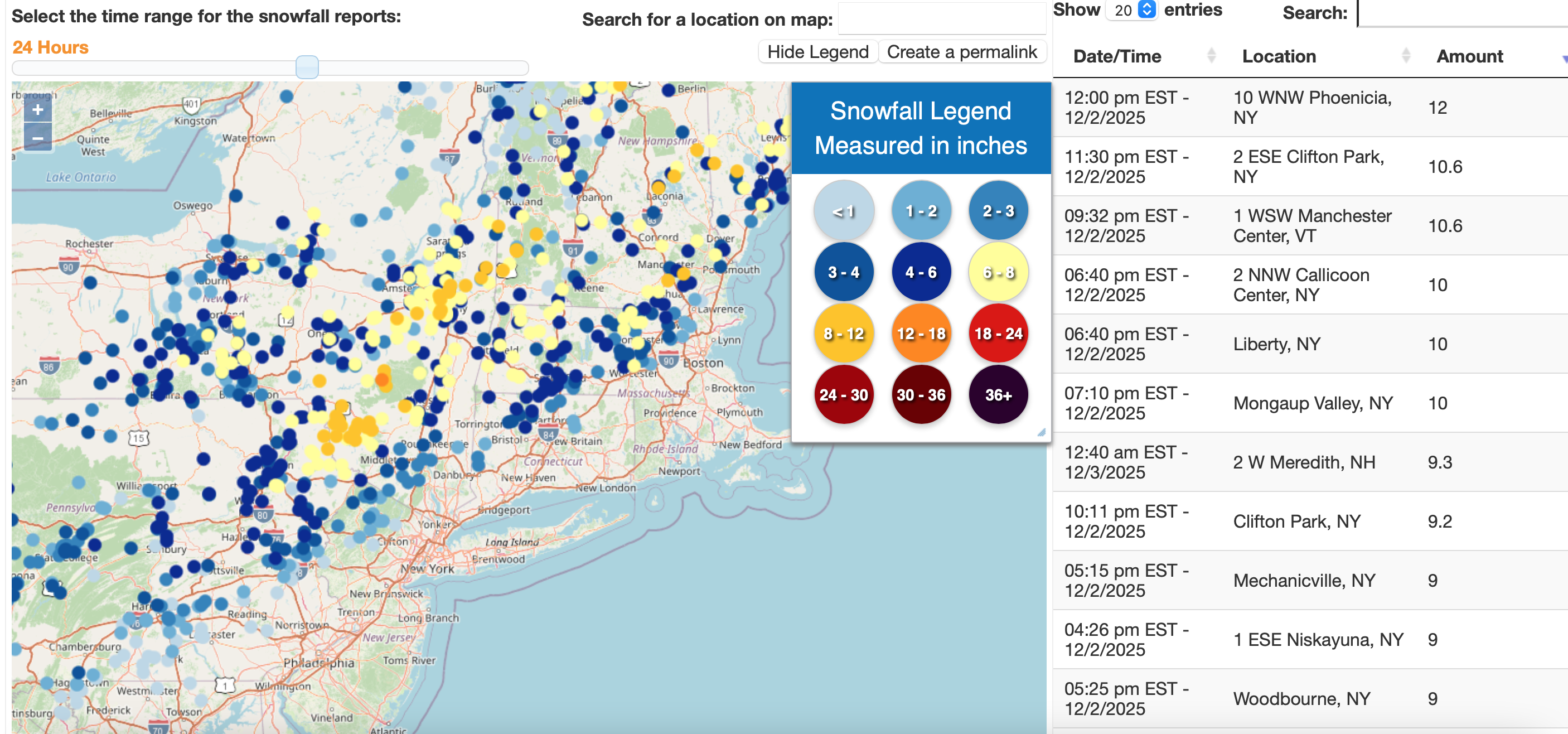
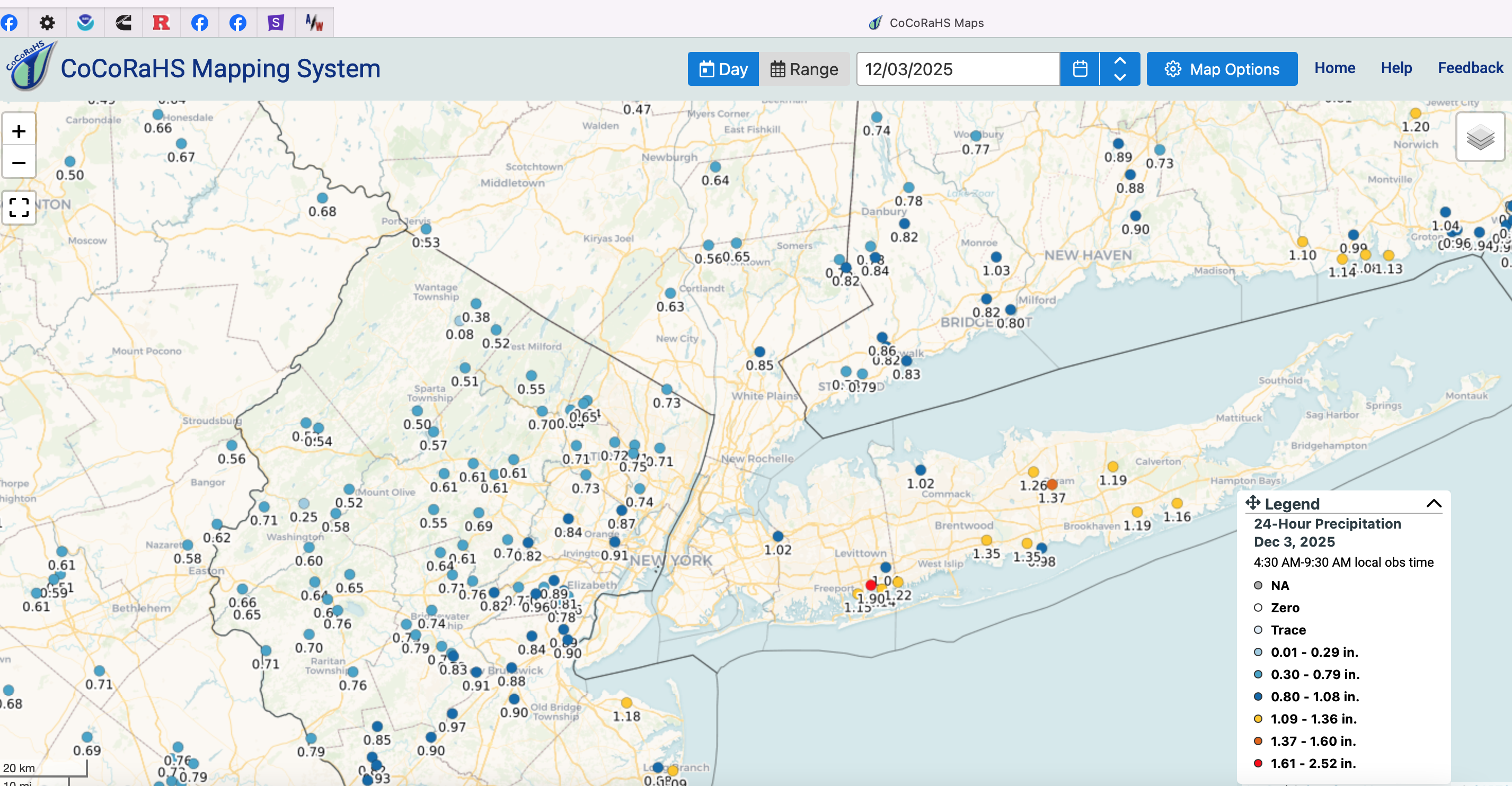
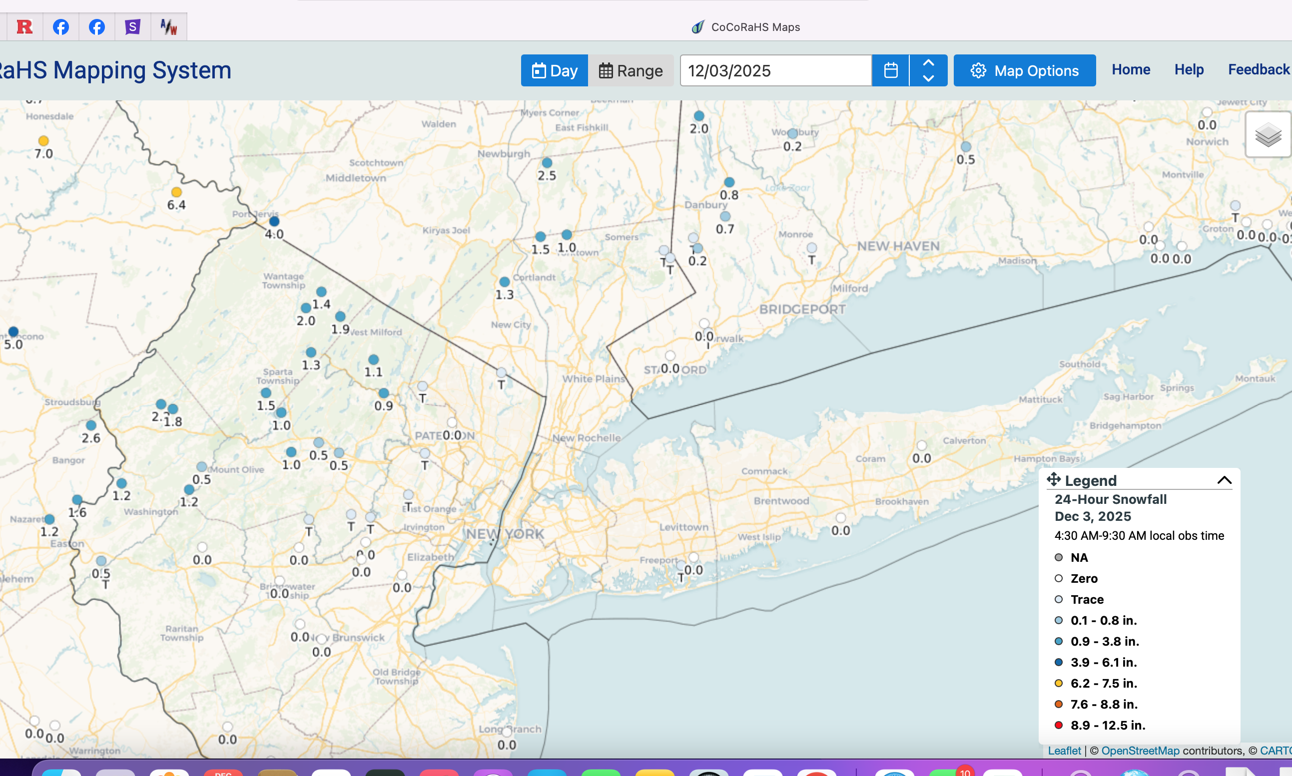
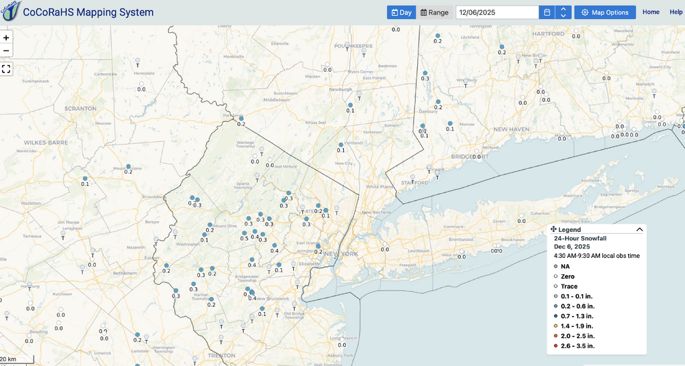
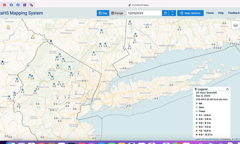
CoCoRaHs snowfall below as of 8A/6. Please click for clarity. Measurable snow sleet occurred at CP, KEWR, KLGA, a couple days earlier than POR normal first date in the second week of Dec. My last on this thread. We can move onto something bigger and more extensive inclusive of LI by the first day of winter (I would hope).
-
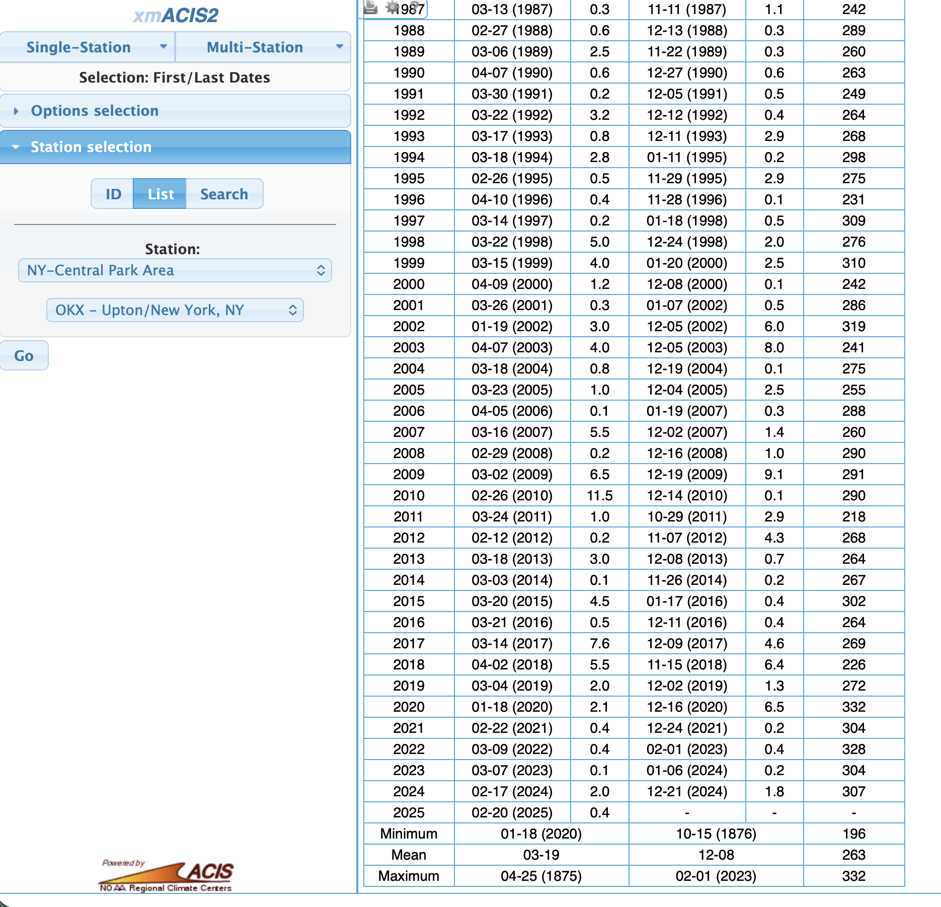
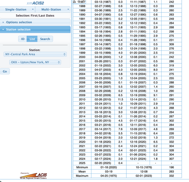
via XMACIS below. Newark POR 1931. normal first day of measurable snow 12/8 LaGuardia POR 1940. normal first day of measurable snow 12/11
-
KLGA and KEWR also measured this morning...both first of the season.
-
Wantage NJ had 0.1" overnight. NYC CP XMACIS first last date of measurable. Median for the period off record dating back to 1869 is Dec 8. see below. CP did it a couple days early! Good call Don via stats a. few days ago.
-
METAR KNYC 061151Z AUTO 00000KT 3SM -SN FEW017 OVC026 M01/M03 A2994 RMK AO2 UPB09E34SNB34 SLP132 P0001 60001 70001 T10061033 10000 21011 56002 First measurable snowfall for the season at CP? A day or so before the normal first day?
-
Bands of what I call junk light mixed freezing precipitation coming through the area next 2-4 hours. Thanks for your reports. NYC had a T of snow and Newark in progress snow with snow sleet. We'll take what we can get. Yes, high res models had an idea and NWS offices responded with the SPS's.
-
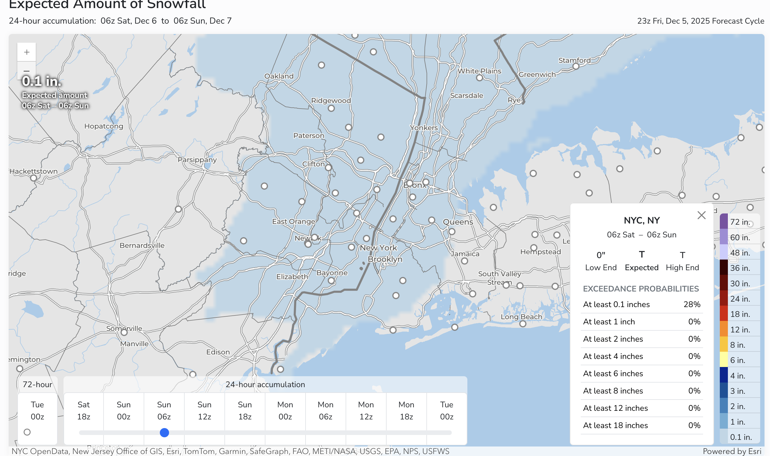
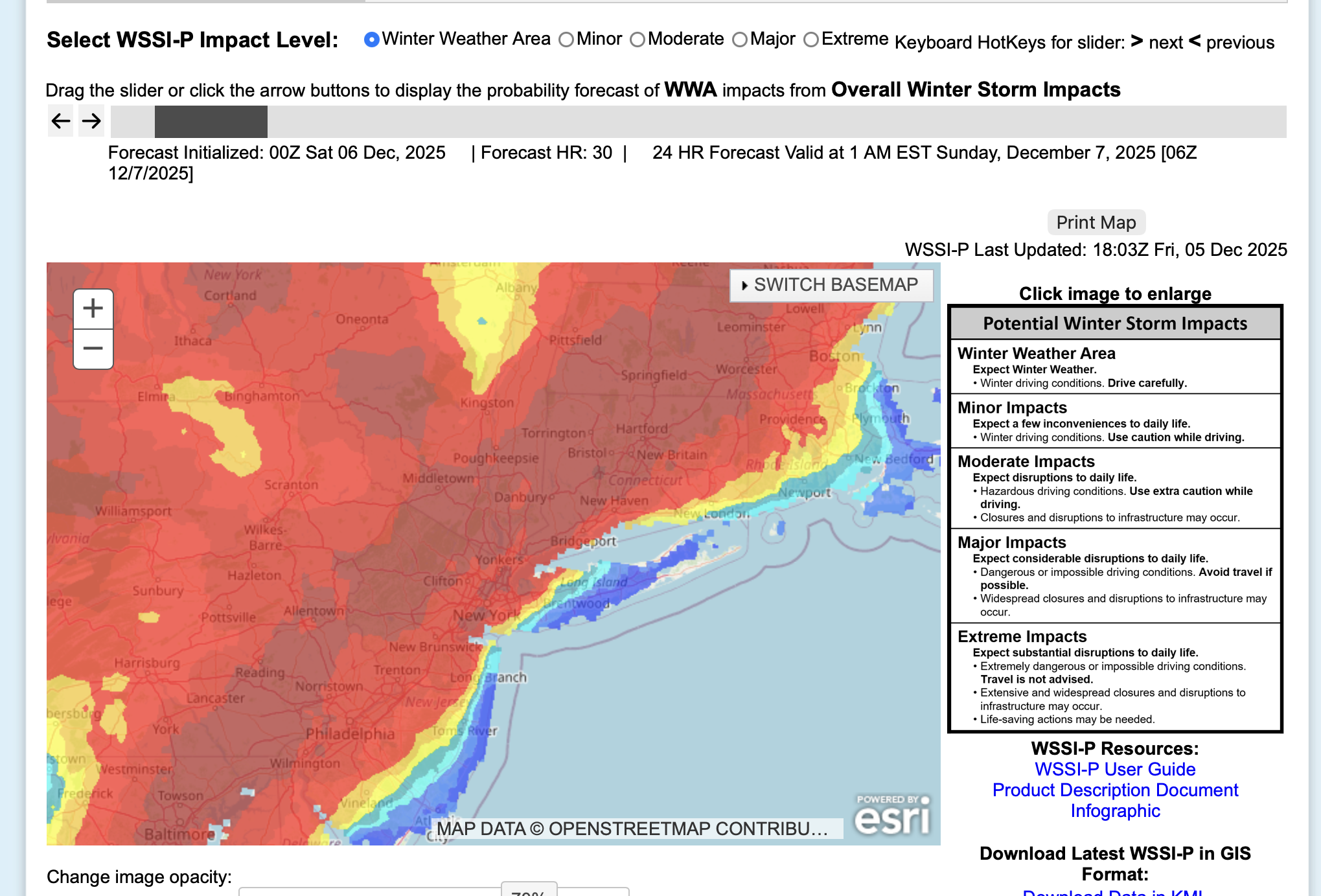
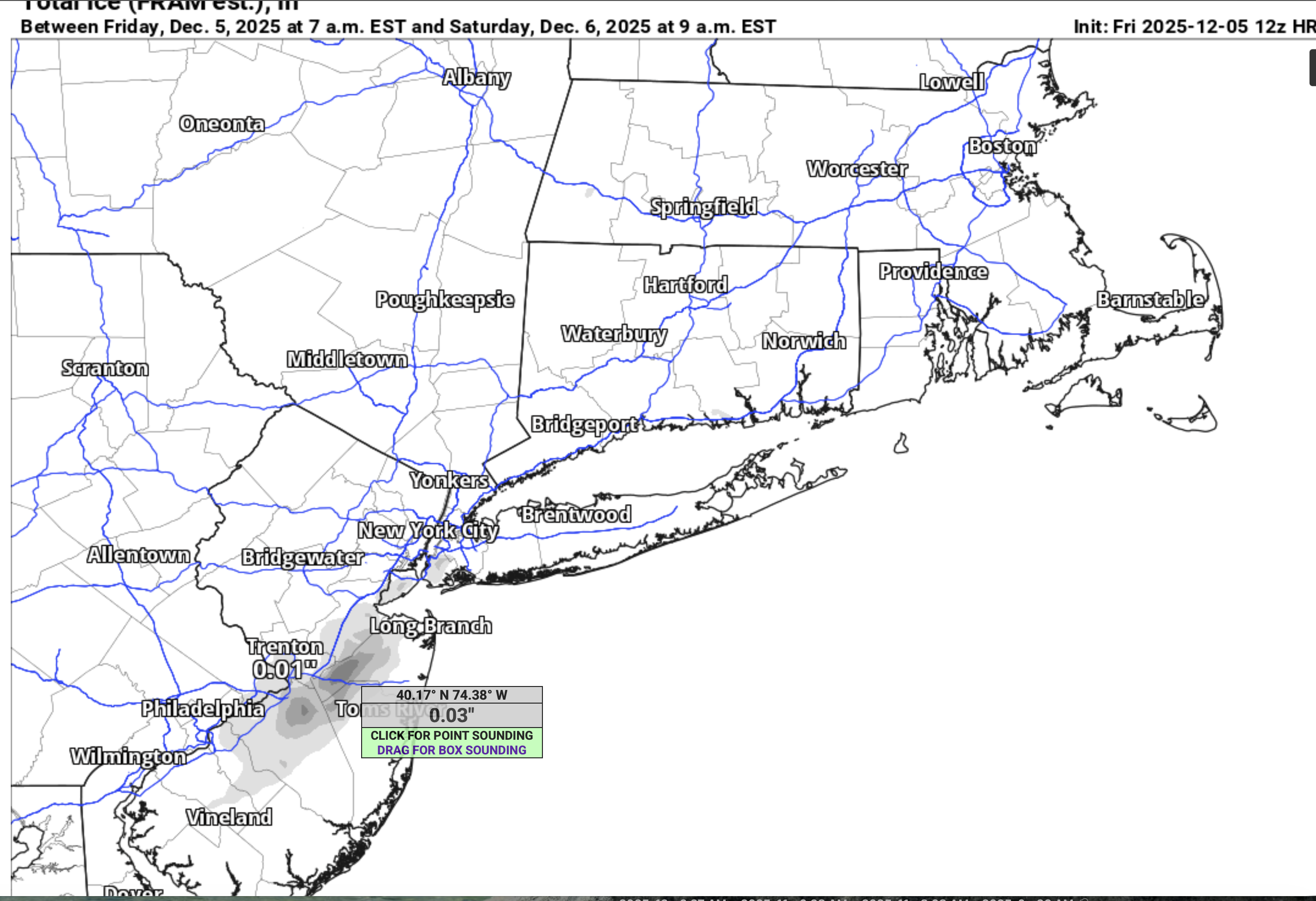
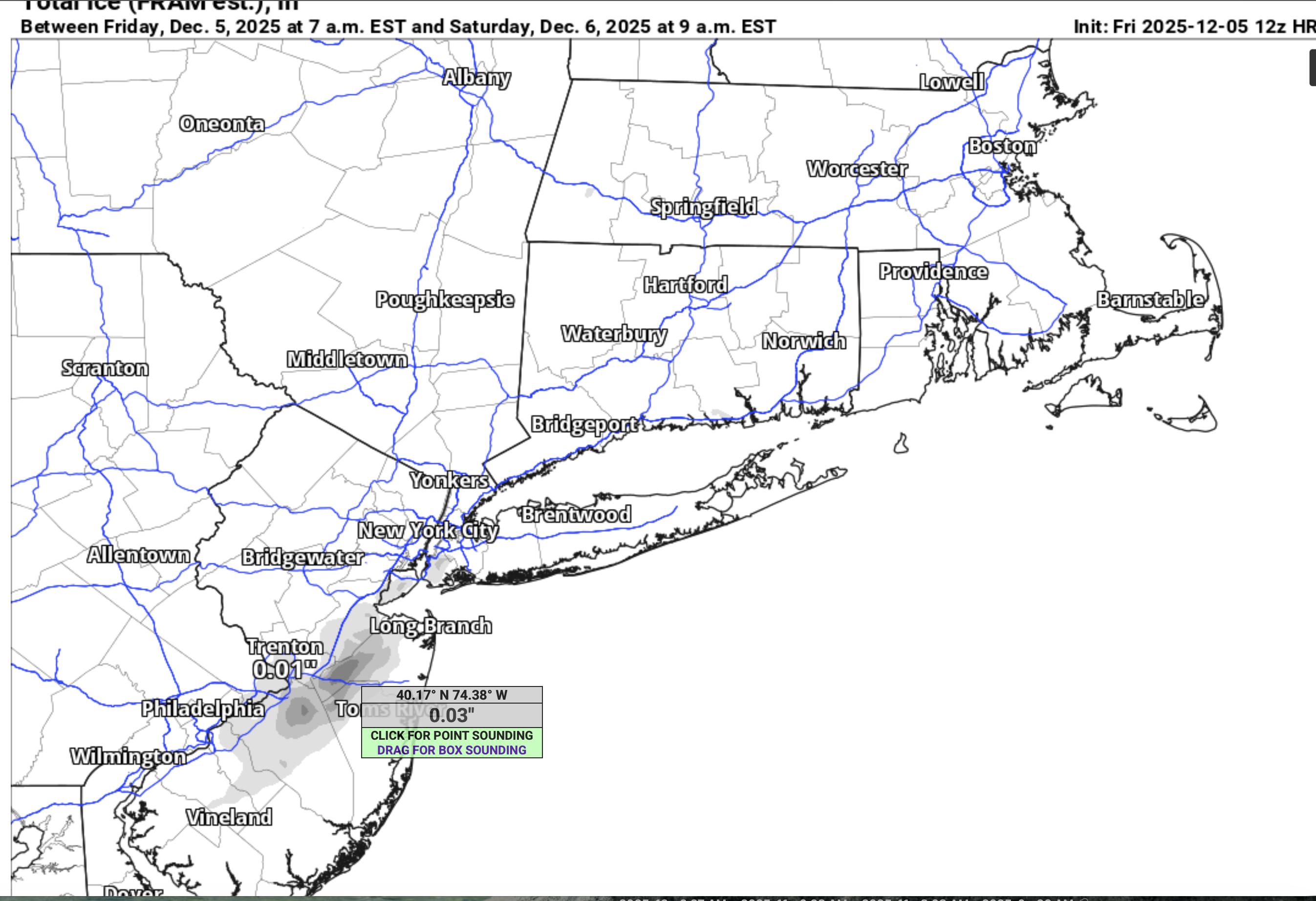
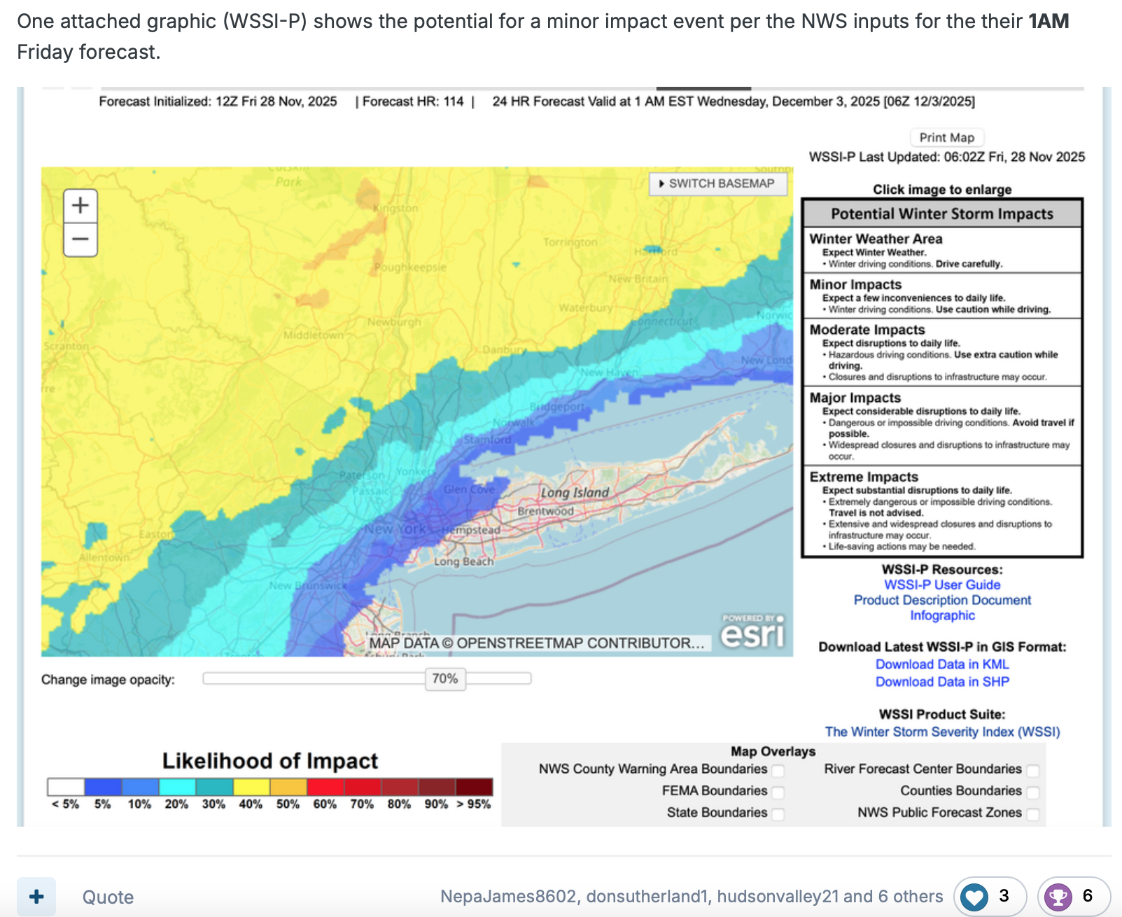
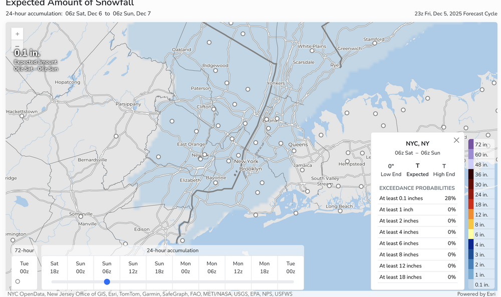
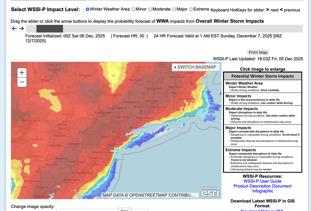
OKX issued an SPS for tomorrow morning covering parts of the area and multiple models but not all, have spotty very light freezing-frozen precipitation in our area over night. mPing may be helpful in addition to monitoring radar developments, especially 4A-9A Sat. Questions are: will the expected low top precipitation be heavy enough to measure 0.01 NYC metro and will temps remain at or below 32F in CP overnight. Couldn't wait much longer to decide. Graphics below: WSSI-P for winter drivIng habits overnight... ie not even MINOR impact according to the criteria, and the probabilstic snow portal for NYC CP. So odds are against but am not waiting this out. Probably no measurable snow NYC but someone in the I95 corridor of NJ-NYC-CT is going to get a little wintry weather overnight... more than the flurries of earlier today. 658P/5
-
am offline til 330. will consider NOW thread for NYC first measurable at 5, if other models join the HRRR and EC. Uncertain ptype an T.
-
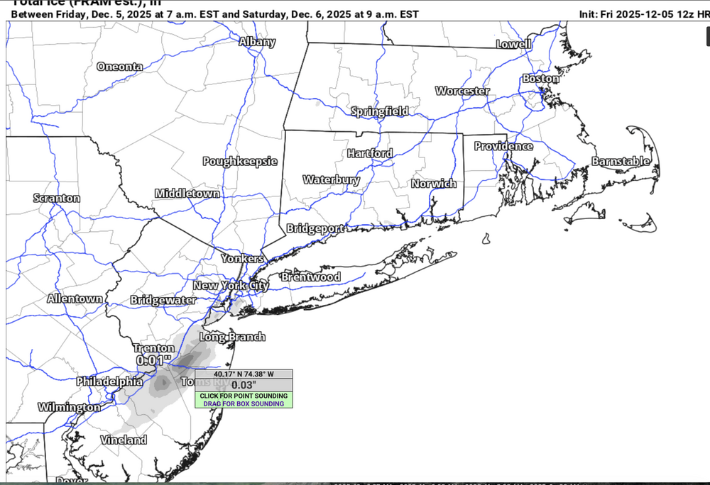
Well, here's your 12z HRRR for tomorrow morning (don't count this mornings snow s of PHL). Will revisit at 5PM for possible first measurable NYC early Sat from the very subtle low level trough.
-
This has had a message to to moderators a couple years ago. I had no feedback and so I live with this map as is, until moderators advise otherwise. Thanks for your own feedback. At least there is opportunity for all the participants to comment and review.
-
My Wantage NJ location low was 7 above with still an inch of snow-ice cover.
-
Heads up early Saturday: NO thread at this time but there could be a frozen-freezing trace to 1/4" snow-sleet-freezing rain event along I95 tomorrow morning between roughly 2A-8A (rain Long Island). Not threading but multiple models trying for this including the late on board EC. It's minor but worthy of monitoring and I could see this eventually needing a short fuse SPS, or even an advisory. These are the unexpected travel issues, especially after an afternoon of temps barely above freezing.
-
Presume I can use this map describing the extent of the NYC subforum> Please confirm. Thank you.
-
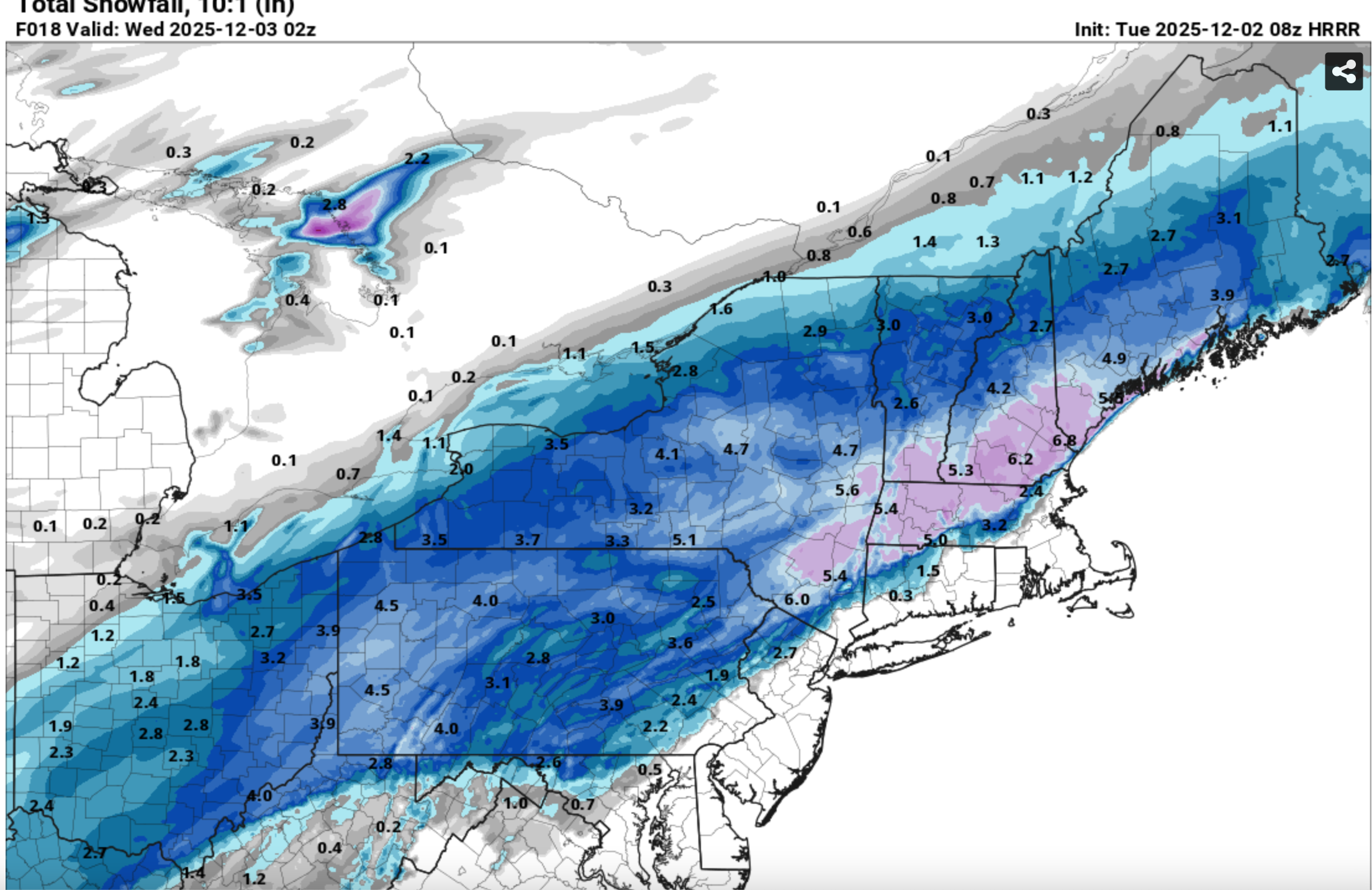
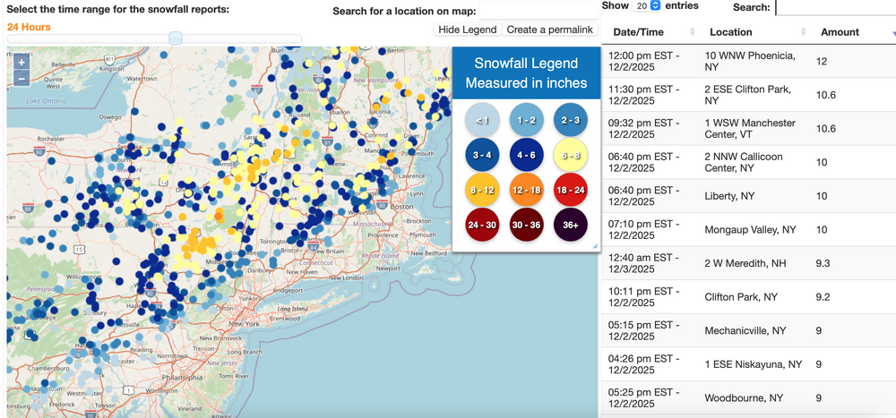
And my last group of graphics: Check out the 08z/2 HRRR and the resultant snowfall... cherry picked that HRRR but its what I used for a local FB post. Scary good science (at least at times close in).
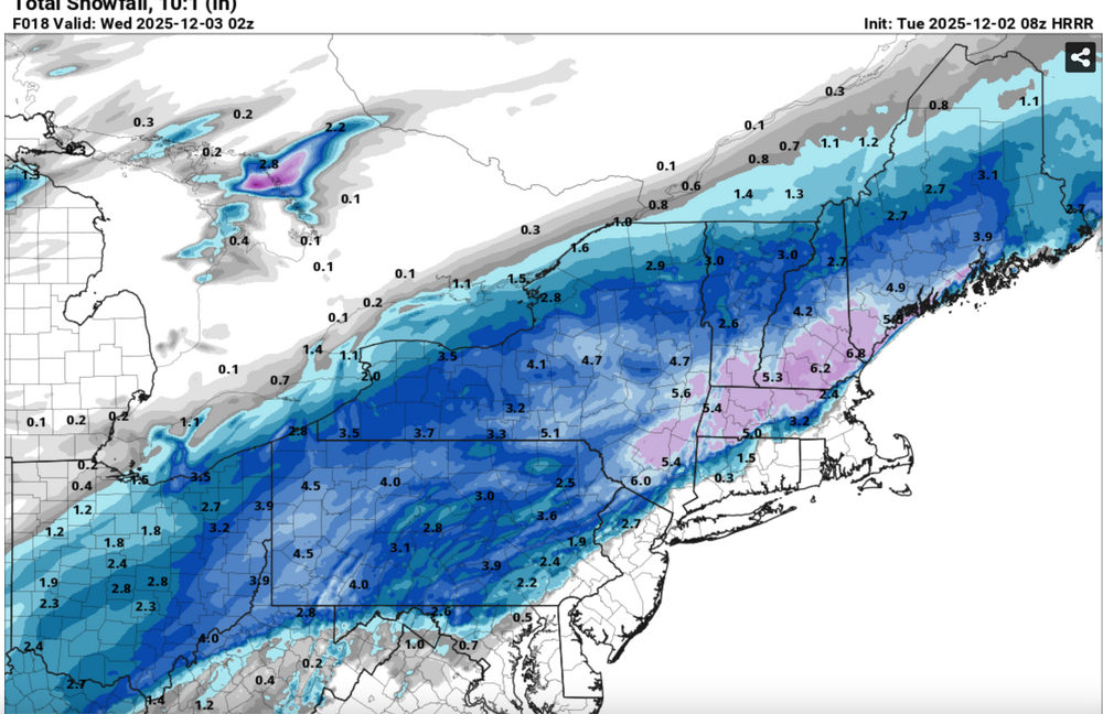
-
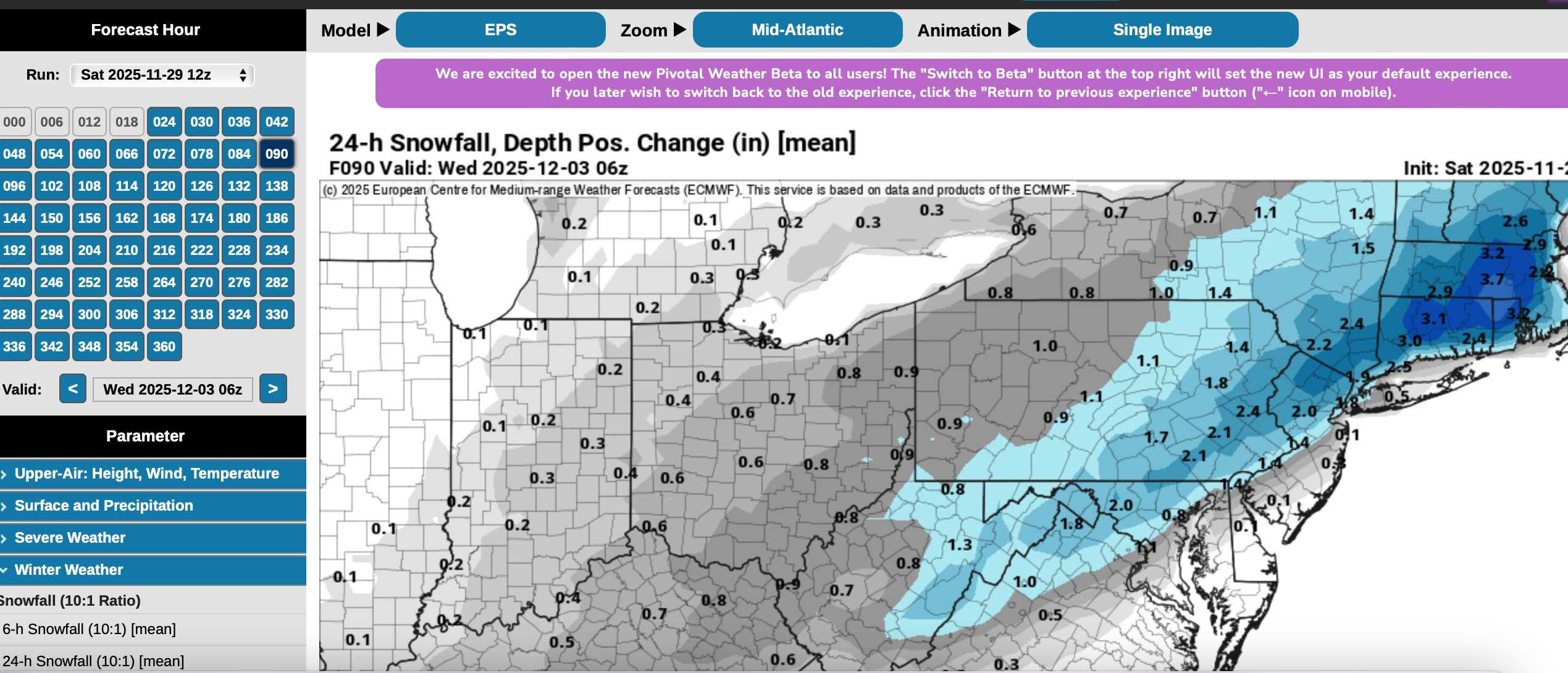
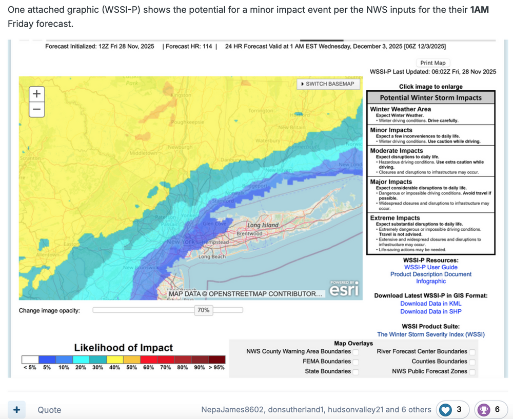
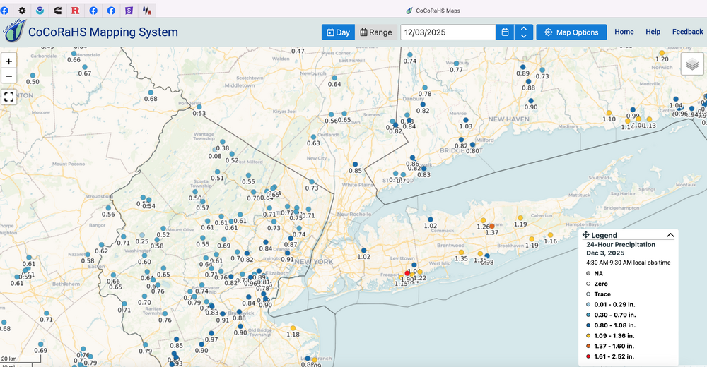
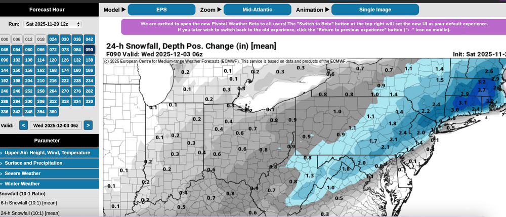
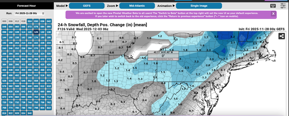
Indulge me for a moment on Thread reasoning despite the fact that all snow/ice was just inland from I95 and therefore missed the bulk of our members (no mPing sleet NYC). I say bulk of our members because I'm not sure we know how may are on here from coastal locations vs inland...I'm pretty sure its not 50 to 1. At Go time last Friday, a thread was made with the following basics. First the WSSI-P... MINOR impact. Yellow was the threat area and CORRECT with significant snow/ice during the morning-midday hours. I will use WSSI P yellow or higher probs for closer in threads during the future. We do have an ample amount of interior folk interested in winter activity. I hadn't heard anything negative from a moderator. So... the yellow thread area in the Friday guidance, even though a 40% threat for D5 is pretty decent for automated guidance. The numbers... plenty of beneficial rainfall for the coasts, AND the snowfall in the interior (doesn't show ice). Now, check the GEFS Modeled 24 hour Positive snow depth change!!!! against the the EPS same...except I could not go back to the Friday version, so I sued Saturday, but you see the EPS was HEAVIER AND WRONG. I hung may hat on what I thought was a better model. From my view: WSSI-P is a tool that should be used by all regarding impact. AND, the EPS (Ecmwf) is not as advanced as I thought it was.... This leaves the door open to more future choices... and am disspoiinted in EPS performance.
-
Reality check for one ensemble indicator: GEFS best and most consistent from 29/00z cycle through todays cycle on the se edge of the 24 hr positive snow depth change, and max axis snow depth change. EPS initially far too far se but slowly corrected Northwest. Ditto CMCE.
-
Wantage 2.3" mostly sleet at 1PM 28.8F.