donsutherland1
-
Posts
24,154 -
Joined
Content Type
Profiles
Blogs
Forums
American Weather
Media Demo
Store
Gallery
Everything posted by donsutherland1
-
A cool April is concluding. At New York City, the monthly mean temperature was 52.8°, which was 0.9° below normal. Tomorrow will be another partly sunny and pleasant day. However, the generally cooler than normal weather will likely persist through Tuesday on account of the ongoing blocking. Then, there could be a short-lived rebound in temperatures before cooler air returns for a time. During the 1991-2020 period, the April 25-May 5 period saw temperatures average 1°-2° below normal when strong blocking coincided with Niña conditions, as has been the case this year. Afterward, approximately 50% of such cases went on to see a warmer to much warmer than normal second half of May. The end result will likely be a warmer than normal May when the month concludes. The ENSO Region 1+2 anomaly was -1.9°C and the Region 3.4 anomaly was -1.0°C for the week centered around April 20. For the past six weeks, the ENSO Region 1+2 anomaly has averaged -0.98°C and the ENSO Region 3.4 anomaly has averaged -0.92°C. La Niña conditions will likely persist into the start of June. The SOI was +6.49 today. The preliminary Arctic Oscillation (AO) was -0.731 today. On April 28 the MJO was in Phase 3 at an amplitude of 0.772 (RMM). The April 27-adjusted amplitude was 0.624 (RMM).
-
May 2022 temperature forecast contest
donsutherland1 replied to Roger Smith's topic in Weather Forecasting and Discussion
DCA _ NYC _ BOS __ ORD _ ATL _ IAH ___ DEN _ PHX _ SEA 1.6 1.4 1.4 0.8 1.2 1.0 0.4 0.9 -2.0 -
Morning thoughts… It will be partly sunny to mostly sunny and a bit milder. High temperatures will likely reach the lower 60s in much of the region. Likely high temperatures around the region include: New York City (Central Park): 66° Newark: 67° Philadelphia: 68° Below normal temperatures will persist through the middle of the first week of May. Normals: New York City: 30-Year: 67.3°; 15-Year: 67.8° Newark: 30-Year: 68.1°; 15-Year: 68.7° Philadelphia: 30-Year: 70.0°; 15-Year: 70.5°
-
The weekend will be several degrees warmer than today. However, the cooler than normal weather will likely persist through Tuesday on account of the ongoing blocking. Then, there could be a short-lived rebound in temperatures before cooler air returns. During the 1991-2020 period, the April 25-May 5 period saw temperatures average 1°-2° below normal when strong blocking coincided with Niña conditions, as has been the case this year. Afterward, approximately 50% of such cases went on to see a warmer to much warmer than normal second half of May. The end result will likely be a warmer than normal May when the month concludes. The ENSO Region 1+2 anomaly was -1.9°C and the Region 3.4 anomaly was -1.0°C for the week centered around April 20. For the past six weeks, the ENSO Region 1+2 anomaly has averaged -0.98°C and the ENSO Region 3.4 anomaly has averaged -0.92°C. La Niña conditions will likely persist into the start of June. The SOI was +15.72 today. The preliminary Arctic Oscillation (AO) was -1.033 today. On April 27 the MJO was in Phase 3 at an amplitude of 0.624 (RMM). The April 26-adjusted amplitude was 0.540 (RMM). Based on sensitivity analysis applied to the latest guidance, there is an implied near 100% probability that New York City will have a cooler than normal April (1991-2020 normal). April will likely finish with a mean temperature near 52.7° (1.0° below normal).
-
Morning thoughts… It will be partly sunny to mostly sunny and a bit milder. High temperatures will likely reach the lower 60s in much of the region. Likely high temperatures around the region include: New York City (Central Park): 63° Newark: 64° Philadelphia: 64° Below normal temperatures will persist through the middle of the first week of May. Normals: New York City: 30-Year: 66.9°; 15-Year: 67.5° Newark: 30-Year: 67.8°; 15-Year: 68.3° Philadelphia: 30-Year: 69.7°; 15-Year: 70.1°
-
Another cold night lies ahead. The cooler than normal weather will likely persist through the middle of the first week of May on account of the ongoing blocking. Then, there could be a short-lived rebound in temperatures before cooler air returns. During the 1991-2020 period, the April 25-May 5 period saw temperatures average 1°-2° below normal when strong blocking coincided with Niña conditions. Afterward, approximately 50% of such cases went on to see a warmer to much warmer than normal second half of May. The ENSO Region 1+2 anomaly was -1.9°C and the Region 3.4 anomaly was -1.0°C for the week centered around April 20. For the past six weeks, the ENSO Region 1+2 anomaly has averaged -0.98°C and the ENSO Region 3.4 anomaly has averaged -0.92°C. La Niña conditions will likely persist into the start of June. The SOI was +30.35 today. That was the second consecutive day on which the SOI was +30.00 or above. The last time that happened was December 25-26, 2021. The last time that happened in April was April 8-9, 2011. The preliminary Arctic Oscillation (AO) was -0.901 today. On April 26 the MJO was in Phase 2 at an amplitude of 0.537 (RMM). The April 25-adjusted amplitude was 0.423 (RMM). Based on sensitivity analysis applied to the latest guidance, there is an implied near 100% probability that New York City will have a cooler than normal April (1991-2020 normal). April will likely finish with a mean temperature near 52.7° (1.0° below normal).
-
Morning thoughts… It will be partly sunny to mostly sunny and cool. High temperatures will likely reach the middle and upper 50s in much of the region. Likely high temperatures around the region include: New York City (Central Park): 58° Newark: 59° Philadelphia: 59° Below normal temperatures will persist through the middle of the first week of May. Normals: New York City: 30-Year: 66.6°; 15-Year: 67.1° Newark: 30-Year: 67.5°; 15-Year: 68.0° Philadelphia: 30-Year: 69.4°; 15-Year: 69.8°
-
Today was partly sunny but unseasonably cool. A cold night lies ahead. New York City will likely see the mercury fall toward or even into the upper 30s. Outside Philadelphia, Newark, and New York City, widespread readings in the lower and middle 30s are likely. The cooler than normal weather will likely persist through the middle of the first week of May on account of the ongoing blocking. During the 1991-2020 period, the April 25-May 5 period saw temperatures average 1°-2° below normal when strong blocking coincided with Niña conditions. Afterward, approximately 50% of such cases went on to see a warmer to much warmer than normal second half of May. The ENSO Region 1+2 anomaly was -1.9°C and the Region 3.4 anomaly was -1.0°C for the week centered around April 20. For the past six weeks, the ENSO Region 1+2 anomaly has averaged -0.98°C and the ENSO Region 3.4 anomaly has averaged -0.92°C. La Niña conditions will likely persist into the start of June. The SOI was +31.44 today. The preliminary Arctic Oscillation (AO) was -0.909 today. On April 25 the MJO was in Phase 2 at an amplitude of 0.423 (RMM). The April 24-adjusted amplitude was 0.373 (RMM). Based on sensitivity analysis applied to the latest guidance, there is an implied 99% probability that New York City will have a cooler than normal April (1991-2020 normal). April will likely finish with a mean temperature near 52.6° (1.1° below normal).
-
Morning thoughts… It will be partly sunny and cool. Some scattered showers are possible this afternoon or evening. High temperatures will likely reach the middle and upper 50s in much of the region. Likely high temperatures around the region include: New York City (Central Park): 63° Newark: 65° Philadelphia: 72° Below normal temperatures will persist through the middle of the first week of May. Normals: New York City: 30-Year: 66.3°; 15-Year: 66.8° Newark: 30-Year: 67.1°; 15-Year: 67.6° Philadelphia: 30-Year: 69.1°; 15-Year: 69.5°
-
The cold front responsible for today's showers will usher in a period of cooler than normal weather that will likely persist through the middle of the first week of May on account of the ongoing blocking. During the 1991-2020 period, the April 25-May 5 period saw temperatures average 1°-2° below normal when strong blocking coincided with Niña conditions. Afterward, approximately 50% of such cases went on to see a warmer to much warmer than normal second half of May. The ENSO Region 1+2 anomaly was -1.9°C and the Region 3.4 anomaly was -1.0°C for the week centered around April 20. For the past six weeks, the ENSO Region 1+2 anomaly has averaged -0.98°C and the ENSO Region 3.4 anomaly has averaged -0.92°C. La Niña conditions will likely persist into the start of June. The SOI was +27.11 today. The preliminary Arctic Oscillation (AO) was -1.444 today. On April 24 the MJO was in Phase 2 at an amplitude of 0.379 (RMM). The April 23-adjusted amplitude was 0.557 (RMM). Based on sensitivity analysis applied to the latest guidance, there is an implied 96% probability that New York City will have a cooler than normal April (1991-2020 normal). April will likely finish with a mean temperature near 52.6° (1.1° below normal).
-
Morning thoughts… It will be variably cloudy. Some showers and thundershowers are possible during the afternoon or evening. High temperatures will likely reach the lower and middle 60s in much of the region. Likely high temperatures around the region include: New York City (Central Park): 63° Newark: 65° Philadelphia: 72° A cooler pattern will develop starting tomorrow Normals: New York City: 30-Year: 66.0°; 15-Year: 66.4° Newark: 30-Year: 66.8°; 15-Year: 67.2° Philadelphia: 30-Year: 68.7°; 15-Year: 69.1°
-
Tomorrow will be variably cloudy and mild. Some showers or perhaps a thundershower are possible. Afterward, the ongoing blocking will likely lead to a more sustained cool pattern that could last into the beginning of May. The coolest period will likely occur from the middle of next week through the middle of the first week of May. During the 1991-2020 period, the April 25-May 5 period saw temperatures average 1°-2° below normal when strong blocking coincided with Niña conditions. Afterward, approximately 50% of such cases went on to see a warmer to much warmer than normal second half of May. The ENSO Region 1+2 anomaly was -1.9°C and the Region 3.4 anomaly was -1.0°C for the week centered around April 20. For the past six weeks, the ENSO Region 1+2 anomaly has averaged -0.98°C and the ENSO Region 3.4 anomaly has averaged -0.92°C. La Niña conditions will likely persist into the start of June. The SOI was +18.17 today. The preliminary Arctic Oscillation (AO) was -1.773 today. On April 23 the MJO was in Phase 2 at an amplitude of 0.562 (RMM). The April 22-adjusted amplitude was 0.786 (RMM). Based on sensitivity analysis applied to the latest guidance, there is an implied 91% probability that New York City will have a cooler than normal April (1991-2020 normal). April will likely finish with a mean temperature near 52.7° (1.0° below normal).
-
Morning thoughts… It will be partly to mostly cloudy. High temperatures will likely reach the lower and middle 60s in much of the region. Likely high temperatures around the region include: New York City (Central Park): 61° Newark: 61° Philadelphia: 66° A cooler pattern will develop at midweek. Normals: New York City: 30-Year: 65.6°; 15-Year: 66.0° Newark: 30-Year: 66.4°; 15-Year: 66.9° Philadelphia: 30-Year: 68.4°; 15-Year: 68.8°
-
Tomorrow will be variably cloudy and pleasant. The ongoing blocking will likely lead to a more sustained cool pattern that could last into the beginning of May. The coolest period will likely occur from the middle of next week through the middle of the first week of May. During the 1991-2020 period, the April 25-May 5 period saw temperatures average 1°-2° below normal when strong blocking coincided with Niña conditions. Afterward, approximately 50% of such cases went on to see a warmer to much warmer than normal second half of May. The ENSO Region 1+2 anomaly was -1.7°C and the Region 3.4 anomaly was -0.9°C for the week centered around April 13. For the past six weeks, the ENSO Region 1+2 anomaly has averaged -0.80°C and the ENSO Region 3.4 anomaly has averaged -0.88°C. La Niña conditions will likely persist into the start of June. The ENSO Region 1+2 anomaly of -1.7°C is the lowest such figure on record for a week centered around April 13. The old record was -1.4°C, which was set in 1994. Since 1982, there were five prior cases where the ENSO Region 1+2 anomaly was -1.5°C or colder. 40% of those cases saw La Niña conditions the following winter; 40% saw neutral-cool ENSO conditions that approached but did not reach La Niña status. 20% of those cases saw an El Niño develop during the following winter. More immediately, the magnitude of cool anomalies implies that the proverbial stage is set for an active to very active Atlantic hurricane season. The SOI was +15.28 today. The preliminary Arctic Oscillation (AO) was -1.687 today. On April 22 the MJO was in Phase 2 at an amplitude of 0.787 (RMM). The April 21-adjusted amplitude was 1.168 (RMM). Based on sensitivity analysis applied to the latest guidance, there is an implied 84% probability that New York City will have a cooler than normal April (1991-2020 normal). April will likely finish with a mean temperature near 52.8° (0.9° below normal).
-
Morning thoughts… It will be partly to mostly sunny and pleasant. High temperatures will likely reach the lower and middle 60s in much of the region. Likely high temperatures around the region include: New York City (Central Park): 63° Newark: 65° Philadelphia: 62° A cooler pattern will develop at midweek. Normals: New York City: 30-Year: 65.3°; 15-Year: 65.7° Newark: 30-Year: 66.1°; 15-Year: 66.5° Philadelphia: 30-Year: 68.1°; 15-Year: 68.5° Through 6 AM MDT, snowfall totals from the ongoing blizzard in the Northern Plains include: Bowman, N D: 12.0”; Dickinson, ND: 8.0”; Watford City, ND: 12.5”; Wildrose, ND: 12.0”; and, Williston, ND: 8.5”. In addition, Casper, WY picked up 6.8” of snow yesterday breaking the daily record of 5.0” from 1958.
-
Tomorrow will be partly sunny and pleasant. The ongoing blocking will likely lead to a more sustained cool pattern that could last into the beginning of May. The coolest period will likely occur from the middle of next week through the middle of the first week of May. During the 1991-2020 period, the April 25-May 5 period saw temperatures average 1°-2° below normal when strong blocking coincided with Niña conditions. Afterward, approximately 50% of such cases went on to see a warmer to much warmer than normal second half of May. Meanwhile, parts of the Northern Plains will see another blizzard dump heavy wind-driven snow tonight into tomorrow. The axis of heaviest snow will cover eastern Montana and western North Dakota. The ENSO Region 1+2 anomaly was -1.7°C and the Region 3.4 anomaly was -0.9°C for the week centered around April 13. For the past six weeks, the ENSO Region 1+2 anomaly has averaged -0.80°C and the ENSO Region 3.4 anomaly has averaged -0.88°C. La Niña conditions will likely persist into the start of June. The ENSO Region 1+2 anomaly of -1.7°C is the lowest such figure on record for a week centered around April 13. The old record was -1.4°C, which was set in 1994. Since 1982, there were five prior cases where the ENSO Region 1+2 anomaly was -1.5°C or colder. 40% of those cases saw La Niña conditions the following winter; 40% saw neutral-cool ENSO conditions that approached but did not reach La Niña status. 20% of those cases saw an El Niño develop during the following winter. More immediately, the magnitude of cool anomalies implies that the proverbial stage is set for an active to very active Atlantic hurricane season. The SOI was +18.60 today. The preliminary Arctic Oscillation (AO) was -1.889 today. On April 21 the MJO was in Phase 1 at an amplitude of 1.166 (RMM). The April 20-adjusted amplitude was 1.256 (RMM). Based on sensitivity analysis applied to the latest guidance, there is an implied 79% probability that New York City will have a cooler than normal April (1991-2020 normal). April will likely finish with a mean temperature near 52.8° (0.9° below normal).
-
Morning thoughts… It will be variably cloudy and pleasant. High temperatures will likely reach the lower and middle 60s in much of the region. Likely high temperatures around the region include: New York City (Central Park): 62° Newark: 63° Philadelphia: 68° Tomorrow will be somewhat cooler. Normals: New York City: 30-Year: 64.9°; 15-Year: 65.3° Newark: 30-Year: 65.7°; 15-Year: 66.1° Philadelphia: 30-Year: 67.7°; 15-Year: 68.1° A blizzard will develop in eastern Montana and western North Dakota.
-
Somewhat cooler air will return for the start of the weekend. Sunday could be somewhat milder before the recent development of a blocking leads to a more sustained cool pattern that could last into the beginning of May. During the 1991-2020 period, the April 25-May 5 period saw temperatures average 1°-2° below normal when strong blocking coincided with Niña conditions. Afterward, approximately 50% of such cases went on to see a warmer to much warmer than normal second half of May. Meanwhile, parts of the Northern Plains, including Minot, ND, will see another blizzard dump heavy wind-driven snow late tomorrow into Sunday. The ENSO Region 1+2 anomaly was -1.7°C and the Region 3.4 anomaly was -0.9°C for the week centered around April 13. For the past six weeks, the ENSO Region 1+2 anomaly has averaged -0.80°C and the ENSO Region 3.4 anomaly has averaged -0.88°C. La Niña conditions will likely persist into the start of June. The ENSO Region 1+2 anomaly of -1.7°C is the lowest such figure on record for a week centered around April 13. The old record was -1.4°C, which was set in 1994. Since 1982, there were five prior cases where the ENSO Region 1+2 anomaly was -1.5°C or colder. 40% of those cases saw La Niña conditions the following winter; 40% saw neutral-cool ENSO conditions that approached but did not reach La Niña status. 20% of those cases saw an El Niño develop during the following winter. More immediately, the magnitude of cool anomalies implies that the proverbial stage is set for an active to very active Atlantic hurricane season. The SOI was +12.11 today. The preliminary Arctic Oscillation (AO) was -1.869 today. On April 20 the MJO was in Phase 1 at an amplitude of 1.254 (RMM). The April 19-adjusted amplitude was 1.365 (RMM). Based on sensitivity analysis applied to the latest guidance, there is an implied 82% probability that New York City will have a cooler than normal April (1991-2020 normal). April will likely finish with a mean temperature near 52.7° (1.0° below normal).
-
Morning thoughts… It will be partly sunny, breezy, and warm. High temperatures will likely reach the middle and upper 60s in much of the region. A few locations could reach or exceed 70°. Likely high temperatures around the region include: New York City (Central Park): 66° Newark: 67° Philadelphia: 70° Tomorrow will be somewhat cooler. Normals: New York City: 30-Year: 64.5°; 15-Year: 64.9° Newark: 30-Year: 65.3°; 15-Year: 65.7° Philadelphia: 30-Year: 67.3°; 15-Year: 67.7°
-
It would be exactly normal for NYC for the previous period.
-
Tomorrow will be unseasonably warm before somewhat cooler air returns for the start of the weekend. Sunday could see one more spike in the temperatures as the development of a new round of blocking leads to a more sustained cool pattern that could last into the beginning of May. During the 1991-2020 period, the April 25-May 5 period saw temperatures average 1°-2° below normal when strong blocking coincided with Niña conditions. Afterward, approximately 50% of such cases went on to see a warmer to much warmer than normal second half of May. The ENSO Region 1+2 anomaly was -1.7°C and the Region 3.4 anomaly was -0.9°C for the week centered around April 13. For the past six weeks, the ENSO Region 1+2 anomaly has averaged -0.80°C and the ENSO Region 3.4 anomaly has averaged -0.88°C. La Niña conditions will likely persist into the start of June. The ENSO Region 1+2 anomaly of -1.7°C is the lowest such figure on record for a week centered around April 13. The old record was -1.4°C, which was set in 1994. Since 1982, there were five prior cases where the ENSO Region 1+2 anomaly was -1.5°C or colder. 40% of those cases saw La Niña conditions the following winter; 40% saw neutral-cool ENSO conditions that approached but did not reach La Niña status. 20% of those cases saw an El Niño develop during the following winter. More immediately, the magnitude of cool anomalies implies that the proverbial stage is set for an active to very active Atlantic hurricane season. The SOI was +25.81 today. The preliminary Arctic Oscillation (AO) was -1.495 today. On April 19 the MJO was in Phase 1 at an amplitude of 1.370 (RMM). The April 18-adjusted amplitude was 1.307 (RMM). Based on sensitivity analysis applied to the latest guidance, there is an implied 75% probability that New York City will have a cooler than normal April (1991-2020 normal). April will likely finish with a mean temperature near 53.0° (0.7° below normal).
-
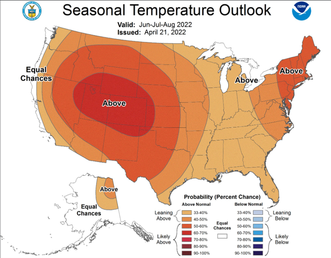
Probably warmer than normal with high dew points based on the SSTAs as they currently stand. The position of the ridging based on the SSTA assumptions probably won’t allow for too many outbreaks of extreme heat. Above normal rainfall with some possible tropical moisture (based on an active hurricane season and position of the ridging) looks reasonable.
-
Morning thoughts… It will become partly to mostly cloudy. High temperatures will likely reach the upper 50s and lower 60s in much of the region. Likely high temperatures around the region include: New York City (Central Park): 59° Newark: 62° Philadelphia: 64° Tomorrow will be an unseasonably warm day. Normals: New York City: 30-Year: 64.2°; 15-Year: 64.5° Newark: 30-Year: 64.9°; 15-Year: 65.3° Philadelphia: 30-Year: 67.0°; 15-Year: 67.4°
-
New paper on marine heatwaves: https://www.nature.com/articles/s41586-022-04573-9