WxUSAF
-
Posts
28,636 -
Joined
-
Last visited
Content Type
Profiles
Blogs
Forums
American Weather
Media Demo
Store
Gallery
Everything posted by WxUSAF
-
You all failed to notice that the Ukie has 1-4” on Saturday for metro corridor and N/W
-
Canadian definitely took a step toward something. Gets NYC to New England after dusting us.
-
Icon has something but a very different evolution. More of a Miller B from the northern vort than a storm approaching us from the south.
-
LFG
-
GFS has a dusting Friday for some of us?
-
12z rgem looks pretty similar. A bit lighter.
-
Holy crap. 6z rgem is like a solid 1-3” for the area Saturday!
-
Euro has been fairly consistent on some of us getting a dusting Saturday morning with the upper level energy swinging around
-
Did it move NW again though? Seems like euro was following GFS, just not as dramatically.
-
Does any snow actually occur with temps at or below freezing? Seems like rain turning to white rain and quickly ending.
-
Don’t know about the 80” snowstorm for southwest PA, but seems like at least one mega cold outbreak is more likely than not for later this month? Probably focused to our west so we don’t get the brunt.
-
Hoco deathband!
-
GFS has some digital blue!
-
It ain’t much, but euro had something for the cape storm? Like dusting -1”?
-
I think it bounces around as much as anything in mid and long range, but it’s pretty deadly inside D5
-
-
Nina’s are exhausting
-
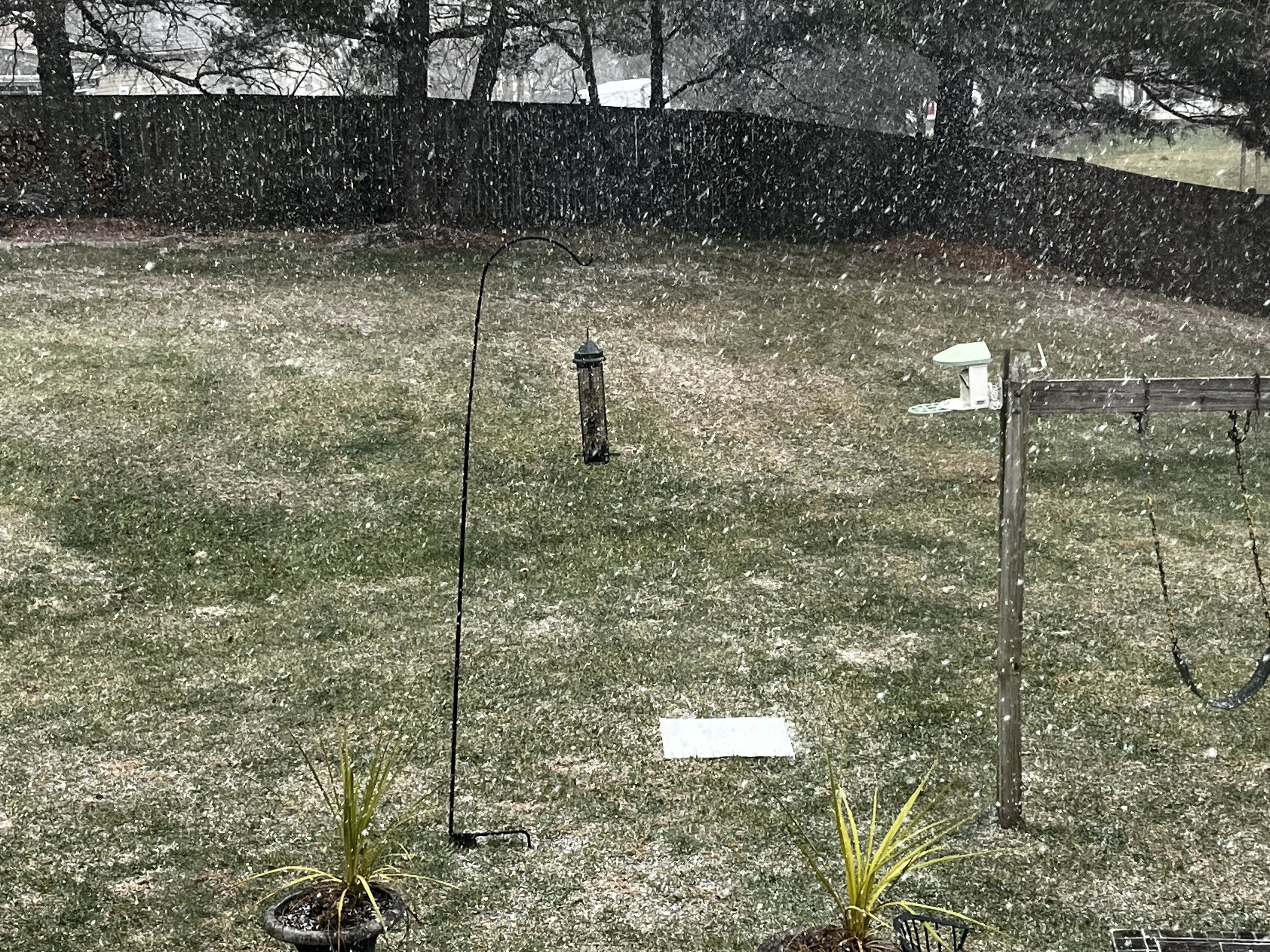
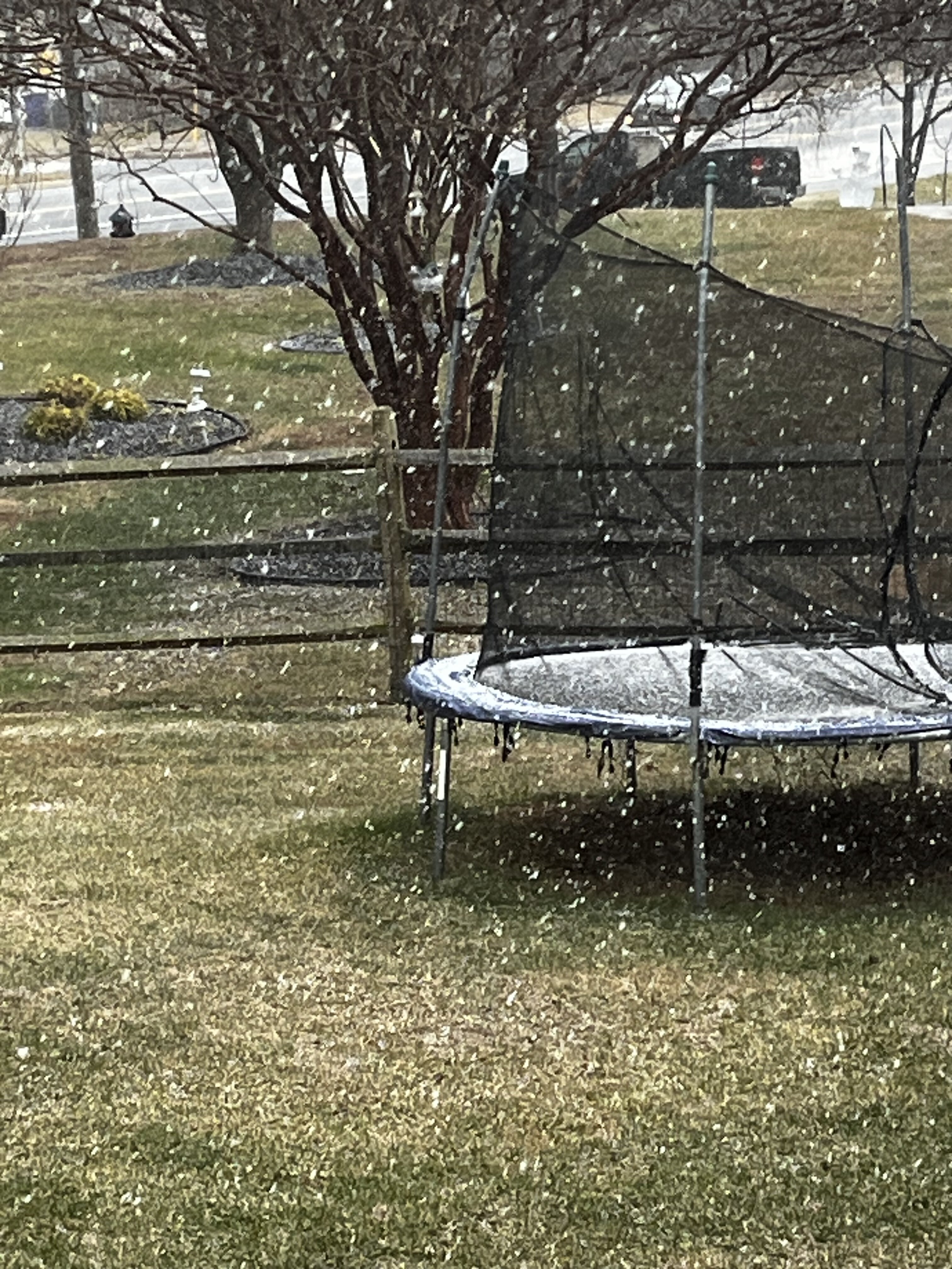
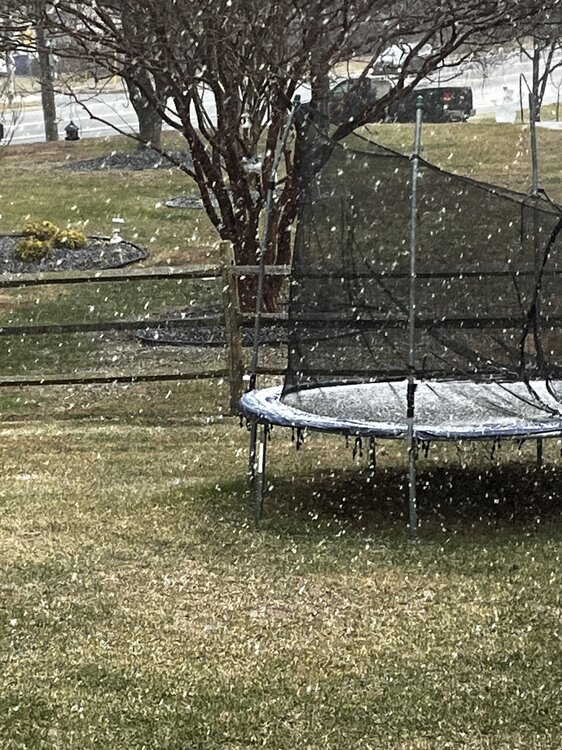
If it wasn’t 48 when it started, we would have definitely gotten a couple tenths in a matter of 3-5 minutes. Temp dropped to 37.
-
Instant mini dusting

- 776 replies
-
- 10
-

-

-
Ripping snow and graupel
-
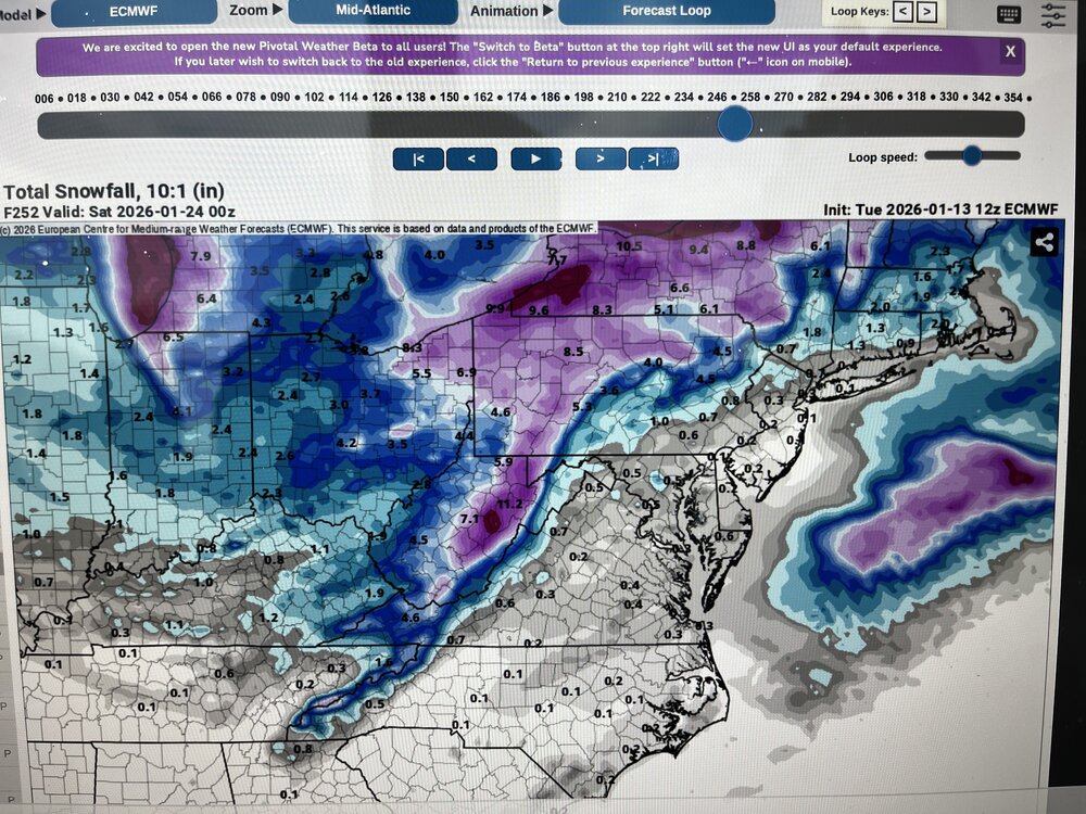
Since the 12-20” idea that one GFS run threw out is obviously gone, we’re trading between the former Euro AI idea of a widespread 1-3” for this solution where some lucky spot may get 6-8” and some people are going to get almost totally skunked.
-
Just had some flakes with temps of like 48
-
Off the top of my head I can’t think of a great analog for this, but I don’t have the photographic memory that @psuhoffmanand others do. I’d guess New England has some experience with these? But you’re looking at a ULL deepening and capturing a surface low basically on top of us. So this is all dynamics driven with strong upward motion. There’s no great moisture feed off the ocean, no WAA or CCB well defined. So I guess we’re looking at where the best lift from the jet streak exit region and the ULL falls? Maybe there will be some frontogen at like 700mb that will produce some of those higher totals? It’s totally a Nowcast. 1-6” would be a reasonable range.
-
This is totally a thoughts and prayers event. 80% going to be broken hearted. Don’t think I’ll be relaxed until I’m shoveling. If we could be objective though, it’s potentially a really cool event to watch just from a dynamics perspective.
-
Storm thread gonna be a scene with a GFS/euro type outcome lol