Tyler Penland
-
Posts
2,523 -
Joined
-
Last visited
Content Type
Profiles
Blogs
Forums
American Weather
Media Demo
Store
Gallery
Everything posted by Tyler Penland
-

2025-2026 Fall/Winter Mountain Thread
Tyler Penland replied to Buckethead's topic in Southeastern States
Absolutely dumped there for a bit but slowing down a bit now. Can't really hear any wind overhead which is weird. Temp only down to 31 but I'm sure that'll fall off soon. -
2025-2026 Fall/Winter Mountain Thread
Tyler Penland replied to Buckethead's topic in Southeastern States
Frontal passage tomorrow looks fun, at least. -
It missed the upslope a bit, but it's been rock solid on upper level features the last 5 days with barely any change. I don't know how much you can really dock it for missing convective snow showers bringing minor accumulations- it's a global model. If it is handling the upper levels better, which it did just fine this go around, I don't foresee anything significant unfortunately. The GFS was remarkably off from the Euro until the 84-90 hour mark for this system and the Euro handled the 500mb pattern much, much better overall. We'll see and I certainly hope the GFS has found its nut for the season, but I'm skeptical.
-
2025-2026 Fall/Winter Mountain Thread
Tyler Penland replied to Buckethead's topic in Southeastern States
Wound up with an inch on the nose here from the convective showers this afternoon. Luckily not much sun to melt it in between downpours. -
2025-2026 Fall/Winter Mountain Thread
Tyler Penland replied to Buckethead's topic in Southeastern States
Coming down pretty solid here right now picked up a nice coating in the last 30 minutes. -
2025-2026 Fall/Winter Mountain Thread
Tyler Penland replied to Buckethead's topic in Southeastern States
The 3km NAM looks convective tomorrow afternoon, works in nearly 100j/kg of surface cape and some mixed layer as well, maybe enough for some isolated lightning strikes as the trough axis swings through. Next weekend is certainly interesting. One thing that gives me caution is the GFS verification scores have not been great lately. That said I'll be down in Georgia next weekend so you can pretty much take a snowstorm to the bank- I missed the November one down there too. -
2025-2026 Fall/Winter Mountain Thread
Tyler Penland replied to Buckethead's topic in Southeastern States
Nice surprise to wake up to. 1.5" in the wind protected holler here at home. 14 for the low. Very nice. Sent from my Pixel 10 Pro using Tapatalk -
2025-2026 Fall/Winter Mountain Thread
Tyler Penland replied to Buckethead's topic in Southeastern States

-
2025-2026 Fall/Winter Mountain Thread
Tyler Penland replied to Buckethead's topic in Southeastern States

-
2025-2026 Fall/Winter Mountain Thread
Tyler Penland replied to Buckethead's topic in Southeastern States
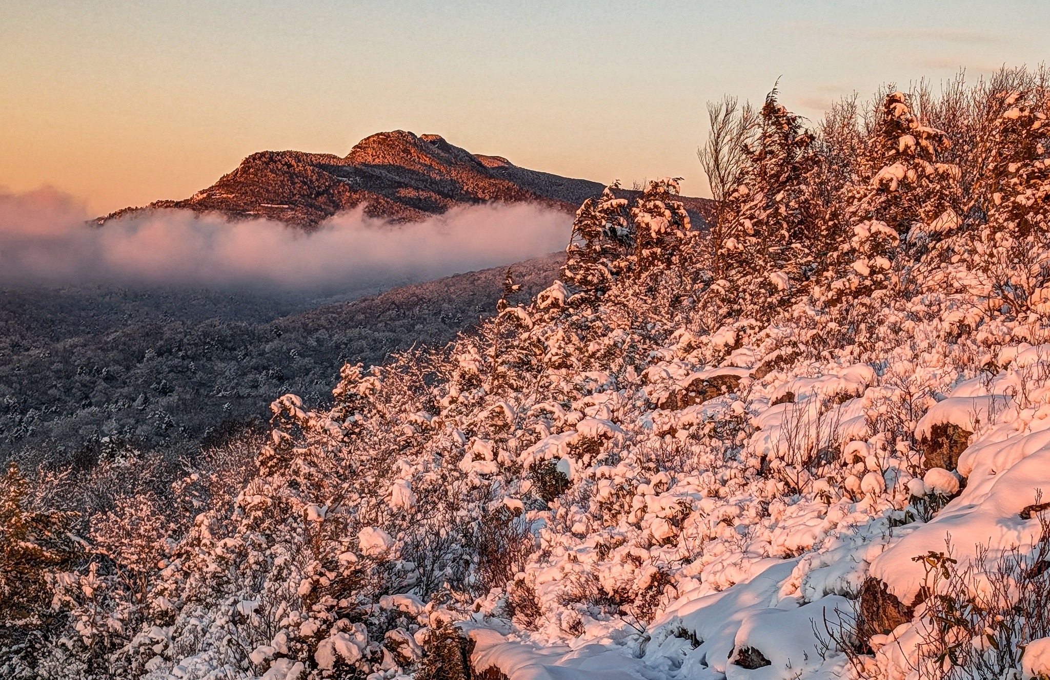
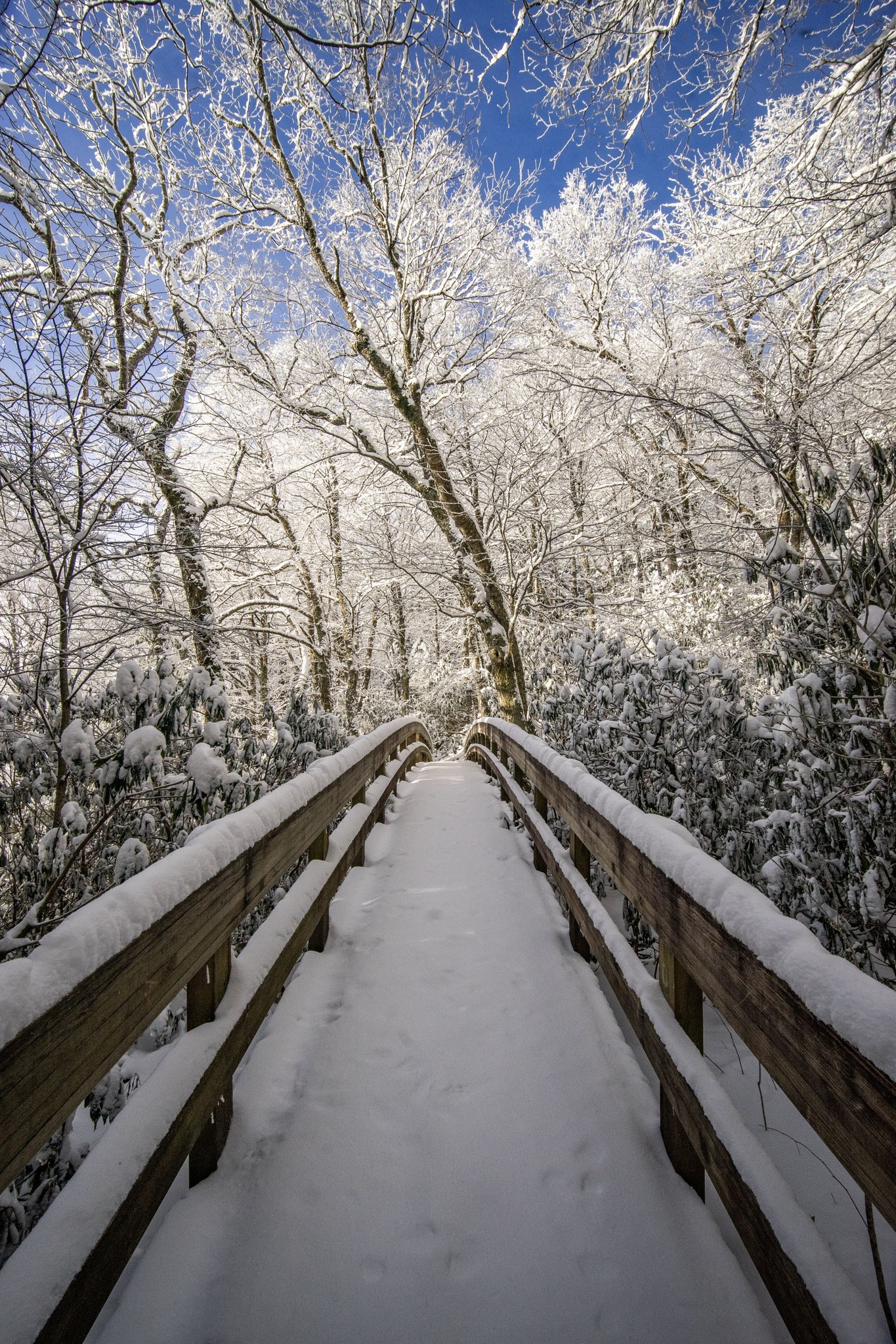
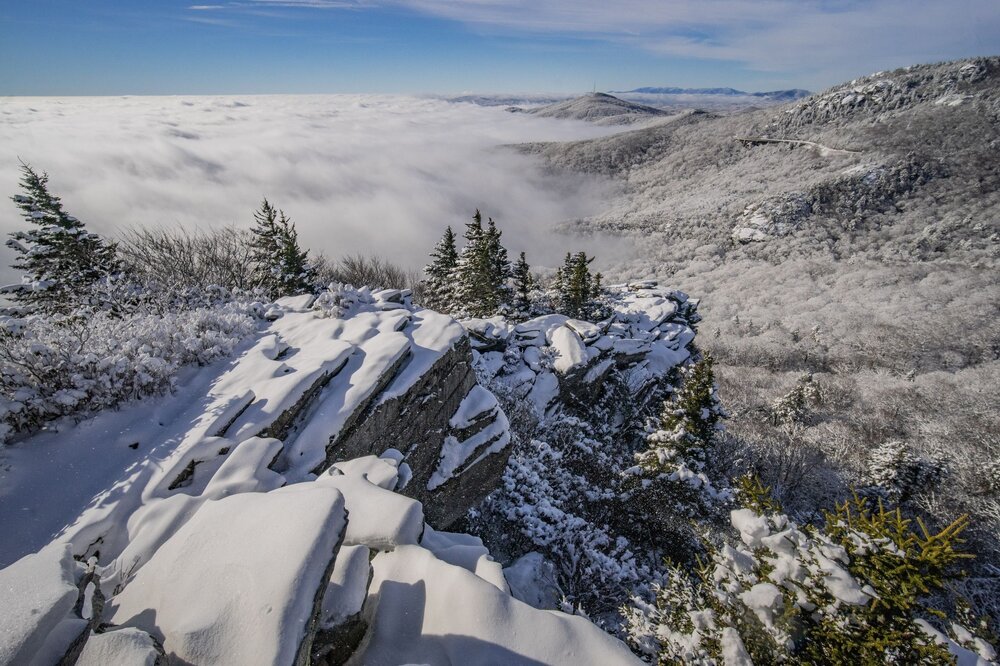
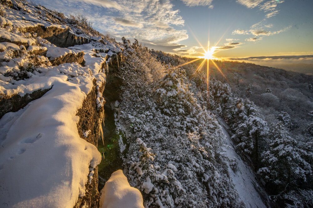
Ok so I cannot figure out why it won't let me upload more than 2 photos per post at a time, but I finally got my laptop back from the repair shop earlier this week (daughter colluded with gravity to break the power button) and got to go through my photos from last Mon/Tue. Really an incredible snow event, and I can't stress enough how rare the lack of wind was up here; I've lived here a decade and this is the first time I've ever seen a snow this calm. We had something similar in 2017 but it was a much, much shorter calm period as the low wrapped around and we briefly cleared before NW flow. Sorry in advance for "spamming" a few posts at once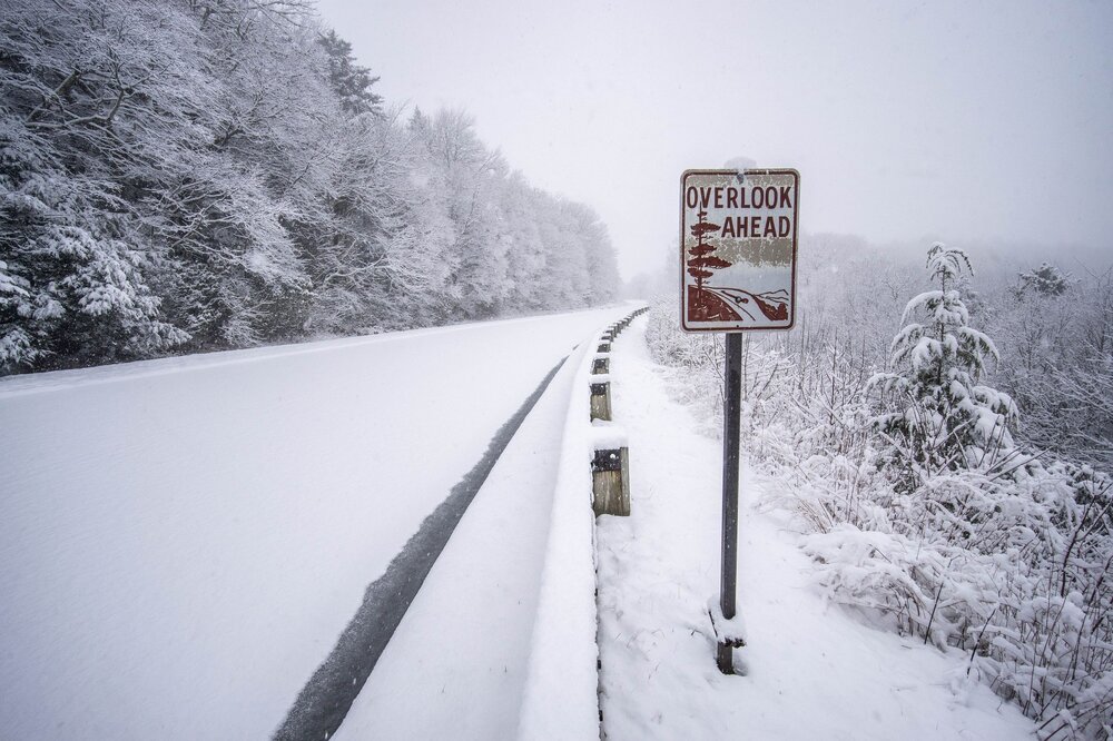
-
2025-2026 Fall/Winter Mountain Thread
Tyler Penland replied to Buckethead's topic in Southeastern States
4.5 here! Froze the water pipes. Makes the coldest we've been in a couple years. Sent from my Pixel 10 Pro using Tapatalk -
2025-2026 Fall/Winter Mountain Thread
Tyler Penland replied to Buckethead's topic in Southeastern States
Stalled out at 10.0/10.2 here in Foscoe. Truck read 9 when I left the store in Blowing Rock and the wind was howling through our lot. Sent from my Pixel 10 Pro using Tapatalk -
2025-2026 Fall/Winter Mountain Thread
Tyler Penland replied to Buckethead's topic in Southeastern States
Pretty wild temperature swings coming up from Winston this evening. 33 at the bottom of the mountain, 41 in Deep Gap, 38 between Deep Gap and Boone then 42 in town. Currently 32 here at the house in Foscoe. Sent from my Pixel 10 Pro using Tapatalk -
2025-2026 Fall/Winter Mountain Thread
Tyler Penland replied to Buckethead's topic in Southeastern States
Another dusting overnight. The NAM means business with the cold moving in Sunday. Drops Boone to 4° by 7PM. Could we go negative with snow cover? Sent from my Pixel 10 Pro using Tapatalk -
2025-2026 Fall/Winter Mountain Thread
Tyler Penland replied to Buckethead's topic in Southeastern States
Super fine grained stuff falling here. Just enough to coat the cars again so far. Sent from my Pixel 10 Pro using Tapatalk -
2025-2026 Fall/Winter Mountain Thread
Tyler Penland replied to Buckethead's topic in Southeastern States
Yeah Ashe County might cash in a few inches out of this one. If it comes in just a hair south Boone could get a surprise. It looks VERY healthy on radar. Sent from my Pixel 10 Pro using Tapatalk -
2025-2026 Fall/Winter Mountain Thread
Tyler Penland replied to Buckethead's topic in Southeastern States
Just over an inch here. My assistant lives over in Sugar Grove area and they have a solid 6". Sent from my Pixel 10 Pro using Tapatalk -
2025-2026 Fall/Winter Mountain Thread
Tyler Penland replied to Buckethead's topic in Southeastern States
Started as a rain/snow/sleet mix here in Blowing Rock. Now all rain but temps crashing fast. Sent from my Pixel 10 Pro using Tapatalk -
2025-2026 Fall/Winter Mountain Thread
Tyler Penland replied to Buckethead's topic in Southeastern States
Looking at the 3km NAM tonight, I wouldn't be at all surprised to see thunder snow in that band on Wednesday evening. Looks stout at the very least. -
2025-2026 Fall/Winter Mountain Thread
Tyler Penland replied to Buckethead's topic in Southeastern States
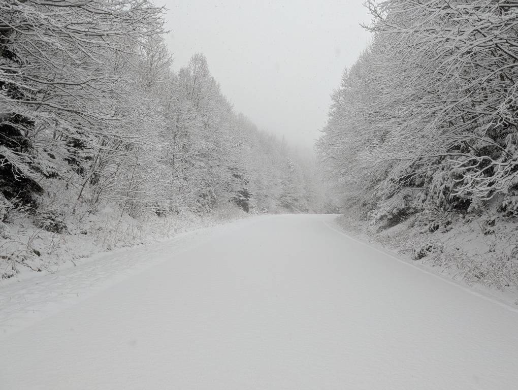
Measured 4" in Blowing Rock when I left. Right at 3" here at the house in Foscoe. Just north of Boone around Todd seems to have been the sweet spot. Sent from my Pixel 10 Pro using Tapatalk -
2025-2026 Fall/Winter Mountain Thread
Tyler Penland replied to Buckethead's topic in Southeastern States
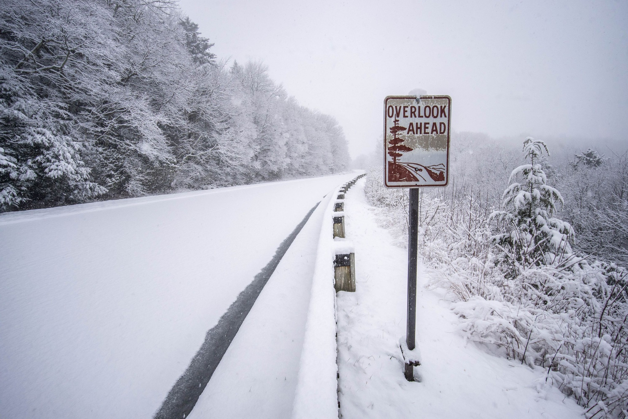
Just measured 3.5" here at the store in Blowing Rock. Can only upload one Pic at a time on my phone but I hopped up on the Parkway this morning before I had to come in. I was the only one up there and it was absolutely gorgeous. Sent from my Pixel 10 Pro using Tapatalk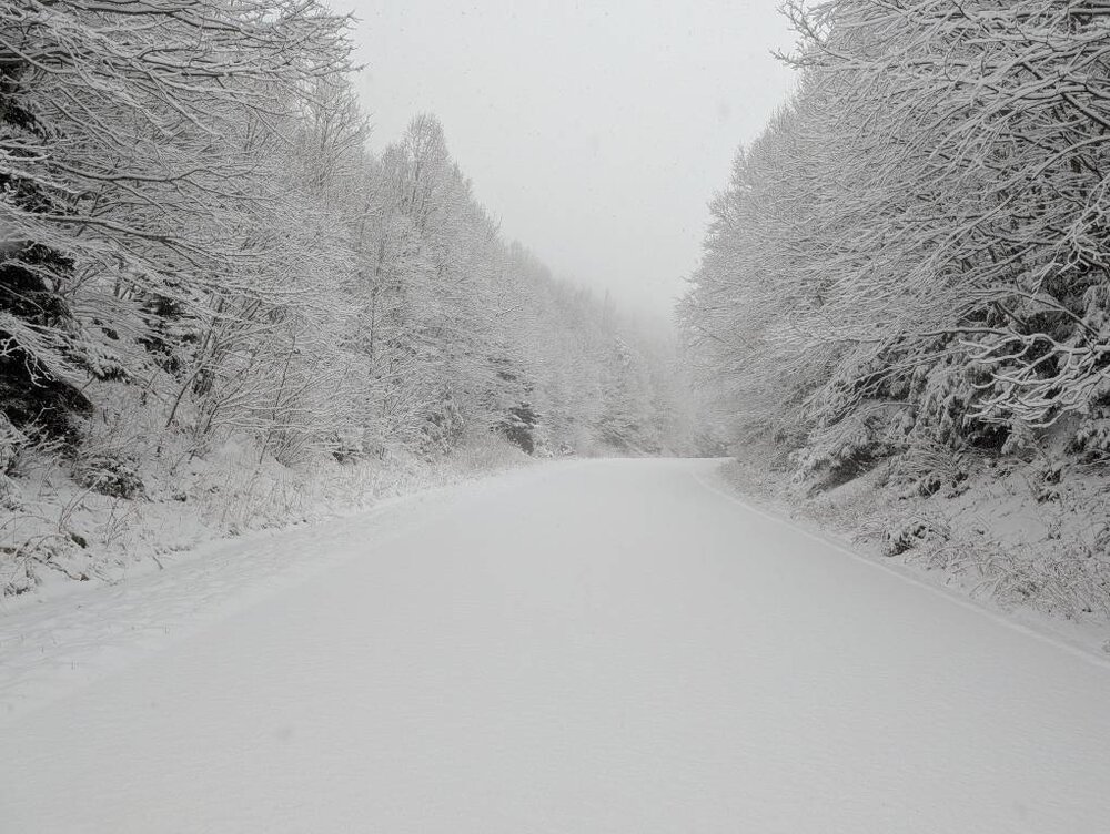
-
2025-2026 Fall/Winter Mountain Thread
Tyler Penland replied to Buckethead's topic in Southeastern States
Plenty of moisture back over MS/TN. Definitely looks healthy. Sent from my Pixel 10 Pro using Tapatalk -
2025-2026 Fall/Winter Mountain Thread
Tyler Penland replied to Buckethead's topic in Southeastern States
Down to 29. 0z HRRR upped moisture a bit again. Looks like pretty heavy snow at 8AM with a nice second round in the afternoon/evening. -
2025-2026 Fall/Winter Mountain Thread
Tyler Penland replied to Buckethead's topic in Southeastern States
Currently down to 31.8. At least we won't be wasting as much moisture saturating this time, surface humidity already at 98%. Sent from my Pixel 10 Pro using Tapatalk -
2025-2026 Fall/Winter Mountain Thread
Tyler Penland replied to Buckethead's topic in Southeastern States
3km NAM finally getting on board with Monday. GFS isn't completely on an island anymore. Sent from my Pixel 10 Pro using Tapatalk