

Tyler Penland
-
Posts
2,523 -
Joined
-
Last visited
Content Type
Profiles
Blogs
Forums
American Weather
Media Demo
Store
Gallery
Everything posted by Tyler Penland
-

2025-2026 Fall/Winter Mountain Thread
Tyler Penland replied to Buckethead's topic in Southeastern States
Down to 21 here in Blowing Rock. HRRR showed it warming through the afternoon-don't see that happening. Still well in the teens at elevation as well. Very deep wedge. -
2025-2026 Fall/Winter Mountain Thread
Tyler Penland replied to Buckethead's topic in Southeastern States
24 and a nice heavy flurry at the store in Blowing Rock. Got a feeling we won't be here for the full day today. I will say there is absolutely nobody out and about this morning- downtown BR was empty. -
2025-2026 Fall/Winter Mountain Thread
Tyler Penland replied to Buckethead's topic in Southeastern States
27.5/15.1 here at the house. No precip yet. I'd love to believe the NAM with its dry slot later but it has handled this initial onset very, very poorly so far. -
2025-2026 Fall/Winter Mountain Thread
Tyler Penland replied to Buckethead's topic in Southeastern States
HRRR cranks the snow up around 3-4PM tomorrow. Should have at least 5-6 hours of snow in the northern mountains with that finger of precip. -
2025-2026 Fall/Winter Mountain Thread
Tyler Penland replied to Buckethead's topic in Southeastern States
Yeah if its like this one it'll happen middle of the following week. I'm just bummed because I was supposed to go see Spamalot in Charlotte on Sunday and now it's been canceled/rescheduled to next Tuesday which ain't happening. :/ -
2025-2026 Fall/Winter Mountain Thread
Tyler Penland replied to Buckethead's topic in Southeastern States
Next weekend's storm doesn't exist until next Tuesday, as far as I'm concerned. Only enough bandwidth for one of these things at a time LMAO -
2025-2026 Fall/Winter Mountain Thread
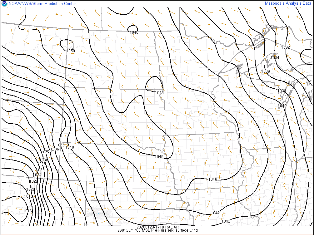
Tyler Penland replied to Buckethead's topic in Southeastern States
1050mb isobars just crossed the line on mesoanalysis.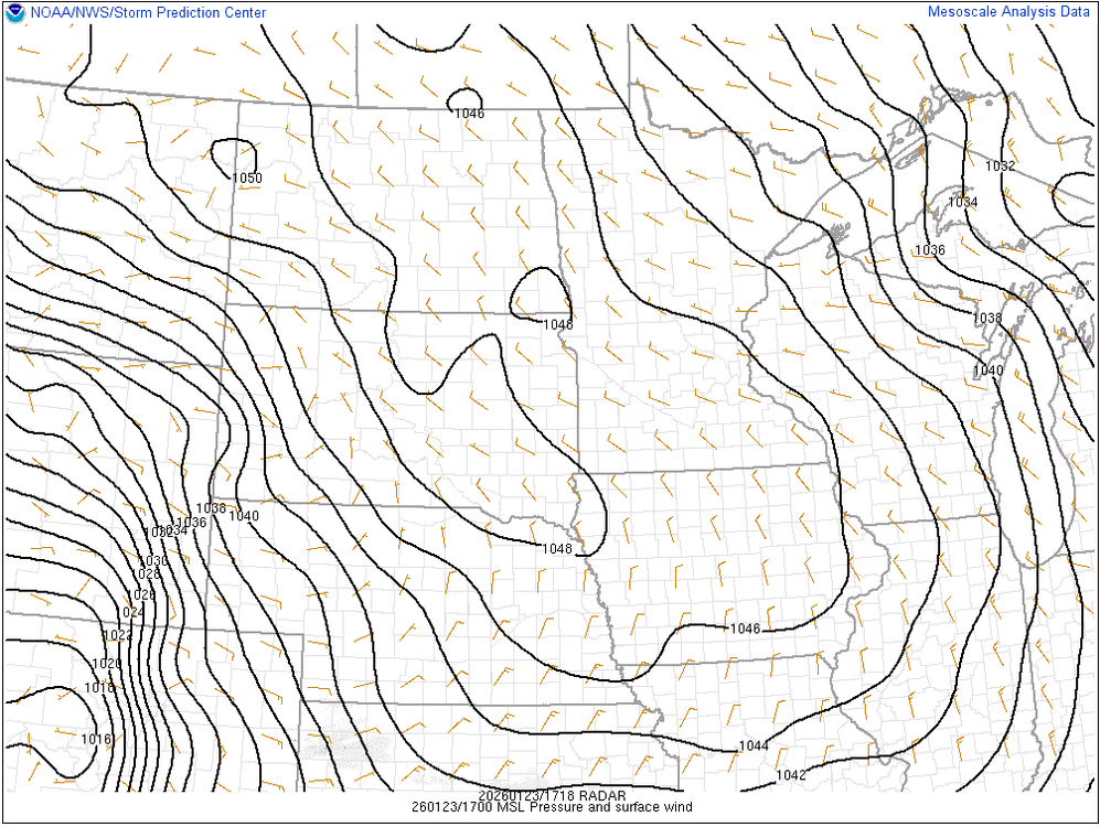
-
2025-2026 Fall/Winter Mountain Thread
Tyler Penland replied to Buckethead's topic in Southeastern States
I'm curious what the disconnect is between the NAM and the GFS on precip. They aren't even in the same ballpark on totals. That said, I remember a storm from a few years ago that was forecast to be a significant ice storm and the globals wound up way overdoing precip and we wound up with just scattered/spotty showers. -
January 25/26 Jimbo Back Surgery Storm
Tyler Penland replied to Jimbo!'s topic in Southeastern States
The Accuweather one still had me getting 8-12" of snow yesterday evening- that hasn't been on the table for days. -
2025-2026 Fall/Winter Mountain Thread
Tyler Penland replied to Buckethead's topic in Southeastern States
This is just... obnoxious. 1 degree standing between the NW mountains and snow at the end of the 3km NAM.thumb.png.0d6324dfb71140b810c93984c5da3e31.png)
-
January 25/26 Jimbo Back Surgery Storm
Tyler Penland replied to Jimbo!'s topic in Southeastern States
Pretty much. Slightly stronger with the wedge once again. -
2025-2026 Fall/Winter Mountain Thread
Tyler Penland replied to Buckethead's topic in Southeastern States
If you check the hourly it is probably rain through midnight, then a temperature freefall to 15 at sunrise behind the front. -
2025-2026 Fall/Winter Mountain Thread
Tyler Penland replied to Buckethead's topic in Southeastern States
I do question the low running into the Apps a bit. Looks weird. -
January 25/26 Jimbo Back Surgery Storm
Tyler Penland replied to Jimbo!'s topic in Southeastern States
The 12km doesn't even have the current precip across Georgia right at initialization. -
2025-2026 Fall/Winter Mountain Thread
Tyler Penland replied to Buckethead's topic in Southeastern States
0z GFS turns out nearly identical by the end. Start as snow for the northern mountains then a sleet storm and ZR at the end. Eventually switches to cold rain but not before the damage is done by ZR/IP. -
January 25/26 Jimbo Back Surgery Storm
Tyler Penland replied to Jimbo!'s topic in Southeastern States
Bullseye of over 2" of ZR north of Atlanta this run. Insane. -
January 25/26 Jimbo Back Surgery Storm
Tyler Penland replied to Jimbo!'s topic in Southeastern States
I mentioned this in the mountain thread but if you go back and look the euro was 2-3mb too weak with the current HP over the northeast at the same range we are from this weekend. It was pretty good from 5-7 days, then showed too weak in the 3-4 day range, then latched on around 72-84 hours or so. It was also a few degrees too warm at the surface in many spots. -
2025-2026 Fall/Winter Mountain Thread
Tyler Penland replied to Buckethead's topic in Southeastern States
At the same range, the Euro was 2-3mb too weak on the current high in the northeast. It didn't latch on to proper placement/strength until about 84 hours out, after being more correct in the 5-7 day range than 3-4. Small changes, but small changes could have big impacts this go around. -
2025-2026 Fall/Winter Mountain Thread
Tyler Penland replied to Buckethead's topic in Southeastern States
WSW from MRX and FFC. I'd expect GSP to follow suit this afternoon. -
2025-2026 Fall/Winter Mountain Thread
Tyler Penland replied to Buckethead's topic in Southeastern States
Make for some freakin' fun sledding, though. -
2025-2026 Fall/Winter Mountain Thread
Tyler Penland replied to Buckethead's topic in Southeastern States
I believe Brad Panovich called that the "glacier solution" which is a perfect descriptor of what 1-2" snow, 3-5" sleet and a half inch of ice would create. -
2025-2026 Fall/Winter Mountain Thread
Tyler Penland replied to Buckethead's topic in Southeastern States
They need to just do away with the lower resolution version entirely and only keep the 3km out to 60hr. I've never seen the use in the lower resolution version myself. -
2025-2026 Fall/Winter Mountain Thread
Tyler Penland replied to Buckethead's topic in Southeastern States
To be fair, the long range NAM is usually pretty strange. -
2025-2026 Fall/Winter Mountain Thread
Tyler Penland replied to Buckethead's topic in Southeastern States
Holy cow. For posterity if nothing else. 18z GFS..png.0e1fba80535421a8c311f77501eac838.png)
-
2025-2026 Fall/Winter Mountain Thread
Tyler Penland replied to Buckethead's topic in Southeastern States
Half inch at the house but barely a dusting coming through Boone. Sent from my Pixel 10 Pro using Tapatalk


.png.460d112f2c92e587f35b4abe18c7913d.png)
