

Tyler Penland
-
Posts
2,523 -
Joined
-
Last visited
Content Type
Profiles
Blogs
Forums
American Weather
Media Demo
Store
Gallery
Everything posted by Tyler Penland
-

2023-2024 Fall/Winter Mountain Thread
Tyler Penland replied to The Alchemist's topic in Southeastern States
It usually significantly overdoes ice totals, similar to the Canadian. It has been on a decent streak lately though. -
2023-2024 Fall/Winter Mountain Thread
Tyler Penland replied to The Alchemist's topic in Southeastern States
Finally making it to the ground here. Looks decently heavy on the Boone Webcam right now. Just popped outside and ground is covered pretty good. -
2023-2024 Fall/Winter Mountain Thread
Tyler Penland replied to The Alchemist's topic in Southeastern States
Yall really can't win for losing here the past couple years down there. I thought for sure with the amount of moisture coming through it would bust through that dry level. I'm sure I'll hear it on the FB posts from the website over the next couple days LOL -
2023-2024 Fall/Winter Mountain Thread
Tyler Penland replied to The Alchemist's topic in Southeastern States
If I had a nickel for every time the Canadian overdid an ice storm I'd have a lot of nickels. -
2023-2024 Fall/Winter Mountain Thread
Tyler Penland replied to The Alchemist's topic in Southeastern States
Got another dusting overnight. These Ts are adding up. -
2023-2024 Fall/Winter Mountain Thread
Tyler Penland replied to The Alchemist's topic in Southeastern States
I'm gonna be in Georgia this weekend so y'all can go ahead and pencil this storm in. Got a good dusting in Blowing Rock this morning. Actually saw a faint snow/fog bow. Never seen one with snow falling. Hopefully it shows up in the pic.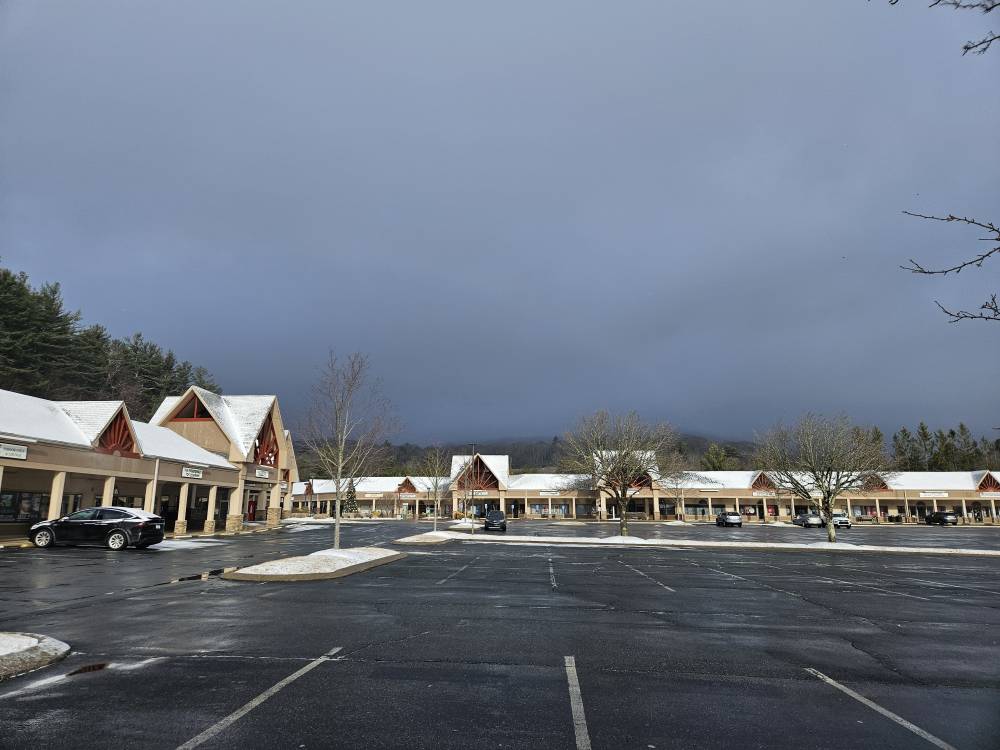
-
2023-2024 Fall/Winter Mountain Thread
Tyler Penland replied to The Alchemist's topic in Southeastern States
The NAM stuck to its guns and if you take into account the GFS/Euros well known issue with northern precipitation shields I think North GA/SW NC have a very good shot at a 1-3" event Wednesday evening/night. Also wouldn't be surprised if border folks wake up to a dusting to kick off the new year. -
2023-2024 Fall/Winter Mountain Thread
Tyler Penland replied to The Alchemist's topic in Southeastern States
Yeah. I don't know how this stacks up in strength or anything other than in how it relates to PSCs (which made it to +42N BTW) but thought it was interesting to see it mentioned somewhere not strictly weather related. I will say that spike is still the forecast but a warming event is underway. Just gotta see how warm it gets. -
2023-2024 Fall/Winter Mountain Thread
Tyler Penland replied to The Alchemist's topic in Southeastern States
Checking Spaceweather after the big solar flare today and they had posted about the SSW. Hopefully this will lead to good things for us soon.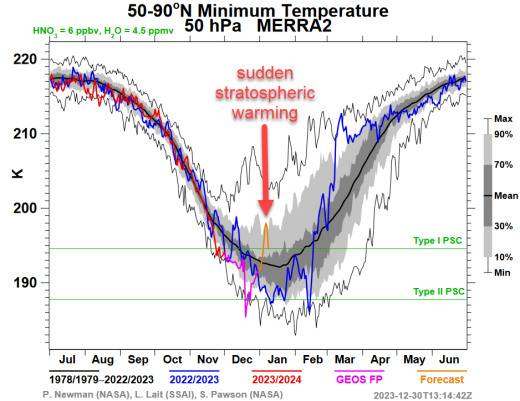
-
2023-2024 Fall/Winter Mountain Thread
Tyler Penland replied to The Alchemist's topic in Southeastern States
0z GFS is a step in the right direction for Wednesday night. I could see this sneak into a light event if things trend a little stronger with the low. -
2023-2024 Fall/Winter Mountain Thread
Tyler Penland replied to The Alchemist's topic in Southeastern States
This mornings dusting melted and has been replaced by another. So two traces makes a quarter inch, right? Lol -
2023-2024 Fall/Winter Mountain Thread
Tyler Penland replied to The Alchemist's topic in Southeastern States
Woke up to a dusting here. Nice surprise. -
2023-2024 Fall/Winter Mountain Thread
Tyler Penland replied to The Alchemist's topic in Southeastern States
That's not far off from a nice hit. Temps aren't great. -
2023-2024 Fall/Winter Mountain Thread
Tyler Penland replied to The Alchemist's topic in Southeastern States
It didn't do so hot last time either, though, so I'd hedge my bets for right now. None of the globals did once we got close. -
2023-2024 Fall/Winter Mountain Thread
Tyler Penland replied to The Alchemist's topic in Southeastern States
Up to 5.55" and still coming down. Watauga is the highest I've seen it in a long time and Linville hit 6ft today. Impressive. -
2023-2024 Fall/Winter Mountain Thread
Tyler Penland replied to The Alchemist's topic in Southeastern States
Already an inch and a half of rain with plenty more to go the next couple days. This should put an end to the local drought. -
2023-2024 Fall/Winter Mountain Thread
Tyler Penland replied to The Alchemist's topic in Southeastern States
GFS and Euro both have an extended NWF event mid/late next week. Been fairly consistent on it as well. -
2023-2024 Fall/Winter Mountain Thread
Tyler Penland replied to The Alchemist's topic in Southeastern States
Yeah I always struggle when it's below freezing. I store extras in an inside pocket on my coat to keep them warm. Once they get cold and thaw out they're back to normal again so I just switch them out as they each get too cold. It was in the upper-10s up there most of the day yesterday so they really didn't appreciate the temps lol -
2023-2024 Fall/Winter Mountain Thread
Tyler Penland replied to The Alchemist's topic in Southeastern States
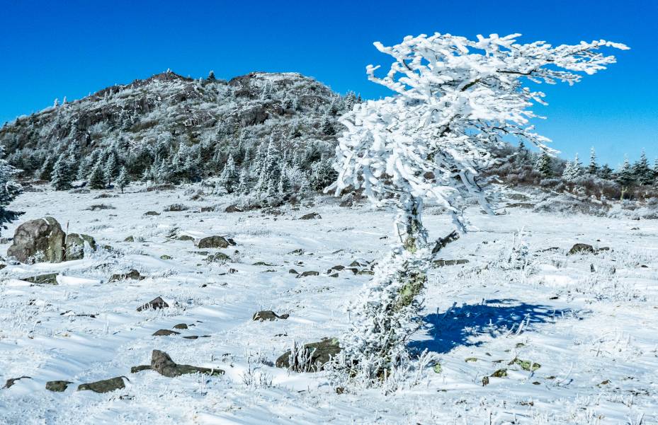
Here's some photos from Grayson Highlands today. Summiting Wilburn Ridge in the snow is definitely sketchy. Made it all the way to Mt Rogers for our first proper snow summit of it, cold but fun trip.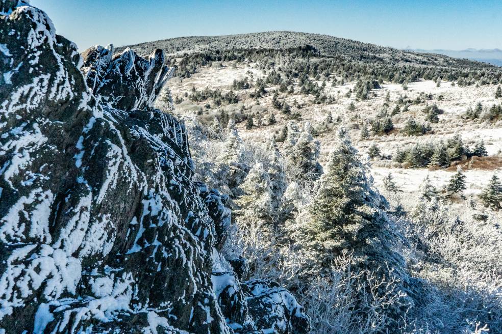
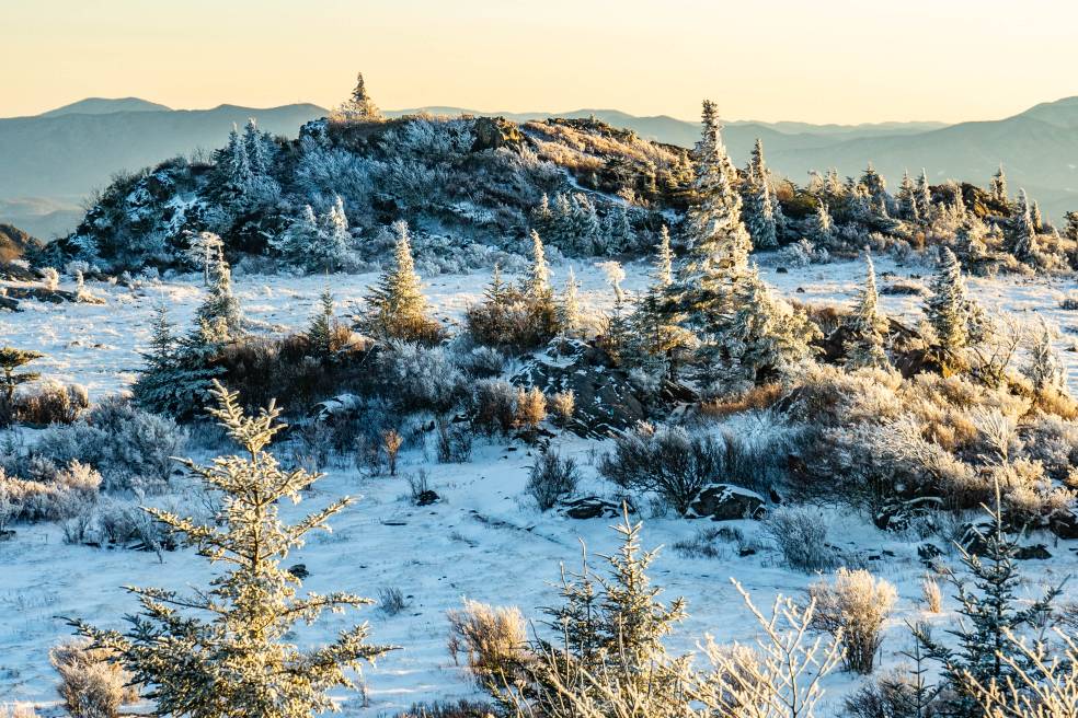
-
2023-2024 Fall/Winter Mountain Thread
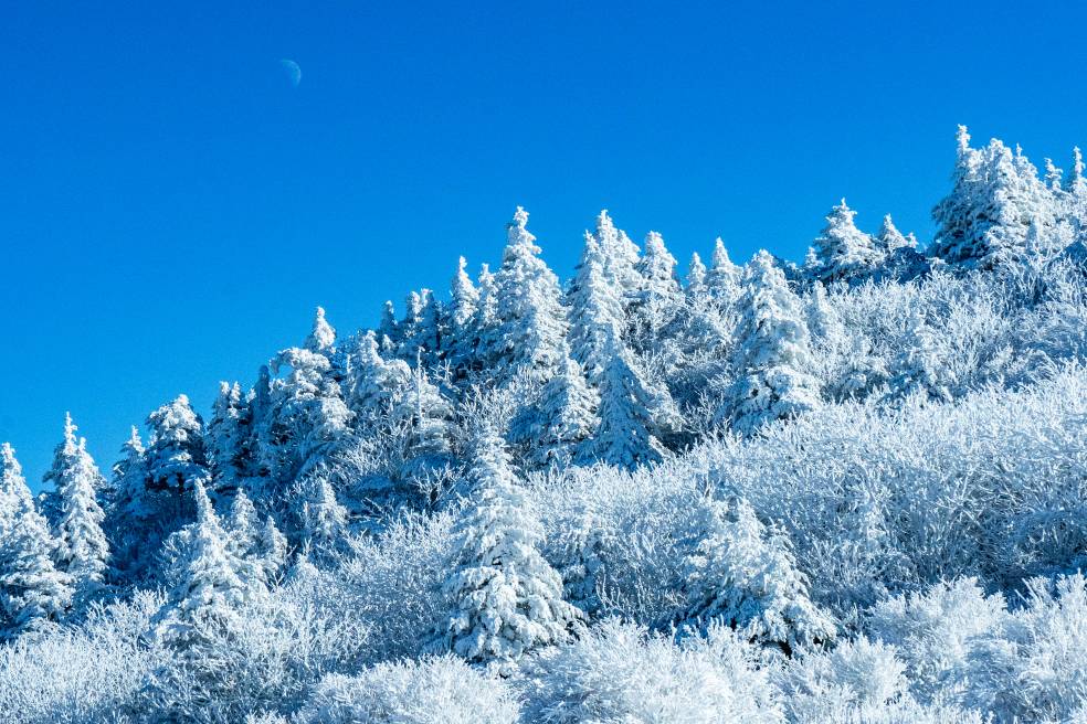
Tyler Penland replied to The Alchemist's topic in Southeastern States
Had a little wind/compaction overnight and measured 2" on the board this morning. Headed up to Grayson Highlands to see how it went up there.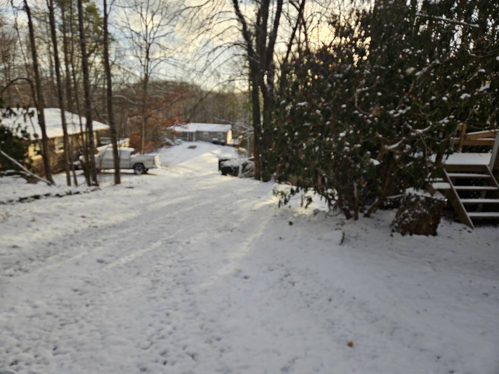
-
2023-2024 Fall/Winter Mountain Thread
Tyler Penland replied to The Alchemist's topic in Southeastern States
Only took 45min to tack on another inch. 2.5 total but it has let up for now. Big sigh of relief we have not repeated last winter. This beats the season total of '22-' 23. -
2023-2024 Fall/Winter Mountain Thread
Tyler Penland replied to The Alchemist's topic in Southeastern States
Under one of those streamers right now. Up to 1.5". Largest snow since the cold snap last Christmas. -
2023-2024 Fall/Winter Mountain Thread
Tyler Penland replied to The Alchemist's topic in Southeastern States
Roads around Watauga are a mess. From FB posts pretty much every road into Boone has stuck cars and wrecked. Dumping here again. We may break last years season total tonight. -
2023-2024 Fall/Winter Mountain Thread
Tyler Penland replied to The Alchemist's topic in Southeastern States
Just drove from Blowing Rock to the house and absolutely dumping. Roads going downhill fast and almost white out at times with the wind. -
2023-2024 Fall/Winter Mountain Thread
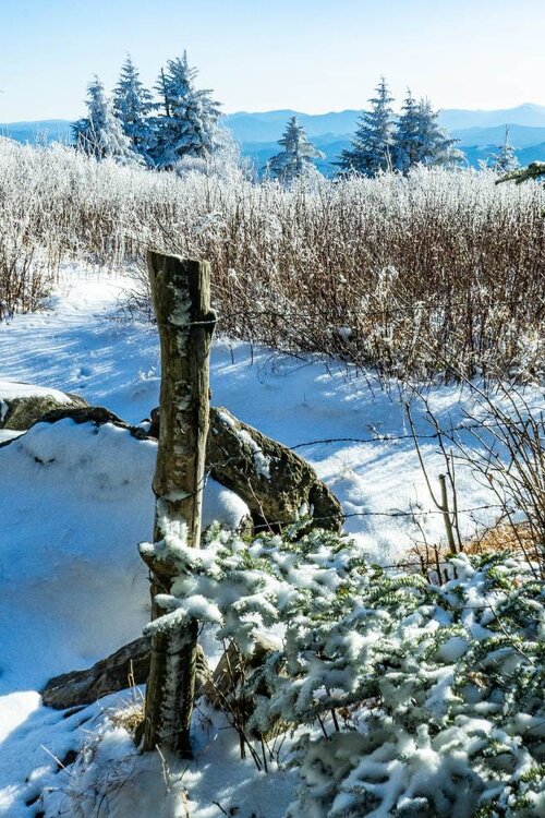
Tyler Penland replied to The Alchemist's topic in Southeastern States
Nice steady light snow in Blowing Rock. Absolutely gorgeous.


