Tyler Penland
-
Posts
2,523 -
Joined
-
Last visited
Content Type
Profiles
Blogs
Forums
American Weather
Media Demo
Store
Gallery
Everything posted by Tyler Penland
-

2023-2024 Fall/Winter Mountain Thread
Tyler Penland replied to The Alchemist's topic in Southeastern States
Yeah there has been a trend on the GFS/euro towards the cold outrunning the moisture a bit and a switchover to snow before precip ends. Interesting look I'm curious to see where it goes. -
2023-2024 Fall/Winter Mountain Thread
Tyler Penland replied to The Alchemist's topic in Southeastern States
Yep. Got a solid dusting here which is more than I expected. We get skunked in the hole here in Foscoe on a lot of these NW flow events so anything more than a flurry is a win. -
2023-2024 Fall/Winter Mountain Thread
Tyler Penland replied to The Alchemist's topic in Southeastern States
Here's a couple photos.
-
2023-2024 Fall/Winter Mountain Thread
Tyler Penland replied to The Alchemist's topic in Southeastern States
Dumping snow up here on Beech. Quickly picked up a dusting. -
2023-2024 Fall/Winter Mountain Thread
Tyler Penland replied to The Alchemist's topic in Southeastern States
I wondered about this little clipper today. Probably gonna have to head up to Roan on Wednesday morning with thunder a possibility.... -
2023-2024 Fall/Winter Mountain Thread
Tyler Penland replied to The Alchemist's topic in Southeastern States
13 here in Foscoe. I'm cautiously optimistic about that clipper/NWFS potential next week. Some moderate agreement between the Euro/gfs, although I'm rooting for the Euros timing personally. Would love to hit Roan in the snow next Tuesday. -
2023-2024 Fall/Winter Mountain Thread
Tyler Penland replied to The Alchemist's topic in Southeastern States
37 and still just rain in Blowing Rock. -
2023-2024 Fall/Winter Mountain Thread
Tyler Penland replied to The Alchemist's topic in Southeastern States
It was 36 and raining when I got to work this morning. Heck of a day to get in 5 pallets of product, first big delivery like that in months. Only managed 1.09" here at the house. Little underwhelming but still a nice dent in the deficit. -
2023-2024 Fall/Winter Mountain Thread
Tyler Penland replied to The Alchemist's topic in Southeastern States
18z gfs has multiple frozen precip chances. Definitely think the El Nino is gonna take over soon. -
2023-2024 Fall/Winter Mountain Thread
Tyler Penland replied to The Alchemist's topic in Southeastern States
Dude! That's awesome!! -
2023-2024 Fall/Winter Mountain Thread
Tyler Penland replied to The Alchemist's topic in Southeastern States
Looking like this coastal low into the weekend might finally shake up the pattern a bit. Both the gfs/euro looking much cooler in the extended. -
2023-2024 Fall/Winter Mountain Thread
Tyler Penland replied to The Alchemist's topic in Southeastern States
Actually managed 0.32" today. Nice slow soak will help with the fire issues in the county. -
2023-2024 Fall/Winter Mountain Thread
Tyler Penland replied to The Alchemist's topic in Southeastern States
19.2 this morning. Got to the store and had no heat which made for a fun morning. -
2023-2024 Fall/Winter Mountain Thread
Tyler Penland replied to The Alchemist's topic in Southeastern States
22/41 today. Not bad for the first day of November. Saw a little snow up around Moses Cone in that gap this morning. It almost always has some with how the wind comes through there though. -
2023-2024 Fall/Winter Mountain Thread
Tyler Penland replied to The Alchemist's topic in Southeastern States
Sitting at 37.8 at the moment. Did manage another 0.04" of rain since midnight which brings me to half a tenth for the event LOL -
2023-2024 Fall/Winter Mountain Thread
Tyler Penland replied to The Alchemist's topic in Southeastern States
0.01" in the bucket so at least I didn't get skunked. -
2023-2024 Fall/Winter Mountain Thread
Tyler Penland replied to The Alchemist's topic in Southeastern States
I haven't had a lot of shooting time since I got back from put west but made it out some today. Definitely a good color year and a crazy sunset.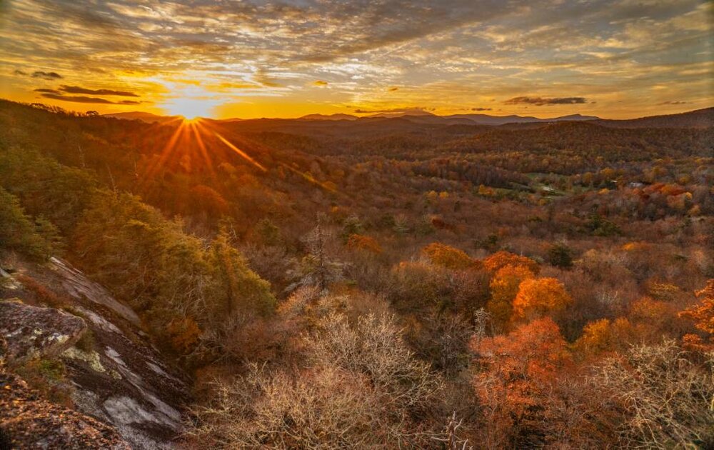
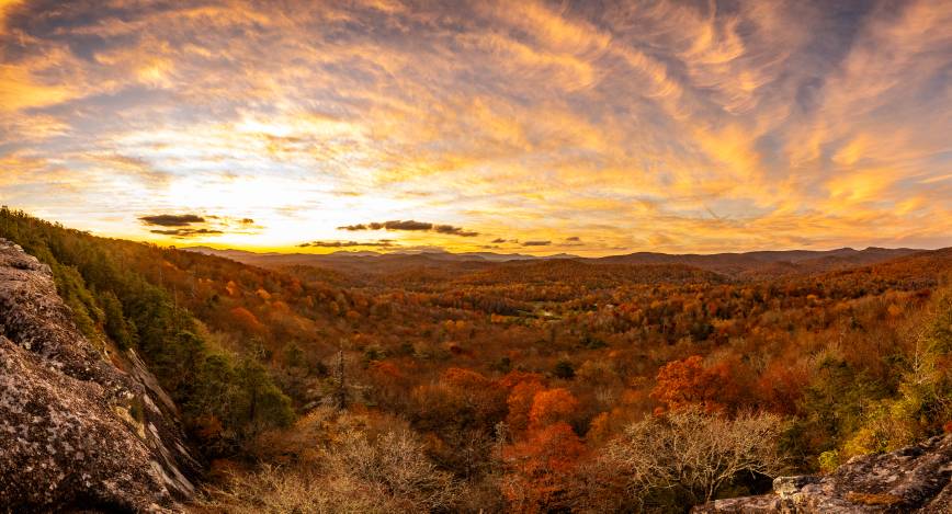
-
2023-2024 Fall/Winter Mountain Thread
Tyler Penland replied to The Alchemist's topic in Southeastern States
That long range storm on the GFS is interesting. Very close to the first proper snow storm for the higher elevations. -
2023-2024 Fall/Winter Mountain Thread
Tyler Penland replied to The Alchemist's topic in Southeastern States
Coldest morning of the season here so far at 33.1 this morning. Getting late to have not see a freeze here yet. Rode up on Grandfather for sunrise and it was 42 up there so nice inversion overnight. -
2023-2024 Fall/Winter Mountain Thread
Tyler Penland replied to The Alchemist's topic in Southeastern States
Man I'm jealous. Congrats guys. Only snow i saw today was some leftovers up on Pikes Peak lol. -
2023-2024 Fall/Winter Mountain Thread
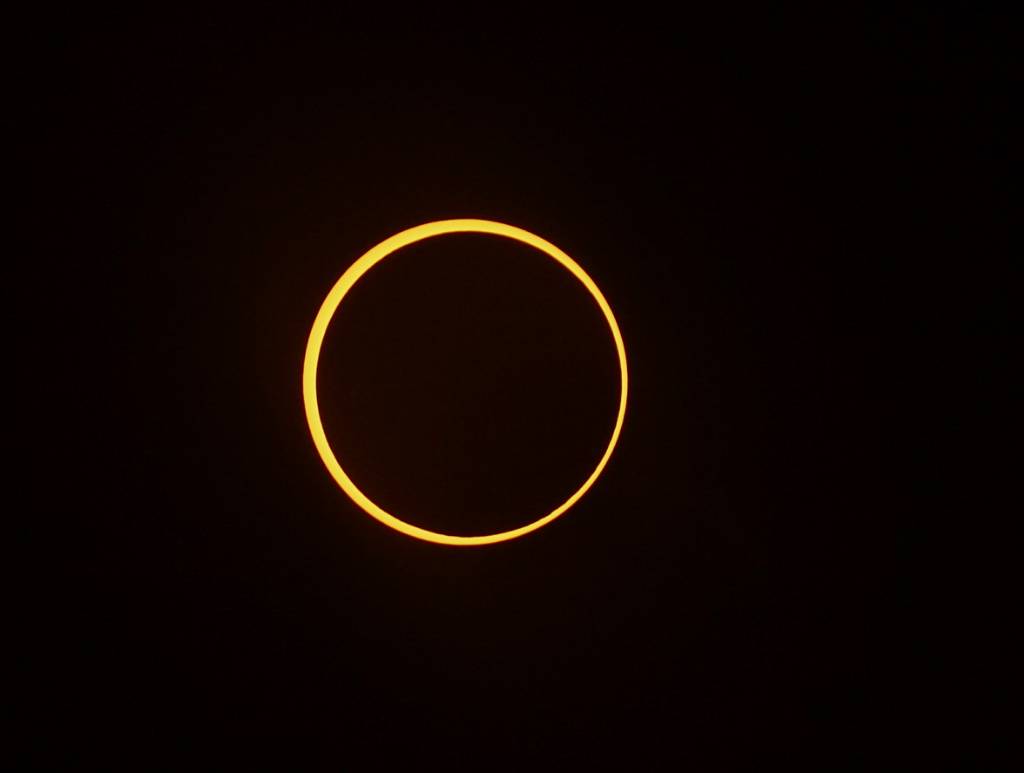
Tyler Penland replied to The Alchemist's topic in Southeastern States
Caught the ring of fire this morning!

-
2023-2024 Fall/Winter Mountain Thread
Tyler Penland replied to The Alchemist's topic in Southeastern States
Here's a few pics for you guys. All taken between 9 and 11kft on I-70. Nice way to spend a kid October day.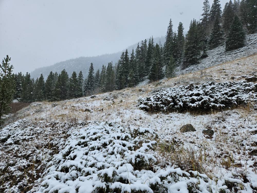
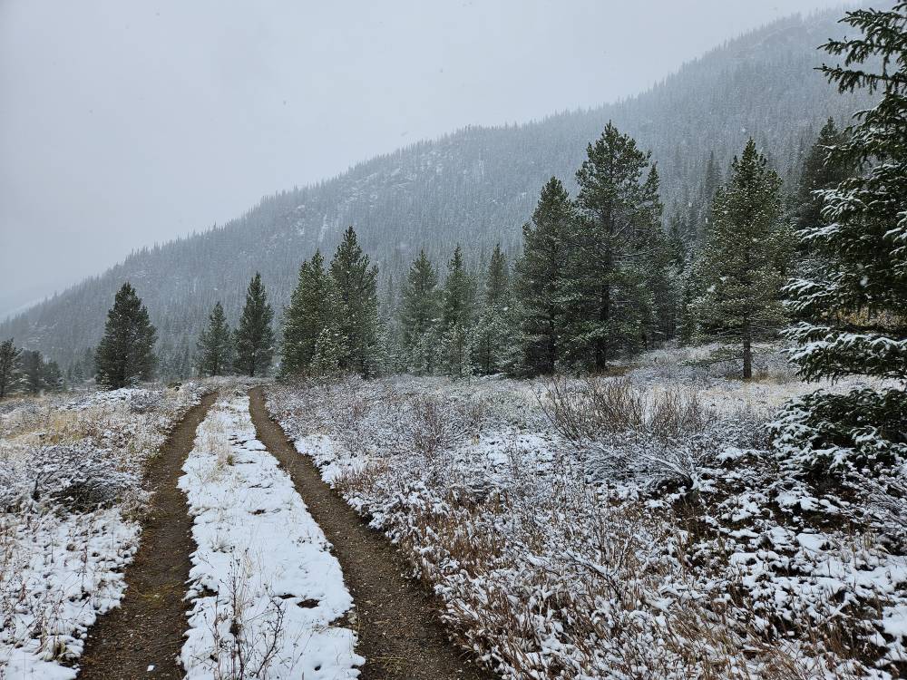
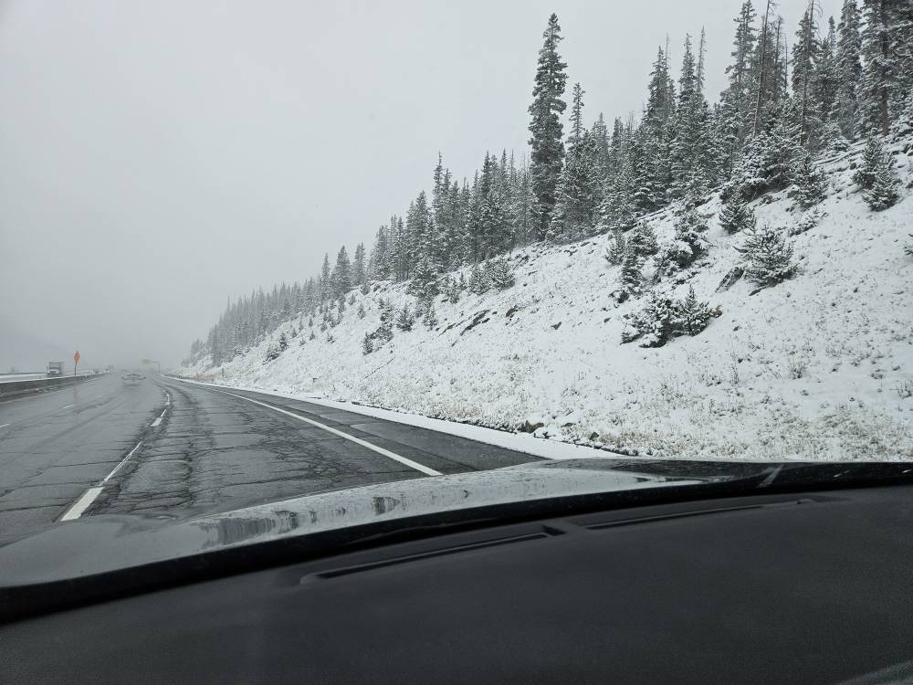
-
2023-2024 Fall/Winter Mountain Thread
Tyler Penland replied to The Alchemist's topic in Southeastern States
I'm right behind ya. Landed in Denver this morning and headed over the pass tonight to Colorado National Monument. -
2023-2024 Fall/Winter Mountain Thread
Tyler Penland replied to The Alchemist's topic in Southeastern States
Just spent a couple days down around the Balsams and it was nice albeit more cloudy than I would have liked from a photographer point of view. Mid-40s this morning at sunrise. Ready for the cold. I'll be out in Colorado/New Mexico late next week through early the next, just in time for the leaves to peak lol. -
2023 Mountains Spring/Summer Thread
Tyler Penland replied to Tyler Penland's topic in Southeastern States
If we keep this dry/cooler pattern it'll be great for the leaves though. Especially if we pick up a couple more CAD events to drop just a little rain/drizzle.