wxmanmitch
-
Posts
2,096 -
Joined
-
Last visited
Content Type
Profiles
Blogs
Forums
American Weather
Media Demo
Store
Gallery
Everything posted by wxmanmitch
-
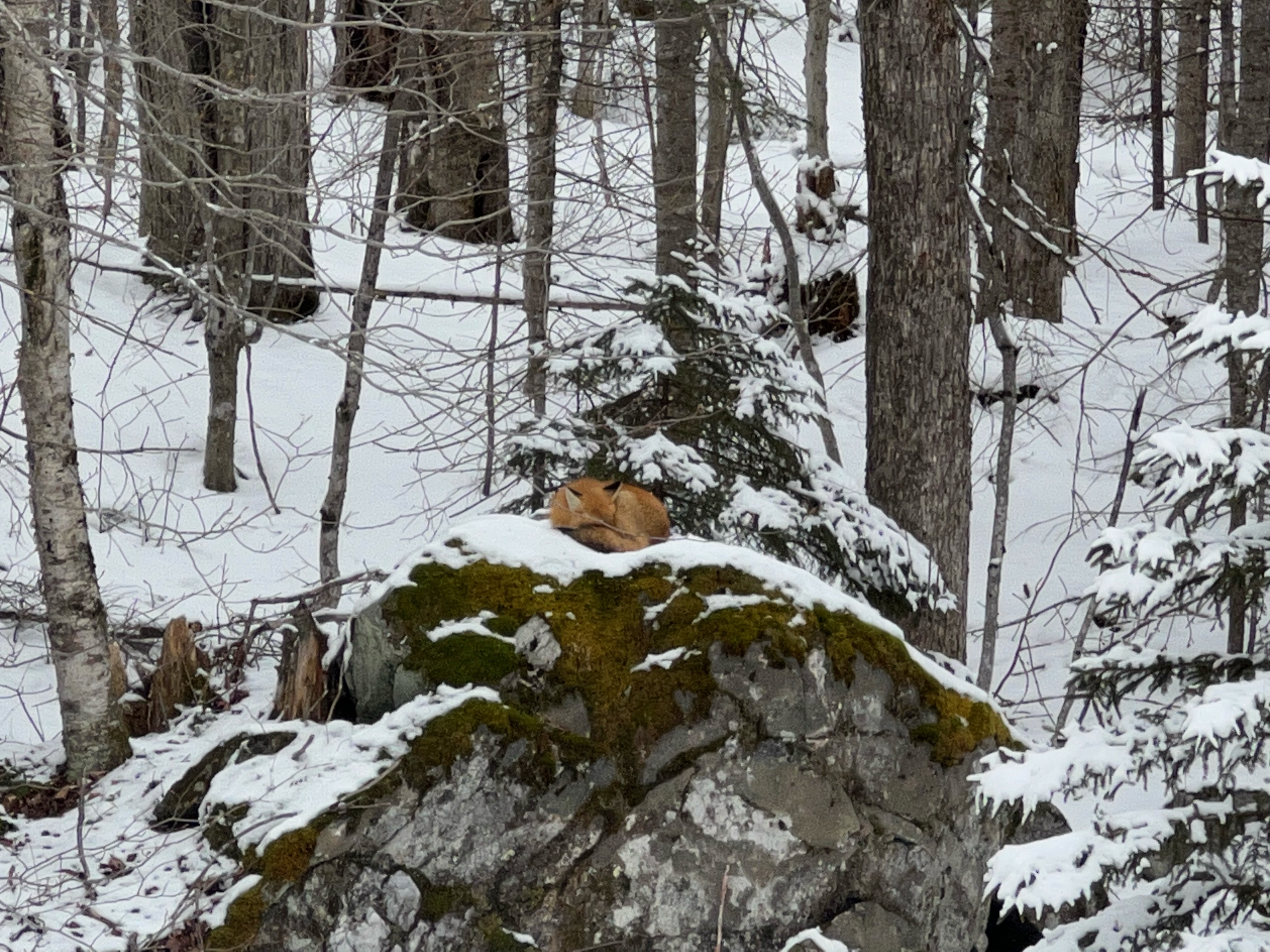
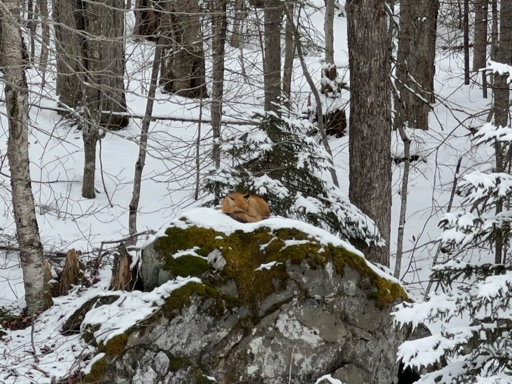
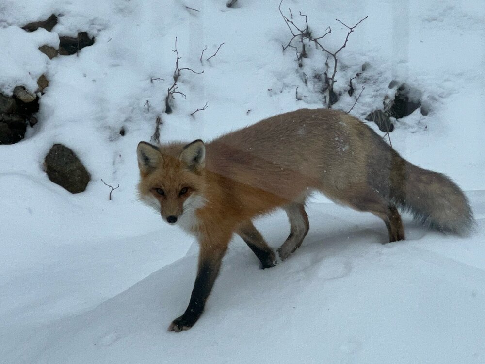
I have this fox that loves napping on this boulder behind the house. I've been seeing it several times a week lately, and today it decided to come close to the house. What a beauty! It's definitely been a lackluster winter...I haven't used the snow blower in a full month, although I expect to use it tomorrow after the snow and sleet associated this SWFE. Hoping to make up for some lost time over the next 10-15 days.
-

The event of the season - 2 days of hell!
wxmanmitch replied to Go Kart Mozart's topic in New England
-25.4° F here on the Davis VP2. Coldest reading I've had here by far in the almost 5 years I've been at this location. I'm pretty sure it was around -27° F here in 2016 based on nearby PWS obs, but this was still a very impressive shot of arctic air. -
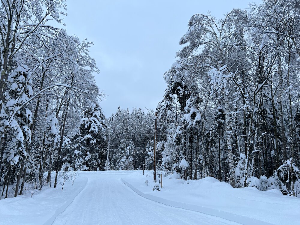
10.2" storm total here on 1.21" liquid. Nice little storm. Very dense snow with a definite bluish hue. There's a slight crust about 5" down so I had a very brief flip to freezing rain/drizzle overnight. Amazingly no power losses other than a few flickers so far although the wind has begun to ramp up so there may be some going forward. Total depth at 17".

-
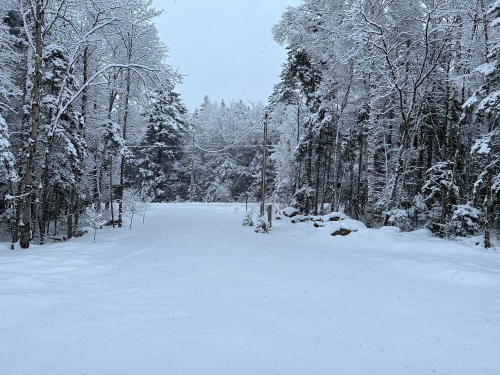
7.0" as of about 20 minutes ago. There was a slight crunch a couple of inches down so we had a touch of freezing rain overnight. Double digits should be attainable here, maybe a foot depending on how the CCB performs.
-
Moderate snow, 25.6° F. Looks like an inch or so down. I like where I stand for this one.
-
4.8" storm total, 4.3" from today's IVT, 0.5" of crud on the bottom from yesterday's bust. Grid power is down, but backup FTW. Per the radar, it's transitioning into more of an upslope situation now, albeit somewhat blocked as the most intense echoes are west.
-
I don't know, drones? I'm not sure how well drones could handle the intense conditions (winds, extreme temperatures, moisture, icing, etc.) and thin air of the upper troposphere and stratosphere though, but just a thought...
-
I posed this question over on Twitter and I'll pose it here too, but I wonder if the loss of weather balloon launches at both Albany, NY and Chatham, MA contributed to today's precipitation type bust? Albany's is due to the apparent Helium shortage and Chatham's due to beach erosion threatening the launch site. Without this valuable upper air data, I wonder if the warm layer aloft was not adequately sampled prior to data ingestion into the 12z model suite, leading to the models predicting colder p-types than what they should have been. After all, a model is only as good as the data that goes into it; hence the term I learned in NWP class back in the day: "garbage in, garbage out". Even today's 12z 3-km NAM (which is usually the warmest among the guidance in these scenarios) had many areas in N MA, S VT, and S NH snowing for a few hours before eventually flipping to sleet and freezing rain. This would've likely led to a few inches before the changeover, but instead it was PL/RA/ZR from the onset. While many places did eventually change to snow briefly due to diabatic cooling eroding the initial warm layer aloft, it took nearly 2 hours here and the WAA won out faster than I had anticipated, flipping my hard earned snow quickly back to PL/RA/ZR after only about 30-40 minutes. I tend to think that the warm layer aloft that was in place prior to the precipitation beginning was warmer than what the 12z models had expected, leading to the warmer p-types observed and longer changeover times to snow. I know that the models often underestimate the WAA aloft with these SWFEs, but usually the high res NAM does a better job than this inside of 12-24 hours to the event. In the absence of upper air data from weather balloon launches, how do we know what the actual temperatures aloft are for a given place and time at say the 850 mb level? Satellite data? If it is satellite data, how accurate is it? Just musing over why things transpired the way they did today...
-
Safe to say that part 1 is going to bust here. Back to ZR/PL after a brief burst of heavy snow. We had a quick 0.5" with the snow. The meso models underestimated the extent of the warm layer aloft prior to the onset of precipitation so we wasted 2 hours as ZR/PL instead of snow, and also underestimated the WAA aloft (as they often do with SWFEs). Both factors severely minimized the time it spent snowing.
-
Snow now after wasting away as freezing rain and sleet for about 2 hours. Flakes are aggregating as they fall through that warm layer aloft, but it has eroded to the point where they can now survive the trip through it, for now anyway. I expect it to flip back to ZRPL soon based on the dual pol CCs. Maybe the backside tomorrow will overachieve. Sometimes these upper low and inverted trough deals can surprise, and the ratios should be in our favor too.
-
Things remain painfully unburied for this time of year with only a crusty inch on the ground with a pixie dust coating covering it, but looking back at the past 5 years of snowfall data (I moved here in March 2018, right before that epic stretch), this winter has had the same general tenor of the past several, albeit warmer. We had a significant pre Xmas snowstorm in all of these winters, except 2021-22, only to have it wiped out by a torch in the Xmas to mid January timeframe followed by a recovery from late January through February primarily resulting from SWFE type events. February 2022 was terrible and we lost our winter pack by late month, only to regain a temporary pack in March. 2020 had a mega January torch only to recover to a decent 25-30" depth my mid February so there's hope. Looking forward we may recover over the next two weeks and beyond with a classic SWFE gradient pattern that favors areas north of the Pike. Jackson, NH and Newry, ME look like good places to be in this upcoming pattern. It's somewhat borderline here in S VT, but hopefully we can cash in on at least some of them on the eastern slope. I'll gladly take a series of 3-5" or 6-8" type events, even if they contain some taint. The past few weeks have been nothing short of a disaster... The late week SWFE coming may very be too warm in the midlevels for much more than some bookend snows here, but early next week and beyond may be better. Snowfall totals through 1/15 and season totals: 2022-23: 45.7" ??? 2021-22: 39.8" 117.9" 2020-21: 50.1" 137.8" 2019-20: 59.2" 143.5" 2018-19: 68.9" 149.8"
-
4" of backside snow here, so my depth is pretty much right where I started at 14". Amazing to have 7.6" from a storm and have no net gain. No loss either... Saw a report of 7" in Dalton, MA on Twitter which has been under that area of enhanced echoes for a while now. Definitely some convergence and SW flow upslope down in the Berkshires.
-
3.6" final on the front end before flipping to a mix of freezing rain and ice pellets. 31° F. Just did a midnight snow blow of the driveway to remove the snow before it turns to glop and then a glacier...
-
Pounding snow, +SN. Good growth too. Probably 1.5-2" down so far, 28° F.
-
Light snow has begun here, 26° F. 18z meso models have mysteriously trended warmer (with the NAMs the most so), which is in opposition to radar and surface obs so I'm tossing and going with the 12z suite, which had 4-6" here on the front end with maybe another 1-2" on the back.
-
Preliminarily ... a medium impact partial Miller B, Friday
wxmanmitch replied to Typhoon Tip's topic in New England
19" on 1.4" liquid here. Nice little snowstorm, but nothing we can't handle around these parts. Depth OTG is ~21". -
Preliminarily ... a medium impact partial Miller B, Friday
wxmanmitch replied to Typhoon Tip's topic in New England
12.5" here with 0.84" liquid equivalent. Kind of surprised at how high the SLR is. Just light snow now, but it should increase a bit again soon as the radar appears to be filling in more to my south and west, 29° F. -
Preliminarily ... a medium impact partial Miller B, Friday
wxmanmitch replied to Typhoon Tip's topic in New England
8.7" on the board as of 20 minutes ago. Snow intensity varying between light and moderate. Dry, but dense snow up here. 27° F. -
Preliminarily ... a medium impact partial Miller B, Friday
wxmanmitch replied to Typhoon Tip's topic in New England
Heavy snow, 30° F. Good snow growth so this is easily 1"+ per hour stuff. I'll check back in the morning and let you know where I'm at. -
Preliminarily ... a medium impact partial Miller B, Friday
wxmanmitch replied to Typhoon Tip's topic in New England
And it has begun. Some low level easterly flow upslope snow already falling out ahead of the synoptic stuff that has yet to arrive from the southwest. Quite breezy. 29° F. Expecting a solid 20"+ dump out of this, maybe 25"+. -
4.2" new snow here. Just missed the heaviest stuff to my S and SW where 8-8.5" fell in parts of the Berkshires. Although there wasn't much wind, I think there was a little upslope assist in that area with the SW flow in the mid levels. A decent little event that serves as a nice appetizer for what could be a very high ceiling snow event here late in the week.
-
1.3" so far on .09" liquid, 21° F. Heavier snow has been trying all afternoon to push in from the SW, but keeps weakening as it pushes NE. Someone in the I-90 corridor from Albany into the southern Berkshires pulls a 6-8" out of this, while I probably finish with 2.5-3". Looking forward to what could be a good dump here on Friday, but whether it's a glorified SWFE that dumps 6-10", 8-12" or a slow moving nor'easter that dumps 18-24"+ is still very much up in the air right now. Regardless, I think this is more of an interior elevation threat given marginal temperatures and low that may very well cut inland across SNE.
-
December 2006 was awful too. El Niño winter with pretty much nothing until early February '07. Then NNE made up a lot of ground in the second half that year starting with the Valentine's Day storm.
-
ORH 77 BOS 56 PVD 50 BDL 52 BDR 34 PSF 81 ALB 68 BTV 70 CON 72 PWM 67 CAR 107 KGINX 59 KRAY 65 KDIT 70 HUBB 84 DXR 48 NYC 31 TAN 42 GON 38 AUG 85 DRYSLOT 82 MITCH HOUSE 133
-
D+, final snowfall total 117.9". It was just barely good enough not be a total dead ratter, but it was a solidly subpar winter with both below normal snowfall and snowpack retention. Max depth was only 18-19" in January after the MLK weekend storm. A couple of good 18"+ storms would've gotten me to near average, but luck was not on my side with year. There were lots of light to moderate snows from fast moving clippers and SWFEs, but the pattern was generally hostile for nor'easters except for the 1/29 storm that I was only fringed by. Then there was that stalled front storm a week later that brought a general 12-18" just to the north and I had nothing but 32-33° F and rain that ended as flurries. That was a rough week. The winter made a modest late recovery in March after losing most of my pack in late February, but this is not Mt. Mansfield, so it was gone by the end of the month and April saw only a few light to moderate transient snows. Hopefully next winter delivers big!