Jackstraw
-
Posts
2,617 -
Joined
-
Last visited
Content Type
Profiles
Blogs
Forums
American Weather
Media Demo
Store
Gallery
Everything posted by Jackstraw
-
Tree benders here this afternoon. A bit unexpected to be as strong here as they are today.
-
So got a measly .2 of precip with the last "severe" outbreak here. Storms have been dodging us like crazy lately. Dust blowing everywhere today with the winds gusting upwards of 40-45. It's brutally dry locally. This incoming line looks to continue the trend.
-
Don't see many Jumbo Shrimp lines like this one has been in April. July maybe but few in April. Pretty impressive.
-
Yeah, folks think he's bad now, he's actually mellowed. Well, let's just say he's aged like Ripple missing the bottle cap. Way back when there were no cameras around he was the WORST! I swung on him in a hotel parking lot after happy hour and missed 30 years ago lol
-
That lines still looking Shrimpy
-
Timmer on it, this time of day on a Friday, densely populated area approaching Chitown burbs, every hill dilly jack boot armchair chaser is gonna be on that thing with Old Styles and IPhones hanging out the windows lol. No thanx
-
About to have a fairly significant cell merger west of Springfield IL. They're out ahead of front all by themselves moving into ever increasing instability and shear with plenty of backing surface winds. If they can get rooted look out, there's nothing in the way. Big overshooting tops.
-
Yes it was. Might be cycling out to a classic hook now. Was the tail end charlie of that initial prefrontal line. This might be the long tracker of the day. Clean uninterrupted juice flowing into it from the south.
-
You can see what they're talking about on the SPC meso page in the 700mb and visible sat. I might add there's a very impressive dry line trying to out run the front in W/NW Iowa SW MN. I think any SUPS in IA. IL, WS will seed there as this area tries to race E ahead of the front. It's pretty prominent and has upper level help coming in behind it.
-
Yeah, we got about .75 the 5th and 6th but nothing since. Of course we had some super soakers back in March but my memory doesn't work that far back anymore lol. Hope you're feeling better
-
Wish I still had it in me to drive more than 50 miles to chase lol. Again, line will come through here overnight, probably just enough to scare the dog and wake me up. To be honest , there's a a good 250 mile stretch of that front that if any kind of updraft can get isolated there's a decent possibility of a long tracker. Yes more so in the N/IL S/C/WI areas, but there are more than enough shotgun/ semi automatic impressive pre-frontal hodo's on the models anyway. Guess my play was back in March with and 80mph downburst lol, may have to wait until June now. Regardless, agree with all, good chance of a long tracker here, and very well could be where one doesn't expect it with this setup. Good luck to all that dare the chase traffic jam and stay away from that one idiot that goes 100mph and runs stop signs. Thats what got Corbin Jaeger, Randy Yarnell and Kelley Williamson (I chased with him a lot many many years ago, great guy) killed. Be the fuck careful man
-
Bone dry here. no significant precip (a couple hundreths here and there) since the 5th/6th. Wind gets above 25 and we've got mini dust storms out here. Pretty crazy. Feels like a desert island. I've got grass that took off thats showing brown because its dry. Hopefully some relief overnight. Timing of these systems lately just suck. By the time they get here we're into overnight hours and lose all forcing. Had one setup (Sweetster hail) where storms trained N and S missing us completely. I could watch both lines from my porch as outflow winds blew through making small dustnado's. My well level is about 4ft below normal. I'm really getting fascinated by micro climates and if theres trends in certain small areas and if there are, what could be the causes. My current problem is not uncommon for this area. We shall see
-
Just got home last Saturday. We've had 0 precip out of all the systems that have rolled through here. The models have been forecasting 2-3 since last week. We're still pretty dry locally and below normal. To quote good 'ol Yukon....

-
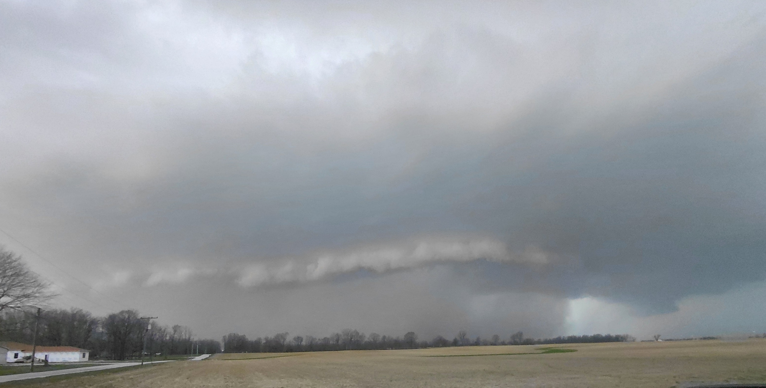
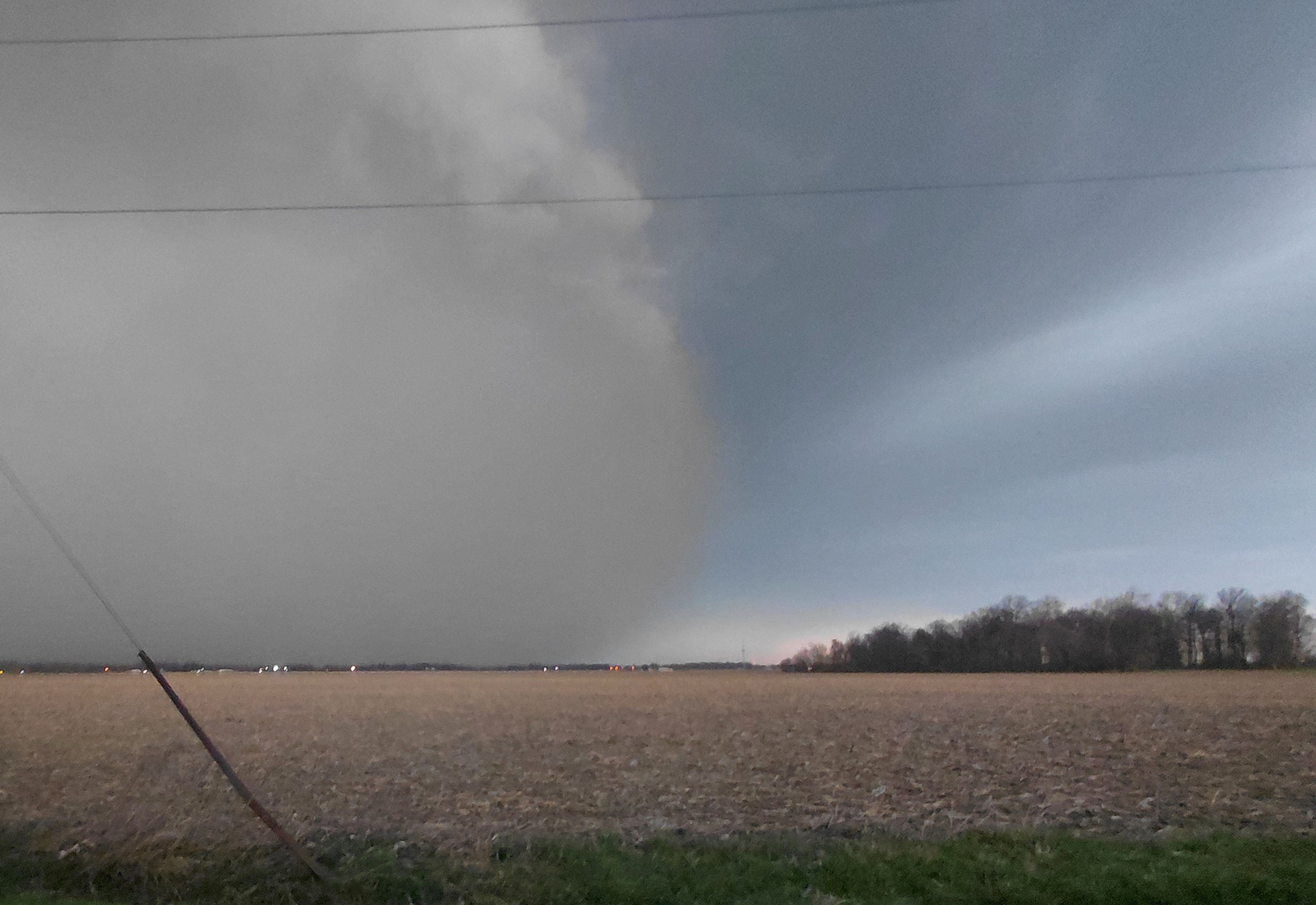
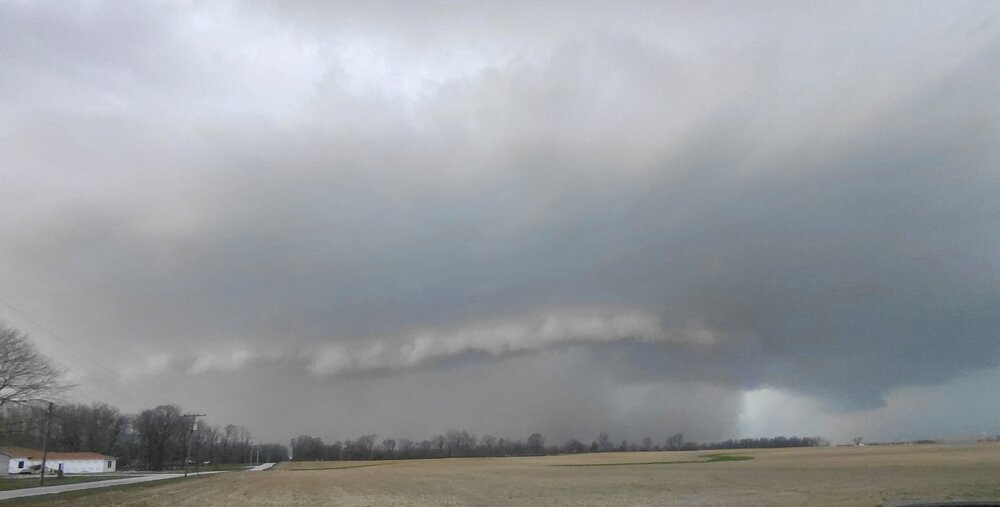
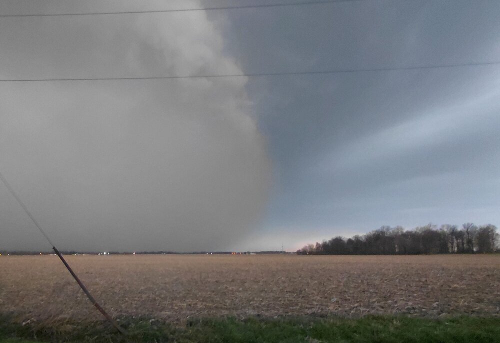
Fun storm. I suck at pics. Massive downdraft just S of the hail core. I had to stop due to the wind. It was a Close Encounters Stop Sign Shaker for sure lol. Registered 68 at home as it passed. Had a nice shelf cloud as I assumed from radar you can see in the first pic which was just after it was Tor warned. This thing had a wall of dust 2k ft in the air in front of it (love Spring gust fronts). You can really see the outside of the "bowl" of dust as part of the core passed just to my N in the second. Its hard to tell but that thing was glowing red from the sun coming through behind that dust. Thats dust in the second, not rain. I was in the desert one minute then horizontal flying mud then sideways rain then sideways hail. That's a crazy ass progression lmao. I got nickel, looks like ping pong about a mile north of me reported.
- 27 replies
-
- 12
-

-
Ima gonna go sit and wait on that cell near Frankfort IN. Its dangling pre frontal all alone and has that look. Its moving @ 60 right at me so shouldn't have to wait long lol Edit: shoiuld have a helluva shelf cloud from velocity if its not too dark
-
Phreakin' confirmed hailers lining up in IN/IL. Stay up there dammit Tor watch for OH where lake breeze interaction has a better chance with already organized cells. Mesoscale Discussion 0292 NWS Storm Prediction Center Norman OK 0325 PM CDT Thu Mar 26 2026 Areas affected...much of Ohio into western Pennsylvania Concerning...Severe potential...Watch likely Valid 262025Z - 262200Z Probability of Watch Issuance...80 percent SUMMARY...Gradual convective development should support an increasing risk for supercells late this afternoon into this evening. Hail, damaging gusts are likely, with a couple of tornadoes possible. DISCUSSION...Afternoon visible and radar imagery showed an area of showers and weak convection gradually intensifying across southern Lower MI into northwestern OH. Located along and south of a front/lake breeze intersection, warming and moistening of the air mass across much of OH and PA this afternoon has resulted in weak to moderate buoyancy. Area VADs show very strong mid-level flow with elongated and veering hodographs. This will favor a mix of supercells and linear segments as the primary storm mode. Given the sufficient buoyancy and strong low/deep-layer shear, hail and severe gusts are likely. Tornadoes are also possible given ESRH of 300-400 m2/s2. Additional vertical vorticity near the lake breeze boundary could also support a locally greater tornado risk given favorable storm motions parallel to the lake shore. Recent CAM guidance and satellite trends regarding the ongoing shallow convection/showers over northwest OH and Lower MI show them gradually deepening as continued heating and mid-level ascent erode inhibition. This should support an increase in the severe risk late this afternoon into the evening. A Tornado Watch will likely be needed. ..Lyons/Smith.. 03/26/2026 ...Please see www.spc.noaa.gov for graphic product... ATTN...WFO...CTP...PBZ...RLX...CLE...ILN...DTX...IWX... LAT...LON 41748249 42038144 42058046 41617949 41077934 40447956 39768013 39258145 39148316 39458405 39838433 40468450 41188445 41648424 41758388 41768347 41748249 MOST PROBABLE PEAK TORNADO INTENSITY...100-130 MPH MOST PROBABLE PEAK WIND GUST...65-80 MPH MOST PROBABLE PEAK HAIL SIZE...1.50-2.50 IN NOAA / National Weather Service National Centers for Environmental Prediction Storm Prediction Center 120 David L. Boren Blvd. Norman, OK 73072 U.S.A. [email protected] Page last modified: March 26, 2026 Disclaimer Information Quality Help Glossary Privacy Policy Freedom of Information Act (FOIA) About Us Career Opportunities
-
Any Tor threat with this is if a surface low can spin up with a strong enough W/NW flow (or super cell outflows, unlikely but non zero). Hell (hehe) the current surface low looks more like a strung out wave. Theres a stout SW around 700mb racing east out of Kansas/Nebraska with a surface reflection but even with it there's no backing flow yet. SPC addresses this in their latest write up. Backside elevated hailers with this moist HOT lol, surface air being flat out jammed upwards into the very cold air aloft by the strong CAA a bigger deal. Might see hail once every couple years where I live, seen it twice in a little more than a week. Last one (similar to this setup) covered the ground completely. Me know likey hail
-
Van Wert (of course lol) wants to kick off the weekend with an 80mph Tpole snapping semi flipping dust storm lol. Tis a bit breezy with multiple 60+ gusts here. for the last 4-5 hours. most N/S highways and Interstates are closed with flipped semi's around here. Preliminary Local Storm Report National Weather Service Northern Indiana 127 PM EDT Fri Mar 13 2026 ..TIME... ...EVENT... ...CITY LOCATION... ...LAT.LON... ..DATE... ....MAG.... ..COUNTY LOCATION..ST.. ...SOURCE.... ..REMARKS.. 0115 PM Non-Tstm Wnd Dmg 2 N Van Wert 40.89N 84.58W 03/13/2026 Van Wert OH Emergency Mngr Multiple semi trucks rolled over and power poles down in Van Wert county. A lot of blowing dust too.
-
Waiting on a reply from my new dog sitter. I'm looking at hotels up around the Rhinelander area. GFS puking out 60 inches lmao. Most snow I ever experienced was in March just outside of Denver in 2014. 26inches in 24hrs. I'm 50/50 just to go see this insanity lmao.
-
Dude, after what you went through you not only picked a great storm to chase again but you did it right (except for one thing). It sounds like you (and from your posts during) were patient and waited for them/it to come to you which is always the best way IMO. ESPECIALLY in the Lakes/OH Valley where we get more 60 mph screaming F3's than most places. Your one mistake was getting on 65. NEVER GET ON 65 when theres bad weather lol. 65 will kill you and I'm serious. It's a Semi UFC ring as far as I'm concerned. It's bad enough on a sunny day. I seldom chase anymore because about 10 years ago my buddy and I were about killed when a Honda Pilot with Harbor Freight flashing lights plastered on it and 3 Iphones hanging out the windows going 90 mph blew through a 4 way stop sign and missed us by inches. Our chase turned from the storm to them and when we caught them we put the fear of God into them. They said they were "pros" and I told them so is this baseball bat. After that nope. You have more chances of getting killed by another chaser than a storm nowadays. Study, prep, pick, sit, wait. Thats my method now if I do lol. Thanx for the vid and hope you exorcised some demons
-
I've got to do a test run with a new dog sitter for my trip late next week. Hell I may just head N into the middle of this cement for a day or 2 for fun. Nothing better than sitting at a bar and hearing people bitch about shoveling concrete lmao
-
Models have been puking out 20-30 inch numbers inside 120 hrs all winter only to cave at the last minute to 2 to 3 and we've come to expect it. Watch this one be the models "I'll show you" moment lmao.
-
2 pages if it were 75 miles S. 1 of them all bitching and moaning. 12Z Euro spitting out 5 to 1 ratios for NE IL. Get out the pick axe's lol
-
Watched that storm on HiRes Sat throughout its life and that was the most impressive sustained updraft with intense rotation up through 50-60k ft I've seen in our sub. I'm also curious how that early lake breeze that moved inland and stalled right around the IKK area affected it. That storm sure looked like it got rooted into that stalled outflow boundary that collided with the warm front. Some extra enhancement there? Thats a rare updraft for even TX hail country to be juggling 5-6 inchers 5 miles in the air. Truly epic updraft.
-
If this long tracker keeps its legs look out. Its starting to enter areas less of farmland and more of subdivisions.