

Jackstraw
-
Posts
2,383 -
Joined
-
Last visited
Content Type
Profiles
Blogs
Forums
American Weather
Media Demo
Store
Gallery
Everything posted by Jackstraw
-

Here comes winter -- October 28-November 1 Snowstorm Potential
Jackstraw replied to Hoosier's topic in Lakes/Ohio Valley
Yeah that 00Z HRRR run was kinda nuts with a squeaker band that far south late tomorrow night early Wed. Got a little support from the other convective models. I get nervous seeing a couple inches of flakes fly even to my NW, this early. This pattern has been locked in for awhile. Like Stebo said hope it holds for another 6 weeks anyway, could get an early Dec. ball buster. -
Here comes winter -- October 28-November 1 Snowstorm Potential
Jackstraw replied to Hoosier's topic in Lakes/Ohio Valley
3k NAM looks to be taking the warm lake water into consideration -
Was so busy didnt see this coming, or just wasn't paying attention. Power just coming on this morning after going out late last night. After the day long down pour the wind really kicked in and there were several transformers popping around here. Green skies at night.
-
Talk about wam bam thank ya mam
-
I got nothing to cover after September lol. Still have some peppers in the garden but a light frost tends to pull the sugars into them so I'm for it. Might get some some sweet hots of the bush's this year, it's been awhile. I can honestly say this is going to be the first weekend that it truly feels like Fall in a long time. The extended seems to keep it coming. I'm all in if we can keep it going to turkey day. I swear, there has not been a Fall of my youth since I moved back 7 years ago. might get some sweet hots off the vine this year been awhile. It'll be patchy if it happens
-
Finally, a chilly light rain the last couple hours. Was going to flip out if we drop 40 degrees in 12 hours and get nothing.
-
Pretty amazing, have had 30-35 dbz returns overhead and hardly a drop. Watched that entire mass of precip just get eaten away as it moved NE of Indy.
-
Looks like we could have our first frost of the season tonight
-
2019 Atlantic Hurricane Season
Jackstraw replied to AfewUniversesBelowNormal's topic in Tropical Headquarters
I can't remember seeing so many suspect areas/formations/storms at or above 30N as this year. -
Well the extended looks like... wait for it... FALL! About freaking time we had one.
-
Cant even squeeze a tenth out of this front.
-
I'd take filthy 4th's around here. Beginning to wonder if camels could be a good investment.
-
Great sat. image depicting the strong SE ridging in place. The cumulus streaks over IL/IN almost look like isobar line lol.
-
2019 Atlantic Hurricane Season
Jackstraw replied to AfewUniversesBelowNormal's topic in Tropical Headquarters
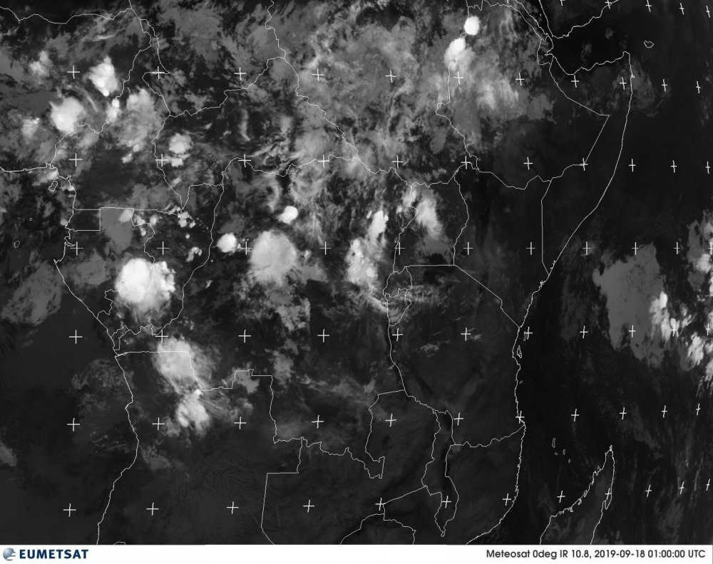
From the Meteosat it's looking like the wave train is full steam ahead. There are several strong and a couple weaker ones lined up like a bowling ball return. We'll see how it pans out, but with the activity over equatorial Africa and the incoming Kelvin Wave it could get very very interesting. Seems #10 and the next wave models have are going to have some decent SAL to fight off so we shall watch the battle begin.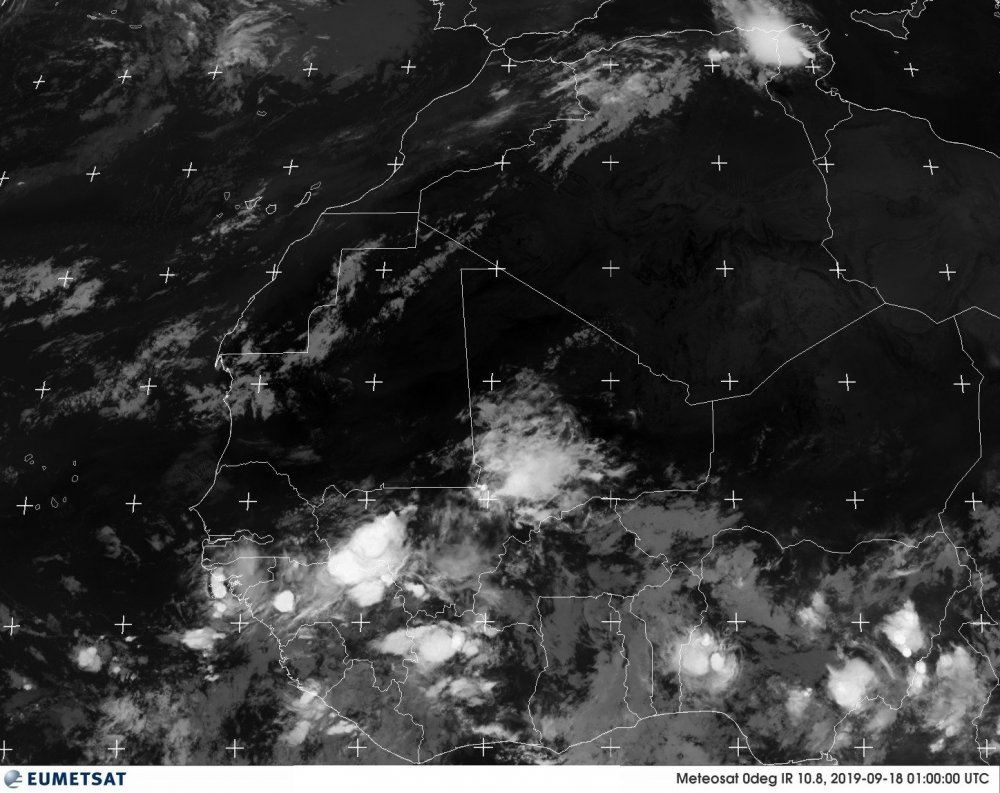
-
I've never been able to tweet embed. True story
-
Spent about 15 years in Fl. Experienced some good ones. Some I chased some didn't have to. Elena (72 hours of hell), Andrew (West coast still a monster), Katrina (scariest cat 1/2 ever), Ivan (was prepared and actually enjoyed it) to name a few. I'm of the opinion know where you live. Canes come with the territory down there so deal with it and prepare yourself. For most of Fl. it's not that hard to evacuate 20 or 30 miles inland (if you have to go that far) if you live within 5 miles of the coast and then hunker down. If you live in Fl. and your evac plan is Georgia move back up north lol. Pinellas county (St. Pete, Clearwater, Largo area where I lived) is just a disaster waiting to happen however because there's just nowhere to go. Water on 3 sides, an average above sea level of about 15-20 feet, 4 bridges and a highway paralleling the coast north the only way out for about 1 million people to evacuate. It's been like 100 years since that area was slammed with a big dog and it will happen again. IMO that area is a powder keg during cane season.
-
2019 Short/Medium Range Severe Weather Thread
Jackstraw replied to snowlover2's topic in Lakes/Ohio Valley
Still raining here. Gonna be a sauna when that big shiny thing comes up in a few hours. -
2019 Atlantic Hurricane Season
Jackstraw replied to AfewUniversesBelowNormal's topic in Tropical Headquarters
"TWA 517, do you want to report a UFO?" Kidding. There are some hints of a trough in the gulf around that time frame on some of the models so we'll see if that blip pops back up. -
2019 Atlantic Hurricane Season
Jackstraw replied to AfewUniversesBelowNormal's topic in Tropical Headquarters
From its performance up around our area I'm wondering if it's atmosphere coupled lol. -
2019 Short/Medium Range Severe Weather Thread
Jackstraw replied to snowlover2's topic in Lakes/Ohio Valley
Well at least an officer on the side of the road wont have trouble reading it lol. That's crazy. Never seen "plate" damage before. -
2019 Short/Medium Range Severe Weather Thread
Jackstraw replied to snowlover2's topic in Lakes/Ohio Valley
Skirts just to my north. Storms have surrounded this area the past week but no love here in N Central IN except the occasional diurnal light show like a poor kid watching the rich kids shoot off fireworks from afar . I'll be moving this discussion to the complaint thread if this pattern persists lol. -
2019 Short/Medium Range Severe Weather Thread
Jackstraw replied to snowlover2's topic in Lakes/Ohio Valley
That outflow is already into Indy so it was moving. -
2019 Short/Medium Range Severe Weather Thread
Jackstraw replied to snowlover2's topic in Lakes/Ohio Valley
The western side will be intersecting an outflow boundary just west of the QC on SE thats very visible on radar. Could provide additional focus. -
2019 Short/Medium Range Severe Weather Thread
Jackstraw replied to snowlover2's topic in Lakes/Ohio Valley
New day 1... Slash right down 65 lol... -
2019 Short/Medium Range Severe Weather Thread
Jackstraw replied to snowlover2's topic in Lakes/Ohio Valley
Decent hail core on it also


