

Jackstraw
-
Posts
2,383 -
Joined
-
Last visited
Content Type
Profiles
Blogs
Forums
American Weather
Media Demo
Store
Gallery
Everything posted by Jackstraw
-

2019 Short/Medium Range Severe Weather Thread
Jackstraw replied to snowlover2's topic in Lakes/Ohio Valley
From the latest SPC meso discussion, perfect timing, and a case where the local NWS re-instituted the watch perhaps? DISCUSSION...The intensity of convection across WW 433 has decreased over the last 30-60 minutes in some area from western TN into eastern AR. Other areas, mainly western KY/southern IL and portions of southern AR, have increased in intensity. In the short term, WFOs PAH, MEG and LZK have addressed the continued strong wind threat will local aerial extensions as needed.... Further north, across western KY/southern IL, the line has been intensifying and surging eastward. This is likely being driven by the expansive cold pool across AR/MO as well as stronger deep flow in the vicinity of stronger forcing occurring with a weak shortwave impulse migrating across the mid-MS Valley region. This portion of the line may continue to produce damaging wind gusts and PAH has addressed this by expanding WW 433. A line of storms moved across parts of western/central KY early today, but recent observations show conditions have likely recovered somewhat across western portions of WFO LMK. This may require an additional watch later this evening depending on trends as the line approaches this previously disturbed airmass. -
2019 Short/Medium Range Severe Weather Thread
Jackstraw replied to snowlover2's topic in Lakes/Ohio Valley
That warned line around Paducha has some wicked QLCS hooks along it -
2019 Short/Medium Range Severe Weather Thread
Jackstraw replied to snowlover2's topic in Lakes/Ohio Valley
Hope it doesn't out run the instability as it moves NE of Indy. -
2019 Short/Medium Range Severe Weather Thread
Jackstraw replied to snowlover2's topic in Lakes/Ohio Valley
These storms are crawling. Maybe 10mph. Whole state is under a flood watch now. -
2019 Short/Medium Range Severe Weather Thread
Jackstraw replied to snowlover2's topic in Lakes/Ohio Valley
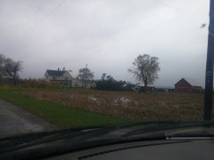
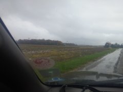
Prelim's from today's survey... Public Information Statement National Weather Service Indianapolis IN 551 PM EDT Sun Jun 16 2019 ...FIRST NWS DAMAGE SURVEY FOR 06/15/2019 ... A widespread tornado outbreak occurred the evening of June 15th as a remnant MCV from earlier storms interacted with a warm front in southern Indiana. This is the first PNS that covers the surveys that were completed today, Sunday June 16th with additional surveys to be completed tomorrow, Monday June 17th. .Tornado #1 Freedom Tornado... Rating: EF-1 Estimated peak wind: 110 mph Path length /Statute/: 8.22 miles Path width /Maximum/: 200 yards Fatalities: 0 Injuries: 0 Start date: 06/15/2019 Start time: 6:29 PM EDT Start location: Freedom/Owen Co/IN Start Lat/Lon: 39.2038 N/-86.8726 W End date: 06/15/2019 End time: 6:45 PM EDT End location: 2 S Spencer/Owen Co/IN End_lat/lon: 39.2738 N/ -86.7509 W The tornado began just southwest of downtown Freedom before moving into the town shearing numerous trees around town. The tornado continued to the northeast leaving a very clear path of sheared and uprooted trees in a path about 200 yards wide. The storm crossed the White River several times over its lifetime and followed the river line to south of Spencer. This is where a large building had its roof uplifted and walls collapsed. The building was part of a business that was set to open for the first time on Monday. The damage ended shortly after and the storm recycled into the next tornado. .TORNADO #2 Ellettsville Tornado... Rating: EF-2 Estimated peak wind: 130 mph Path length /Statute/: 3.7 miles Path width /Maximum/: 400 yards Fatalities: 0 Injuries: 0 Start date: 06/15/2019 Start time: 6:48 PM EDT Start location: 2 W Ellettsville/Monroe Co/IN Start Lat/Lon: 39.2739 N / -86.6075 W End date: 06/15/2019 End time: 6:58 PM EDT End location: 4 N Ellettsville/Monroe Co/IN End_lat/lon: 39.2473 N / -86.6671 W The tornado began in rural countryside northeast of Ellettsville doing some tree damage before crossing State Road 46 and doing significant tree damage along Chafin Chapel Road. A 400 yard wide path of trees was completely shredded in spots. Additional widespread tree damage was found on Mount Tabor road and West Cowden Road. Along West Cowden Road, several barns and outbuildings were destroyed as well as a loosely anchored garage completely swept off of its foundation. The tornado continued into rural forest before dissipating. .TORNADO #3 Greene County Tornado... Rating: EF-2 Estimated peak wind: 130 mph Path length /Statute/: 3.52 miles Path width /Maximum/: 400 yards Fatalities: 0 Injuries: 0 Start date: 06/15/2019 Start time: 6:56 PM EDT Start location: 4 NE Koleen/Greene Co/IN Start Lat/Lon: 39.0456 N / -86.7965 W End date: 06/15/2019 End time: 7:00 PM EDT End location: 5 SSE Solsberry/Greene Co/IN End_lat/lon: 39.0500 N / -86.7312 W The tornado started west of North Crowe Road causing significant damage to a newly built building on Crowe Road. The owner verified it was well built and in very good shape. The track continued across State Road 54 and left a wide swath of tree damage with a resident stating over 100 acres of trees were snapped. The storm cross State Road 43 and dissipated in a field to the east. .TORNADO 4 BEECH GROVE TORNADO... Rating: EF-1 Estimated peak wind: 100 mph Path length /Statute/: 1.86 miles Path width /Maximum/: 200 yards Fatalities: 0 Injuries: 0 Start date: 06/15/2019 Start time: 7:26 PM EDT Start location: 2 SW Beech Grove/Marion Co/IN tart Lat/Lon: 39.7071 N / -86.0971 W End date: 06/15/2019 End time: 7:30 PM EDT End location: 1 E Beech Grove/Marion Co/IN End_lat/lon: 39.7160 N / -86.0641 W The tornado began southwest of Beech Grove causing roof damage before crossing Emerson Avenue and causing additional roof damage to a school and house. The tornado continued for several hundred feet before dissipating. .TORNADO 5 East Marion Co... Rating: EF-0 Estimated peak wind: 70 mph Path length /Statute/: 0.9 miles Path width /Maximum/: 100 yards Fatalities: 0 Injuries: 0 Start date: 06/15/2019 Start time: 7:37 PM EDT Start location: 4 E Beech Grove/Marion Co/IN Start Lat/Lon: 39.7397 N / -86.0009 W End date: 06/15/2019 End time: 7:38 PM EDT End location: 5 E Beech Grove/Marion Co/IN End_lat/lon: 39.7411 N / -85.9842 W A brief touchdown near Brookville road and East Raymond street caused significant damage to several outbuildings and minor tree damage near Brookville Road. EF Scale: The Enhanced Fujita Scale Classifies Tornadoes into the following categories. EF0...Weak......65 to 85 mph EF1...Weak......86 to 110 mph EF2...Strong....111 to 135 mph EF3...Strong....136 to 165 mph EF4...Violent...166 To 200 mph EF5...Violent...>200 mph NOTE: The information in this statement is PRELIMINARY and subject to change pending final review of the events and publication in NWS Storm Data. -
2019 Short/Medium Range Severe Weather Thread
Jackstraw replied to snowlover2's topic in Lakes/Ohio Valley
They are out today.... https://www.weather.gov/ind/jun15stormsurvey -
2019 Short/Medium Range Severe Weather Thread
Jackstraw replied to snowlover2's topic in Lakes/Ohio Valley
Severe Weather Statement National Weather Service St Louis MO 212 PM CDT Sat Jun 15 2019 ILC083-151945- /O.CON.KLSX.TO.W.0037.000000T0000Z-190615T1945Z/ Jersey IL- 212 PM CDT Sat Jun 15 2019 ...A TORNADO WARNING REMAINS IN EFFECT UNTIL 245 PM CDT FOR EAST CENTRAL JERSEY COUNTY... At 211 PM CDT, a severe thunderstorm capable of producing a tornado was located near Brighton, moving east at 25 mph. HAZARD...Tornado. SOURCE...Radar indicated rotation. IMPACT...Flying debris will be dangerous to those caught without shelter. Mobile homes will be damaged or destroyed. Damage to roofs, windows, and vehicles will occur. Tree damage is likely. This dangerous storm will be near... Brighton around 215 PM CDT. -
2019 Short/Medium Range Severe Weather Thread
Jackstraw replied to snowlover2's topic in Lakes/Ohio Valley
URGENT - IMMEDIATE BROADCAST REQUESTED Tornado Watch Number 360 NWS Storm Prediction Center Norman OK 245 PM EDT Sat Jun 15 2019 The NWS Storm Prediction Center has issued a * Tornado Watch for portions of east central and southeast Illinois central and southern Indiana * Effective this Saturday afternoon and evening from 245 PM until 1000 PM EDT. * Primary threats include... A few tornadoes possible Scattered damaging wind gusts to 70 mph possible Isolated large hail events to 1.5 inches in diameter possible SUMMARY...Isolated supercell development appears possible along a warm front advancing northward across the region through late afternoon and early evening. A few of these storms may pose a risk for producing tornadoes. The tornado watch area is approximately along and 60 statute miles north and south of a line from 30 miles southwest of Mattoon IL to 60 miles east of Bloomington IN. For a complete depiction of the watch see the associated watch outline update (WOUS64 KWNS WOU0). -
2019 Short/Medium Range Severe Weather Thread
Jackstraw replied to snowlover2's topic in Lakes/Ohio Valley
That same cell is N of Terre Haute now and warned again with numerous reports of a wall cloud. It's pretty much on its own now. -
2019 Short/Medium Range Severe Weather Thread
Jackstraw replied to snowlover2's topic in Lakes/Ohio Valley
URGENT - IMMEDIATE BROADCAST REQUESTED Severe Thunderstorm Watch Number 168 NWS Storm Prediction Center Norman OK 1250 PM CDT Thu May 16 2019 The NWS Storm Prediction Center has issued a * Severe Thunderstorm Watch for portions of East-central and northeast Illinois West-central and northwest Indiana * Effective this Thursday afternoon and evening from 1250 PM until 600 PM CDT. * Primary threats include... Scattered damaging wind gusts to 70 mph possible Isolated large hail events to 1.5 inches in diameter possible A tornado or two possible SUMMARY...A small linear bowing cluster may continue southeast along the Illinois and Indiana border region this afternoon. Damaging wind gusts and severe hail are the primary hazards, although a brief tornado or two is also possible. The severe thunderstorm watch area is approximately along and 65 statute miles east and west of a line from 35 miles west northwest of Valparaiso IN to 30 miles south southeast of Danville IL. For a complete depiction of the watch see the associated watch outline update (WOUS64 KWNS WOU8). -
2019 Short/Medium Range Severe Weather Thread
Jackstraw replied to snowlover2's topic in Lakes/Ohio Valley
00Z HRRR took a rather ominous turn continuing the threat into central IN. Has some support from the 00Z HRW circus as well as the RAP. This pattern over the next 48 hours seems a little strange to me for May. Almost a quasi August ridge riding pattern with a cold front kicking in behind. Lucy and Charlie? lol -
Pretty crazy stuff from the KILM Disco.... This will likely be the storm of a lifetime for portions of the Carolina coast, and that`s saying a lot given the impacts we`ve seen from Hurricanes Diana, Hugo, Fran, Bonnie, Floyd, and Matthew. I can`t emphasize enough the potential for unbelievable damage from wind, storm surge, and inland flooding with this storm.
-
Well Ryan said google it lol. https://en.wikipedia.org/wiki/List_of_Arabian_Peninsula_tropical_cyclones That would be an amazing sight especially just after landfall. I wonder if there is plant/animal(not necessarily multi cell) life in the area that lays dormant until such an event happens.
-
-
-
The August 21, 2017 Great American Eclipse
Jackstraw replied to ice1972's topic in Weather Forecasting and Discussion
We packed a tent and coolers and headed out Saturday morning with an idea but no plan. I had been watching the forecast and far western KY kept improving. Finally chose to go "somewhere" East of the Shawnee National Forest in IL across the river in KY for a few reasons. It was fairly close for us to drive, 300 or 400 miles. The forecast was giving us a better than 80% chance of no clouds. There's really nothing in that area but hills, farm land and little KY towns pretty spaced apart . There's only a couple of places to cross the Ohio to get into that area and they're about 50 miles apart. So I figured fairly remote, if the clouds role in to the NW in the center of the Carbondale madness, the 2 bridges are going to bottleneck the crazies trying to make a mad dash to find the sun, then that area would be a perfect place to enjoy it and not have the crowds or madness. Military strategy, we had a good defense in that area lol. Question was where to camp? Not knowing the area very well and unbeknownst to me, my girl got on FB and started searching for some folks in that area. Lo and behold she started up a conversation with a wonderful couple who had a big plot of wooded land right in the general area we were targeting.. After she spoke with them on the phone and turned on her charm they said we could camp there under the condition it was just us. They were really concerned about their property and the hype of the tons of people flowing into the Carbondale Hopkinsville corridor. We assured them it was just us and we would gladly pay and take care of their property like it was our own. Still hesitant they wouldn't tell us exactly where it was at, they just said call when we cross the Ohio. When my girl told me I said hey, we either got a place to camp or we're gonna be on one of those real life mystery crime documentary's! So we headed out and along the way we planned our escape for after the eclipse kind of making notes for escape routes if we got stuck in traffic. Regardless it all worked out great when we got down there, the folks were awesomely gracious and we all hit it off and had a blast. Come to find out they wanted to experience it in a similar manner as we did. Alone and reflective with someone you care about. I had targeted the area south of Morganfield KY and thats where we ended up. about 5 miles from the center line. The trip back wasn't bad. It really paid off taking some time to plan escape routes. We didn't spend more than 10 miles on any road with an "I" in front on the way back. Hardest parts of the trip home were the Ohio and Wabash river crossings, definitely bottle necked at both. But as soon as we crossed we hit the secondary's and the thirdendary's and even fourthendaiy's lol. Think storm chasing experience helped, the escape plans, plus two of us sharing the navigating and driving was a plus. It truly was an awe inspiring experience, well worth the minor headaches here and there on the road. I really can't add much more than what other's have already said about the actual event other than as awesome as it was, it was truly humbling at the same time. Really put's you in your place in this vast universe. Oh, and during totality , seeing it in person the pure 3 dimensional view really stood out. Pictures and video cannot reproduce that. Amazing! Besides the Eclipse we really did meet some great new friends and hope to spend some time with them again soon and repay their hospitality. Truly wonderful and memorable all around. -
I'm supposed to drive up to Norwalk Ohio leaving North Central In. at 4am Monday. I usually take 69 and cut over on 30 then back North. Any guesses on if the roads will be passable if this thing pans out?

