

weatherwiz
-
Posts
79,813 -
Joined
-
Last visited
Content Type
Profiles
Blogs
Forums
American Weather
Media Demo
Store
Gallery
Everything posted by weatherwiz
-

December 2025 regional war/obs/disco thread
weatherwiz replied to Torch Tiger's topic in New England
I'm sure there will be a passing game for just snow showers -
December 2025 regional war/obs/disco thread
weatherwiz replied to Torch Tiger's topic in New England
At least this GIF is festive Looks like the color changing Christmas Lights people hang outside -
December 2025 regional war/obs/disco thread
weatherwiz replied to Torch Tiger's topic in New England
The GFS/Euro for the second half of the week across the country are not even on the same planet lol. Not sure if its because the GFS has some cut off energy held in the deep South but it's absolutely insane how different they are. -
December 2025 regional war/obs/disco thread
weatherwiz replied to Torch Tiger's topic in New England
That model needs a lot of work -
December 2025 regional war/obs/disco thread
weatherwiz replied to Torch Tiger's topic in New England
My stance is by 12z runs tomorrow any guidance that was ticking more “favorable” will revert back leaving an outcome of just some snow showers. Maybe someone gets a coating -
NOOOOOOOOOOOOOOOOOOOOOO I'm going to miss Tequila Barry Send him my best
-
December 2025 regional war/obs/disco thread
weatherwiz replied to Torch Tiger's topic in New England
I was wondering if there would be upgrades to warnings in the OV for tonight. Surprised there aren't more warnings. I could see a narrow but elongated strip of 6-8". Going to be some surprised peeps there in the morning. -
December 2025 regional war/obs/disco thread
weatherwiz replied to Torch Tiger's topic in New England
December can have some biggies but that also shows that March used to be just as snowy, if not snowier than December. I'm sure the BDL average for March the past 10-15 years has went down -
December 2025 regional war/obs/disco thread
weatherwiz replied to Torch Tiger's topic in New England
I have the gaps in the data in a notebook that Will posted way back in the day and some stuff from Ryan too for BDL. It just sucks you check the records online and you either have no data or incorrect. Just think of the discrepancies it elicits. Like if you go check BDL on threadex for 1995-1996...it only has BDL like 106" or something versus 115.2" or 116.2" (forgot what it is). -
December 2025 regional war/obs/disco thread
weatherwiz replied to Torch Tiger's topic in New England
that data gap is so stupid. It pisses me off everytime I look at snowfall data. -
December 2025 regional war/obs/disco thread
weatherwiz replied to Torch Tiger's topic in New England
there is almost a better shot at getting severe weather on May 31 than there is a white Christmas -
I was just looking at that This is phenomenal work. Incredible job to all involved in this.
-
December 2025 regional war/obs/disco thread
weatherwiz replied to Torch Tiger's topic in New England
most exciting weather upcoming will be the landslides in the PAC NW next week -
December 2025 regional war/obs/disco thread
weatherwiz replied to Torch Tiger's topic in New England
This deserves post of the year -
December 2025 regional war/obs/disco thread
weatherwiz replied to Torch Tiger's topic in New England
nahhh otherwise Metfan would have spammed us with 8000 images from the JMA by now -
December 2025 regional war/obs/disco thread
weatherwiz replied to Torch Tiger's topic in New England
How bout 726 hr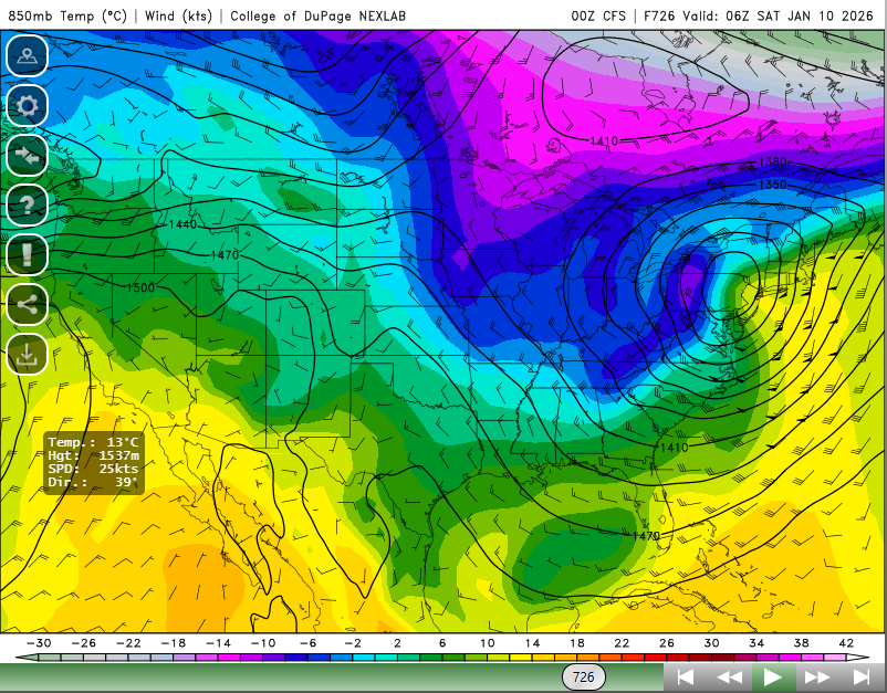
-
December 2025 regional war/obs/disco thread
weatherwiz replied to Torch Tiger's topic in New England
I retired from drinking 40's of Steel Reserve -
December 2025 regional war/obs/disco thread
weatherwiz replied to Torch Tiger's topic in New England
I was just rip and reading the GFS lol. But I just happened to look at the Euro...what a difference. anyways I am with you, I think the extent of the ridging we've been seeing will end up getting muted (though we probably still end up on the milder side). -
December 2025 regional war/obs/disco thread
weatherwiz replied to Torch Tiger's topic in New England
Gotta say...for that Christmas period, it is getting a bit more difficult to find any potential to wedge at the surface. The position of the sfc low would favor deep southwesterly flow across the eastern third of the country. Doesn't look like there is any room for a high to our north or northeast. -
December 2025 regional war/obs/disco thread
weatherwiz replied to Torch Tiger's topic in New England
Right...2-4" does so much to the morale. The 4" I got last week was perfect. It really sucks things haven't worked out as well in this pattern. You get 3-4 events which produce even 2-4" and they just add up quick. -
December 2025 regional war/obs/disco thread
weatherwiz replied to Torch Tiger's topic in New England
Well I guess if there is any consolation, it goes to show what we could have if we can get one of these to work out -
December 2025 regional war/obs/disco thread
weatherwiz replied to Torch Tiger's topic in New England
Speaking of fluff factor, there's going to be some awesome ratios within the Ohio Valley tonight. Might see upwards of 20:1!!! -
December 2025 regional war/obs/disco thread
weatherwiz replied to Torch Tiger's topic in New England
IMO, there's alot more that needs to happen than just trending west but I am also not necessarily sold on some of the recent trends we have seen with the ridging and better interaction of the two energies...we've seen this happen plenty of times of late where within this time range (3-5 days) there are these subtle shifts which trend better. I suspect by 12z Friday we will begin to see a trend back in the opposite direction with the heights in the west and energy interaction. Also, even with the better interaction of energies, the upper level dynamics still aren't very favorable for low pressure development at the sfc...we have to look closer to where the baroclinic zone is present to get some llvl spinup present and I think its just too far south to do any good for us. But that said, at least snow showers are still possible farther east. -
December 2025 regional war/obs/disco thread
weatherwiz replied to Torch Tiger's topic in New England
probably more so a few hundred miles but we always play the "what if" game with these things A heck of alot more needs to happen than just tweaking the interaction between the two energies -
December 2025 regional war/obs/disco thread
weatherwiz replied to Torch Tiger's topic in New England
Would be nice and I hope that happens but all of these "nice trends" are going to have to happen upwards of several hundred miles farther west. Not very likely to get that at this stage


