weatherwiz
-
Posts
79,812 -
Joined
-
Last visited
Content Type
Profiles
Blogs
Forums
American Weather
Media Demo
Store
Gallery
Everything posted by weatherwiz
-

December 2025 regional war/obs/disco thread
weatherwiz replied to Torch Tiger's topic in New England
Fair -
December 2025 regional war/obs/disco thread
weatherwiz replied to Torch Tiger's topic in New England
Doesn’t mean it has to be liked. Sitting in traffic during rush hour is part of going/coming to work, but nobody enjoys that -
December 2025 regional war/obs/disco thread
weatherwiz replied to Torch Tiger's topic in New England
Cold and wind is pointless if it isn’t snowing. If it wasn’t windy it wouldn’t be terrible out. Just nothing fun about it -
December 2025 regional war/obs/disco thread
weatherwiz replied to Torch Tiger's topic in New England
I can promise you about 99% of the population in New England would say the same thing. So 99% of the population just should up and move to Florida -
December 2025 regional war/obs/disco thread
weatherwiz replied to Torch Tiger's topic in New England
Still liking that post Christmas period but I sure hope we get a bit of a mild up moving into January or get an early spring in March. This cold/wind is horrible. -
White Christmas Miracle? December 23-24th
weatherwiz replied to Baroclinic Zone's topic in New England
There should be some decent frontogenesis that crosses the region. Still have a quite a bit to iron out with the details but there should be a sizable swath of 1-3 inches. Def some concerns with boundary layer temps in some spots, but that won't be much of a concern if we get a decent precip. shield and a far enough south track. -
Got back to Springfield to a coating of snow
-
In terms of convectively induced wind damage, not bad for December.

-
Driving to Hartford soon for the Wolf Pack game. Haven't been since opening night (boooo) but trying to leave a tad earlier to avoid any squalls that might come in as early as 6
-
December 2025 regional war/obs/disco thread
weatherwiz replied to Torch Tiger's topic in New England
This right here for 100000 -
I wish I did a before and after picture lol.
-
All of the snow in my backyard is gone...vanished. Outside of some bare spots along the fence line which is hit by the sun, there was probably a good couple inches of cover still. I can see gradd, mud, and melted dog poop
-
Tornado Warning in Hawaii!
-
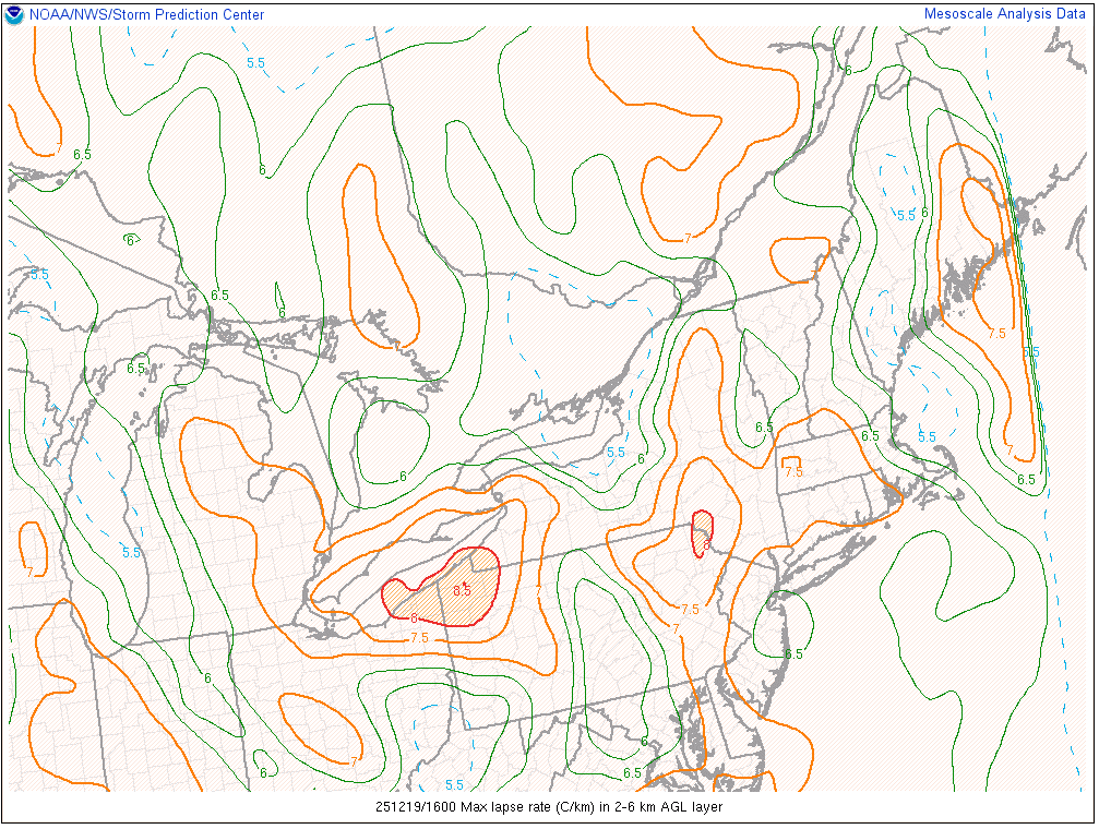
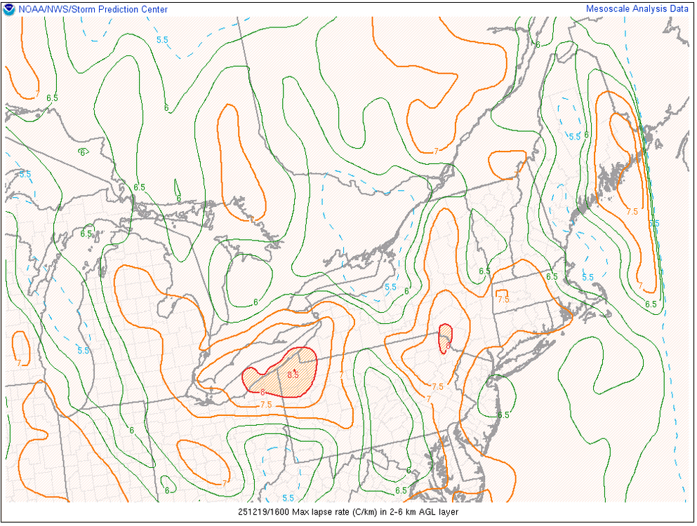
We've steepened up the 2-6km lapse rates well. Gusts here in Springfield are becoming more frequent and a bit stronger too. Really curious to see what the next 1-2 hours brings, especially with the thinning overcast on satellite.
-
wow, a mesonet station in Middletown, CT measured 63 mph
-
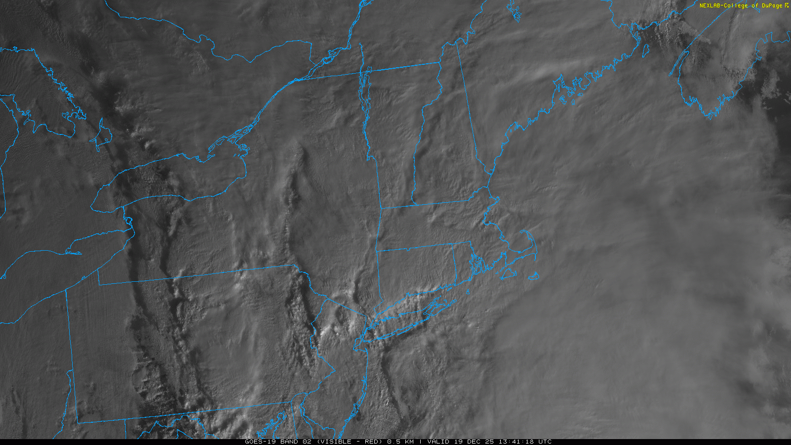
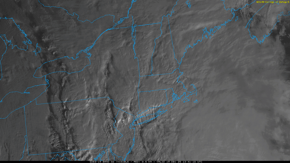
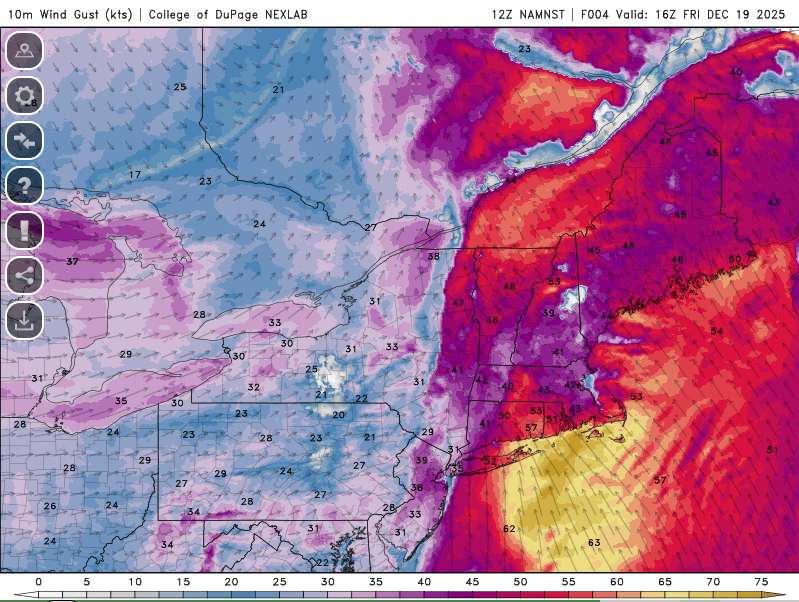
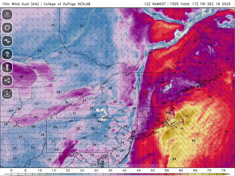
I would definitely watch for some low topped convection to evolve this afternoon and move across Rhode Island and interior southeast Mass. Wouldn't even rule out the potential for a very brief tornado. You can see some convection developing south of Long Island now. We get any convection with thunder/lightning and we may see some 70-75 mph gusts (not widespread but very localized).
-
A pretty impressive satellite presentation this morning and you can see some embedded areas of convection which have contributed to some locally stronger gusts. Noticing some breaks too just to our southwest, so something to watch as we move through the next 3-4 hours.
-
Just ripped a pretty solid gust here a few minutes ago. I love how every now and then you can hear what sounds like a freight train
-
Interesting stuff! Makes alot of sense
-
When I was at WestConn, one semester during my broadcasting class I had made a snow map for a potential storm we were getting (I don't remember the year). But I had text saying, totals could shift depending on track...but I wrote shit and didn't catch it until we reviewed the video in class.
-
I literally have no clue what is wrong. Over the past week or two I've been making some insane typing errors. Like I am typing stuff that is not matching what I am thinking in my head...like missing words of a sentence or using incorrect verbiage (like saying uncertain but forgetting to add on "ty"...things like that). so weird
-
Pretty intrigued seeing mesos this impressive still this close in
-
3km is pretty wild out east late morning and early afternoon. If we can dry out behind this bath of rain there could be some room for 65-70 mph gusts.
-
December 2025 regional war/obs/disco thread
weatherwiz replied to Torch Tiger's topic in New England
yeah I imagine that might rip some solid gusts just out ahead of it or along it. Beautiful looking fine line -
December 2025 regional war/obs/disco thread
weatherwiz replied to Torch Tiger's topic in New England
Its a cesspool for weather...absolutely horrible. Believe it or not though, I think its actually worse for severe weather than it is in winter weather. The severe weenies on there are awful