weatherwiz
-
Posts
79,819 -
Joined
-
Last visited
Content Type
Profiles
Blogs
Forums
American Weather
Media Demo
Store
Gallery
Everything posted by weatherwiz
-

September vibes - Last 90s for some, 1st frost for others
weatherwiz replied to tamarack's topic in New England
It's definitely a very warm look, those are some serious 850 anomalies, particularly across the northern tier of the country. We'll certainly get some cool shots and some chilly nights mixed in but the overall theme is going to be above-average. -
September vibes - Last 90s for some, 1st frost for others
weatherwiz replied to tamarack's topic in New England
Quite a bit of model uncertainty for the end of the week across the eastern third of the country. -
September vibes - Last 90s for some, 1st frost for others
weatherwiz replied to tamarack's topic in New England
About as much as the patriots offense averaged in the first half -
I wish they added more blocks for the number of years you can input. I know with the temp maps on the climate division site you posted they increased the blocks from 20 to 30. I know you mainly focus on ENSO events post 1950 while I was going back to 1900, however, I am beginning to wonder if I should put any weight on forecasts using events prior to 1950. I don't want to abandoned studying patterns of ENSO events prior to 1950 but it is evident as daylight there is a major shift in how ENSO's behave over time...especially after the 1960's/1970's. For example, I stupidly went below-average temps for like the eastern third of the country last winter...but if I eliminated EL NIno events from before 1960 from my list, I probably wouldn't have done that.
-
I have to send a follow up email to PSL but a few months back the site I was using to make composites compared to the appropriate period stopped generating images. When I initially emailed them they said they were looking into it. This happened just before everything happened with the dog and just haven't followed up. I had some new ideas I wanted to try with the breakdowns based on ENSO/strength but have fallen really behind. I wish I either had significantly more time or was smart enough to learn programming and coding...that right there would go a long way in all this. But I wanted to start assessing previous ENSO events and pattern evolution on a weekly basis starting from like mid-Fall. What's becoming very challenging with using ENSO in seasonal forecasting though is, focusing on ONI and SST's alone just aren't cutting it anymore. ENSO events and how they are impacting atmospheric circulations are behaving much differently over the last 20-30 years. Obviously there needs to be some skepticism with that statement because when assessing events prior to 1950 much of the data is re-analysis and derived from ship data and there are huge gaps in data during the 2 world wars. But what I re-started back in the spring was creating a list of ENSO events for each of the following methods ONI ENS-ONI RONI I was then looking into SOI data and assessing the SOI and looking at SOI data for the following methods SOI from the Bureau of Meteorology (Australia) SOI from the University of East Anglia SOI from Long Paddock CPC SOI CPC Equatorial SOI The methods used to calculate the SOI are extremely similar, however, Long Paddock/Australia used a x10 multiplier and Long Paddock also uses a bit longer climo background. I think Long Paddock/Australia's method makes SOI assessment much easier. Then next looking into MEI. What sucks with MEI is v2 only dates to 1979. There is the extended version which dates to like the 1870's but I believe it stopped being updated in the 2000's.
-
September vibes - Last 90s for some, 1st frost for others
weatherwiz replied to tamarack's topic in New England
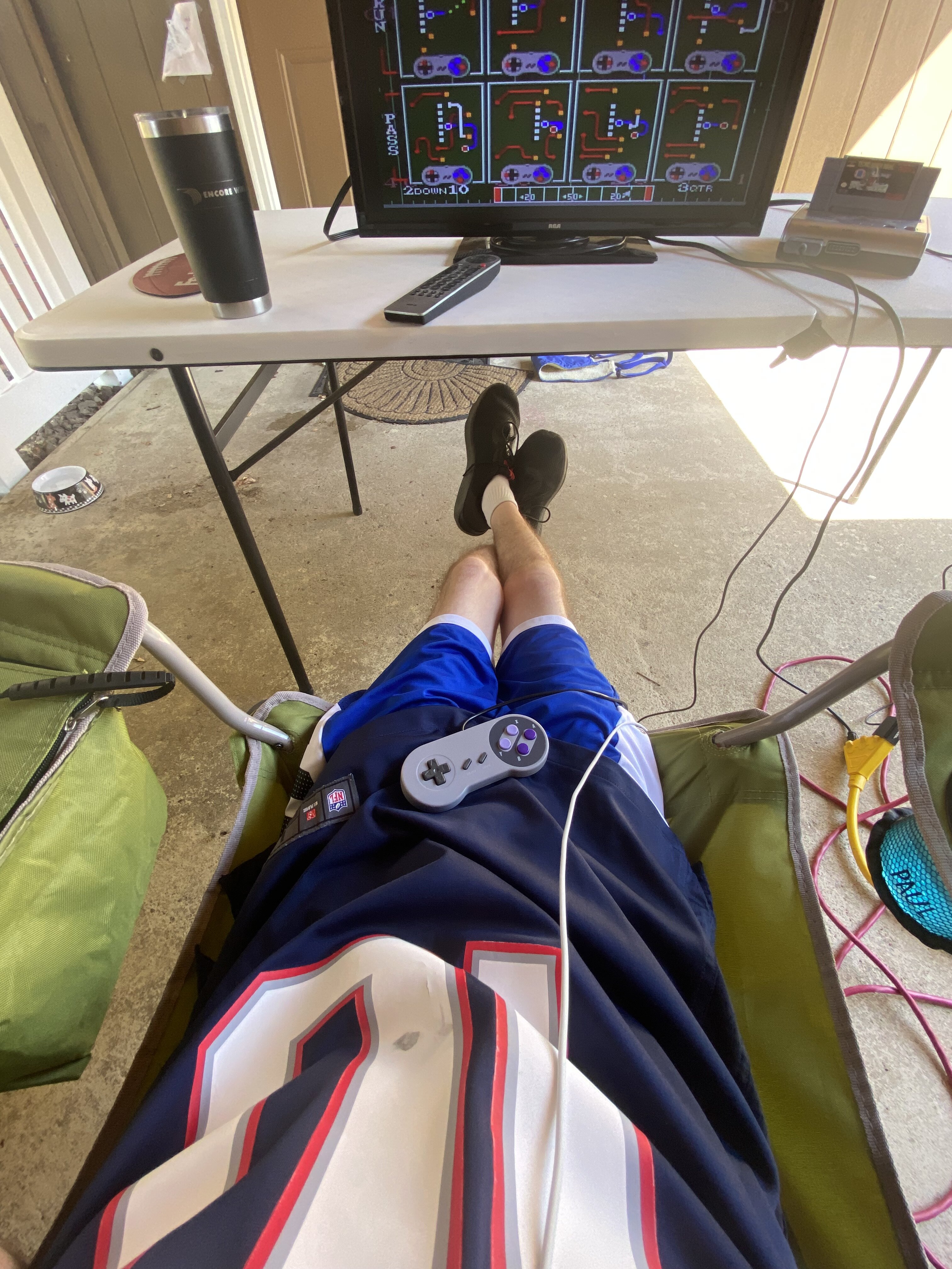
Hope we keep this until November. Anyways, really starting to notice the loss of daylight now. Looked at the clock last night thinking it was like 9:00 and it was only 7:30 lol. At least though we're remaining mild at night. Was outside with shorts until the end of the SNF game...pretty wild for me. -
Very much too far out to take it serious, but if you look at that synoptic evolution, that's exactly what you want to see so can't totally discard this one yet.
-
September vibes - Last 90s for some, 1st frost for others
weatherwiz replied to tamarack's topic in New England
We may have a shot if that pattern verifies Too bad it will probably be 70's with dews in the 50's -
September vibes - Last 90s for some, 1st frost for others
weatherwiz replied to tamarack's topic in New England
Latent heat from the monster hurricane in the Gulf pumping heights north -
I could be off on this but technically the Atlantic does get designations as category 3 or higher are called major hurricanes.
-
September vibes - Last 90s for some, 1st frost for others
weatherwiz replied to tamarack's topic in New England
Never thought I’d be outside in shorts wearing a football jersey and being able to watch the game outside. Keep this through November PLEASE
-
September vibes - Last 90s for some, 1st frost for others
weatherwiz replied to tamarack's topic in New England
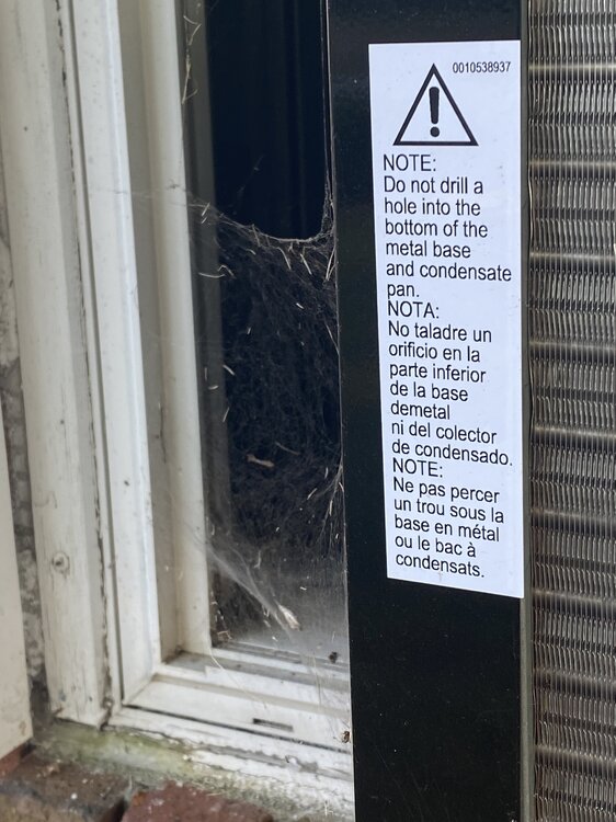
So I just encountered one of those flying spiders. I was outside with the dog and I see this thing floating through the air. It looked somewhat like those white things from flowers but it was definitely parachuting. I followed it until it landed and it started to crawl. -
September vibes - Last 90s for some, 1st frost for others
weatherwiz replied to tamarack's topic in New England
I’m cleaning gutters. Don’t need one jumping on me and knocking me off the ladder -
September vibes - Last 90s for some, 1st frost for others
weatherwiz replied to tamarack's topic in New England
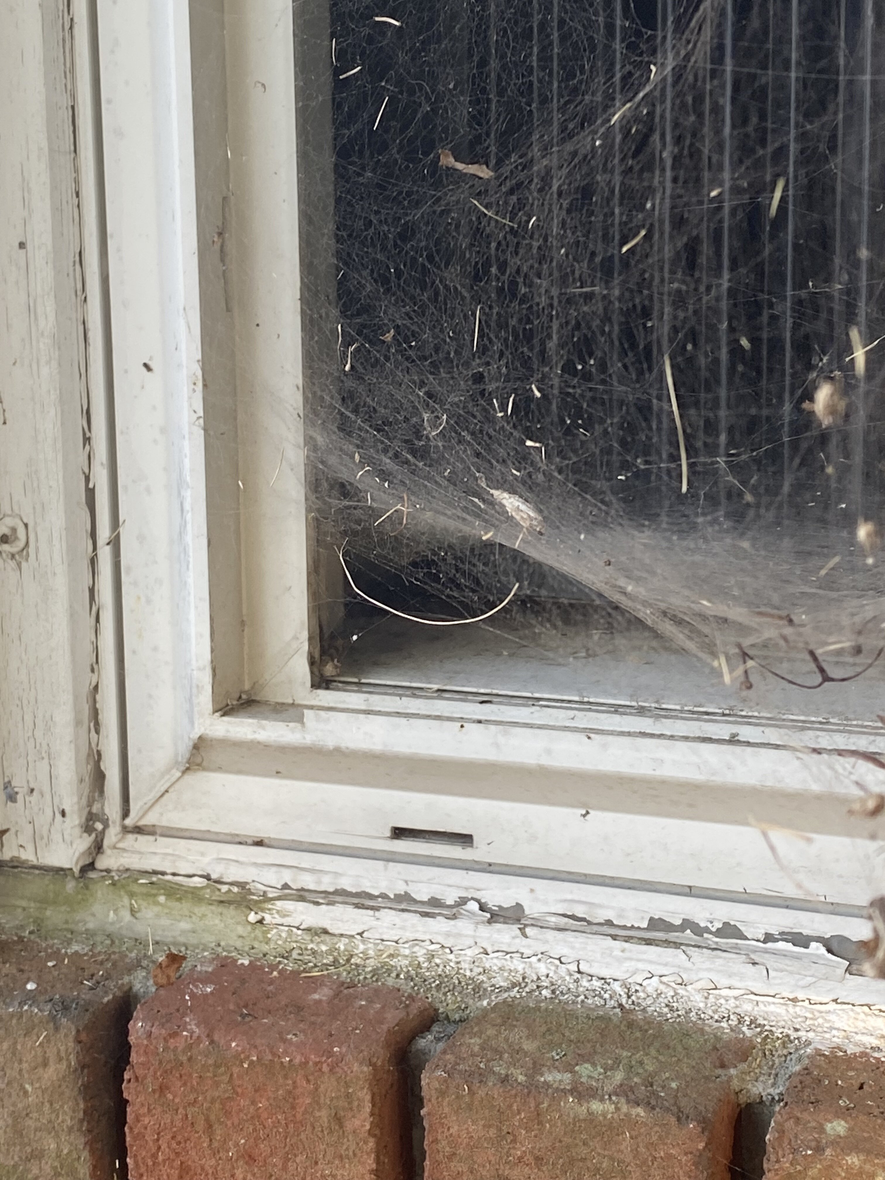
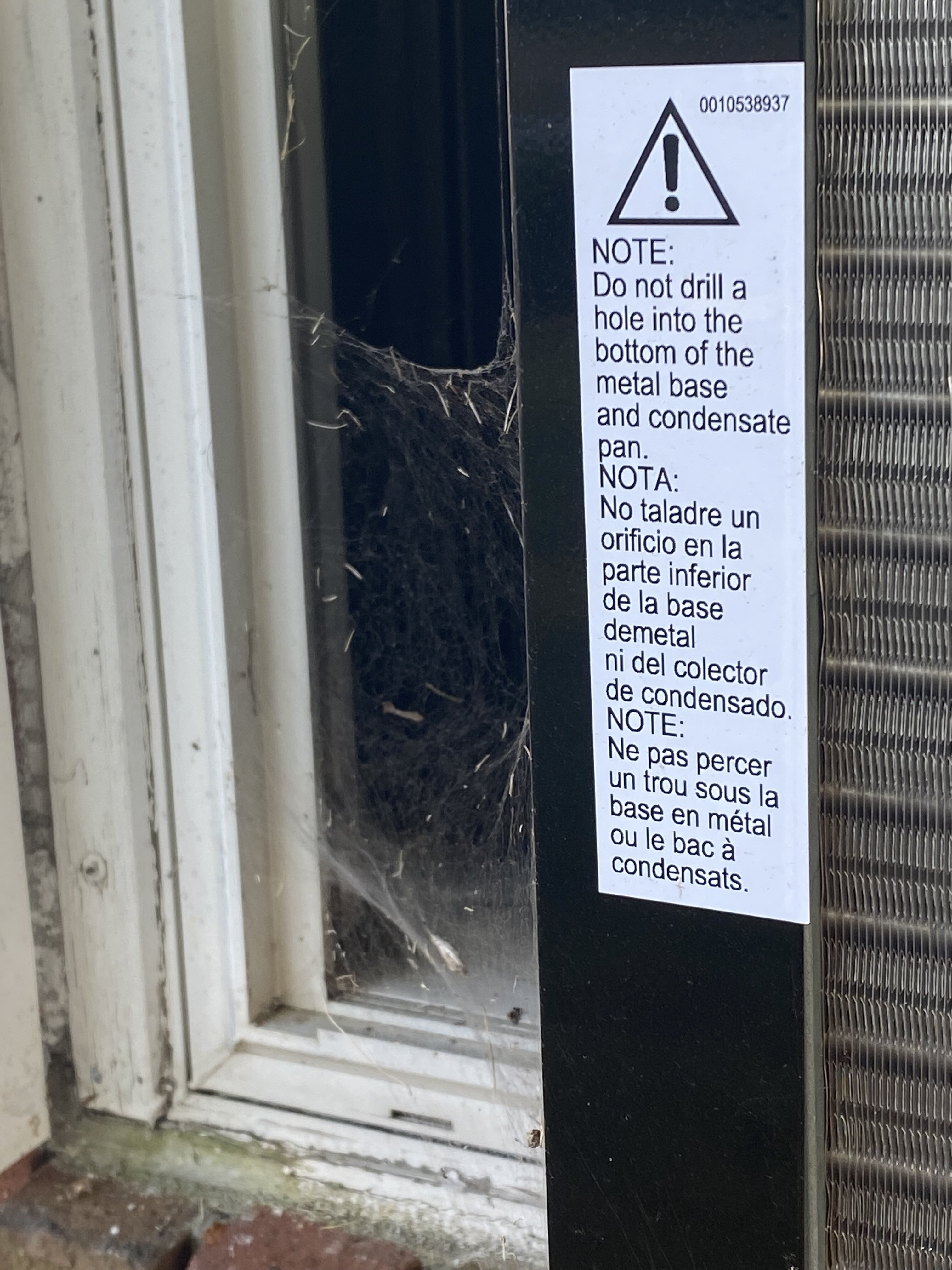
Is this is a funnel weaver web?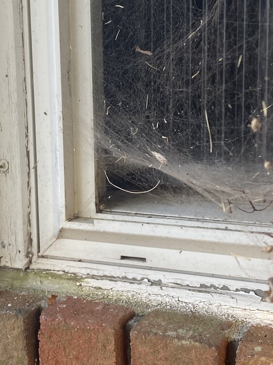
-
September vibes - Last 90s for some, 1st frost for others
weatherwiz replied to tamarack's topic in New England
There is some sort of creature in the unit on the left. Anyone ever have that happen? Who do you call besides Ghostbusters. A bird once got through the fireplace at my grandparents when I was younger and squirrels get inside my moms (with one dancing in my face when I was drunk in bed) but I’ve never had this…who do you call besides Ghostbusters??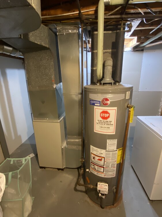
-
September vibes - Last 90s for some, 1st frost for others
weatherwiz replied to tamarack's topic in New England
WTF? Where is that? Looks like a wolf spider or a brown recluse or a mixture of the two. Get out of there ASAP. -
September vibes - Last 90s for some, 1st frost for others
weatherwiz replied to tamarack's topic in New England
All that traffic was just because people wanted to see the color of leaves...LMFAO -
September vibes - Last 90s for some, 1st frost for others
weatherwiz replied to tamarack's topic in New England
I'm sure we'll get a pretty potent front at some point during October which will bring the chance for some transition precip up north on the backside of the front. Of course if we are active with any coastal systems could get something light for the elevated interior. -
September vibes - Last 90s for some, 1st frost for others
weatherwiz replied to tamarack's topic in New England
Hard to get snow when its 70's and 80's -
September vibes - Last 90s for some, 1st frost for others
weatherwiz replied to tamarack's topic in New England
Better chance of the Patriots going 17-0, winning the Super Bowl AND the Red Sox to sneak into the playoffs and win the World Series. -
September vibes - Last 90s for some, 1st frost for others
weatherwiz replied to tamarack's topic in New England
They shouldn't run models past 180 hours. Its a waste of resources and with the explosion of social media, just elicits unnecessary hype which spills into the public and creates nothing but chaos. -
September vibes - Last 90s for some, 1st frost for others
weatherwiz replied to tamarack's topic in New England
We need a blowtorch reaction -
September vibes - Last 90s for some, 1st frost for others
weatherwiz replied to tamarack's topic in New England
sucks the timing of the s/w rotating through is so late today -
September vibes - Last 90s for some, 1st frost for others
weatherwiz replied to tamarack's topic in New England
We were having issues getting the main water valve to the house shut off but we didn’t want to do that because we still would have to figure out what was going on with the hose hookup. I was able to get part of the gutters cleaned before the first round of showers. That ordeal wasted a good 3 hours of the day. It should have taken 3 seconds to legit shut the water off. but as shitty as this was I think a potentially larger issue was prevented. Our water bill had been getting quite high the past year and I’ve noticed the hose would always be dripping. When I took the hose off and the water started gushing out (and the outside valve…did not shut the water off. When twisting it went from the gushing water to massively gushing water. So it occurred to me that water must have been constantly running. The whole situation is bizarre. Never came across anything like this. want to try and do gutters tomorrow but have a ton of stuff to also do before the Pats game. -
September vibes - Last 90s for some, 1st frost for others
weatherwiz replied to tamarack's topic in New England
What a disastrous day. Started cleaning the gutters and was going to use the hose to blast out any residue. Turn on the water, nothing coming out. Went to disconnect the hose from the house and all of a sudden water started gushing out so I go into the basement to find the shutoff valve. Couldn’t find it anywhere…spent over an hour and a half, so water was just gushing out. Called neighbors, realtor, tried turning off every valve I could find. finally we had to call non-emergency fire. They came and found out that we couldn’t find the valve because there was none so they grabbed something to get it shut off. Got a plumber to come and get a valve on there and replace the outside faucet which we had had some leaking issues with. I was starting to feel stupid not being able to find a shutoff valve…they’re not hard to find but there was no freaking valve on the stupid pipe