Sn0waddict
-
Posts
4,703 -
Joined
-
Last visited
Content Type
Profiles
Blogs
Forums
American Weather
Media Demo
Store
Gallery
Everything posted by Sn0waddict
-
Considering I have already exceeded their high end amount I would say yes, it’s wrong.
-
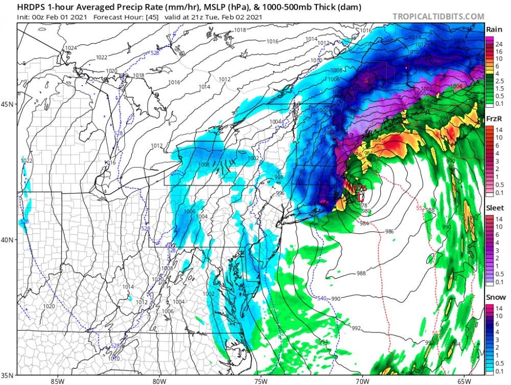
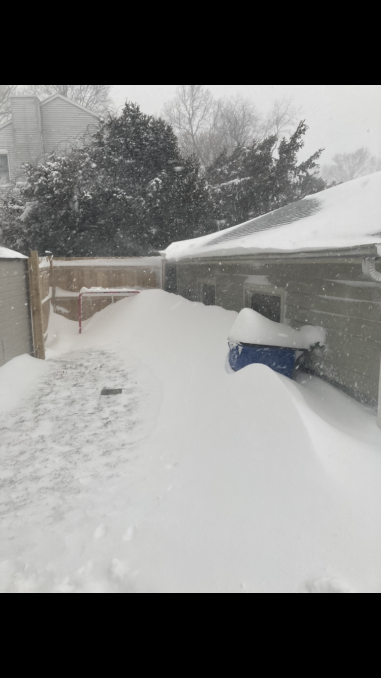
 Impossible to measure but I think we are around 13 inches in Milford, CT
 -
Insanity here. Guessing over a foot.
-
Easy to measure!
-
Some of the heaviest stuff coming through right now. Will attempt to measure soon.
-
It’s almost impossible to measure lol
-
So did Waterbury.
-
My guess is a town right next to the Merritt. Maybe Easton?
-
Should reach a foot and then some if that is the case.
-
The sleet line is south of Long Island lol
-
Tough as hell to measure, between 8-10 inches is what I was getting away from drifts . Dry slot is starting to get a little concerning.
-
Ya radar was terrible for a while. Temperature actuallly dropped a degree to 25 as well.
-
LOL I mean there was for almost the entire night. But like I also said we were just getting the dry slot out of the way early
-
As others have said it’s way too difficult to measure. But it’s somewhere between 5-7 inches. Blizzard like conditions.
-
Let’s gooo
-
I’m directly to your south in the yellow banding. Going to go out soon and measure.
-
Dumping snow here. 26F
-
Radar has filled in nicely over SW CT
-
That’s an error with the HRRR algorithm. Check the sounding and you will see that there is no warm layer. Did this with the last storm too.
-
Radar is beginning to blow up over NJ. Hoping it does the same here ASAP.
-
Radar refuses to cooperate, everything dries out as it gets here. Hope that changes soon.
-
Comparing 0z to 4z HRRR it seems to be moving the low east a bit. Also more impressive with snow totals. Has SW CT at 7 inches by 15z vs 5 inches. Low is stronger as well.
-
Does it finally show the storm hitting us or is it still trying to send it to Bermuda? (Second best model btw)
-
Looks like we will have to wait until that NYC band gets here for sure to start seeing the flakes fly.
-
TT