

Tatamy
-
Posts
2,326 -
Joined
-
Last visited
Content Type
Profiles
Blogs
Forums
American Weather
Media Demo
Store
Gallery
Posts posted by Tatamy
-
-
18 minutes ago, psv88 said:
Thanks lol. I was holding out for a house north of the where I am but there was almost no inventory and what was available was awful.
Yes probably. This area is usually on the frozen side in marginal events and also got a solid inch last week. Will be interesting to see if there is much of a difference
After I married I moved from E Northport to Brentwood and then Sayville. There is definitely a big difference year round between the center and south shore of the island and the north shore. Now I am in eastern PA and that is even more different. Good luck with your move.
-
 1
1
-
-
Just recorded a wind gust to 35 mph as this squall arrives.
-
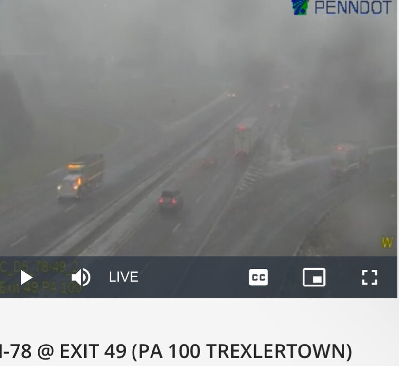
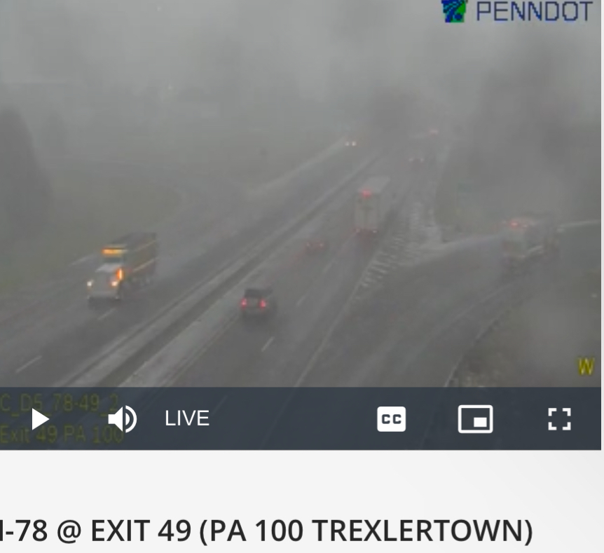
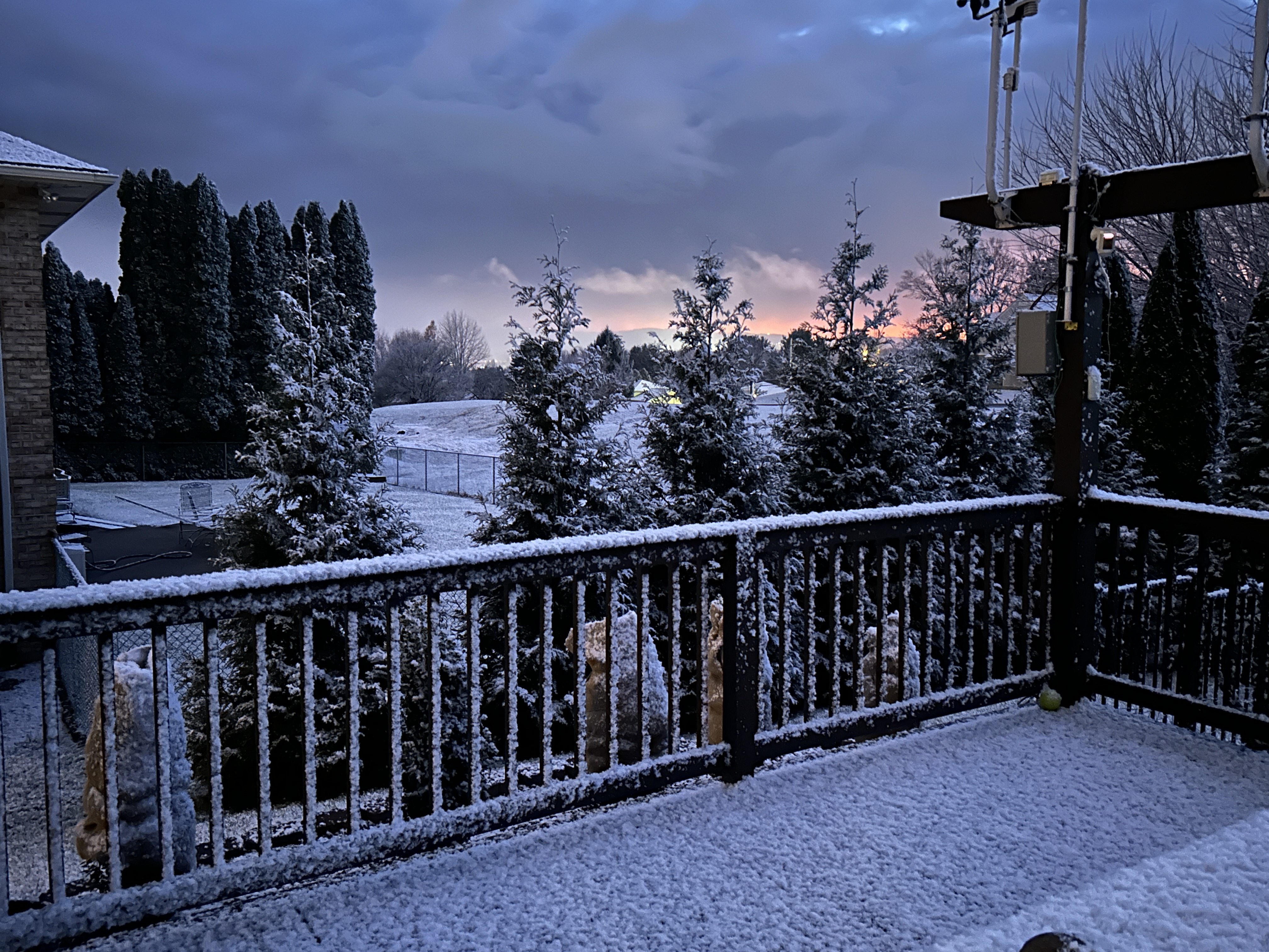
This is what it looks like on the west side of Allentown right now.
-
3
-
-
Round #3 is on its way. Heavy snow showers/squalls are just west of Allentown. This activity looks to be low topped as it is just coming into view on the Mt. Holly radar. Visibility out in that area has really dropped in association with this activity as seen on I78 traffic cams.
-
1
-
-
The line of echoes across western and NW NJ and eastern PS contains heavier snow showers. The rates are like a squall but the winds do not meet the criteria. In any case we have a fresh half inch here. 33/32
-
1 hour ago, MJO812 said:
Not that far
Good trend from 12z. We are still in a good pattern. Hopefully this trends more south before the milder pattern comes.
A couple members on the GEFS biting on it however the mean is still well north and west.
-
1
-
-
Very light snow and flurries here. 36/23
-
1 hour ago, Dark Star said:
For the NYC immediate metro area, (true) snow squalls are rare. Unless you have a truly dynamic system, they are near impossible to predict with accuracy. Much like a line of summer T-Storms, once they pass over the eastern Appalachians in eastern PA, then move over the foothills of NJ, the downslope robs most of them of their punch.
Snow squalls that sometimes affect eastern PA and parts of northern and western NJ are typically the ends of lake effect streamers that have some channelized vorticity with them to keep them going. Without that vorticity they do die out in the Poconos and Catskills and the downsloping finishes the process.
-
7 hours ago, RedSky said:
Found a few dendrites on the car and trash can from earlier. Long range after a snow shower chance Thursday is shut the blinds. Honeybees will be back out next week on the bird feeder.
Very narrow snow swath from the snow squall yesterday evening. Most of the Lehigh Valley just got flurries except for my area with 0.5”
-
Low here of 23. Combination of snow, frost, and black ice didn’t seem to have much impact on temperatures even with calm winds most of the night.
-
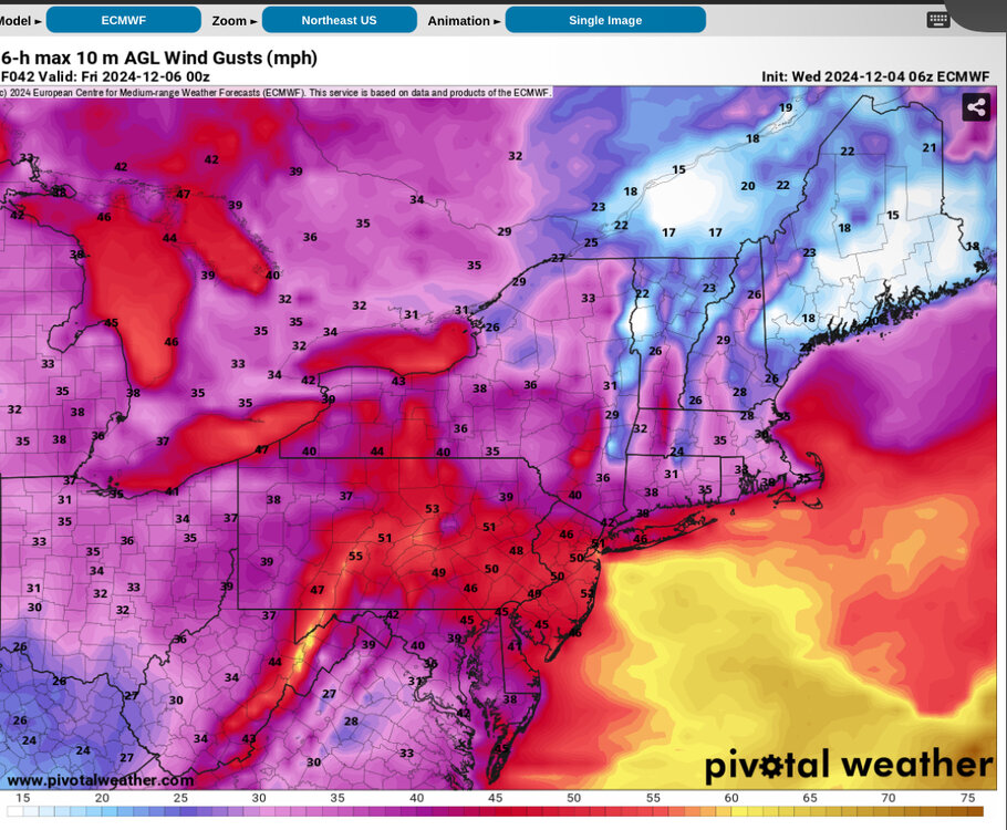
Six hour maximum wind gusts from the 06z Euro for tomorrow as of 7 pm.
-
1 hour ago, eduggs said:
The meso models are not enthused about snow prospects Wed night. Maybe they will be wrong and the snow shield will be more widespread, but I doubt it. Downsloping off terrain with a SLP to our NNW rarely works out. Best chance of whitening the ground will probably come with scattered instability snow squalls on Thurs. morning.
The Mesos missed the snow squall we had earlier tonight. To their credit Mt. Holly did outlook it in their AFD. I would agree on the idea of the best chances being Thursday morning especially north of the city.
-
Mt. Holly’s Snow Squall warning verified (minus the wind). We have 0.5” new. That’s probably more than what we will see tomorrow night and Thursday.

-
6
-
-
9 minutes ago, Stormlover74 said:
.A SNOW SQUALL WARNING REMAINS IN EFFECT UNTIL 430 PM EST FOR CENTRAL WARREN...NORTHWESTERN LEHIGH...CARBON...SOUTHWESTERN MONROE AND NORTHAMPTON COUNTIES...
At 403 PM EST, a dangerous snow squall was located along a line extending from near Columbia to near New Mahoning, moving southeast at 25 mph.
HAZARD...Whiteout conditions with near zero visibility associated with intense bursts of heavy snow and gusty winds leading to blowing snow. Wind gusts up to 35 mph.
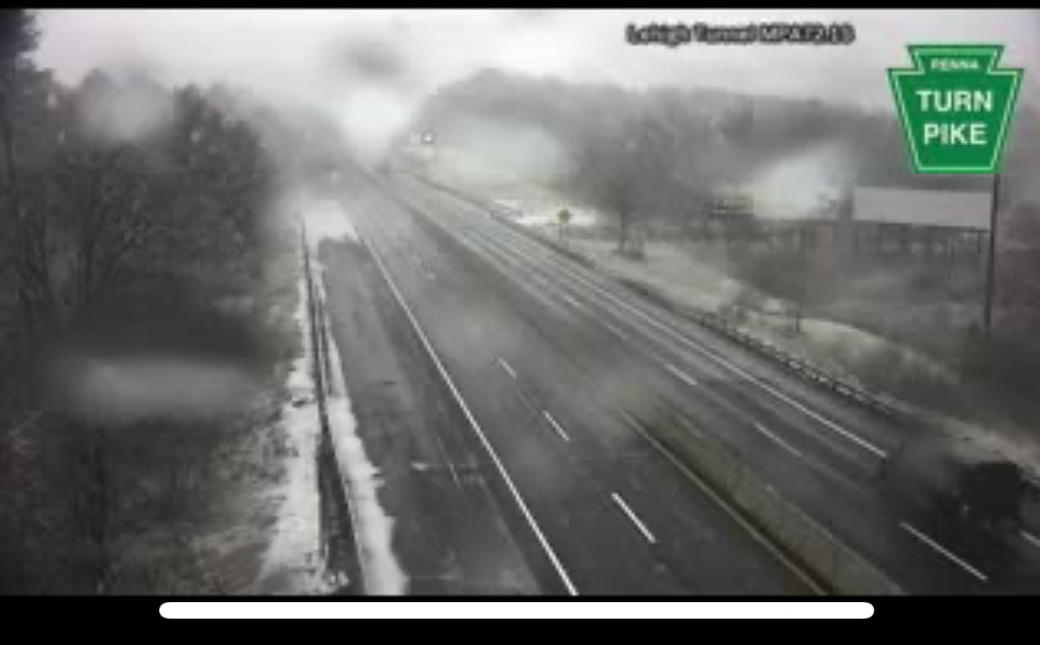
I saw that and there is some really heavy snow coming down along the Tpke at tunnel near Lehighton. Waiting to see how much of that makes it down here or into western/NW NJ
-
2
-
-
HRRR has been showing snow showers and squalls across eastern PA and into parts of northern NJ for a few runs for tomorrow afternoon. Something to watch for.
-
22 minutes ago, winterwx21 said:
A little front end snow well to the NW on the Euro. As snowman19 said, we just don't have the cold air in place yet for this event. That along with the bad track means you're going to have to be well to the NW to see any snow, unless we see dramatic changes.
I'm excited about the extended cold pattern after that storm though. It has been a long time since we've seen a December snowstorm here, and we're gonna have a real shot in early December for a change.
Snowman is correct. Arctic stream involvement is a must for snow for this event in this area.
-
2
-
-
1 hour ago, MJO812 said:
Euro is a rainstorm
Euro/CMC are both going for snow for places in the Poconos/Catskills/Berks and north with the late week event. Euro has been going for this for a few runs now.
-
Looks like the center of SLP is crossing LI now. My station on Fire Island has recently seen an abrupt change in wind direction from NE to W with a temperature drop of 4 degrees in the past half hour.
-
8 minutes ago, Allsnow said:
Lake snow band about to move in to cle for the browns Steelers game
It’s there now!
-
1
-
-
.95 overnight
-
 1
1
-
-
6 minutes ago, RU848789 said:
For Thanksgiving snow, our region hasn’t had much, but in 1989 4.4" fell in NYC, 6.0" fell in Newark and 4.6 fell in Philly from Weds night into T-giving. Before that one has to go back to 1938 for snow in NYC on Thanksgiving, when 3.9” fell. On average we get November snowfall once every 3 years, with the last major one being 11/15/2018, when 4-7” fell across most of the Philly-NJ-NYC corridor and NW of there (less towards the coast) - that was the storm that shut down much of the region as the snowfall was significantly underestimated by almost everyone, despite the Euro/NAM (EE rule, lol) being bullish on snow for the 95 corridor. Loved that storm, as I got out of work in Rahway by 2 pm, as I knew things were getting bad, and it only took me 30 min to get home (10 miles), while people who left an hour later took hours to get anywhere.
The Thanksgiving Snowstorm in ‘89 was preceded by a powerful cold front on the Tuesday prior. This front was accompanied by widespread violent severe thunderstorms across Long Island and other parts of the region with many reports of damaging wind gusts of 40-60 mph.
-
Walt - please start the thread. This storm could be quite impactful.
-
1
-
-
3 hours ago, RU848789 said:
The difference between the 0Z NAM and the 0Z GFS is astonishing, especially for NNJ/NEPA. I have a very hard time believing in the GFS here.


It’s an outlier solution.
-
0z GFS is all in with the potential for significant snows across NW NJ and NE PA.
-
2
-

Wednesday Dec 11, 2024 1.5-4" rainfall, wind gusts coastal NJ LI CT 50-70MPH 1PM-mIdnight w power outages and Wed afternoon-eve OBS
in New York City Metro
Posted
Winds are starting to crank here as the cold front slowly approaches. Recent wind gust to 29 mph and I am well inland. Winds will really start to crank along the coast soon.