

Tatamy
-
Posts
2,329 -
Joined
-
Last visited
Content Type
Profiles
Blogs
Forums
American Weather
Media Demo
Store
Gallery
Everything posted by Tatamy
-
Recent gust at this station to 65 mph as the northwest eyewall moves in.
-
28.19 in HG at Placida Boat ramp near Cape Haze (Davis network).
-
I was posting that data earlier.
-
Barometric pressure at this station now down to 28.58 in HG
-
Looks like the wind sensor at this station has been knocked out. Barometric pressure at the station is 28.75 in HG
-
Most recent gust at this station up to 97 mph.
-
This station has just reported a wind gust to 91 mph.
-
Most recent report from this station shows a wind gust to 85 mph. It is located just north of Sanibel and is in the edge of the eastern eyewall.
-
Recent gust at this location up to 81 mph within the last 10 minutes.
-
That has to be at least 4 feet of water in that location.
-
Recent gust to 63 mph at St. James City (Davis network).
-
From post on FB by Sandy Delgado at the NHC.
-
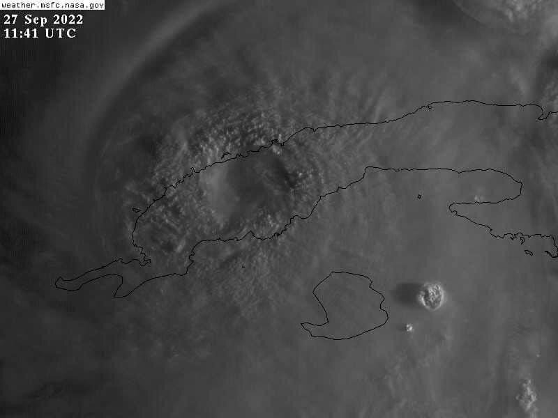
Cuban Weather Radar http://www.insmet.cu/asp/genesis.asp?TB0=PLANTILLAS&TB1=RADAR&TB2=../Radar/02IJuventud/pdeMAXw01a.gif
-
Euro 06z at 84 hours Euro 12z at 78 hours
-
CMC is west with an Apalachicola landfall at 102 hours.
-
Andrew hit south Florida in August 1992. I took a vacation down there in April 1993. I drove around the Homestead area and the area where the Turkey Pt. Nuclear plant is situated. Every tree along SW 344th street was ripped out of the ground and pointed east. Every home in the area was either leveled or badly damaged. The east coast of Florida dodged a serious bullet when that well timed trough approached and steered Dorian to the north. I would not wish a Cat 5 landfall on anyone.
-
This is a link to the NWS office in Tampa that provides watches and warnings. Click on your locality and it will provide information on all current watches and warnings for your area. https://www.weather.gov/tbw/
-
Storm Surge?
-
Cuba Weather Radar http://www.insmet.cu/asp/genesis.asp?TB0=PLANTILLAS&TB1=RADAR&TB2=../Radar/02IJuventud/pdeMAXw01a.gif
-
We have been getting doused over the past hour. Total on the day up to 0.64”
-
Nice lightning storm in progress out here. 230 strikes in the past 3 hours with this activity.
- 1,529 replies
-
- 1
-

-
- hurricane
- tropical storm
- (and 1 more)
-
New Moon for the Tampa Bay Area as of 5:54 PM today. The lunar cycle will also be a factor in the impending tidal surge threat.
-
Strongly agree as shown on the scenario in this run.
-
18z GFS - A track like this where the center lingers along the west coast of FL not far from Tampa Bay is going to cause major tidal surge issues.
-
Strongest winds I have seen have been 84 mph at Henry Island and 77 mph at Gabarus. Also a gust 79 mph near Glencoe.

