Tatamy
-
Posts
2,583 -
Joined
-
Last visited
Content Type
Profiles
Blogs
Forums
American Weather
Media Demo
Store
Gallery
Everything posted by Tatamy
-
There were training cells in that area. My station on Fire Island has a storm total of 1.48” so I may have caught the NW edge of that band out there.
-
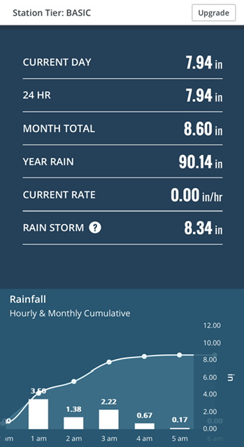
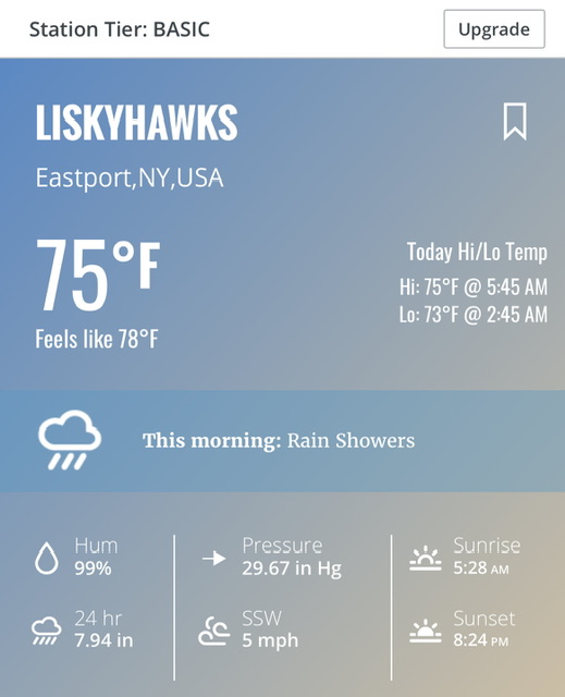
This is data from a Davis station near Eastport. Actual ground truth.
-
I saw that cell on radar earlier this morning just before 4:00 AM. It was very clearly rotating. Let’s see if there are any damage reports.
-
Radar is getting / still busy at some places around the area including LI. My station on Fire Island has recorded 1.07” since midnight.
-
All done here at 2.03”
-
My Storm total is up to 2.00”
-
My total on the day is up to 0.70”
-
As the trough axis moves east there will definitely be a pick up in the activity in NJ, SE NY, and in close to the city.
-
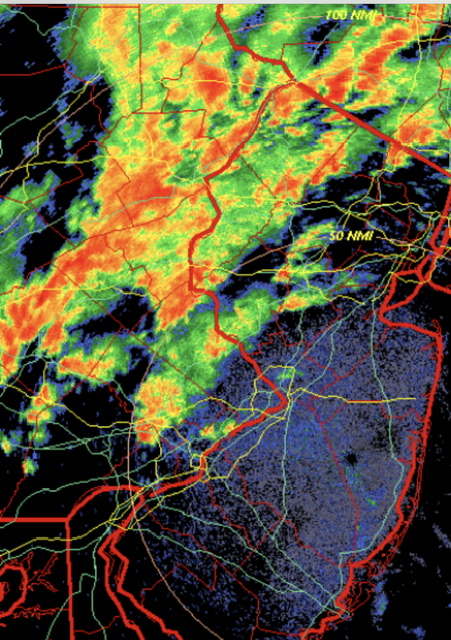
The best echos are located along and in proximity to Blue Mountain. That is the 1500’ ridge that runs from the Delaware Water Gap back to Harrisburg, PA. The county lines run along it so you can trace it on the radar map.
-
Much of what is going in eastern PA and NW NJ is related to orographic lift. The prevailing flow from the south is interacting with the higher elevations in those areas and resulting in the echoes that you are seeing.
-
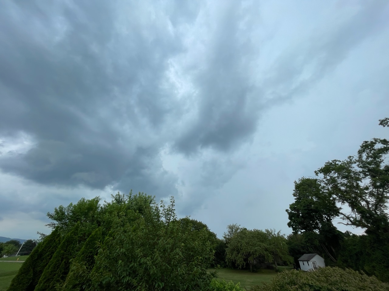
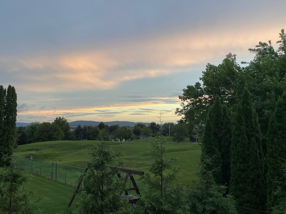
Atmosphere is really starting to pop now across eastern PA and NW NJ. Starting to see some downpours and rumbles of thunder. 78/74
-
Don’t you get any convection where you are?
-
I am under the front of it now. It’s rumbling and bumbling very slowly to the east.

-
The deed is done here. We received 0.40” with a 15 minute downpour.
-
Second Tornado Warning just issued for a storm SE of Reading, PA.
-
Tornado warning issued for the cell moving into the Lehigh Valley in eastern Pennsylvania.
-
It’s back…
-
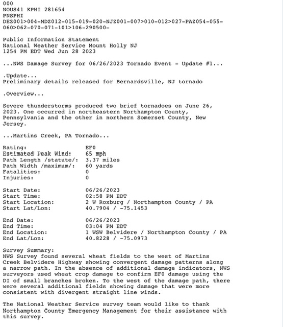
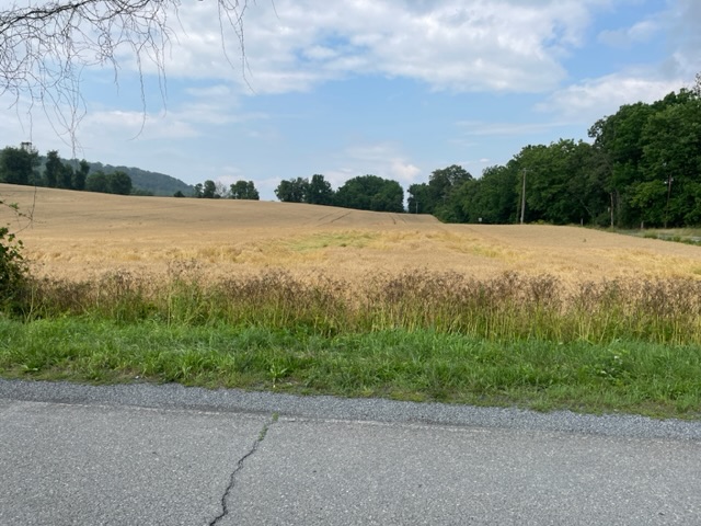
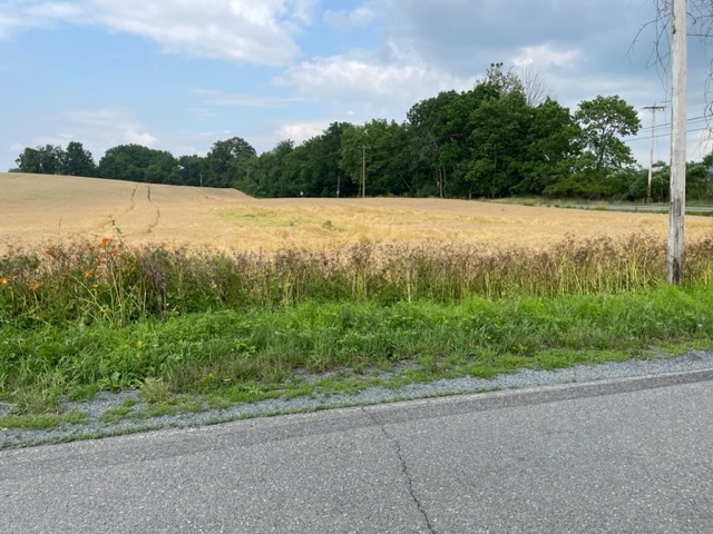
NWS Mt. Holly did damage surveys for Tornadoes that occurred on Monday in Northampton Cty, PA and Somerset Cty, NJ. I am attaching photos below of what I saw in the Northampton Cty. Survey area. The damage survey information is also shown. I saw two wheat fields with damage and took photos of the one with the more significant damage. As noted there was no other crop damage seen besides that in the wheat fields. The second one had a few small spots with the wheat knocked down. There are corn fields, soy fields, and stands of woods in the immediate vicinity. I did not see any evidence of broken branches, twigs, or leaves on those trees. Such is the fickleness of Mother Nature.
-
With another downpour this afternoon my two day event total is up to 3.48”
-
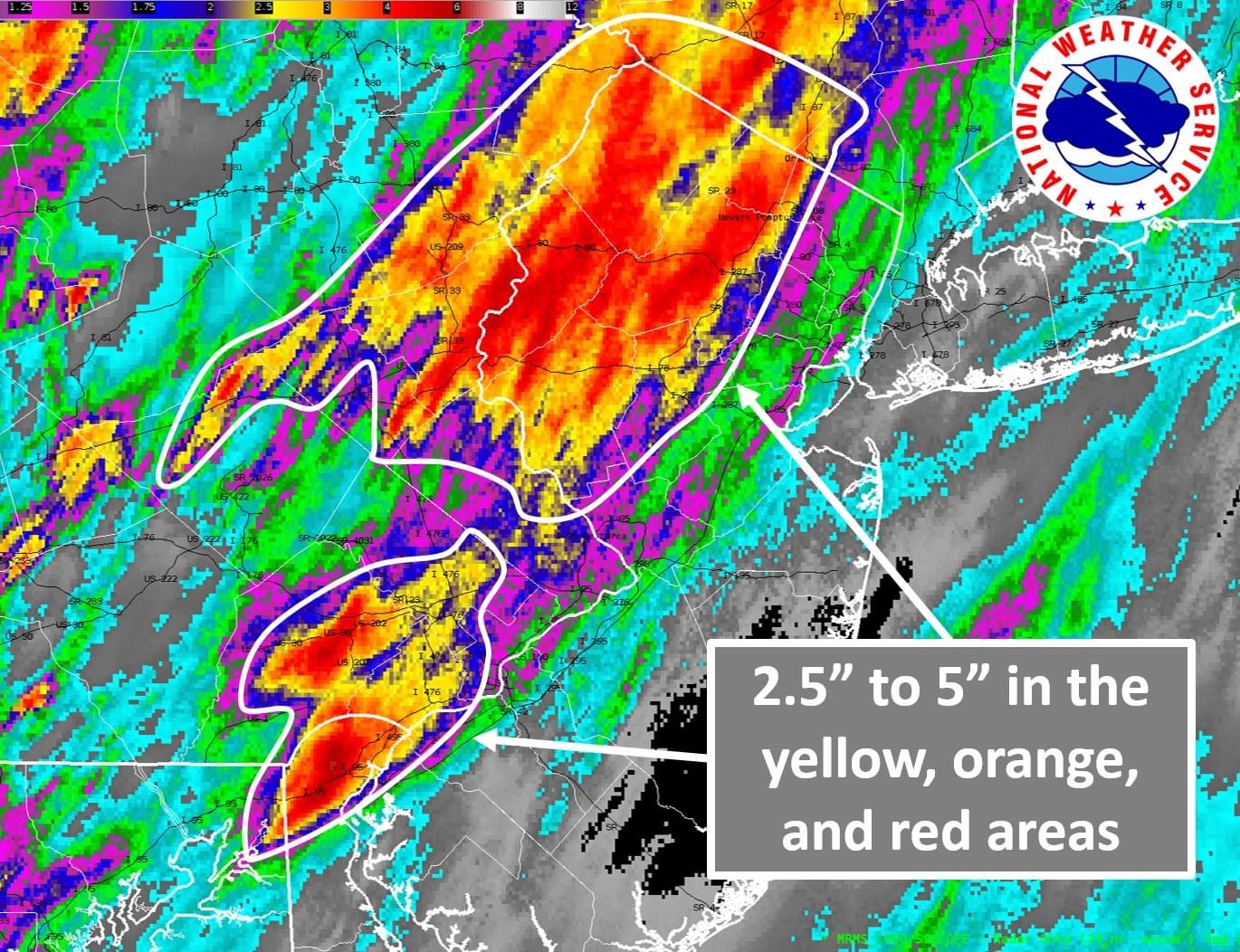
One of the features of this event was the gradients in precip amounts over short distances. The map from Mt. Holly posted above clearly shows that. In my situation a station a mile to my east received an inch more than I did.
-
Mt. Holly radar estimates of rainfall totals in NJ and PA.

-
It sure is.
-
Same here as well. Convection seems to be working up along preexisting boundaries left over from earlier storms. Have received over 2.5” here with large variations across the area in amounts due to the mesoscale processes taking place.
-
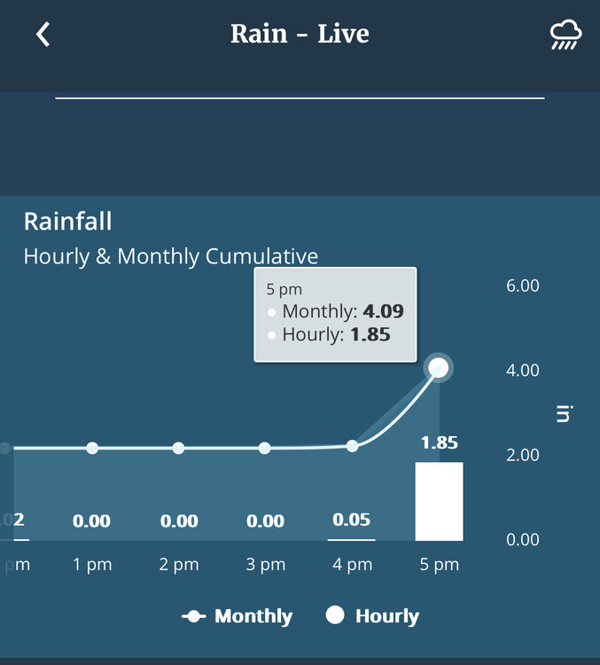
Still under those training echos. Have received almost one half of my monthly rain total in the 4:00 PM hour.
-
Under those training echoes in eastern PA. Up to 1.65”