Jump to content

Tatamy

Members
  • Posts

    2,038
  • Joined

  • Last visited

Everything posted by Tatamy

  1. I have been tracking hurricanes since 1971. In that time period I have never seen a storm cross the full length of the DR and look like this only a few short hours later after emerging into the Atlantic. This is quite spectacular to watch unfold.
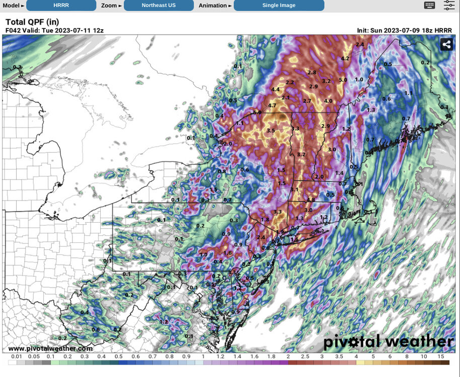
  2. Fiona continues to move NW over the eastern DR.
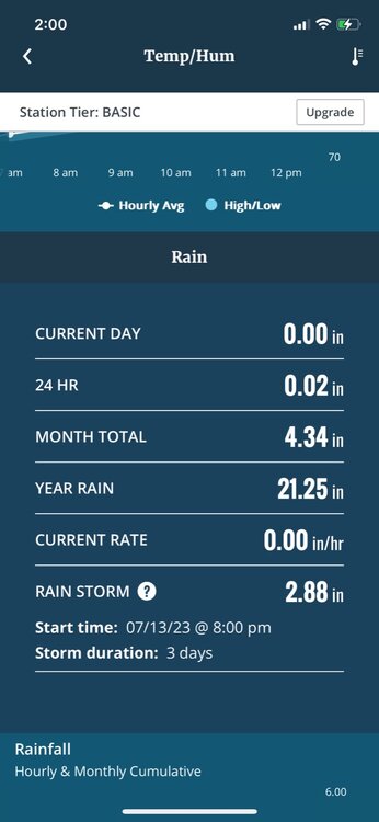
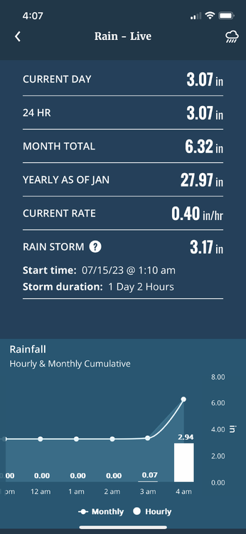
  3. 0z Euro takes Fiona into Nova Scotia at 174 hrs. 937mb central pressure at that time with impacts spreading into Maine.
  4. You are going to need a meridional flow pattern with a big east central deep US trough if you are looking for this to come up the coast. No ensemble support for this currently. As SnoSki 14 said this thing is likely gone once it passes through or even east of the Bahamas (assuming it crosses Hispaniola).
  5. 0z Euro crosses NW across Hispaniola and then slowly moves just north of eastern Cuba and through the eastern Bahamas. It then moves off in the general direction of the Carolinas while intensifying to a 966 mb hurricane. At 240 hours it is centered south of Cape Hatteras and due east of Jacksonville. Slow mover.
  6. FYI - There is a separate thread for Fiona under Tropical Headquarters…
  7. I like the idea of the system really struggling in the short term with a new center developing under or closer to the deeper convection.
  8. List of known / suspected hurricanes / tropical cyclones that affected the New York Region in the 1600's / 1700's / 1800's. List of New York hurricanes From Wikipedia, the free encyclopedia Jump to navigationJump to search Track map of all storms known to have made landfall in the state of New York Eighty-five tropical or subtropical cyclones have affected the state of New York since the 17th century. The state of New York is located along the East Coast of the United States, in the Northeastern portion of the country. The strongest of these storms was the 1938 New England hurricane, which struck Long Island as a Category 3 storm on the Saffir–Simpson hurricane scale. Killing more than 60 people, it was also the deadliest. Tropical cyclones have affected the state primarily in September but have also hit during every month of the hurricane season, June through November. Tropical cyclones rarely make landfall on the state, although it is common for remnants of tropical cyclones to produce heavy rainfall and flooding. Contents 1Before 1800 21800–1899 31900–1949 41950–1974 51975–1999 62000–2009 72010–2019 82020–present 9Listed by month 10Deadly storms 11See also 12References 13External links Before 1800[edit] Between 1278 and 1438: A major hurricane struck the modern-day New York/New Jersey area.[1] August 25, 1635: A hurricane that is reported to have tracked parallel to the East Coast impacts New England and New York, although it remains unknown if any damage occurred.[2] September 8, 1667: A 'severe storm' is reported in Manhattan and is reported to be a continuation of a powerful hurricane which affected the Mid-Atlantic.[2] October 29, 1693: The Great Storm of 1693 causes severe damage on Long Island, and is reported to create the Fire Island Cut as a result of the coast-changing storm surge and waves.[2][3] September 23, 1785: Several large ships crash into Governors Island as a result of powerful waves which are reported to have been generated by a tropical cyclone.[3] August 19, 1788: A hurricane strikes New York City or Long Island and is reported to have left the west side of the Battery "laid in ruins" after severe flooding occurs.[3] 1800–1899[edit] Estimated track of the 1821 Norfolk and Long Island hurricane October 9, 1804: Heavy snow falls in Eastern New York peaking at 30 inches (75 cm) as a hurricane tracks northward along the East Coast and becomes extratropical, as cold air fed into the system.[4] September 5, 1815: A hurricane tracks over North Carolina and parallels the East Coast before producing a heavy rainstorm in New York.[5] September 24, 1815: Several hundred trees fall and the majority of the fruit was stripped off apple trees just prior to harvesting time after a hurricane makes landfall on Long Island.[6] September 16, 1816: A possible hurricane strikes New York City, but damage remains unknown.[2] August 9, 1817: A tropical storm produces heavy rainfall in New York City and Long Island.[2] September 3, 1821: The 1821 Norfolk and Long Island hurricane results in severe damage on Long Island and is accompanied by storm surge of 13 feet (4 m). High wind causes a ship to crash on Long Island killing 17 people.[7] June 4, 1825: A hurricane moves off the East Coast and tracks south of New York causing several ship wrecks, and killing seven people.[3] August 27, 1827: High tides are reported in New York City which are caused by a hurricane offshore.[8] August 1, 1830: A hurricane passes to the east of New York and produces gale-force winds to New York City and Long Island.[9] October 4, 1841: Gale–force winds affect New York City as a hurricane tracks north along the East Coast of the United States. Damage is estimated at $2 million (1841 USD, $41 million 2007 USD).[10] October 13, 1846: The Great Havana Hurricane of 1846 tracks inland, causing some damage to New York City.[3] October 6, 1849: Severe structural damage occurs in New York City and Long Island with the passage of a hurricane to the east.[3] July 19, 1850: A hurricane destroys a Coney Island bath house and causes heavy rain, although damage is unknown.[3] This storm destroyed the ship Elizabeth off Fire Island and drowned American transcendentalist Margaret Fuller. August 24, 1850: A storm that is reported to be a hurricane affects New York and New England although there is no known damage.[2] September 9, 1854: A hurricane brushes the East Coast from Florida to New England causing rain on Long Island.[3] September 16, 1858: Low barometric pressure of 28.87 inches mercury at Sag Harbor is reported, and is thought to be associated with a tropical cyclone which causes no known damage.[3] September 6, 1869: A category 3 hurricane makes landfall in Rhode Island and brushes Long Island, which is affected by rain, although minimal damage resulted from the storm.[3] October 28, 1872: A tropical storm passes over New York City and Long Island.[11] October 1, 1874: New York City and the Hudson Valley receives rainfall after a minimal tropical storm tracked over Eastern New York.[11] September 19, 1876: The remnants of the San Felipe hurricane track over western New York State, although damage is unknown.[11] October 24, 1878: The state is affected by tropical storm-force winds and heavy rain with the passage of a hurricane, which made landfall in Virginia.[11][12] August 22, 1888: A tropical storm tracks over New York City before tracking north along the East Coast of the United States.[11] August 24, 1893: Hog Island is washed away by strong storm surge associated with a tropical storm of unknown strength.[3] According to HURDAT, this was a Category 1 hurricane that struck the western end of the Rockaway Peninsula, passing through Brooklyn as a weakening hurricane. Manhattan Island saw gale-force winds to 56 mph. August 29, 1893: | Sea Islands hurricane moves thorough the Hudson Valley as a tropical storm.[13] Lives were lost in the Rockaways and when tow boats were destroyed at various points along the Hudson River. Roofs, structures, boats and crops were destroyed or damaged from Brooklyn to as far west as Dunkirk. Winds of 54 and 57 MPH recorded in New York and Albany respectively.[14][15] October 10, 1894: 10 People were killed and 15 injured at 74 Monroe Street in Manhattan when winds blew a building under construction onto a tenement crushing it. Extensive damage in the NYC and Long Island to telegraph lines, trees and boats docked on shore. Storm formed over Gulf of Mexico as a Category 3 weakened over land in the Southeast and re strengthened to a Category 1 over the Chesapeake Bay before striking Long Island.[16][17]
  9. This system will be a dying tropical storm as it moves through the area as shown on this run with the heaviest rains to the south and west.
  10. 1.16” at my station at Cherry Grove on Fire Island. Two other nearby stations had even higher amounts (WU).
  11. Total here yesterday was 1.02”. Waiting for the skies to open up currently.
  12. It’s been a rainy one out here since before sunrise. Have received 0.72” so far today.
  13. I recorded 0.22” at my station at Cherry Grove on Fire Island with this event.
  14. It’s been pouring out here. I received a total of 0.60” on Saturday and Sunday. Have now received 1.02” since midnight and it’s still coming down.
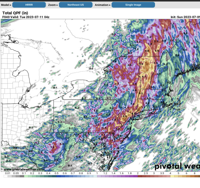
  15. 4-8” for northern NJ on the 18z NAM.
  16. After having moved north of me this morning the front has just dropped back south again. I am getting into some light rain while I await the arrival of some convection now over southern PA.
  17. Radar is starting to get active in my area now. This activity will form up and move towards NW NJ.
  18. The pictures posted below are one example of how an outflow boundary or frontal zone produces convection. This took place by me yesterday evening over a 30 minute period. I picked up 0.25” from this feature.
  19. If you look at this run and the position of the stationary front it appears that the Euro is focusing on both the position of the front itself along with terrain influences in this region.
  20. The position of this stationary front as we go through the day is going to be a major player in terms of where the convective activity sets up.
  21. The activity over eastern PA relates to an outflow boundary in the area. I have received 0.15” from it so far. Right now the area to be for heavy rain in looks to be in the southern area of SI and adjacent central NJ.
×
×
  • Create New...