Tatamy
-
Posts
2,329 -
Joined
-
Last visited
Content Type
Profiles
Blogs
Forums
American Weather
Media Demo
Store
Gallery
Everything posted by Tatamy
-
No rain or storms here but the smell of the smoke is very noticeable.
-
This is what that hail core over Oyster Bay looked like at the time of your post.
-
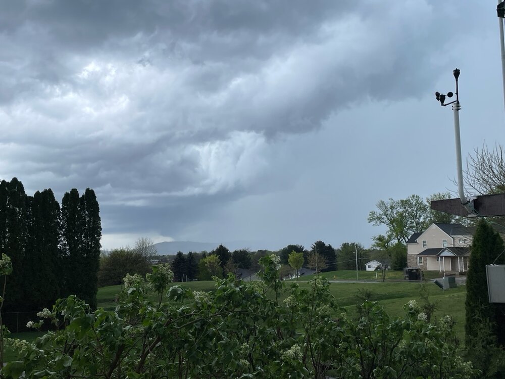
Received zip out here in eastern PA. Looks like the cutoff was about west central NJ. Some of the Mesos overdid the western extent of the event yesterday for my area before correcting east overnight.
-
0.65” so far at my station on Fire Island.
-
Steady rain this evening here - .40” so far.
-
50 with light rain here.
-
Seems unusual to have a sea breeze this far inland however that is exactly what has occurred here today. I reached a high of 78 at 4 PM and have now dropped back to 58.
-
My total from yesterday was 1.45”
-
Between cells currently. 1.20” on the day so far.
-
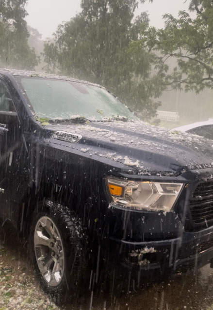
Just to keep things interesting we just received some pea size hail along with close in CTG lightning.

-
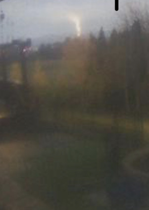
This is the cell just to my SW. There is radar indicated hail with this.
-
Now under a FFW for the training cells in my area. Apparently there are radar estimates of 2 - 2.5” having already fallen with another 1 - 2” possible. The axis of this is just a couple of miles to my west.
-
Atmosphere has popped directly over me and it’s pouring. Models since yesterday have been insistent on at least a half inch of rain here with some calling for over an inch. I am already at a half inch with this downpour. Mt. Holly has issued a SSW for my area. Just some rumbles currently.
-
86 here. Hottest day so far this year.
-
Severe Thunderstorm Warning for the cell arriving now.
-
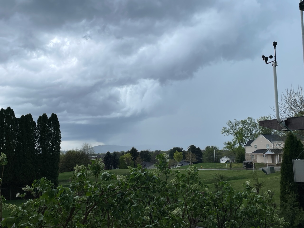
We are starting off the day out here with a loud booming thunderstorm. This definitely looks to be an interesting severe day. These cells are rolling east quickly into NJ too.
-
Heavy snow showers/ squalls currently moving across northern and northeastern PA and into the western Catskills.
-
I am currently seeing snow falling along I80 (heavy in places) for many miles to the north and west of State College. If you are up there in elevation across NE PA, NW NJ, and in places especially from Orange Cty north and west I think you have a real shot to wake up to some snow on the ground (HRRR is on board). This Arctic front certainly does mean business.
-
Rates have picked up out here too. Visibility at 1 mile with a temp of 32.0
-
How much snow did you get at your place in the Poconos?
-
And you were worried about getting snow yesterday up there! Models hit your area fairly well and they seem to be verifying.
-
Light flurries here. 33.5
-
Wet snow is also falling in the higher elevations of the Poconos above about 1100’.
-
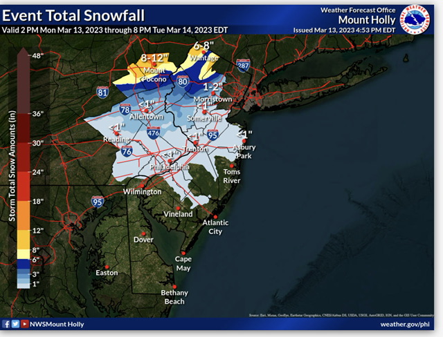
Mt. Holly cancels the WSW for Warren and Morris Counties and issues a WWA for these counties. A new snow map has been issued.
-
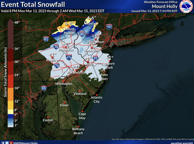
Latest Mt. Holly snowmap