nj2va
-
Posts
15,204 -
Joined
-
Last visited
Content Type
Profiles
Blogs
Forums
American Weather
Media Demo
Store
Gallery
Everything posted by nj2va
-

Jan 24-26 Weekend Snow and Sleetfest Model Thread Part Tres
nj2va replied to H2O's topic in Mid Atlantic
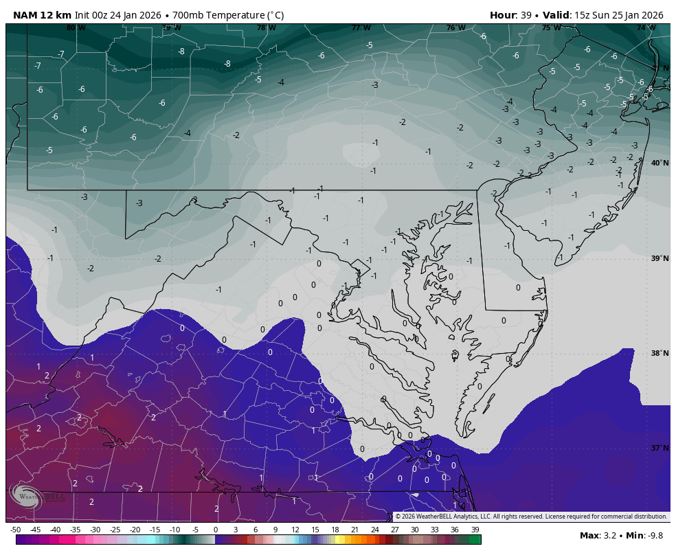
15z on the 12k NAM at 700
-
January 24-26: Miracle or Mirage JV/Banter Thread!
nj2va replied to SnowenOutThere's topic in Mid Atlantic
Alexandria, I think it’ll be fun with the snow/sleet and freezing rain (to end). If McHenry was getting 2-3’, I would have chased. -
Jan 24-26 Weekend Snow and Sleetfest Model Thread Part Tres
nj2va replied to H2O's topic in Mid Atlantic
48H HRRR is better off being in the banter. -
January 24-26: Miracle or Mirage JV/Banter Thread!
nj2va replied to SnowenOutThere's topic in Mid Atlantic
I don’t know, I’m totally out on this storm until I know if Jenkins is back in. -
Jan 24-26 Weekend Snow and Sleetfest Model Thread Part Tres
nj2va replied to H2O's topic in Mid Atlantic
Temp dropping like a rock, down to 34/10. 5/0 at Deep Creek. -
January 24-26: Miracle or Mirage JV/Banter Thread!
nj2va replied to SnowenOutThere's topic in Mid Atlantic
Sorry, I forgot to respond last night…I don’t think it’s the greatest upslope setup with the departing storm track but certainly will have snow showers on Monday. -
January 24-26: Miracle or Mirage JV/Banter Thread!
nj2va replied to SnowenOutThere's topic in Mid Atlantic
Martini for happy hour - we got a snowstorm coming y’all! -
Jan 24-26 Weekend Snow and Sleetfest Model Thread Part Tres
nj2va replied to H2O's topic in Mid Atlantic
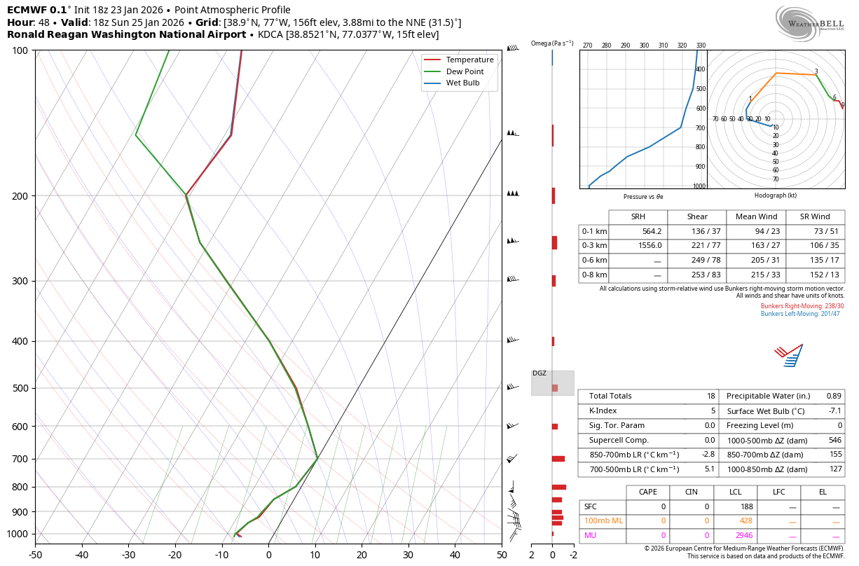
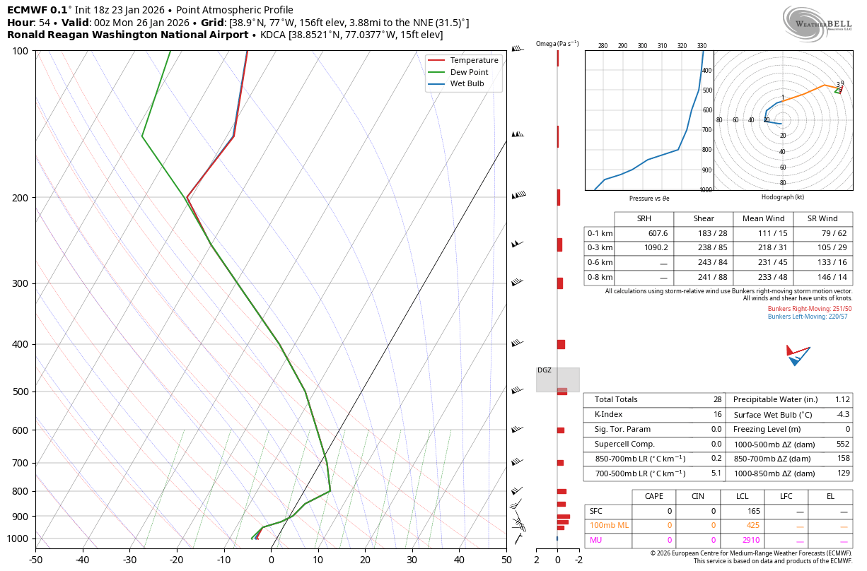
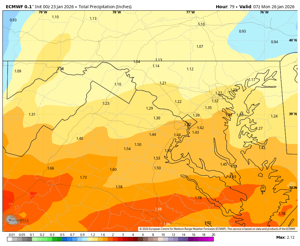
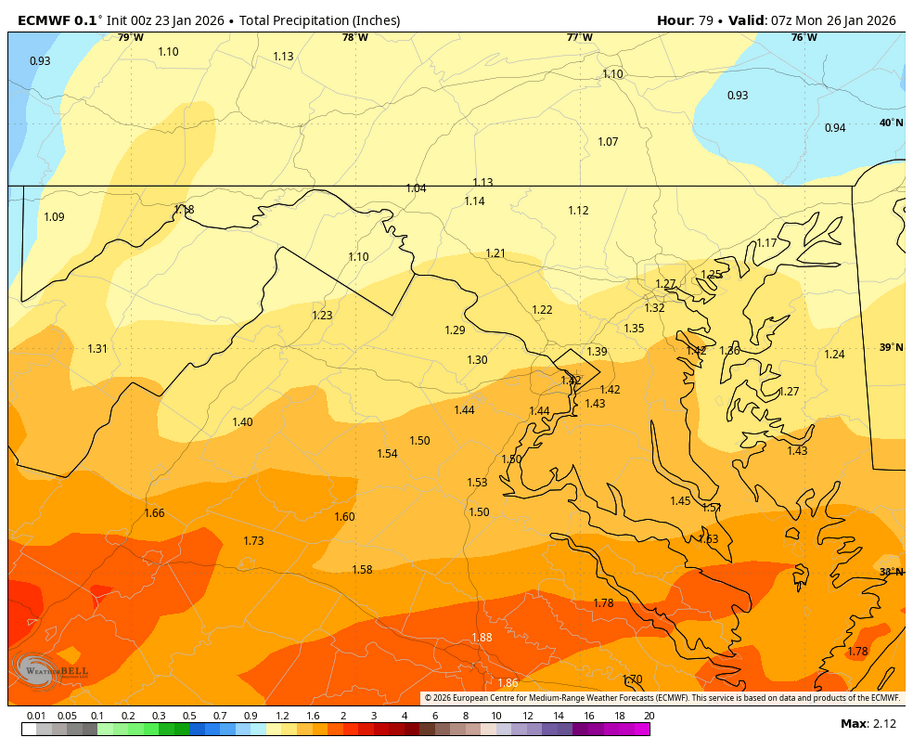
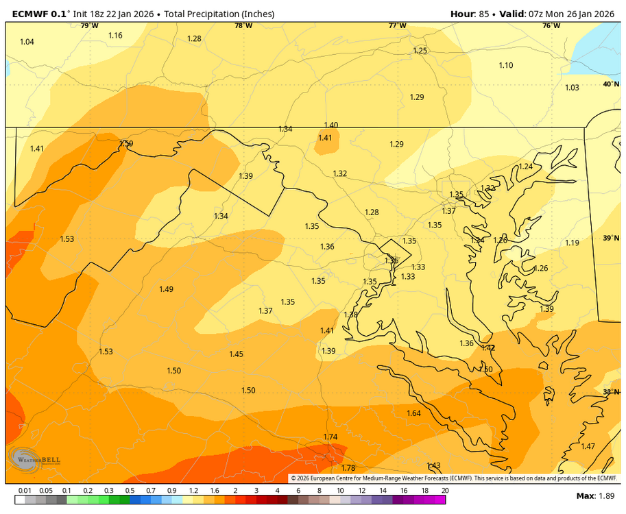
That was a fantastic run for us. We hold until 18z with about 0.9” QPF by then. Here’s 18z at DCA. To me, this does look like freezing rain at 00z Monday but someone much smarter could correct me.
-
Jan 24-26 Weekend Snow and Sleetfest Model Thread Part Tres
nj2va replied to H2O's topic in Mid Atlantic
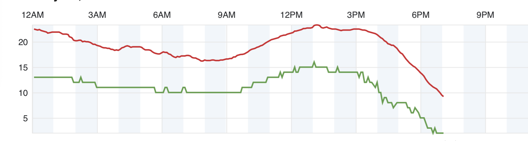
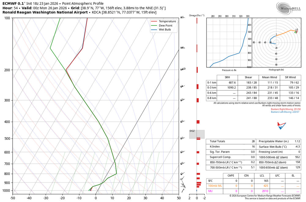
For sure, here’s our Deep Creek temp. Down to 8 degrees.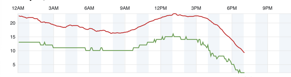
-
We leave for vacation on the 31st…tragic
-
NWS Pittsburgh just upgraded their watches to warnings. I’d expect LWX to be next.
-
00z 18z
-
January 24-26: Miracle or Mirage JV/Banter Thread!
nj2va replied to SnowenOutThere's topic in Mid Atlantic
The Potomac River is probably salt water at this point -
January 24-26: Miracle or Mirage JV/Banter Thread!
nj2va replied to SnowenOutThere's topic in Mid Atlantic
Back to other things - who else is watching the Australian Open? -
Dude, the answer is extend the trip if that happens verbatim.
-
Deep Creek is getting buried this run.
-
Might be too much of a good thing and amp too much.
-
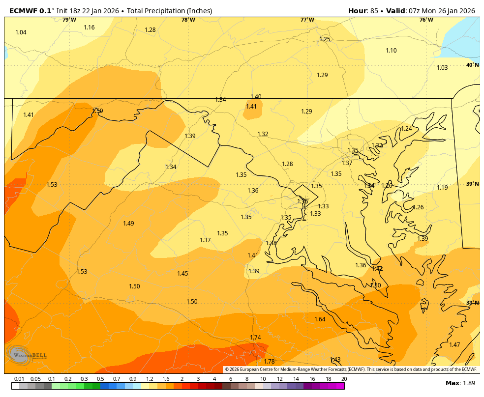
Looks like DC stays all snow until about 15z Sunday on CMC based off the 700 map. By then 1” of QPF has fallen so its quite the thump.
-
January 24-26: Miracle or Mirage JV/Banter Thread!
nj2va replied to SnowenOutThere's topic in Mid Atlantic
Welcome back, glad you’re back to being in on this storm! -
January 24-26: Miracle or Mirage JV/Banter Thread!
nj2va replied to SnowenOutThere's topic in Mid Atlantic
At least the Australian Open 3rd round is on live…Alcaraz cruising. -
January 24-26: Miracle or Mirage JV/Banter Thread!
nj2va replied to SnowenOutThere's topic in Mid Atlantic
I am looking forward to your obs Sunday morning that its a “BEATDOWN right now” out by you! -
21z Sunday the 700 freezing line is bisecting DC and heads just north of DC at 00z Monday. DC already has 0.9” QPF at 21z. eta: it crashes east of 95 by 6z Monday and ends as snow (I think)
-
Steady as she goes.
-
January 24-26: Miracle or Mirage JV/Banter Thread!
nj2va replied to SnowenOutThere's topic in Mid Atlantic
Dude, you might want to just stop looking at models tonight lol. We’re going to see snow - but we’re all (or most of us) mixing. Hopefully we can keep it at bay for as long as possible. -
RGEM lost all credibility for me when it showed like 65” in MD a few years ago about 6 hours out from storm start.