nj2va
-
Posts
15,206 -
Joined
-
Last visited
Content Type
Profiles
Blogs
Forums
American Weather
Media Demo
Store
Gallery
Everything posted by nj2va
-
X
-
Sorry, thought WxBell had updated with that.
-
UK is a huge hit.
-
GEFS cave
-
130+ reading the thread, love it
-
Congrats to IU! What a turnaround of a program and Mendoza had a hell of a season.
-
GFS zoomed in

-
It’s a complete cave by the GFS
-
GFS another step in the caving direction, regardless of the end solution.
-
Classic lol
-
He’s so good. Love to watch him play
-
You were basically like “compuserve awww thats cute”
-
Wow, you had internet at age 6? Impressive
-
Down to 6/0 out at the Deep Creek house. 33/13 here at home.
-
Dude, compuserve was our first internet we had. I felt so poor not having AOL like all my friends.
-
I was thinking the same thing, but I know CAPE would ban me if I did.
-
Impressive drive by Indiana there
-
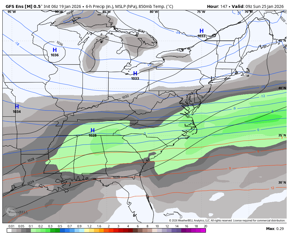
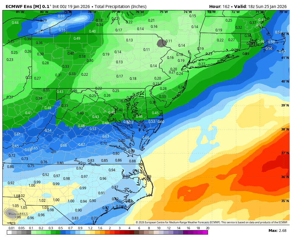
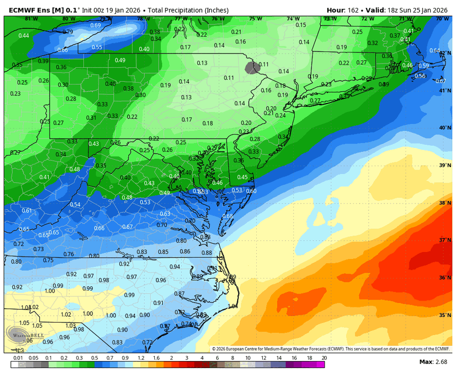
Last 3 runs of the regular EPS (only to 144 on 18z so I stopped it there). While the EPS is favoring S VA/NC for the heaviest QPF, its been bumping totals to the north.
-
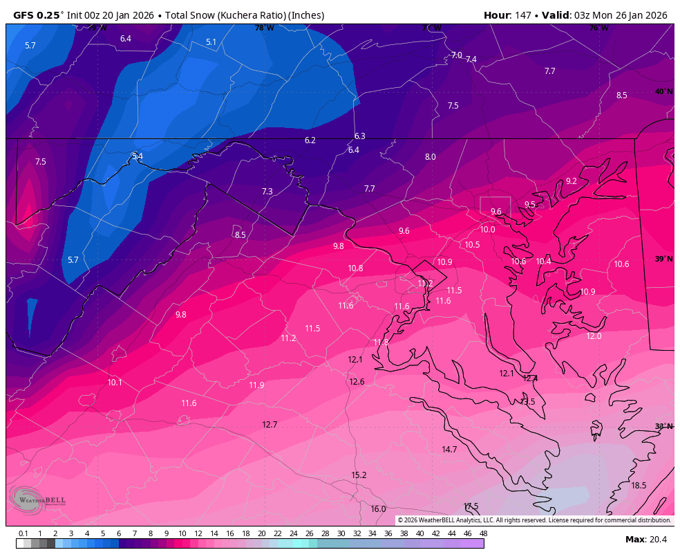
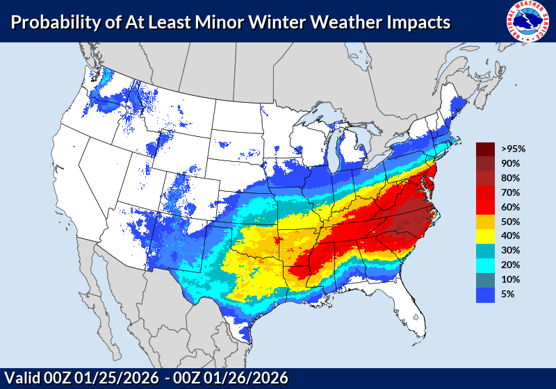
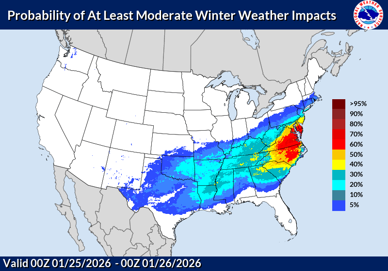
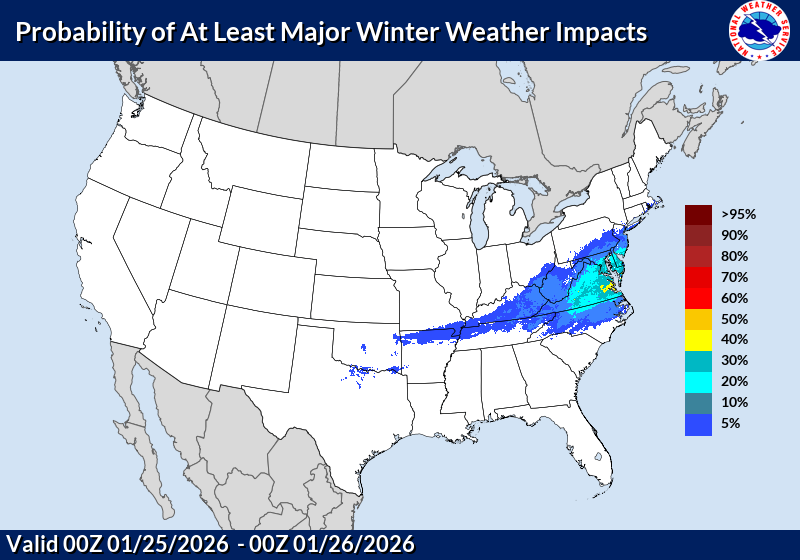
WPC thoughts on Minor, Moderate, and Major impacts…bullish.
-
Where are these posted on LWX’s site? I no longer see it under the Winter Weather section.
-
I got stuck in the subsidence/dry slot for like 5-6 hours between the WAA and CCB but still got about 22” in 2016. That was a fun storm.
-
A nice 3-6”/4-8” cold powder would be fine with me. Always best in a Nina to keep expectations in check. Oh and go Indiana!
-
Probably a lot more with what’s still lined up behind it.
-
Check out that CCB, classic blizzard look.