nj2va
-
Posts
15,345 -
Joined
-
Last visited
Content Type
Profiles
Blogs
Forums
American Weather
Media Demo
Store
Gallery
Everything posted by nj2va
-
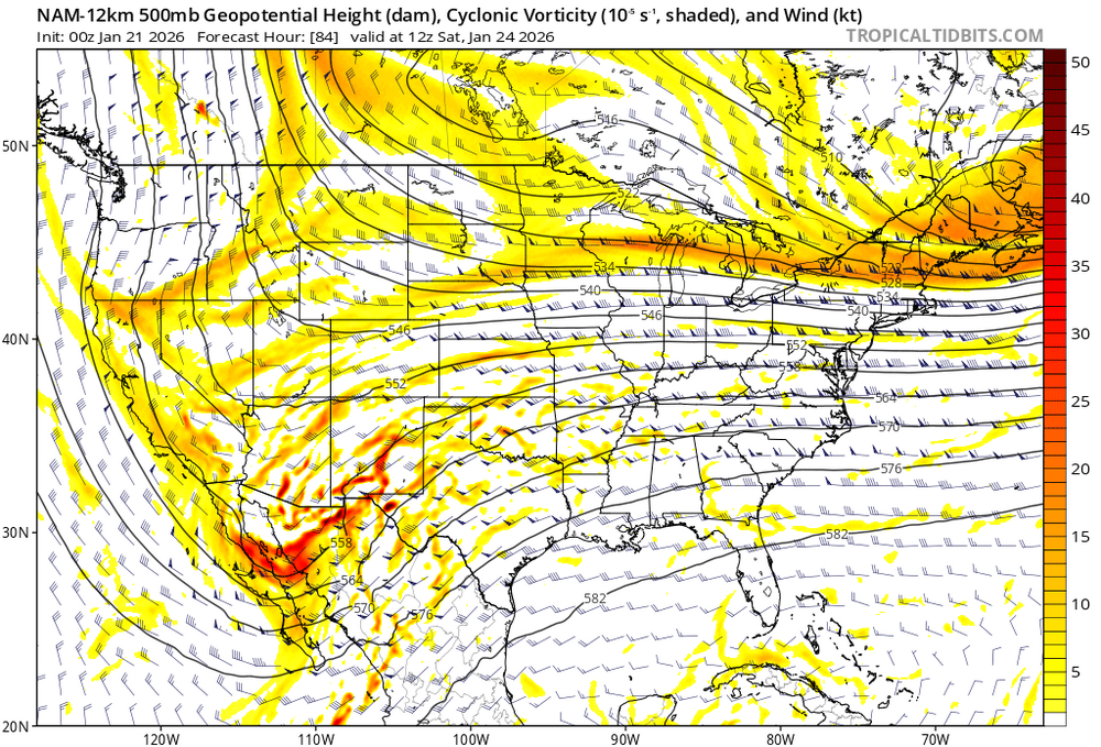
It’s a terrible model but whatever, NAM at 84H is eye candy. Don’t ban me @CAPE
-
We’re thinking Succotash in DC on Thursday…I’ve got an appointment at 430 so I’ll be there around 6 but @NorthArlington101 can get there earlier if you guys (and anyone else) are down.
-
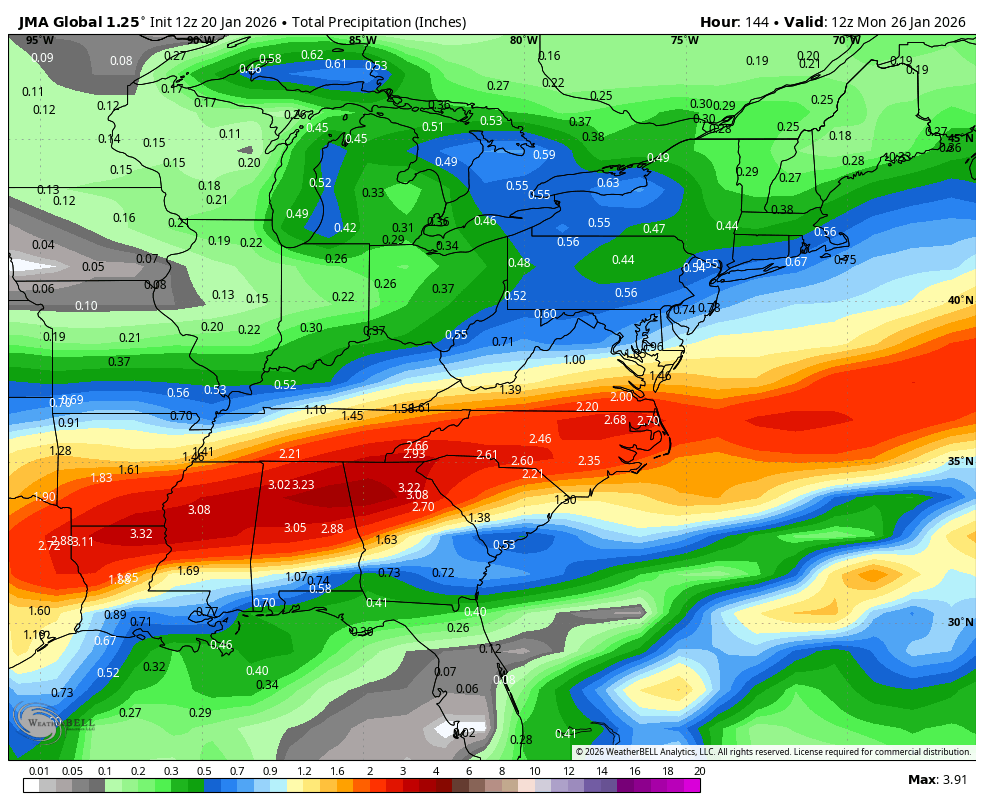
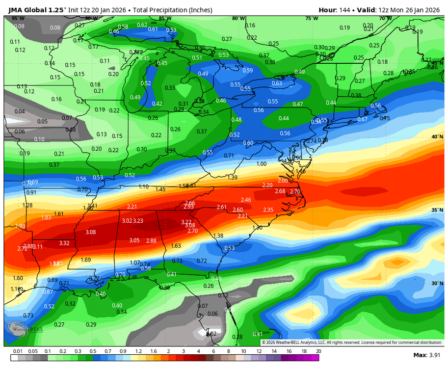
I can’t put JMA in the storm thread so putting it in banter. Cold smoke…for the amped worriers, NOT amped.
-
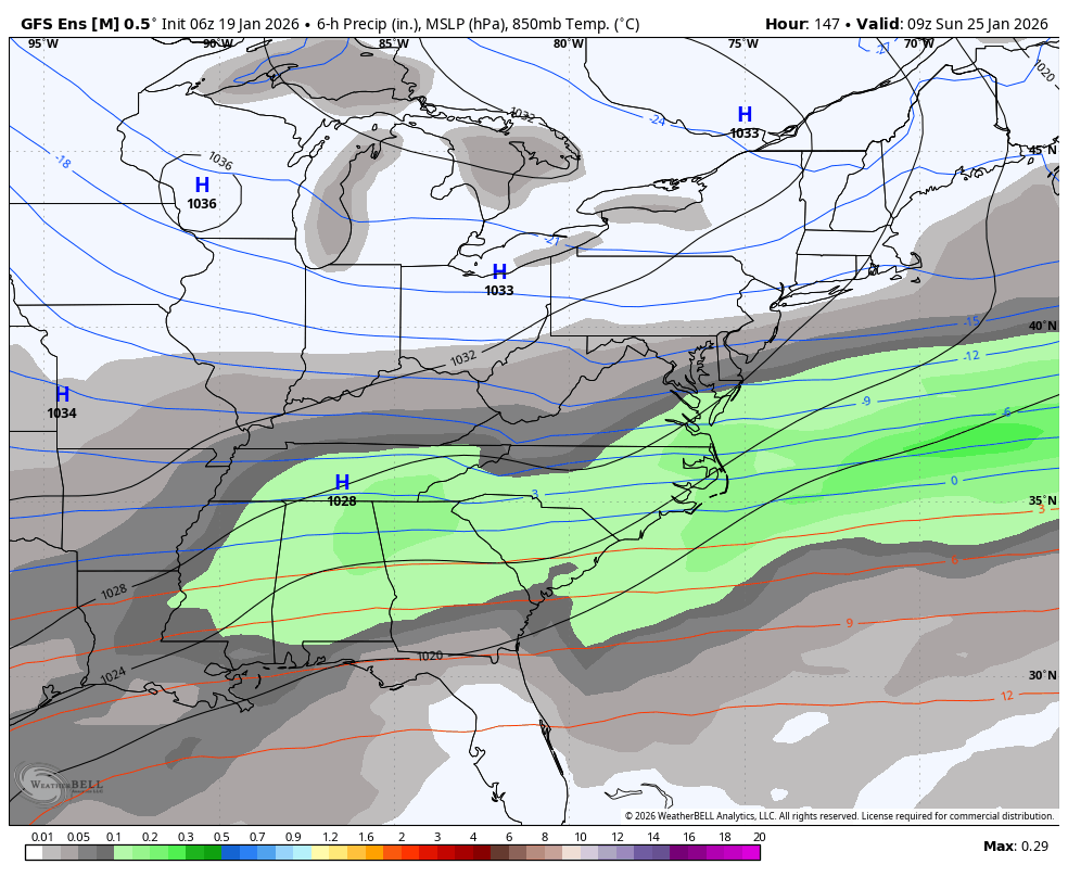
We are going down a rabbit hole about mixing. It’s a IMBY sport and the folks rooting for a super amped solution are in Southern PA so take those posts with a grain of salt. We are staring down our largest region wide event in a long time.
-
Looks like we’ve reached the storm phase where we’re both worried about suppression AND amped.
-
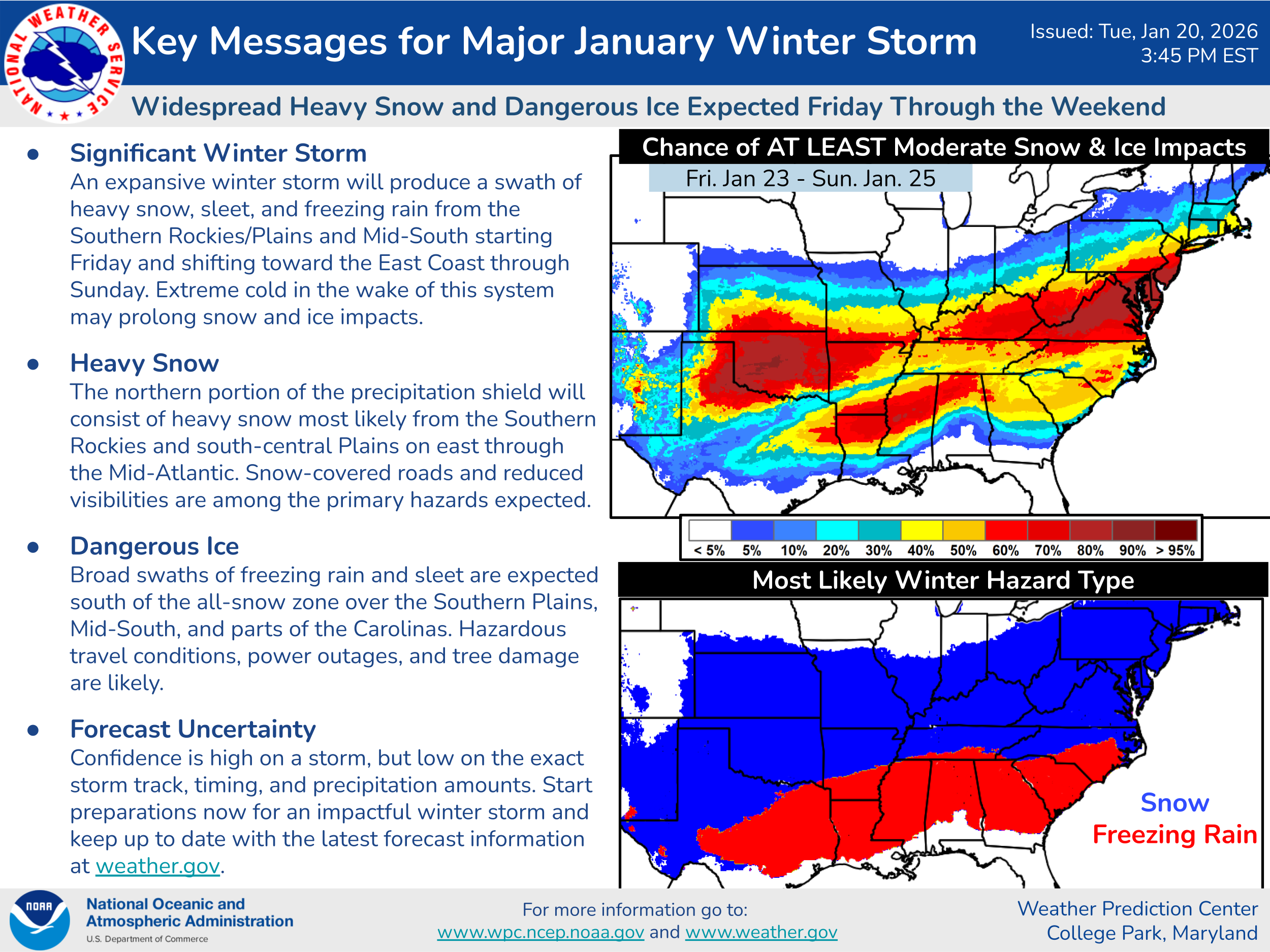
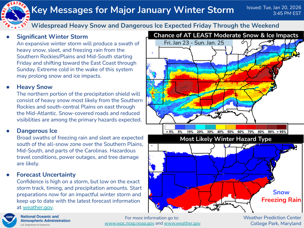
Latest WPC from this afternoon 80% contour through DC for at least a moderate storm. On the WPC site, DC is in the 60% contours for a major event.
-
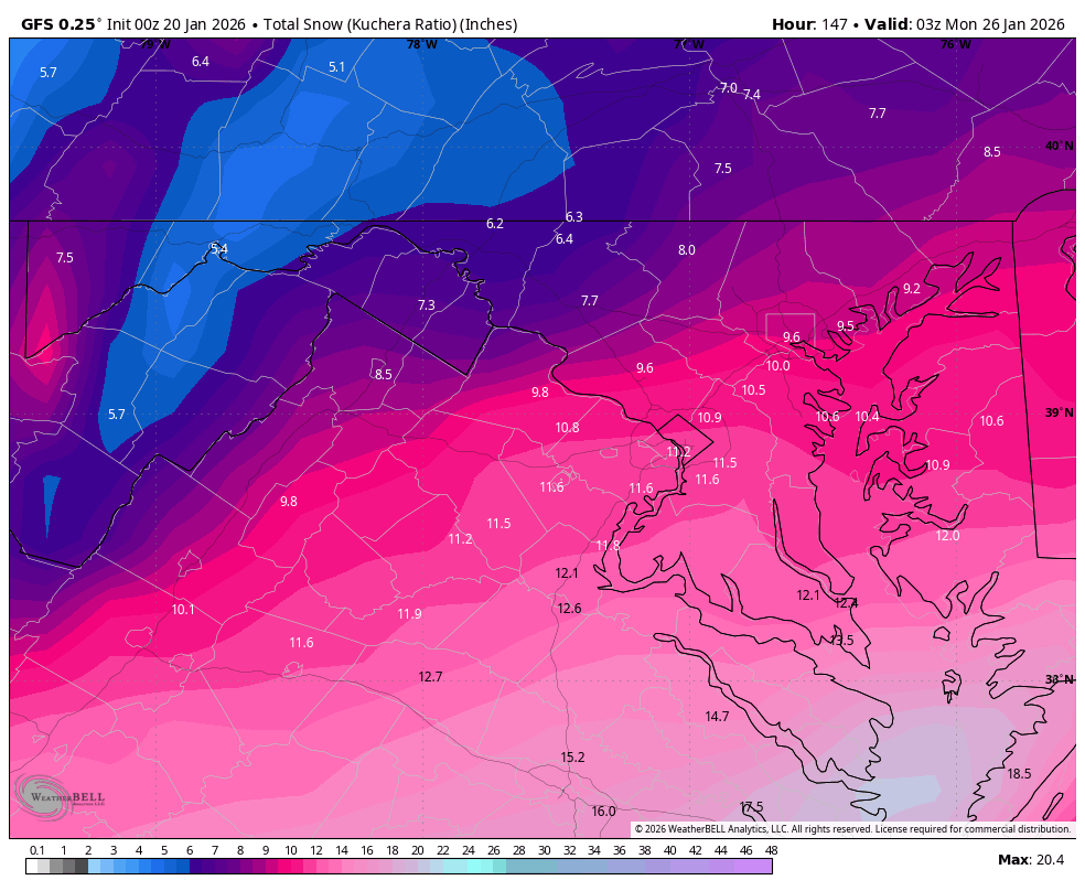
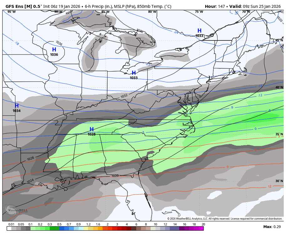
First time for the storm seeing a foot show up on the mean. Northern extent went north too which is nice to see a large swath of 6”+ - not sweating a 50 mile swath of a narrow band.
-
Yep, I’m in. I work in Arlington but easy to metro into the city if want something there or stay along orange line in Arlington if easier.
-
Got down to -2! Kinda surprised it got that low.
-
This storm may delay your next move next week
-
Thanks to @NorthArlington101 for the link https://www.weather.gov/lwx/wintermaps Days 3-7 Threat
-
Not everyday we see a high in the low 20s with snow likely. Sunday Snow likely. Mostly cloudy, with a high near 22. Chance of precipitation is 60%.
-
My productivity at work is about to be negative 100 this week
-
X
-
Sorry, thought WxBell had updated with that.
-
UK is a huge hit.
-
GEFS cave
-
130+ reading the thread, love it
-
Congrats to IU! What a turnaround of a program and Mendoza had a hell of a season.
-
GFS zoomed in

-
It’s a complete cave by the GFS
-
GFS another step in the caving direction, regardless of the end solution.
-
Classic lol
-
He’s so good. Love to watch him play
-
You were basically like “compuserve awww thats cute”