nj2va
-
Posts
15,345 -
Joined
-
Last visited
Content Type
Profiles
Blogs
Forums
American Weather
Media Demo
Store
Gallery
Everything posted by nj2va
-
Wow, you had internet at age 6? Impressive
-
Down to 6/0 out at the Deep Creek house. 33/13 here at home.
-
Dude, compuserve was our first internet we had. I felt so poor not having AOL like all my friends.
-
I was thinking the same thing, but I know CAPE would ban me if I did.
-
Impressive drive by Indiana there
-
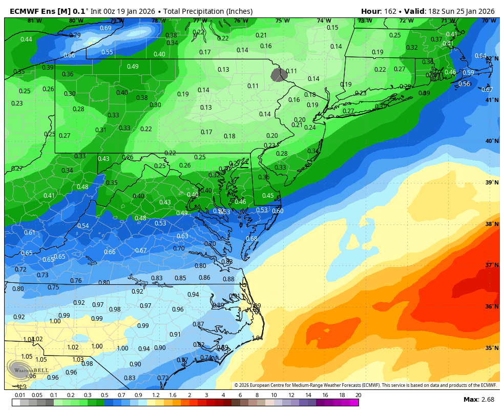
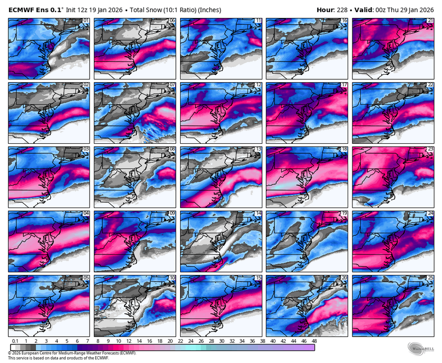
Last 3 runs of the regular EPS (only to 144 on 18z so I stopped it there). While the EPS is favoring S VA/NC for the heaviest QPF, its been bumping totals to the north.
-
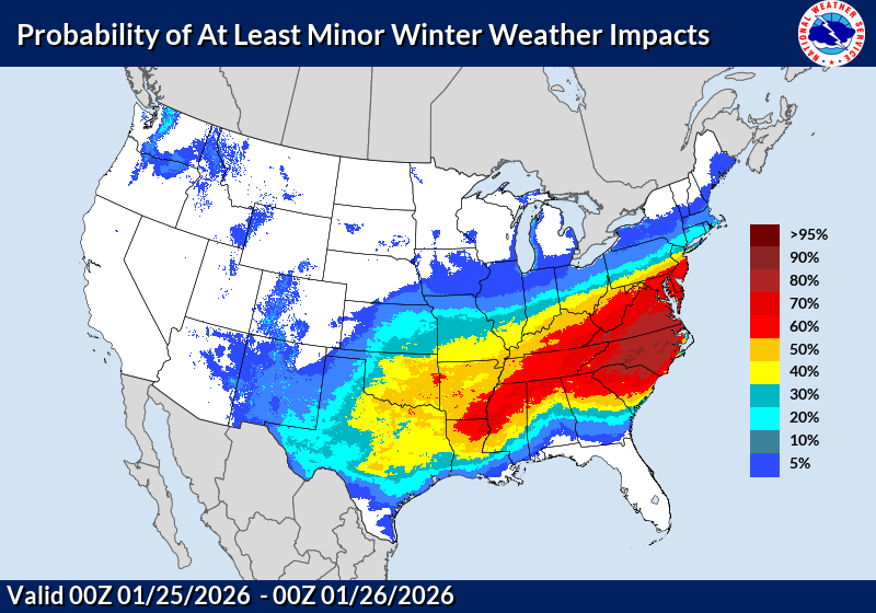
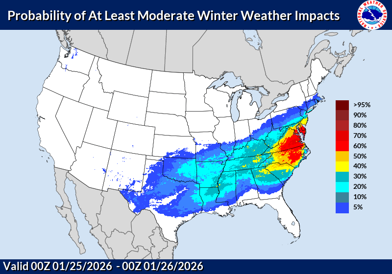
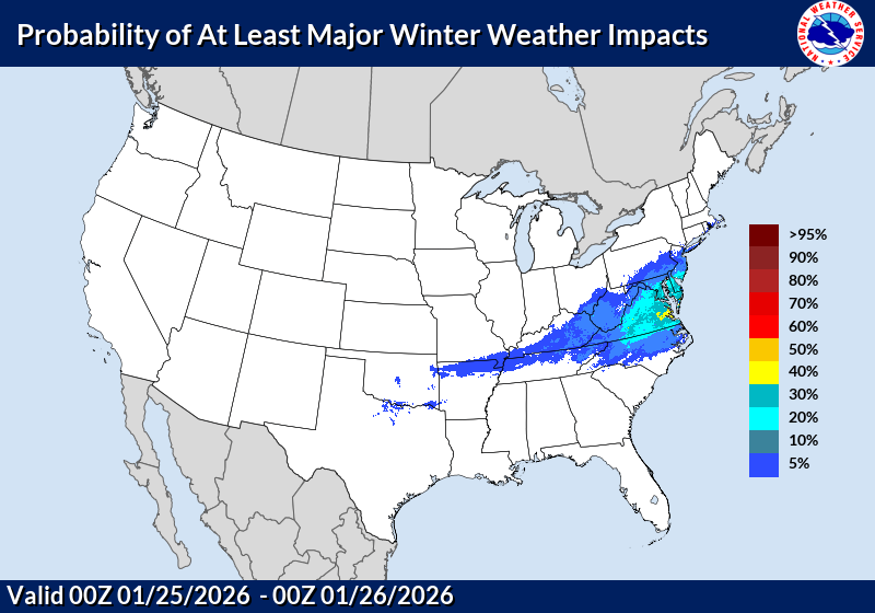
WPC thoughts on Minor, Moderate, and Major impacts…bullish.
-
Where are these posted on LWX’s site? I no longer see it under the Winter Weather section.
-
I got stuck in the subsidence/dry slot for like 5-6 hours between the WAA and CCB but still got about 22” in 2016. That was a fun storm.
-
A nice 3-6”/4-8” cold powder would be fine with me. Always best in a Nina to keep expectations in check. Oh and go Indiana!
-
Probably a lot more with what’s still lined up behind it.
-
Check out that CCB, classic blizzard look.
-
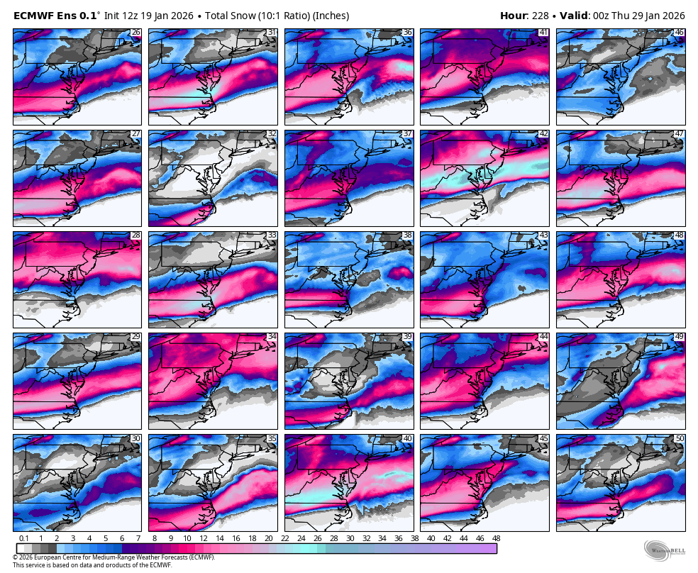
WxBell skipped between 168 and 228 so this isn’t all from this first threat. There’s enough spread here to give caution to these ginormous hits on the OP. I’ll take # 42 please.

-
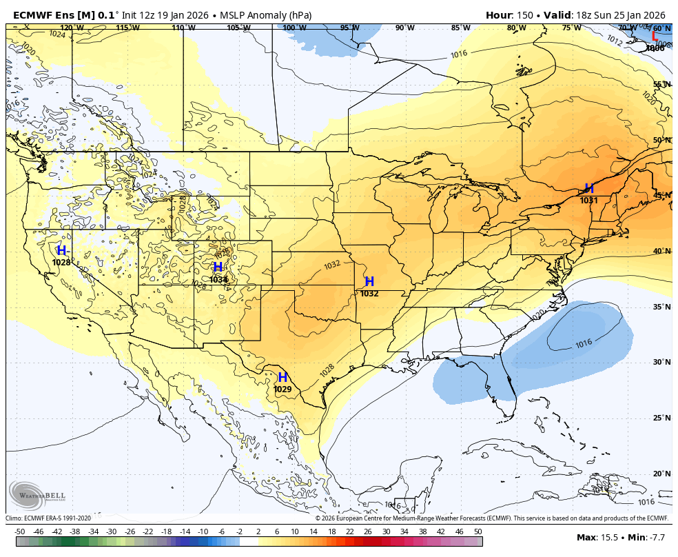
Banana High

-
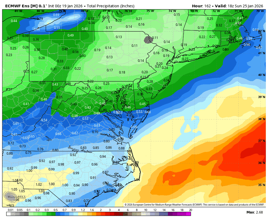
EPS mean snowfall totals bumped higher vs 00z…6” line through DC at H168. Definitely favors Cent/S VA with 8”+ down there.
-
12z Euro 850s are in the -10 to -15 range while 2m temps are in the upper teens during the storm. Has 0/-1 2m temps for the low Monday morning. LFG.
-
Yeah its locked for me too.
-
Kind of reminds me of 12/19/09 in terms of the cold powder / no mixing concerns east of the fall line.
-
Looks like snow starts late Saturday night ~11p/12a Sunday. Kuchera is like 16” in DC lol.
-
Euro is cold powder, love to see it.
-
Time to start the thread?
-
Just absolutely absurd. They gotta fix this. Bills fans must be so pissed
-
Your self awareness is on point