

Mr. Windcredible!
-
Posts
2,991 -
Joined
-
Last visited
Content Type
Profiles
Blogs
Forums
American Weather
Media Demo
Store
Gallery
Everything posted by Mr. Windcredible!
-
Not downplaying the potential flood threat here in CT…but after all the hype I’m the past 48 hours…gotta admit this weather alert from NBC is pretty funny
-
Odds on Eversource shutting off the grids just they can take credit for restoration times faster than 3 weeks?
-
It was meh-central around here a couple hours ago. I saw one other guy at the hardware store grabbing a gas can and maybe a an extra car or two topping off at the gas station. Seemed like your average day at Stop & Shop. I think some people are still sleeping on this one.
-
you're forgetting we're in DST too...so the sun sets an hour later
-
We're in the same boat. I keep waffling back and forth between which option I'd prefer. I think I lean towards the rain...as I'm not in a low lying area and the biggest risk there is some water in the generally unfinished basement. I really hate the though of a tree falling on the house or stressing out about keeping the generator fueled and food from spoiling...not to mention the uncomfortable nights without AC. Honestly I'm kind of hoping for a continued W shift over NYC with a compact wind field that keeps any widespread wind damage close to the core.
-
August Disco 2021. Do record dews continue?
Mr. Windcredible! replied to Damage In Tolland's topic in New England
When news stations realized a map showing 105 generates more clicks than one showing 95. Gotta hype it up! -
we've managed a couple sneaky showers in the past week...but only 0.35". Still nearly 8" on the month though...so I'm not complaining. Wouldn't have minded a decent storm though just for some excitement. I probably jinxed it by opening the window to listen to it roll in. Could hear the thunder when that line was still back west of 91.
-
We're all used to Severe Thunderstorm Warnings that don't produce...but I think that's the first time I was under one only to see it cancelled like 10 minutes later.
-
Both you and @Kevin W are awesome for keeping this going and making up for my laziness. In the future...where should I log my totals? I remember using that NE snow site several years ago...honestly didn't even know it was still active. I just thought you were just taking people's totals from here in the forum.
-
@The 4 Seasons I'm a little late at updating since the last event...but 34.5" season total. Was really hoping we could eek out one more decent event to get to 40". But even if done for the year, total is still better than past 2 years combined. Edit: oops...looks like you already pulled it from another thread.
-
6.4” total here...most of that with the initial thump yesterday midday.
-
Round 1 just ended here. Apparently it was pounding harder than I thought. Measured 4.5" in multiple spots. Not too shabby for 4 hours. Shoreline jacks are pretty rare...so I'm pretty stoked!
-
Just got into the western portion of that band...definitely heaviest snow so far. Probably picked up 1" in the past 40-45 minutes. Eyeballing at least 2" or so total.
-
About 1” here...perhaps a smidge more. There’s been a couple brief lulls since things started around 10..,but overall pretty nice snow growth
-
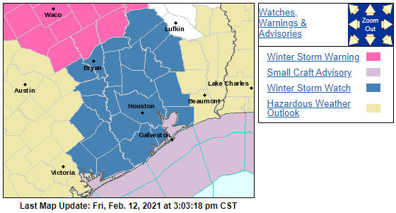
Assuming any amount of freezing rain though? I'm guessing that's the main threat Houston and south at this point.
-
WSW up for Houston/Galveston. Have a friend down there that was already bitching about the arctic cold on FB...it was in the 40s.
-
Getting OT...but the videos as it happened are crazy... Skip to 35 seconds here for the FedEx truck hitting:
-
0.9” here...pure fluff
-
It was an estimate...could've easily been 0.2" once you factor in the glaze...but what's a tenth of an inch among friends? But I put it down as 0.1" in my books officially. That's 27.2" on the season since I saw you're keeping up that seasonal totals map.
-
Liking the chances for an inch of fluff overnight. Definitely beats yesterday's 0.1" dusting/glaze combo down here.
-
18Z GFS has something for everyone. Suppression on Thu/Fri, ice on Sunday, region wide snowstorm middle of next week, then inland runner for next weekend. Certainly no one can be complaining about lack of storm threats.
-
Quick Hitter Obs/Nowcast, Feb 7-8th
Mr. Windcredible! replied to The 4 Seasons's topic in New England
Just shy of 7.5” here. No complaints! -
Quick Hitter Obs/Nowcast, Feb 7-8th
Mr. Windcredible! replied to The 4 Seasons's topic in New England
No...most of them were lower than 10:1 in CT. Probably a combination of a warm BL and most models not getting the best banding as far NW into CT as it did. -
Quick Hitter Obs/Nowcast, Feb 7-8th
Mr. Windcredible! replied to The 4 Seasons's topic in New England
I was down on this storm, but man is it delivering here. Eyeballing 4-5” new with biggest dendrites of the event falling now. -
Quick Hitter Coastal Threat, Feb 7-8th
Mr. Windcredible! replied to The 4 Seasons's topic in New England
There’s gonna be some deflated weenies in the morning


