Sey-Mour Snow
-
Posts
6,896 -
Joined
-
Last visited
Content Type
Profiles
Blogs
Forums
American Weather
Media Demo
Store
Gallery
Everything posted by Sey-Mour Snow
-
 Def would love a tic south at go time from this
-
Ya gfs has been so consistent . Would be awesome for it to score a coup
-
Ok not bad just loaded for me
-
Hot as in rain ☔️ ? I’m only out to 39
-
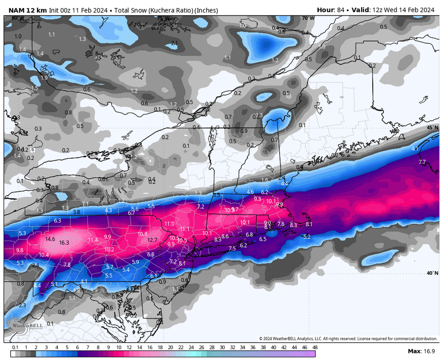
00z Super cold at surface not much precip compared to globals and obviously well south. Just another option on the table, if mesos hold the southern course then it’s going to be a load bath tomorrow to see what wins out. for Also no wind to speak of on NAM
-
EPS loves the Pike
-
Timing with this also correlates to the warmth and lesser totals south.. Timing really moving up again on EURO ..
-
It feels horribly wrong but it's 100% true with this storm.. EURO has been jumpy all season so it's no surprise.. Funny I might owe an apology to the ICON if it's ends up right.. 18z EURO a lot closer to ICON than any other guidance is..
-
Some are delusional with beer. The EURO (aka the new NAM) has ticked 100 miles north today in 2 runs .. We will just follow GFS which seems to be more stable .. Stay the course for now, EURO simply can't be trusted check out the run to run consistency at every layer just putrid..

-
congrats albany that was an awful run for CT now many see where the worry comes, back to back warm bumps on EURO 12z and 18z
-
18z euro is an example of the worry for southeners lmao
-
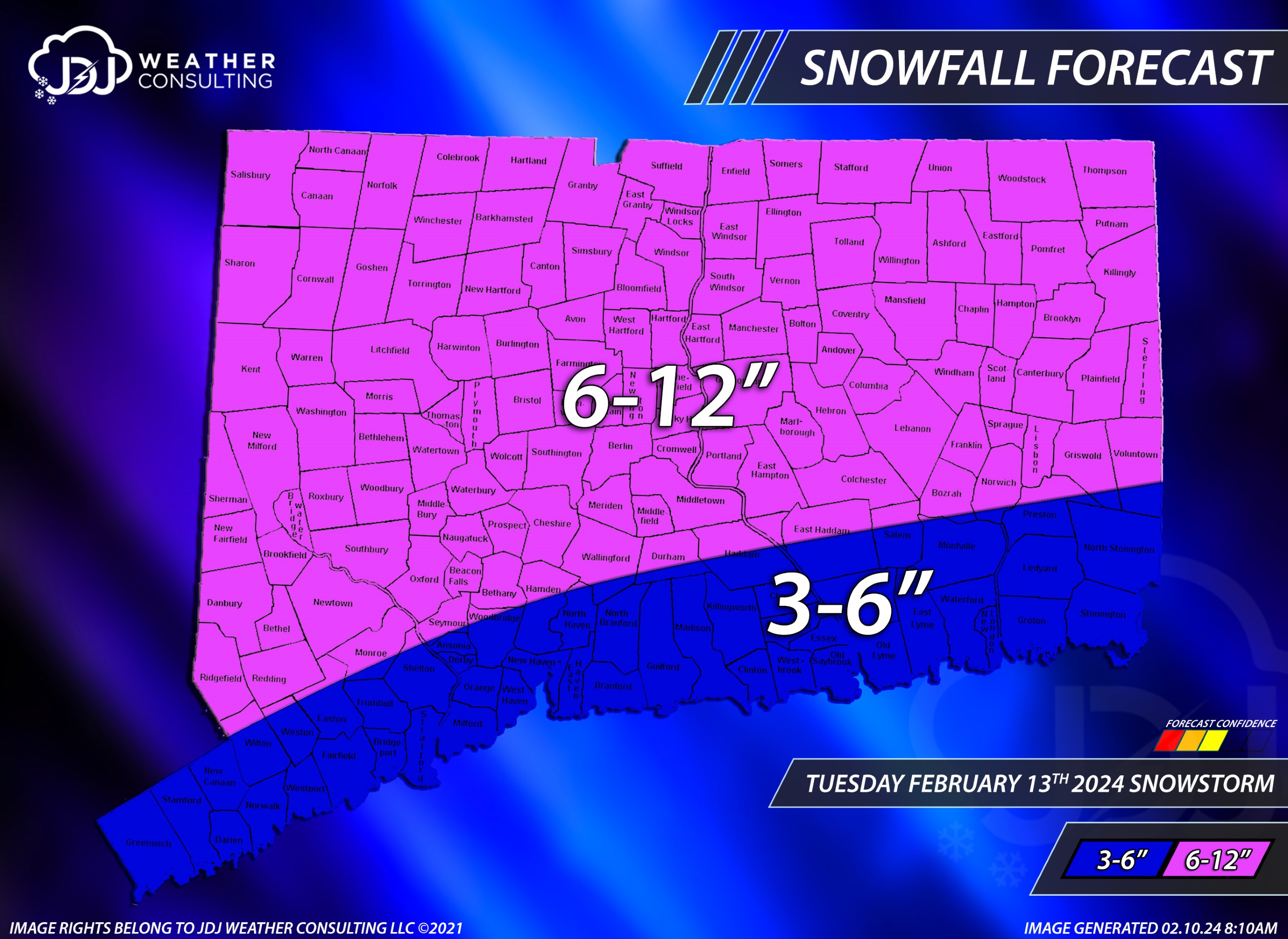
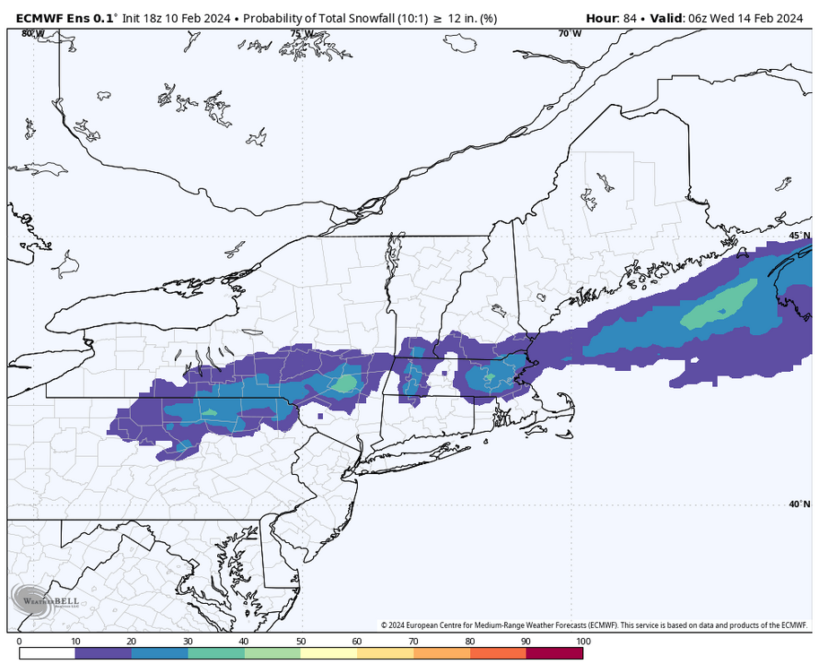
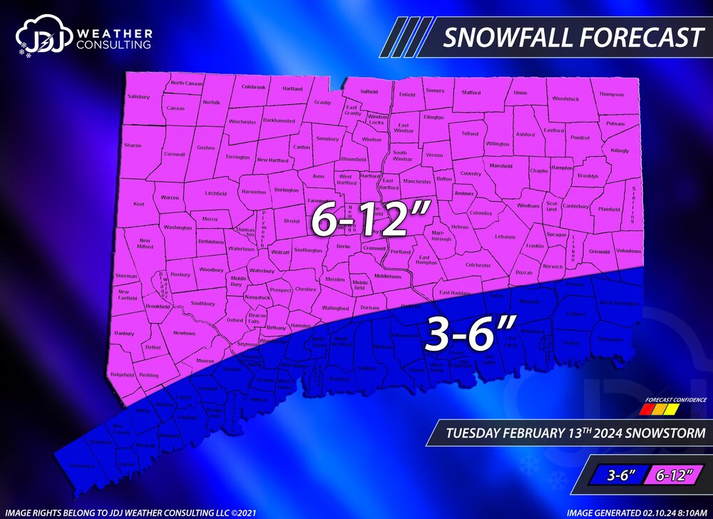
First call … 65% chance we bump the 6” line up to 84 and a 35% chance we bump it down to immediate shoreline.
-
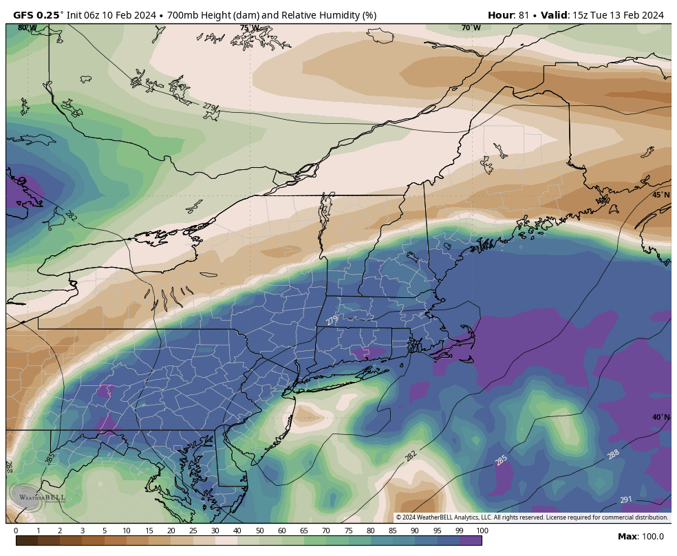
Ya I don’t think people realize how borderline this is for south ct temps like 33-34 with 700mb flirting with freezing.
-
GEFS with another good bump nw.. south ct crew with toasters on stand bye
-
Wait another cycle and it will be somewhere totally different . Last run 700mv low was in central Jersey . Could either go back south or end up over BDL next run
-
Ya would be interesting I think we can get close to blizzard criteria for immediate shore . Should be quite the scene Tuesday with heavy wet snow 35-45 mph wind for coasts and almost low dark visibility .
-
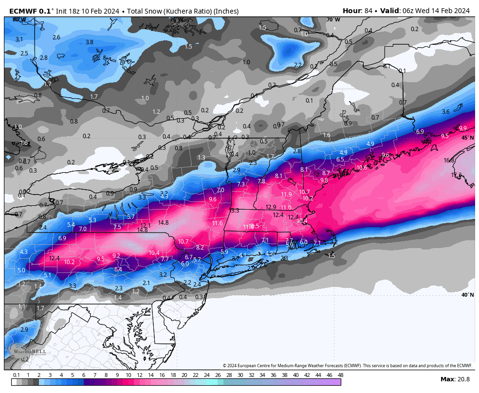
Would be a widespread outage for southern ct verbatim 12” of snow at 33 degrees
-
It was a Flop... February 2024 Disco. Thread
Sey-Mour Snow replied to Prismshine Productions's topic in New England
Wild loaded look for Presidents’ Day -
Box going 4-10” with wind for the watch . Upton going 6-10” most in hills. Power outages will be a major issue with wind and on the southern extent of significant snow.
-
It was a Flop... February 2024 Disco. Thread
Sey-Mour Snow replied to Prismshine Productions's topic in New England
Ya they are nice -
It was a Flop... February 2024 Disco. Thread
Sey-Mour Snow replied to Prismshine Productions's topic in New England
If anyone wanted to know what EURO was going to do post day 10 take a look at the control run for sh*ts and giggles.. Some wild solutions are likely in the 10-15 day timeframe -
Mid level tracks are the reason not qpf
-
EURO has been so damn jumpy unlike GFS for a change.. Last run that was shifted 150 miles SW