Sey-Mour Snow
-
Posts
6,893 -
Joined
-
Last visited
Content Type
Profiles
Blogs
Forums
American Weather
Media Demo
Store
Gallery
Everything posted by Sey-Mour Snow
-
 @Ginx snewx sitting back smiling at GEFS
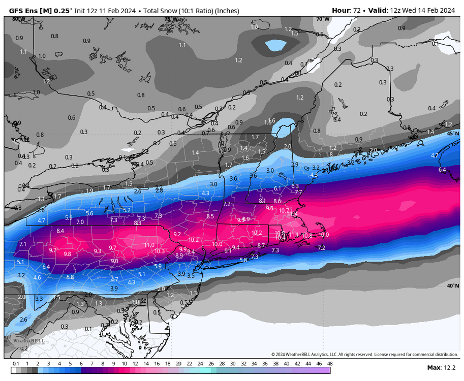
-
Feel the same about your optimism sometimes. Can’t just sit back and smile when the inevitable is right in your face .. I haven’t been wrong yet with every storm falling apart here since 2021.. when things look good I’ll be positive when they don’t I’ll note the possible negatives. I said pretty clearly I feel pretty damn good and optimistic for a widespread 3”+ south and 6”+ 84 north.
-
ok dude I bet you are sitting back smiling on your horse right now ..
-
Canadian still not biting fully, heavy snow up to pike only.. Weird how slow it's been to buy in
-
Ya instead its a LBW look ... Looks like we built a border wall on the CT/NY line
-
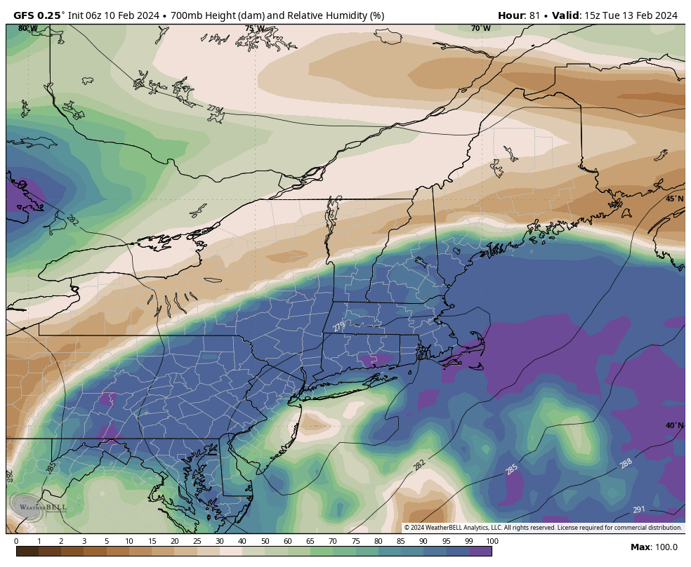
GFS ticked surface / 850 / 700 SE and is cold enough for 95% snow in CT.. just not as much precip .. almost 12km NAM Like
-
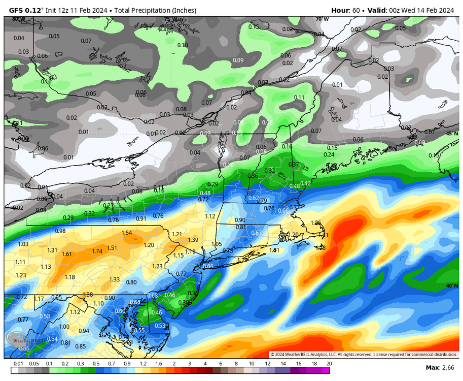
GFS with a messy precip shield , a lot less juicy
-
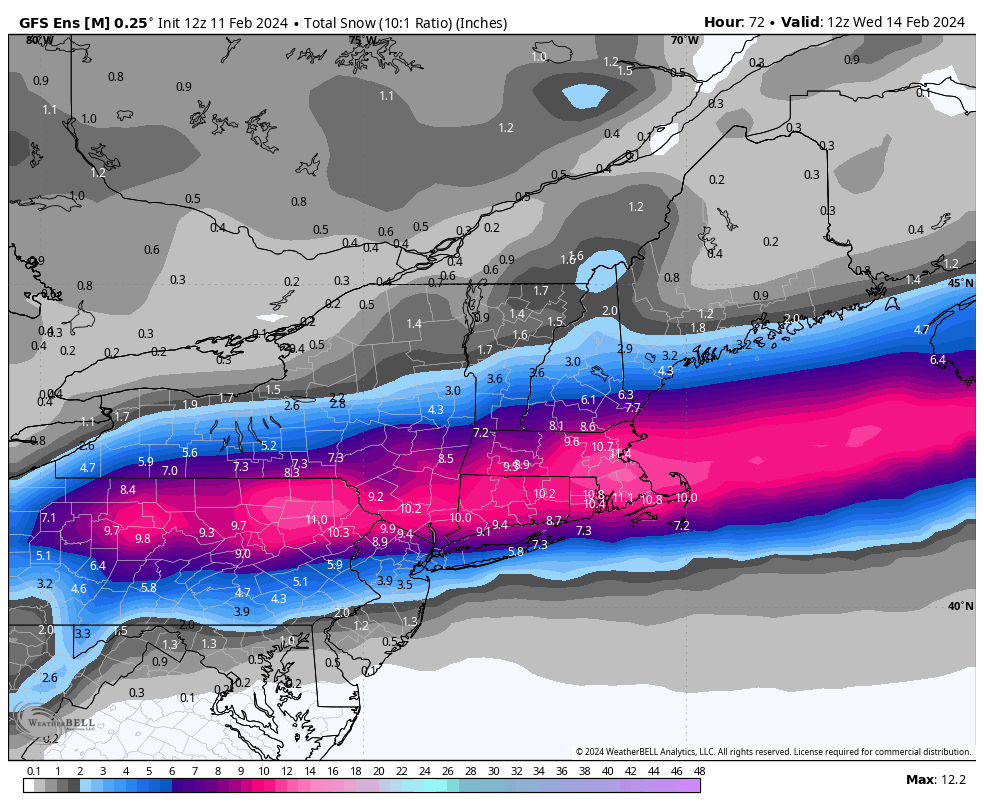
Ya this has a lot higher floor than all the other junk we've seen.. think 3"+ for all then 6" + 84 north .. not your normal coating to 2" until you get to extreme northern CT
-
It's ticked 200 miles south with the heavy snow axis since 12z yesterday ... Just a Global NAM
-
GFS is a tic South again this run through 30
-
A widespread 3" + in southern CT would be the biggest storm since the Jan 22 blizzard miss. I'm pretty optimistic that we do see a widespread 3"+ down here ..
-
Reggie is actually pretty consistent .. 850, 700, and surface lows all in general same spot, that run was just more amped with the goods.
-
I don't see any reason to be conservative with the warm air aloft.. It's going to come flying in and north.. 3km has the right idea
-
Wild 84 corridor is a degree or two between 700-800 from 12-18" of snow or less than 6"
-
ya looks just like ICON and the warmest EURO solutions ..
-
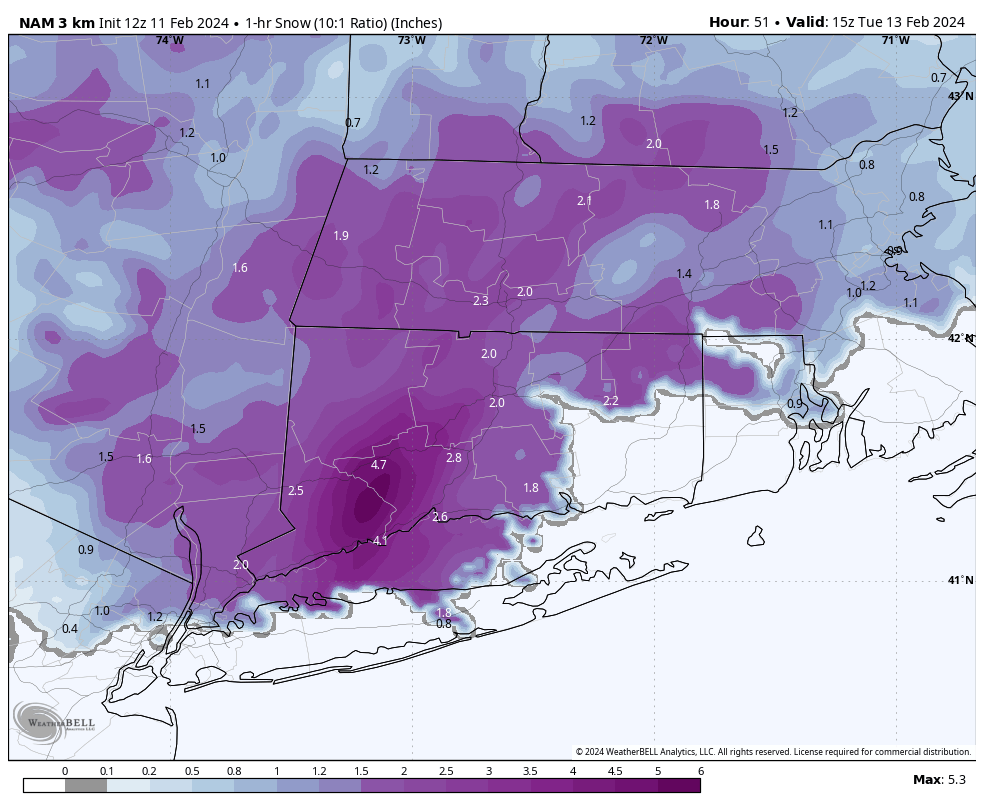
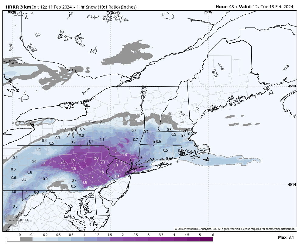
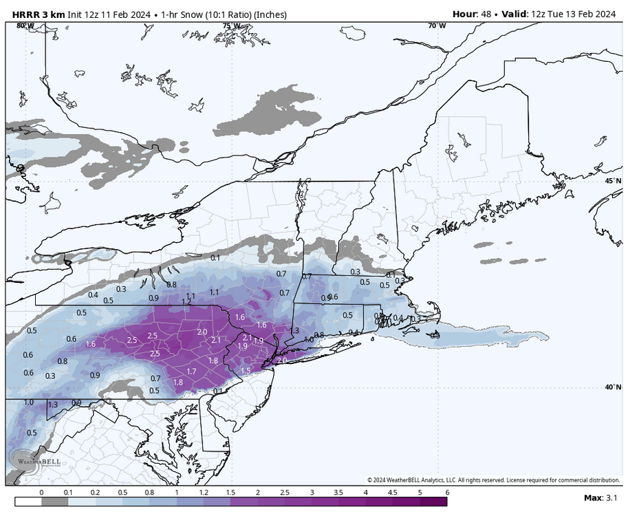
Just ran the 3km NAM 1 hr snow from my basement.. 5.3" of snow in one hour lol.. The 3km snow output total is from only 2-3 hours of snow, not good relying on 6" of snow to accumulate in 2-3 hours with borderline temps..

-
Ya I agree, that run makes a lot of sense with the mid level tracks
-
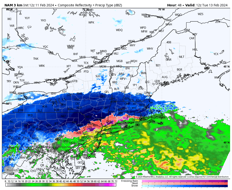
All guidance is adamant on a rather large band of extremely heavy snow moving through all of SNE..

-
Ya warm nose gets just north of 84 at the peak before crashing down with heavier rates.. would still get 6"+ for most of CT as it pounds right after that.. 12km much cooler..
-
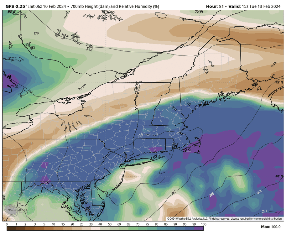
If we can lock this in verbatim I'll forgive this winter forever. Would be 2-3"+ for several hours in daylight.. Too bad its long range hrrr..
-
Def would love a tic south at go time from this
-
Ya gfs has been so consistent . Would be awesome for it to score a coup
-
Ok not bad just loaded for me