Sey-Mour Snow
-
Posts
6,893 -
Joined
-
Last visited
Content Type
Profiles
Blogs
Forums
American Weather
Media Demo
Store
Gallery
Everything posted by Sey-Mour Snow
-
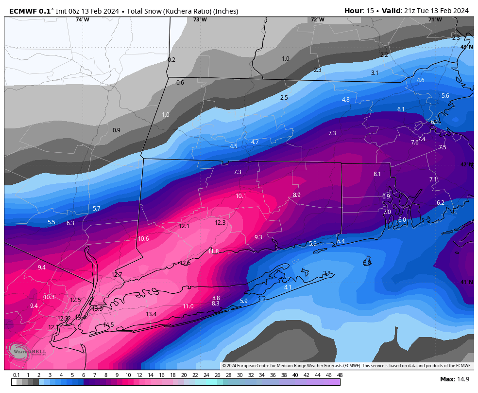
All 12z guidance ramping up a bit with HRRR most impressive. 1-3” to 84 possible, with some iso 3”+ on the south coast. Rhode Island and SE MASS look to get in on the action as well with a dusting to an inch up to the pike? Haven’t had much of a chance to dig in yet. Let’s discuss here and free up the other thread?
-
 Wow that's a lot of liquid ..
 -
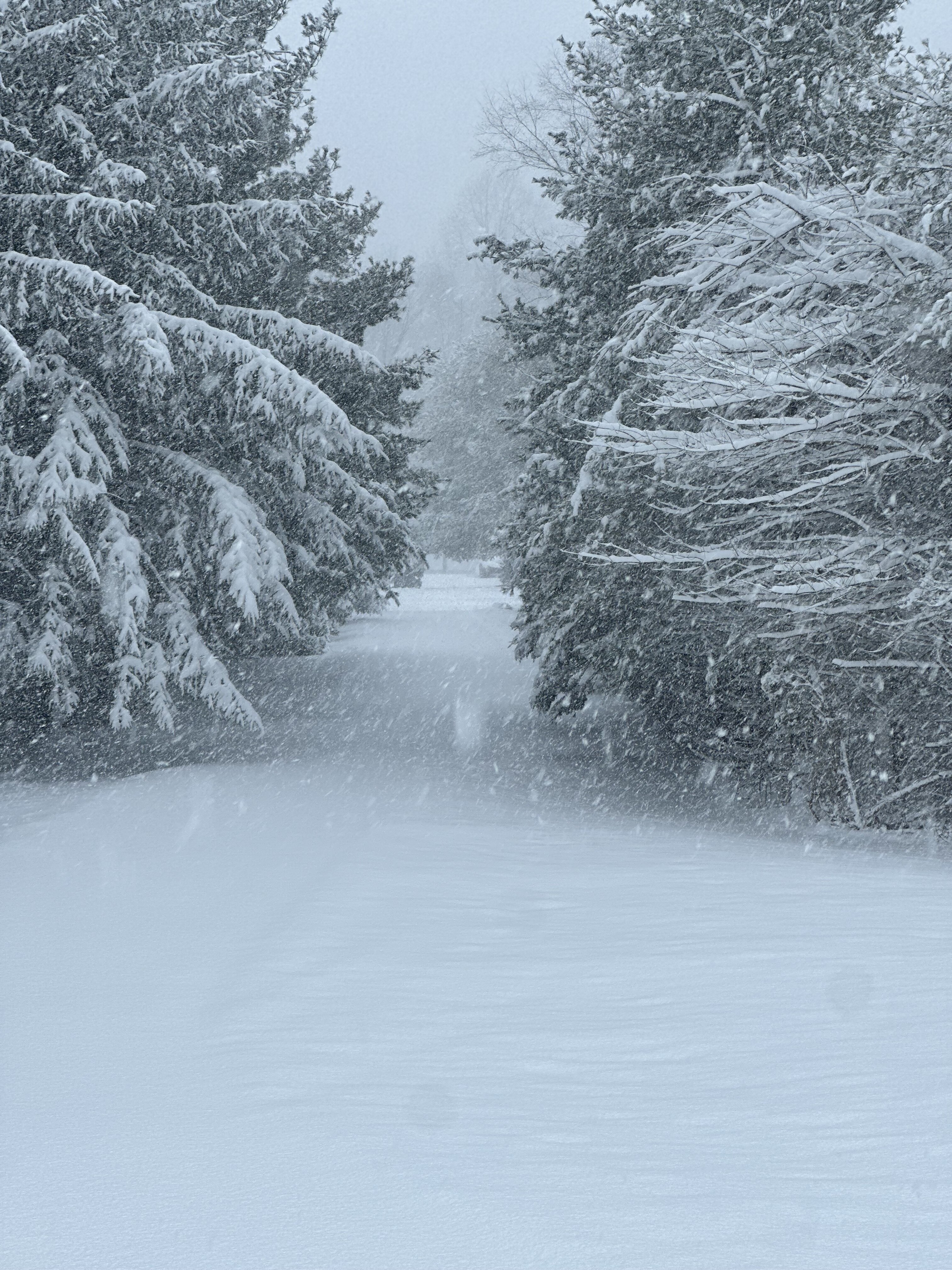
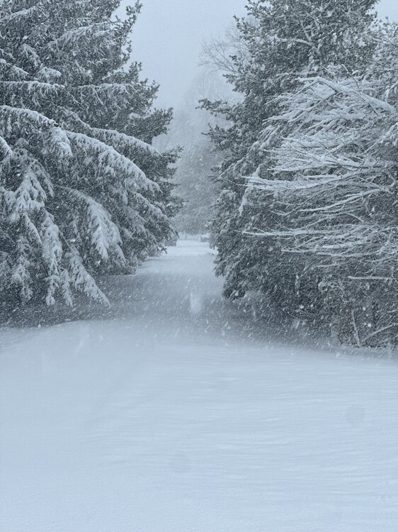
Absolute paste a ton of liquid in this. Has that blue tint to it. Def over an inch liquid. About 90 min in clearing still another hour to go.
-
10.5" Storm total here .. Nice positive bust ..
-
That stinks sorry, I was on the southern edge of the fronto band earlier and also I have about 600 more feet elevation than a lot of Derby, was 29 degrees for the first 5" every flake accumulated.
-
I'd guesstimate 10 million people in the North East United States have 6.0" + but it's only a rural CT storm
-
Halfway done clearing still moderate lot heavy snow another 45 min to go .. 9.0” depth 10.0” total 8.0” before clearing another 2.0” since
-
Closing in on 9” trees sagging
-
what do you have
-
Central park has plowable 2" plus based on live video that I see
-
6.8" snowing 2"+ per hour last 30 minutes
-
Hanny with an 11" report damn
-
What are you at
-
Burlington to Windsor Bloomfield and Ellington getting 2-3" per hour rates as that band is blowing up
-
Ya it's enhancing rates here , peak is next 2 hours .. should be some insane rates
-
First 10" report Farmington from Twitter
-
cams are wild along 84.. you must be 8" by now with 10" to your SW along 84 in Litchfield county
-
MESO issued for heavy snow for SE mass.. Not a shit storm for CT, biggest storm in 3 years for many ..
-
Pivoting down to our SW in EPA / JERSEY
-
Highest report I see is almost 8" in Farmington.. 3" stamford , 3" norwalk .. just about 5.3" here ..
-
yup .. GFS made American Forecasting Great Again
-
lol EURO is 10-14" from nyc metro to waterbury