Sey-Mour Snow
-
Posts
6,904 -
Joined
-
Last visited
Content Type
Profiles
Blogs
Forums
American Weather
Media Demo
Store
Gallery
Everything posted by Sey-Mour Snow
-
Yes.
-
HRRR 00z weenie run much colder/ intense squalls tomorrow too
-
Snow 33.7.. been snowing since 7:30.. but it’s pretty much white rain for now.
-

December 2024 - Best look to an early December pattern in many a year!
Sey-Mour Snow replied to FXWX's topic in New England
Look at that squall in WMass headed for BDL -
Ya it finally woke up. Thats reassuring for many to see at least their first light accumulation this season.
-
Slightly west better than 00z . Just noise. But ya this is close to being nothing with another bump east and less impressive at 12z. Could use a bump thumpier and west
-
Yes, Can’t take another bump east though
-
December 2024 - Best look to an early December pattern in many a year!
Sey-Mour Snow replied to FXWX's topic in New England
Waiting for rays post on the 18z gfs lol -
November 21-22 Rain to Snow Disc/Obs SWNE Wake up to 6” ?
Sey-Mour Snow replied to Sey-Mour Snow's topic in New England
I drove through 84 through Danbury and up to Poughkeepsie. Just a dusting in Western Danbury. South of Poughkeepsie there was a large stretch of the drive that looked to be about 2-4/3-6”. -
November 21-22 Rain to Snow Disc/Obs SWNE Wake up to 6” ?
Sey-Mour Snow replied to Sey-Mour Snow's topic in New England
North Jersey getting crushed .. -
Let’s use this thread to discuss the potential for our first snow in SW New England tonight and tomorrow. Radar looking juicy in Jersey.
-
Blowvember - and not named for wind potential
Sey-Mour Snow replied to Go Kart Mozart's topic in New England
wild to see cold air advection from the SW -
Blowvember - and not named for wind potential
Sey-Mour Snow replied to Go Kart Mozart's topic in New England
GFS insisting on a CCB over extreme western NE tonight and SENY .. would be some very heavy snow -
Blowvember - and not named for wind potential
Sey-Mour Snow replied to Go Kart Mozart's topic in New England
… -
Blowvember - and not named for wind potential
Sey-Mour Snow replied to Go Kart Mozart's topic in New England
Tolland is favored to win I hear. They crushed Seymour’s nemesis. -
Blowvember - and not named for wind potential
Sey-Mour Snow replied to Go Kart Mozart's topic in New England
Are your girls still in soccer in high school? Big state quarterfinal game tonight Seymour vs Tolland at Mount Seymour. -
Blowvember - and not named for wind potential
Sey-Mour Snow replied to Go Kart Mozart's topic in New England
First freeze, 31.5 for the low. -
Blowvember - and not named for wind potential
Sey-Mour Snow replied to Go Kart Mozart's topic in New England
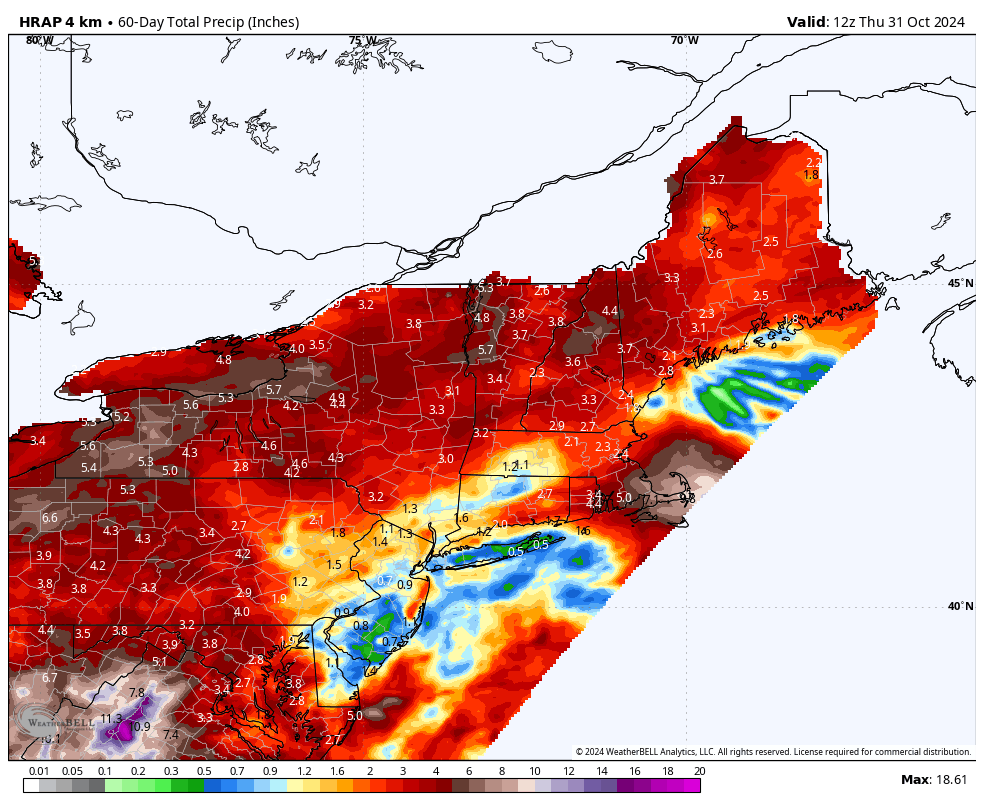
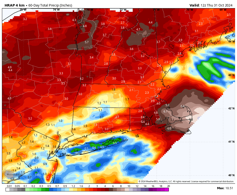
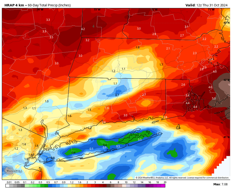
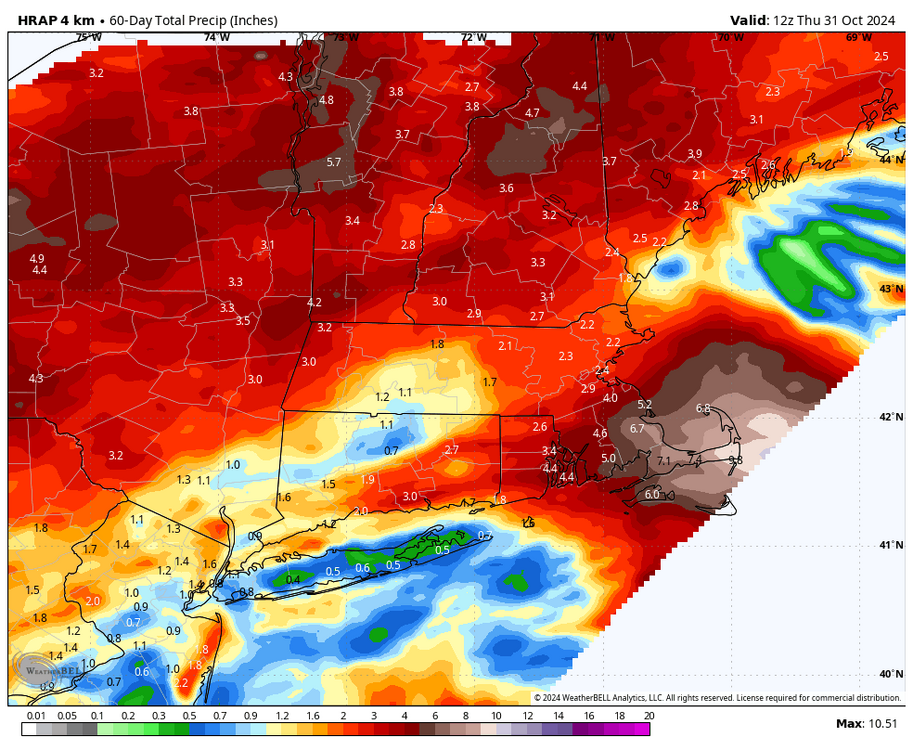
Wow It hasn’t rained in most of the state of New Jersey in over 30 days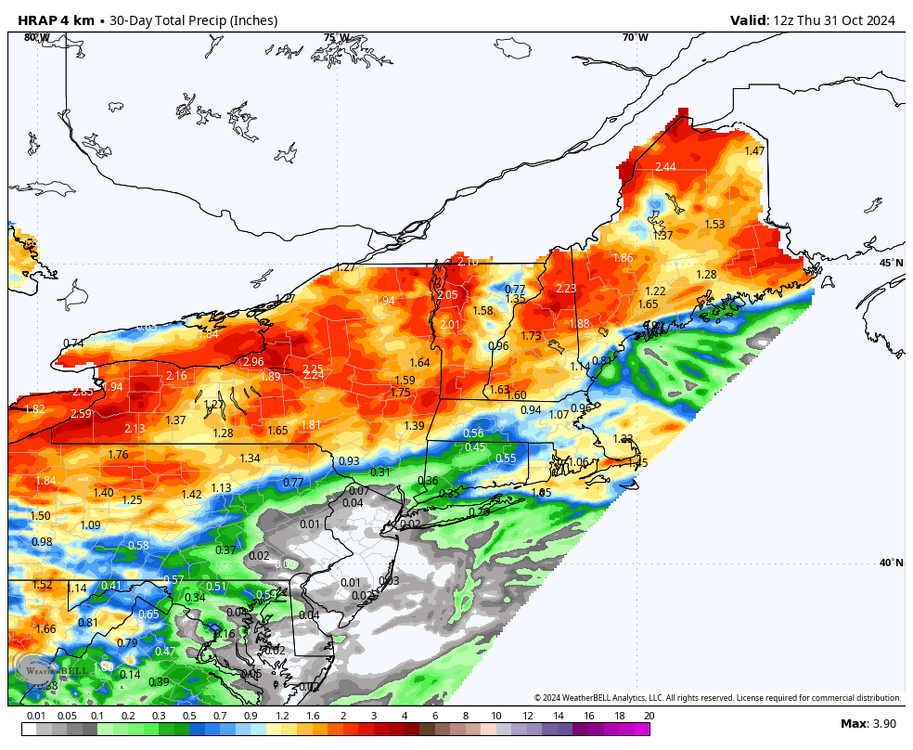
-
Blowvember - and not named for wind potential
Sey-Mour Snow replied to Go Kart Mozart's topic in New England

-
Blowvember - and not named for wind potential
Sey-Mour Snow replied to Go Kart Mozart's topic in New England
Are you saying you want to make November great again? -
Blowvember - and not named for wind potential
Sey-Mour Snow replied to Go Kart Mozart's topic in New England
I’d rather not waste any cold/favorable patterns , bring on the warmth. Let’s shake things up starting on Turkey Day! -
NAM went from upper 40s in SWCT to mid 70s tomorrow lol
-
Hrrr looks like it’s bumping north too will be like gfs .. I’m glad want to get some fall stuff done outside tomorrow could be a gorgeous fay like today down here.
-
Still wild temperature differences .. gfs is mid 70s here most other guidance 55-60.. have a feeling gfs will be 100% right on that too, it’s been owning euro
-
898mb unofficially