michsnowfreak
-
Posts
18,387 -
Joined
-
Last visited
Content Type
Profiles
Blogs
Forums
American Weather
Media Demo
Store
Gallery
Everything posted by michsnowfreak
-

Fall/Winter '24 Banter and Complaints Go Here
michsnowfreak replied to IWXwx's topic in Lakes/Ohio Valley
Thanks, and I would tend to agree with you Chicago folks with a D winter for Chicago. The winter in Chicago finished just under a degree colder than average, but even if you use the coldest 30 year averages ala beavis, the bottom line is Chicago saw way less snow than they should have for what the temp was. The 17.6" of snow ranks as Chicagos 5th least snowy winter, but the DJF temp of 27.3F is just 76th warmest. -
Winter 2024-2025 Forecast
michsnowfreak replied to Stormchaserchuck1's topic in Weather Forecasting and Discussion
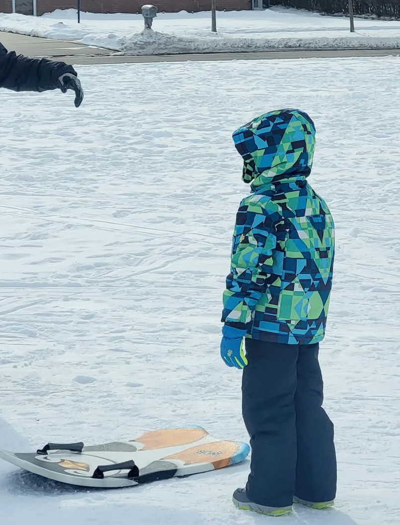
copied from a post in the Lakes forum. My grade for this winter (the weather itself, not a forecast grade) My grade for this winter here would be a C- The bad- Snowfall finished at 29.5” imby & 28.7” at DTW, a 2nd sub-30” winter in a row. December was lackluster again, and March was a no-show. Also, this was the 2nd winter in a row with no big (6”+) snowstorms. This winter really surprised me (esp since it was a Nina) with its lack of storminess in the region. In the grand scheme of climo, none of this is worrysome because lower snow years were needed to balance out the excessive snowfall from the 2000s-2010s, but its still annoying. The good- Jan and Feb were solid winter. Snow covered the ground nearly the entire time, it was way colder than I had expected with solidly below avg temps, and with the plentiful ice on the lakes and white landscape, it truly was “deep winter” for those 2 months. Despite no big storms, snowflakes were in the air nearly every day. Even though the holiday season saw lackluster snow, a cold & white Thanksgiving weekend made a perfect atmosphere for cutting down the Christmas tree, and a few other outdoor holiday events I attended were also cold & flakey. The unusual- A totally subjective statement, but in some recent milder winters (esp 2019-20 & 2022-23), some remarked that the total snowfall number made the winter look better than it was. I would consider 2024-25 the first winter in 10 years, and just the 2nd this century, where the winter was actually better than the snowfall total would indicate. Nov 29th - first blanket of snow of the season made for a white Thanksgiving weekend Jan 11th- after multiple dustings to 1.5" type snows, finally a decent snowfall Lots of cold winter days whether it was sunny, cloudy, or snowy Plenty of ice on the Detroit River Feb 12 - more fresh powder Feb 16 - conifers always steal the show in snow Feb 16 frigid air behind another snowfall Feb 21 - cold but sunny Feb 22 - plenty of sledding fun in Jan/Feb this year Apr 10 - winters last encore


-
Fall/Winter '24 Banter and Complaints Go Here
michsnowfreak replied to IWXwx's topic in Lakes/Ohio Valley
My grade for this winter here would be a C-. The bad- Snowfall finished at 29.5” imby & 28.7” at DTW, a 2nd sub-30” winter in a row. December was lackluster again, and March was a no-show. Also, this was the 2nd winter in a row with no big (6”+) snowstorms. This winter really surprised me (esp since it was a Nina) with its lack of storminess in the region. In the grand scheme of climo, none of this is worrysome because lower snow years were needed to balance out the excessive snowfall from the 2000s-2010s, but its still annoying. The good- Jan and Feb were solid winter. Snow covered the ground nearly the entire time, it was way colder than I had expected with solidly below avg temps, and with the plentiful ice on the lakes and white landscape, it truly was “deep winter” for those 2 months. Despite no big storms, snowflakes were in the air nearly every day. Even though the holiday season saw lackluster snow, a cold & white Thanksgiving weekend made a perfect atmosphere for cutting down the Christmas tree, and a few other outdoor holiday events I attended were also cold & flakey. The unusual- A totally subjective statement, but in some recent milder winters (esp 2019-20 & 2022-23), some remarked that the total snowfall number made the winter look better than it was. I would consider 2024-25 the first winter in 10 years, and just the 2nd this century, where the winter was actually better than the snowfall total would indicate. Nov 29th - first blanket of snow of the season made for a white Thanksgiving weekend Jan 11th- after multiple dustings to 1.5" type snows, finally a decent snowfall Lots of cold winter days whether it was sunny, cloudy, or snowy Plenty of ice on the Detroit River Feb 12 - more fresh powder Feb 16 - conifers always steal the show in snow Feb 16 frigid air behind another snowfall Feb 21 - cold but sunny Feb 22 - plenty of sledding fun in Jan/Feb this year Apr 10 - winters last encore
-
2025-2026 ENSO
michsnowfreak replied to 40/70 Benchmark's topic in Weather Forecasting and Discussion
Chicago snowfall really sucked this winter but it still was a lot colder than most forecast. Using yout SDDs metric Chicago had 42 and Detroit 142 -
2025-2026 ENSO
michsnowfreak replied to 40/70 Benchmark's topic in Weather Forecasting and Discussion
I am not familiar with that area at all, but Im wondering if Fizz's point is not that there is UHI or what not, but that the PHL thermometer still seems high. Detroit data comes from the suburbs, not the city. DTW is located in a suburban area that actually radiates fine, but the airport itself has gotten SO much concrete now that its a given the temps will be warmer than surrounding areas (even though obviously ASOS is in a grassy area, Im sure the same is at PHL). Its just the way it goes, so I have no issue with it (I think the fact that DTW currently being in suburbia at a concrete heavy airport MORE than levels the playing field and makes up for the fact that 70-150 years ago data was taken in the city but with far fewer artificial warming influences). But if I noticed that the thermometer was consistently reading too high even considering those circumstances, Id be pissed too. -
2025-2026 ENSO
michsnowfreak replied to 40/70 Benchmark's topic in Weather Forecasting and Discussion
Im assuming the philly temps are high? I dont think ive ever seen an ASOS issue where temps are too low, but frequently where they are too high. If its a first-order station (which obviously PHL is) they should be calibrated immediately. But if it is not a first order station they often just let it go, which is why some love to bring up funky data from random stations to show how "warm" they are. Im also under the understanding that ASOS can run slightly WARMER than a real mercury thermometer would, but as long as its within whatever the margin of error is, its fine. Really, IMO all these things are absolutely ridiculous, but ill zip my lip for discussing further. DTW had a problem with their ASOS, I want to say last summer. They had people working on it immediately but I guess they had to order parts for it or whatever. Because of this, for like 2 weeks they had to use the temps and rainfall from nearby YIP. None of these problems would have EVER happened in the 1890s, 1920s, 1950s, 1970s etc when you had a mercury thermometer and a standard rain gauge that was all monitored by a human (the same humans that some are maligning for their alleged snow measuring practices that they assumably took, as if we were there to corroborate lol). -
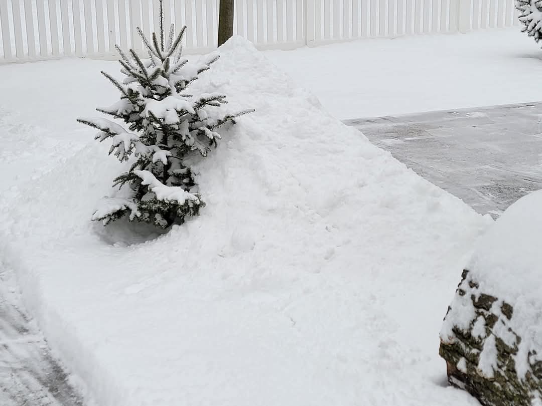
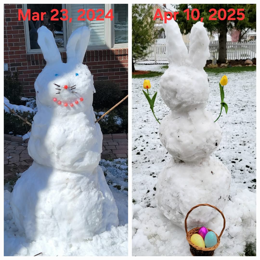
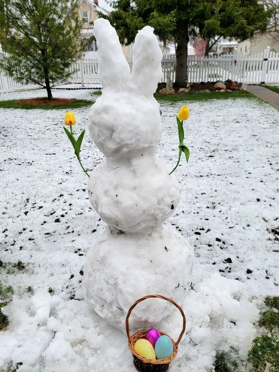
Snow bunny fully melted yesterday afternoon. Weather pretty zzzz.
-
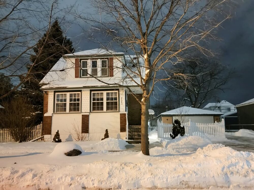
Yesterdays snow melted by mid-afternoon, but the high only maxed out at 38F. Cold start to April, but milder with some sun today.
-
2025-2026 ENSO
michsnowfreak replied to 40/70 Benchmark's topic in Weather Forecasting and Discussion
Pretty much every winter forecast that is supposed to be El Nino or La Nina has that same generic graphic of expected weather patterns in a Nino/Nina that spreads like wildfire on social media weather "forecasting" outlets. -
2025-2026 ENSO
michsnowfreak replied to 40/70 Benchmark's topic in Weather Forecasting and Discussion
Interesting. I feel that DTW is a good centralized spot for southeast Michigan (and not because I live close lol). The far northern suburbs with their slight tick in elevation are snowier and year-round colder than the rest of the region, and downtown Detroit and especially east of their is too marine influenced. But DTW is a perfect spot, and I feel that is what most NWS offices should do, pick the most "centralized" spot. I always assumed that was central park, but if its LGA it should be LGA. Any mets from NYC post here? Why dont they question central parks measurements when they seem low? NWS has every right to do that (same as if it was too high). -
Thats cool, I never knew that. Thanksgiving to just before Christmas had plenty of salting-worthy snowfalls, and Jan and Feb were solid deep winter, just no biggies. I used the snowblower probably 3 times and shoveled multiple times. Salt galore was dumped on the roads, but next winter we need to grind to a halt with a big one.
-
2025-2026 ENSO
michsnowfreak replied to 40/70 Benchmark's topic in Weather Forecasting and Discussion
Cold neutral? -
We were due for a stat padder this winter. I mentioned before, but this is the first winter in 10 years that was better than the total snowfall would indicate. The complete opposite feel of a winter like 2019-20, where a record November snowstorm, some late April snow, and a few good wet snowstorms during the winter helped push the season total to 44" despite so many mild DJF days
-
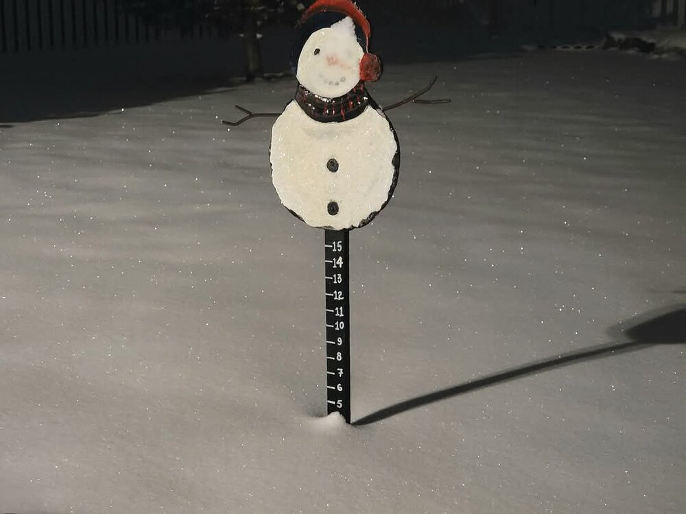
Thanks! They are fake tulips. My nephews got such a kick out of it last year that I made one this year and sent a pic to them.

-
2025-2026 ENSO
michsnowfreak replied to 40/70 Benchmark's topic in Weather Forecasting and Discussion
In these ENSo threads, weve discussed some of the weird things that have occurred since the nino of 2015-16, so I thought Id share this. Since the snowy blitz of 2007-15, winters have exhibited a very strange characteristic at Detroit. While Jan-Feb stays snowy, some wonky thinks have been happening on the fringe ends of the season. The amount of times in a snow season recently that either November has had more snow than December, or April has had more snow than March, has been astounding. 2024-25: Apr snowier than Mar 2023-24: Nov snowier than Dec 2021-22: Nov snowier than Dec & Apr snowier than Mar 2020-21: Apr snowier than Mar 2019-20: Nov snowier than Dec & Apr snowier than Mar 2018-19: Nov snowier than Dec 2015-16: Nov snowier than Dec 2014-15: Nov snowier than Dec -
2025-2026 ENSO
michsnowfreak replied to 40/70 Benchmark's topic in Weather Forecasting and Discussion
lol and that is wrong. Central Park would actually be a perfect area to measure snow. A park presents more of the "textbook definition" of a preferred area to measure snow (sheltered but open, less prone to drifting). Many airports snow observers (DTW included) are measuring snow at a nearby more "user friendly" site because of the difficulty modern airports can produce. Central Park is literally A PARK and they cant get it right? -
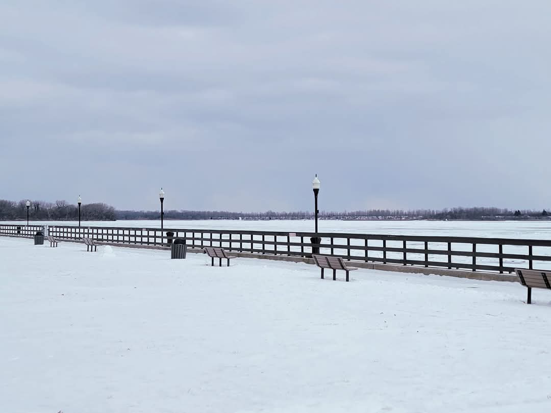
Since 2021, this is the 5th snowfall that DTW has seen 1”+ on or after April 10th. April 15, 2020: 1.3” April 17, 2020: 3.4” April 20/21, 2021: 3.5” April 18, 2022: 2.3” April 9/10, 2025: 1.8” Also...since the snowy blitz of 2007-15, winters have exhibited a very strange characteristic at Detroit. While Jan-Feb stays snowy, some wonky thinks have been happening on the fringe ends of the season. The amount of times in a snow season recently that either November has had more snow than December, or April has had more snow than March, has been astounding. 2024-25: Apr snowier than Mar 2023-24: Nov snowier than Dec 2021-22: Nov snowier than Dec & Apr snowier than Mar 2020-21: Apr snowier than Mar 2019-20: Nov snowier than Dec & Apr snowier than Mar 2018-19: Nov snowier than Dec 2015-16: Nov snowier than Dec 2014-15: Nov snowier than Dec
-
2025-2026 ENSO
michsnowfreak replied to 40/70 Benchmark's topic in Weather Forecasting and Discussion
Yeah, the east coast is prone to that moreso than here. I dont see snowfall turning feast or famine here, but snowcover days might. -
2025-2026 ENSO
michsnowfreak replied to 40/70 Benchmark's topic in Weather Forecasting and Discussion
I have noticed this subtly for years now...the milder winters do better with snow now than they did decades ago. Honestly, a warming climate is a boon for snow lovers in northern New England, the upper midwest and northern Great Lakes. And once you get down to your and my latitude, while it can lead to some frustration it can also lead to some great winters, and I do not see our snowfall averages falling anytime soon. More worries once you get to NYC, but even there, I wouldnt exactly worry if i lived there since it can snow in Pensacola lol. -
2025-2026 ENSO
michsnowfreak replied to 40/70 Benchmark's topic in Weather Forecasting and Discussion
100%. Its as simple as can be. And again, outside of these huge storms its really a minor issue. Although today was a great example of that. We were treated to a late season snowfall last night ( @LibertyBell you thought the flurries at the game the other day were nice, it snowed steadily all night last night!). I swiped my board at midnight. 0.5" fell before midnight and 1.1" after, so I finished with 1.6" of wet snow, however my morning snow depth was 1". -
2025-2026 ENSO
michsnowfreak replied to 40/70 Benchmark's topic in Weather Forecasting and Discussion
I sound like a broken record repeating over and over....most first order stations in climates prone to snow have used the 6 hour method since 1950. I wouldnt worry about coop totals because they ALWAYS should be taken with a grain of salt, whether its the early days of the 1800s or the present day. As for pre-1950 measurments, were any of us THERE to confirm what snowfalls were accurately or accurately not measured? Its crazy to to me to think that some will take a journal from the 1700s or a newspaper from the 1800s at face value, and assume "wow if they say there was 3 feet on the level imagine how much would be meausured every 6 hours".....yet they question these 1900s-1940s measurments that have well documented records by the then Weather Bureau to go with them. I normally dont play the game of finding some random city that appears to have undermeasured snowfall in the 1930s and assume that was everyone, but for every one of those i could post 10 first order stations who data appears just fine. But Im so intrigued by this NYC discussion i may poke around in some of their data on ncdc later. -
Most areas got 1-2" but it was a weird event. Washtenaw and all but far NE Wayne county (the I-94 corridor from Ann Arbor to DTW) had a solid 1.5-2". Much of Lenawee county also had around 2", with northern Monroe getting 1-2" but then nothing at all in the city of Monroe due to Marine influence of the east wind off Lake Erie. Downtown Detroit into St Clair shores west to about Royal Oak, in a narrow band, also got no snow accumulation due to the wind off Lake St Clair, whereas west of St Clair and north to the rest of Detroits north burbs had around 1". DTW had 0.42" precip and 1.8" snow. This brings the season total to 28.7", & the 1.6" I got here brings my season to 29.5". What started as a joke with my nephews is now a tradition, if theres snow during Easter season we make a snow bunny. Overnight was a true winter wonderland, but by daylight it was much more sloppy and slushy as youd expect.
-
Rain turned to snow around 11pm here and started sticking almost right away!
-
Wow...in Hillsdale?
-
Very intrigued with tonight's setup. Models making it look like rain will develop and quickly turn to snow here.