michsnowfreak
-
Posts
18,382 -
Joined
-
Last visited
Content Type
Profiles
Blogs
Forums
American Weather
Media Demo
Store
Gallery
Everything posted by michsnowfreak
-
The other night we had some of the heaviest rates anyone in this sub has had this Winter (outside of a lake band I'm sure). 3" fell in 1.5 hour and it was dense snow too. Total accumulation for the 4 hour event was just over 4" so obviously not a big storm, but coming from someone who has criticised many big storms over the years for taking too many hours, you should have appreciated the weather porn aspect of it.
-
Thank you! I heard the elk are amazing. I will be exploring other things too, just wanted opinion of that park.
-
It's nice to see the entire state a frozen winter wonderland now. Will be in Gaylord Feb 24-26. Have you been to Aspen Park? I want to check that out.
-

Winter 2020-21 Medium/Long Range Discussion
michsnowfreak replied to Hoosier's topic in Lakes/Ohio Valley
Before you know it were going to be worse than the Eastern subs when it comes to making storm threads lol. I do like the potential tho -
Feb 3rd - 5th Potential strong stm threat
michsnowfreak replied to Brian D's topic in Lakes/Ohio Valley
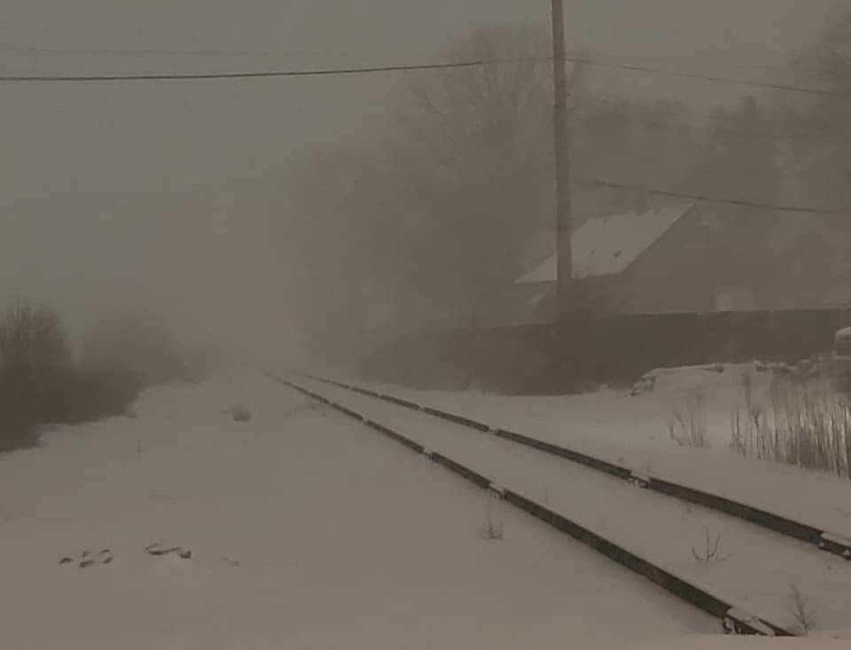
While I was counting down minutes to the blinding snow band with this storm, the general public just hear "Winter weather advisory", the same thing they issue when you grind out to 2-4" over 12 hours they issue when you go from dry to near 0 visib in minutes and 2"+/hr rates. I know people who were caught driving in it the other night that said they could not see anything in front of them. I know NWS recently started doing snow squall warnings but it still seems the advisory/warning system is quite flawed with the variety of weather we can see. -
Nice winter sunset tonight. The cold has just begun.
-
How would you like to be in Bismarck North Dakota the next few weeks? No snow on the ground and 50 below windchills
-
Beavis is going to ban you for hikacking his thread. Beavis im sure you are loving this deep Winter, plenty of potential ahead
-
Feb 3rd - 5th Potential strong stm threat
michsnowfreak replied to Brian D's topic in Lakes/Ohio Valley
Flakes flying but I don't think we had any more accumulation. The dense wet snow froze as temperatures plummeted (peaked at 35F post snow at 1am). It's so much more fun using the snowblower instead of shoveling lol -
Feb 3rd - 5th Potential strong stm threat
michsnowfreak replied to Brian D's topic in Lakes/Ohio Valley
Here's video I took last night. -
Feb 3rd - 5th Potential strong stm threat
michsnowfreak replied to Brian D's topic in Lakes/Ohio Valley
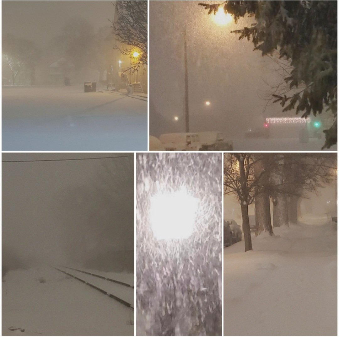
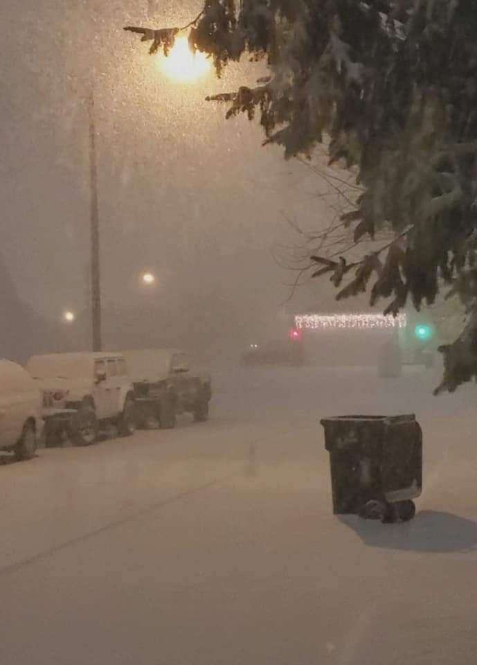
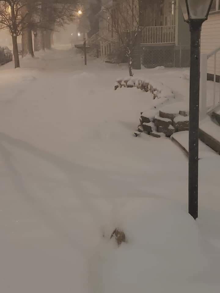
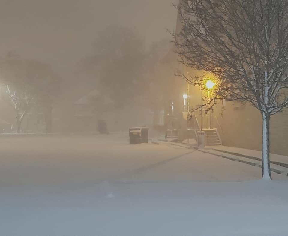
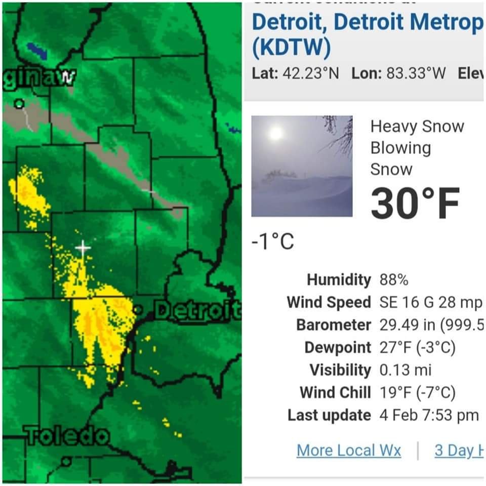
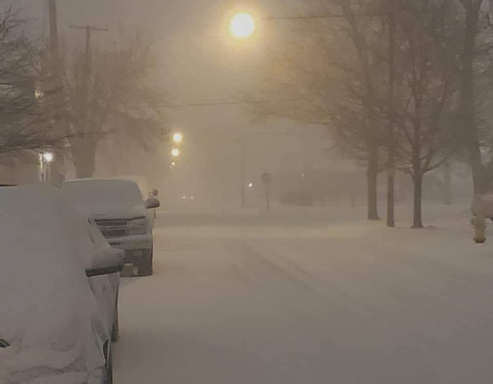
Quite a mini storm tonight. Finished with 4.2" of packing snow in about 4 hours however as I mentioned the 1st 3" fell in the 1st hour and a half. At 24.2" on the season. Technically the biggest storm of the season is still the 4.3" on Nov 30/Dec 1st but it goes without saying that tonights storm was much more exciting. DTW was at 1/8 mile visib for near an hour, you often don't see that in many 8 to 12" storms. They received 4.1" which is their largest on the season so far (they had 3.9 Nov 30/Dec 1) and are at 23.7" season. I did not see thundersnow but there were lightning strikes detected over the river. Snow is actually compacting a bit now it is very dense and there's a little bit of dripping but the flash freeze is a few hours away. Deep winter returns to Michigan . Going to use the snowblower in the morning, it will be interesting to see what a heavy packing snow on cement turns into when the temperature plummets into the low teens.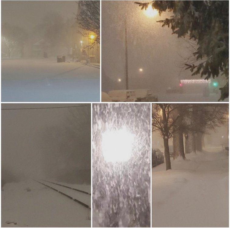
-
Feb 3rd - 5th Potential strong stm threat
michsnowfreak replied to Brian D's topic in Lakes/Ohio Valley
Just awesome out here tonight. Heaviest snow rates I've seen in a while. Thundersnow in spots.


-
Feb 3rd - 5th Potential strong stm threat
michsnowfreak replied to Brian D's topic in Lakes/Ohio Valley
I did not see thundersnow but I was out driving it and you could not see anything. Picked up 3" in the 1st 1.5 hours as a 15 minutes ago -
Feb 3rd - 5th Potential strong stm threat
michsnowfreak replied to Brian D's topic in Lakes/Ohio Valley
can't see anything driving. it's awesome. easily 2+/hr in that band -
Feb 3rd - 5th Potential strong stm threat
michsnowfreak replied to Brian D's topic in Lakes/Ohio Valley
omg talk to text acting up -
Feb 3rd - 5th Potential strong stm threat
michsnowfreak replied to Brian D's topic in Lakes/Ohio Valley
Snow literally came in like a wall of heavy snow just as models advertised. Snow literally came in like a wall of heavy snow just as models advertised. Sticking immediately to pavement and it's not even wet snow, looks more powdery. -
Thanks! I was thinking northern lower since it's closer.
-
Feb 3rd - 5th Potential strong stm threat
michsnowfreak replied to Brian D's topic in Lakes/Ohio Valley
Hope you feel better. Too bad your sick this could be one where you really want to video the rates -
Winter 2020-21 Medium/Long Range Discussion
michsnowfreak replied to Hoosier's topic in Lakes/Ohio Valley
model huggers never learn -
Feb 3rd - 5th Potential strong stm threat
michsnowfreak replied to Brian D's topic in Lakes/Ohio Valley
that's sarcasm I hope lol. It's gonna rip snow and will probably end as drizzle. Even conservative DTX said that -
Feb 3rd - 5th Potential strong stm threat
michsnowfreak replied to Brian D's topic in Lakes/Ohio Valley
Heavy snow band looks to roll through the Detroit area between 7 and 10:00 p.m. this evening -
New York would be fun during a storm but afterward your talking about a bunch of dirty snow & immediate melting. Brother lives in Chicago, theyve been kind of due, esp on the lakeshore, so I can't hate. Jokes aside the entire state of Michigan should be a frozen Winter wonderland but I really think some of the Lake effect could be epic in spots.
-
Feb 3rd - 5th Potential strong stm threat
michsnowfreak replied to Brian D's topic in Lakes/Ohio Valley
Incredibly I saw thundersnow 3 times during the 2007-08 Winter and that was after being royally screwed on the actual January 1st storm. Also saw thundersnow GHDI but not GHDII (even tho ghdI saw 10" and ghdII saw 17"). I also saw it February 20, 2014 and with a squall Feb 1 2017. I believe that was the last time. -
will Gaylord proper be too far east? supposed to head north in a few weeks. What would you recommend is the best spot based on the upcoming setup?
-
Feb 3rd - 5th Potential strong stm threat
michsnowfreak replied to Brian D's topic in Lakes/Ohio Valley
could be really heavy snow for a few hours this evening. Snow will probably end as drizzle then flash freeze.