michsnowfreak
-
Posts
18,382 -
Joined
-
Last visited
Content Type
Profiles
Blogs
Forums
American Weather
Media Demo
Store
Gallery
Everything posted by michsnowfreak
-
The 1st week of January is going to be a torch there is no doubt about it. But that has absolutely nothing to do with the rest of the season
-
There's been no sun here in a while. Christmas was overcast with snow falling most of the day. I don't mind the overcast
-
Definitely muted due to a number of reasons. Mainly lake influence and a constant low overcast/snow, but also timing of the front. The high end December 23rd was 34 at midnight. Temperatures hovered between 0 and 1゚ for most of the day into the overnight of the 24th.
-

Historic Christmas Lake Effect Blizzard
michsnowfreak replied to BuffaloWeather's topic in Upstate New York/Pennsylvania
I think it goes without saying that this was more severe than your November storm despite November being the epic total. Kudos for getting a measurement and not giving up lol. I had a hard enough time here with 8 to 10" snow drifts in my yard with other spots 1". It would be very easy to inflate or low ball snow in those winds but I know you take care in your measurements. -
Season to date snowfall imby 8.0" (Nov 2.9, Dec 5.1) and DTW 7.5" (Nov 2.5, Dec 5.0). I'm thinking they finish right around to very slightly warmer than average for Dec. No surprise, it's been an extremely overcast December. Through the 25th average sky cover is 9.2 out of 10.
-
The high of 16 at Detroit made for the 5th coldest Christmas high temp yesterday. A winter wonderland for a week before the torch hits. Judah Cohen likes a return to cold after the first week of Jan.
-
Winter 2022/23 Short/Medium Range Discussion
michsnowfreak replied to Chicago Storm's topic in Lakes/Ohio Valley
Oh. I'm sorry I misread that. I thought you meant DTW was 79% of average. I have a friend in Livonia who can attest to getting less than DTW/downriver last winter. And again so far this year with the Nov and Dec events so far. I'm sure it's a blip though. You should not avg less than the small spot in Macomb Co or algonac which averages a bit less. -
I went 2.4 on Dec 23 0.3 on Dec 24 2.0 on Dec 25
-
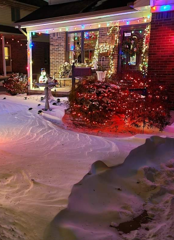
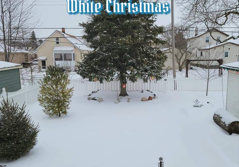
I was hoping that band would sink to the 94 corridor but was shocked to wake up to 2 fresh inches here. It was an even blanket covering the other drifty snow, it really was a Courier and Ives White Christmas. 3rd time in 6 years we wake up to fresh white Christmas morning.
-
Pre-Christmas (Dec 21-23rd) Winter Storm Part 2
michsnowfreak replied to Chicago Storm's topic in Lakes/Ohio Valley
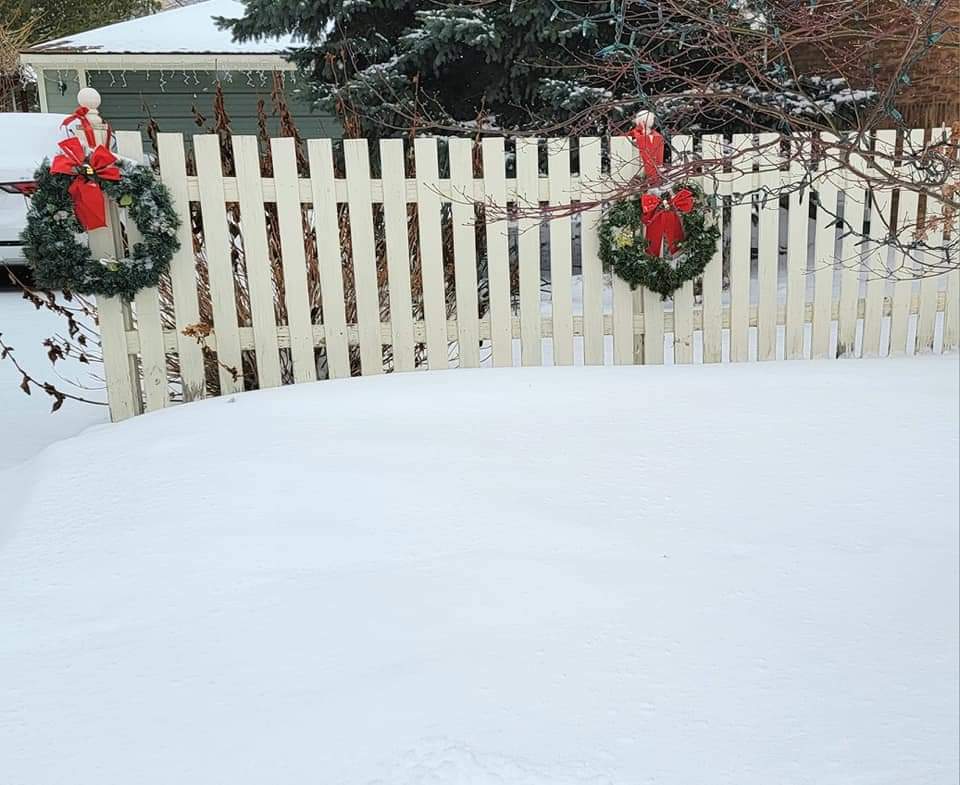
Exactly. This was my mom's house yesterday
-
Merry Christmas everyone! It ended up snowing all night unexpectedly thanks to lake Michigan. Picked up 2.1" of fluff overnight into this morning. My mom said when she got out of midnight mass it was a Christmas postcard. The high ratio fluff covered up the low ratio sugar and drifts to make for a beautiful white Christmas.

-
What a nice Christmas surprise. After 2 days of nonstop blowing snow, the winds calmed down and we picked up 1.5" of snow overnight via Lake MI. The fluffy topping on the drifty snow makes for an absolutely beautiful white Christmas
-
Winter 2022/23 Short/Medium Range Discussion
michsnowfreak replied to Chicago Storm's topic in Lakes/Ohio Valley
DTW finished at 47.1" last winter. Not sure what you mean 79%. That is an interesting thought though, it condensed Winter. Winter lasts so long overall but it's not continuous. Would be interesting if we crammed everything into a couple months. -
Winter 2022/23 Short/Medium Range Discussion
michsnowfreak replied to Chicago Storm's topic in Lakes/Ohio Valley
I think mimillman was being sarcastic lol. Last 3 winters have been around average at Detroit snowfall wise, and the last 2 near average snowcover. Just very Feb based (ie much snowier/whiter in Feb than avg to counter the dull parts of winter). I, like you am a snowcover person. There is no longterm decline in snowcover at all, but of course we are still fairly fresh off the record snowcover 2013-15. -
Winter 2022/23 Short/Medium Range Discussion
michsnowfreak replied to Chicago Storm's topic in Lakes/Ohio Valley
@Mimillman, here's the graphic. Wonder when they will release 1991-2020. -
Winter 2022/23 Medium/Long Range Discussion
michsnowfreak replied to Chicago Storm's topic in Lakes/Ohio Valley
January has been more the wild card. Certainly snowier tham Dec, but we are due for a snowy Jan. The theme hast been AN snow in November, February, & April and BN in December and March. But as hoosier said, we can't always count on Feb to be rockin. One of these years it won't be (likewise one of these years we will get a snowy December again). -
The location is perfect, the price was beyond reasonable, and I have a view of lake superior from my backyard.
-
I'm staying in a vrbo near L'anse Feb 16-20. Can't wait! An additional mood dusting today but the LES is just dust here. At least it's a White Christmas!
-
It's a cold white Christmas in the Midwest, but whatever the weather, may all my fellow weenies and their families/friends have a very Merry Christmas!
-
Winter 2022/23 Short/Medium Range Discussion
michsnowfreak replied to Chicago Storm's topic in Lakes/Ohio Valley
Hmm where did I hear "anyone can paint brush their own snow map". That map doesnt include most of yesterday's snow actually. Not sure why you follow maps anyway. You are proven wrong time and time again with them and then when you are, you simply resort to a generic "we suck". Over the years youve managed to find something wrong with every snow record, snowstorm, etc that occurs, and usually your gripe is with the conditions. Well yesterday the conditions were legit. When it's pointed out how Detroit has had more 6"+ storms last 20 years and a higher average than most non belt Midwest cities, you have to go back to the big dog obsession which no one outside buffalo has had. -
Pre-Christmas (Dec 21-23rd) Winter Storm Part 2
michsnowfreak replied to Chicago Storm's topic in Lakes/Ohio Valley
I agree. The constant drifting is just insane. While it's impossible to be precise due to the flash freeze and temperature drop, I'm thinking the ratios were less than 10 to 1 on the snow here. I got a total of 0.57" liquid snowfall of 2.4", but the rainfall portion was approximately 0.25-.30". Were going on 30 hours now where "blowing snow" has been a part of nearly every observation. Official totals were 2.2" at Detroit and 4.5" at Flint. -
Pre-Christmas (Dec 21-23rd) Winter Storm Part 2
michsnowfreak replied to Chicago Storm's topic in Lakes/Ohio Valley
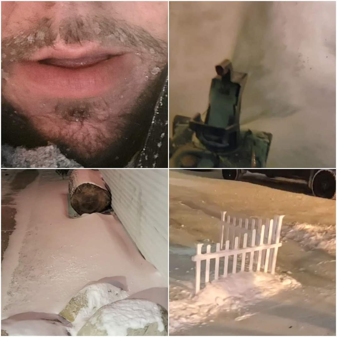
Per friend in Livonia it seems like you guys got a little less snow than here. But conditions were just brutal all day. Havent seen constant blowing/drifting like this in years. It definitely made for a "North Dakota" like day as was joked about earlier. Going with storm total of 0.57" precip on 2.4" snow here. Some very impressive drifts while driving around, Some of the roads that have been plowed have big snow banks that would make it look like a big snowstorm, but then you see the fields that are scoured of snow. Winds gusted between 45 and 50 miles per hour all day, temperature hovered right around 0 and wind chills hovered around 30 below. Again, give me a run of the mill 6 to 10" snowstorm any day over this, but it was definitely a fun and unique weather day. Snow blowed some of the drifting out of my driveway and ended up with icy facial hair.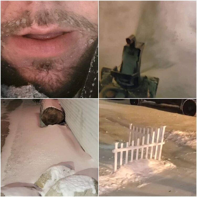
-
Pre-Christmas (Dec 21-23rd) Winter Storm Part 2
michsnowfreak replied to Chicago Storm's topic in Lakes/Ohio Valley
Very interesting. Most of the roads here are snow covered/drifted/rutted and slippery -
Pre-Christmas (Dec 21-23rd) Winter Storm Part 2
michsnowfreak replied to Chicago Storm's topic in Lakes/Ohio Valley
Bingo. My sister went out to pick up a piece of her mailbox that flew off in the wind lol, and discovered she had quite the artistic decoration in front of her house. Like I said. It is really cool to see the wind and the constant blowing snow, but next time just giving me an even deep blanket. -
Pre-Christmas (Dec 21-23rd) Winter Storm Part 2
michsnowfreak replied to Chicago Storm's topic in Lakes/Ohio Valley
Grass would be poking through no matter how much snow you've got. It's legit outside. It's cool to see but I'm definitely more of an even blanket of snow type of person then these blizzardous winds. My backyard has grass tips in spots and 3 to 6" in other spots