

michsnowfreak
-
Posts
18,458 -
Joined
-
Last visited
2 Followers

About michsnowfreak

- Currently Viewing Topic: 2026-2027 Super El Nino
- Birthday 05/08/1983
Recent Profile Visitors


.thumb.gif.f92b16c631a1d15d405ed77b33f0710d.gif)


-

2026-2027 Super El Nino
michsnowfreak replied to Stormchaserchuck1's topic in Weather Forecasting and Discussion
People always focus on a total anamoly too much as well, warm or cold. Do you know how long a winter season is and how many fronts, systems, etc will be occurring during the season? Even if someone nailed a forecast seasonal anamoly, theres no way to tell whats going to happen with the actual weather. -
2026-2027 Super El Nino
michsnowfreak replied to Stormchaserchuck1's topic in Weather Forecasting and Discussion
1951-80 stable? By stable you mean coldest because it had the abnormally cold 1960s and especially 1970s? The 1950s were way warmer than the 1970s, so i dont see how that's "stable". How about we just use 1931-60 normals. -
2026-2027 Super El Nino
michsnowfreak replied to Stormchaserchuck1's topic in Weather Forecasting and Discussion
You know the drill lol. The summer of 1987 through July 31st was hotter at Detroit than the summer of 2026. Since winter all we hear about is the conus avg. Forget regional weather patterns or local weather. Its wild that weather, on a weather board, is now constantly overshadowed by a singular average temp for the United States. -
2026-2027 Super El Nino
michsnowfreak replied to Stormchaserchuck1's topic in Weather Forecasting and Discussion
Some assume theres some linear connection with the strength of nino and how warm it will be and simply ignore everything else. -
2026-2027 Super El Nino
michsnowfreak replied to Stormchaserchuck1's topic in Weather Forecasting and Discussion
97-98 wasnt the disaster here that it was on the east coast, but it was one of the last strong Ninos Id pick, only '82-83 was worse. Interesting about '97-98 is that it was front-loaded and Feb was a shutout. mid Nov to mid Dec was actually decent. So was the 2nd half of Jan. Everything else sucked. Shittiest strong Ninos locally: 1982-83, 1997-98, 2023-24 Best strong Ninos locally: 1877-78, 1972-73, 2015-16 At Detroit, the least snowy strong Nino is 1982-83 with 20.0" and the snowiest 45.0" in 1972-73. -
2026-2027 Super El Nino
michsnowfreak replied to Stormchaserchuck1's topic in Weather Forecasting and Discussion
My sister was born July 18, 1991. I was 8 years old and I remember how brutally hot and humid it was. My mom always talks about how it was so hot when she was born. -
I got 0.37". Honestly more than I expected.
-
Wow we really dodged this heat. 88 at DTW today should be hottest of the week.
-
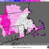
2026-2027 Super El Nino
michsnowfreak replied to Stormchaserchuck1's topic in Weather Forecasting and Discussion
Those are neat snow maps. Any idea how far back they go? I tried populating 1972-73 and it wouldnt load. -
2026-2027 Super El Nino
michsnowfreak replied to Stormchaserchuck1's topic in Weather Forecasting and Discussion
Yeah thats a good point. Ive heard the average that 1" of sleet is about 3" of snow. Every location has its nuances. Up here, you get so many mood flakes that dont show in any aspect of the weather stats. In any given snow season, there will be approximately 35-45 days with a Trace of snow in addition to all the measurable snowfall. Its what happens in a Great Lakes climate. So "how many times did it snow last winter" is never a valid question here for determining winter severity. In the south, a disproportionate amount of wintry precip is ice vs snow, which is unfortunate for snow lovers because I imagine the mindset is "hey, its finally cold enough to snow, why is it raining?". -
2026-2027 Super El Nino
michsnowfreak replied to Stormchaserchuck1's topic in Weather Forecasting and Discussion
Just a suggestion if you guys make future snow maps closer to winter. It usually helps if you give a rough % of average to go in line with your thinking. I knew what raindance was getting at with the snow map (admittedly just a preliminary joke map rough idea) but it always looks funny when you see something like "snowy" in Atlanta and "not snowy" in Marquette. -
Let's not forget....I LOVE Fall. So as much as I love winter, not yearning yet. However, July 5th starts my annual "bring on Fall" attitude.
-
So nice to let fresh air in the house! Beautiful day. Very low humidity, 50s to start rising to the mid 70s.
-
2026-2027 Super El Nino
michsnowfreak replied to Stormchaserchuck1's topic in Weather Forecasting and Discussion
See my above post- almost EXACTLY what I was trying to say! I have lots of trees in my yard, drive a fuel efficient vehicle, work from home, recycle...I do my part. And I frankly could not care less about a warming planet. I have 4 distinct seasons regardless of ENSO or anything else. This year I have had wind chills to -40F and heat index to 105F, air temp from -10F to 98F. Most years have a similar range. Much like the east coast with its noreasters, its fascinating to see how often and how many ways the Great Lakes influence weather. If ALL of that is overshadowed by "but we are warming 0.5F per decade"....well, tell me youre not a weather enthusiast without telling me. -
2026-2027 Super El Nino
michsnowfreak replied to Stormchaserchuck1's topic in Weather Forecasting and Discussion
I agree with that, especially forecasting-wise. But I was more referring to it in past tense. Everytime anyone brings up this past winter's cold, like clockwork, the post gets dissected by the same few discussing warmth in the west/CONUS/globe etc. It really seems that a few of the warmistas have that chip on their shoulder. You should be able to use the words cold/snow WITHOUT prefacing "yes i know the worlds getting warmer" every single time. I was a weather observer before I had the internet, and I knew my local climate data history before I know how to read a single model map. Ive always thought it was cool to look into trends of local weather, and living in a place with extreme seasons, it's neat to see subtle trends that dominated decades past and how theyve changed for the better or the worse. I dont care if last winter was an inferno in the entire world, I will remember what happened here, and here it was a cold, white winter. Glittery snow for months straight gets an A+ for scenery/feels, but there is zero doubt in mind that the cold pattern that dominated the region was PROHIBITIVE to heavier snowfall here. So yes, Im saying if I wanted more snow in last years pattern, I actually needed it warmer. And of course the same rings true for the opposite. If its a colder CONUS winter, it wont mean a damn to me if I get a mild winter.


