

Terpeast
-
Posts
6,592 -
Joined
-
Last visited
Content Type
Profiles
Blogs
Forums
American Weather
Media Demo
Store
Gallery
Everything posted by Terpeast
-
Very slight dusting, enough to call it a trace
-
Light snow but no dusting yet
-
Flurries in ashburn. 28
-
Haha don’t hold your breath
-
I wouldn’t take AI too seriously when it comes to thermals. While they do pretty well at upper level verification, they actually do poorly with temps.
-
Probably an erroneous thing. Might be gone next run
-
I can only speculate. They might be worried behind closed doors, but also constrained in what they can do.
-
I do, but its through my job. We compare AI models with all other NWP models in the 1-5, 6-10, 11-15 day ranges.
-
AIFS is smoking the GFS in the 6-15 day verification scores Edit - even blows GFS out of the water in 1-5 day scores, wow
-
GFS might suppress this one, but might be overdoing the cold/PV again like it did last time.
-
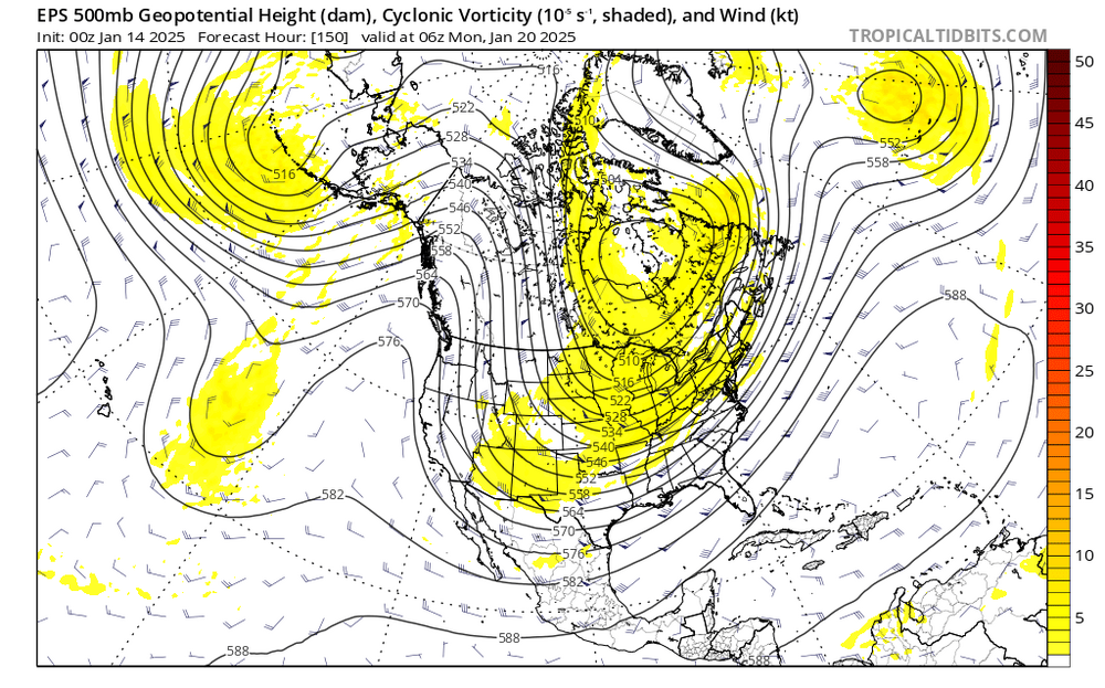
And here comes another s/w. Four corners at hr 150
-
Just fringed us, but this wasn't there since 12z yesterday. Very close miss. Won't take much to shift it to a 2-4/3-6" hit
-
18z GFS trying to brew something off the coast. Light snow to the SW of us Sunday afternoon
-
Like I said… Euro’s bazooka.
-
Unlike the last storm, there is nothing to prevent it from trending NW as psu alluded to the other day. hardly any blocking over greenland, s/w energy hanging back west. That PV is pressing south, but one tiny shift the other way, the track is coming north. And you want a proverbial reshuffle? Careful now… you might get a SE ridge with that.
-
Agree. Love what the 18z euro is showing. Looks like it’s loading up its bazooka and aiming it right at us.
-
My mby station maxed at exactly 50 degrees today. Now 40 and dropping. On clear days, it is one of the lowest at night and one of the highest in full sun. that said, snowpack is still decent. 85-90% coverage with bare ground being south facing inclines.
-
It’s gonna be a long week. Maybe not a bad idea to sneak in a checkup with the doc? (I’m actually gonna do the same…)
-
34 with cloud cover, dews at only 22. If the cloud cover holds, the snowpack should hold, too. What's left after today will remain for the rest of the week.
-
Pretty big changes. Lots to resolve yet. This is going to be one of those cases where models won’t have anything pinned down until inside 96 hours or so
-
Low of 19 so far
-
Yeah, their stats only compare the AIFS with the other AI models, but not the NWP models. I usually like to compare AI vs NWP of the same model family (Euro AI vs NWP, GFS AI vs NWP, etc). That’s where I got my assessment from.
-
Wouldn’t be surprised if this went into OT
-
23.4 so far for the low


