Terpeast
-
Posts
6,754 -
Joined
-
Last visited
Content Type
Profiles
Blogs
Forums
American Weather
Media Demo
Store
Gallery
Everything posted by Terpeast
-
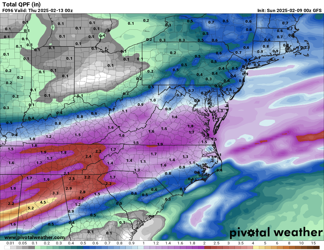
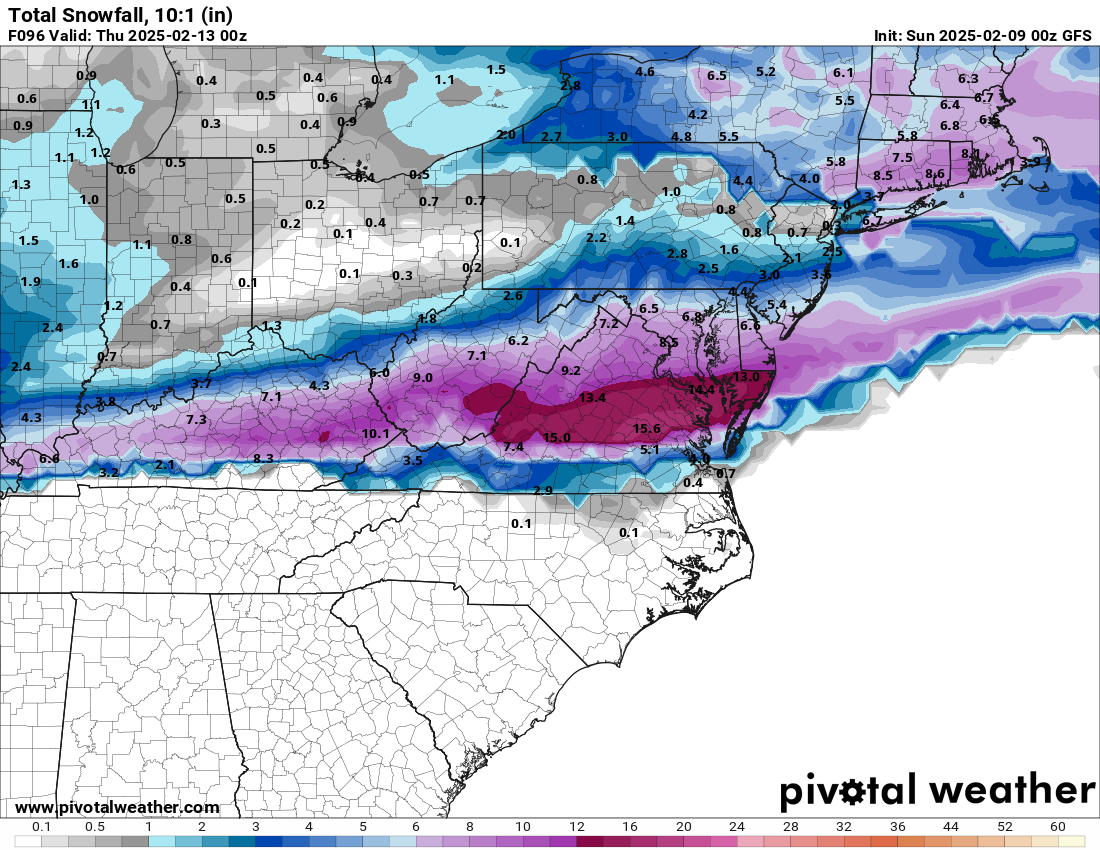
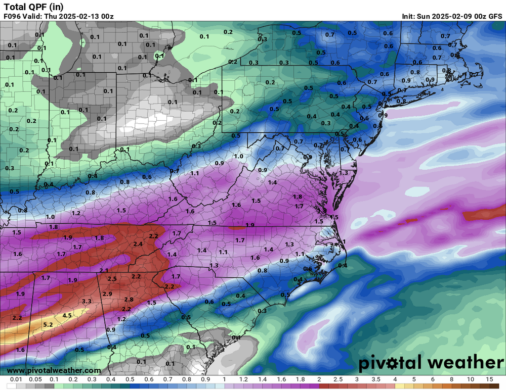
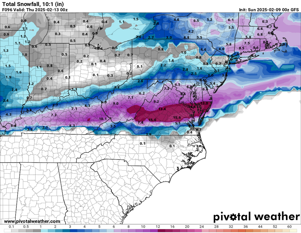
Qpf 10:1
-
Wetter. Good slug of moisture thru TN
-
At 63, more moisture and beefier precip shield
-
NAM shifted north too, at least with the precip shield
-
Not much difference in track vs recent runs of other models
-
Just loving this board. When models trend south, we say it’s not coming back north and bail from the storm. Then the second models shift north, we say it’s gonna go all the way to PA.
-
Pretty big shift north by the euro, or at least the northern extent. CMC has also the mix line coming up to DC and slightly north. It’s not over yet, folks.
-
I wouldn’t attempt driving in this for sure
-
Gefs 18z was nearly identical to 6z. Still windshield wipering a bit.
-
We’d need that 1051 high to reinforce cold air as that low gets east, or it’ll be mix to rain for all of us. Still time
-
Haha well more like baby icicles off my deck chairs and grill cover. They were so small and “cute” that when I showed them to my 4 year old daughter, she laughed like she saw the funniest thing
-
31. Rain. Icicles forming
-
6” line bisecting DC w to e. Probably translates to 4” otg
-
Probably best to let the CAMS figure out the thermals a bit closer in. We have a 1036 high up top
-
Looks like the second slug idea might have legs
-
Freezing rain. Seeing small amounts of accretion on the deck. 32
-
I agree with this.
-
12/24: 0.1” 1/3: 0.3” 1/6: 7.6” 1/11: 1.3” 1/16: 0.5” 1/19: 2.0” 2/8: 0.1” Season total: 11.9”
-
Drizzle. 34
-
Yeah, I think its gonna be somewhere in the middle, maybe probably a bit less than the middle. Will be interesting to see what the euro shows today.
-
Like I said, models seem to be converging on a 2-4/3-5er DC metro with a little more south, less north
-
I think a reasonable expectation for DC metro and surrounding burbs is half of gfs output. 2-4” areawide with 5-6” at ezf. I’d always leave the door open for a more expansive shield on the north side though. I would never count that out.
-
Looks same as 6z. Mostly noise imho
-
Deck starting to get dusted
-
Light snow/sleet