Terpeast
-
Posts
6,618 -
Joined
-
Last visited
Content Type
Profiles
Blogs
Forums
American Weather
Media Demo
Store
Gallery
Everything posted by Terpeast
-
Torrential now
-
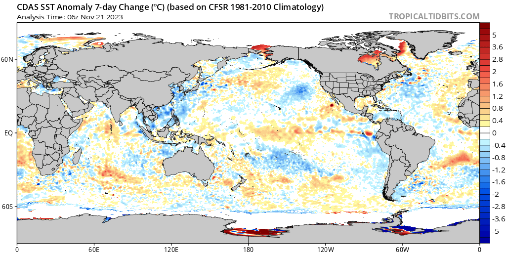
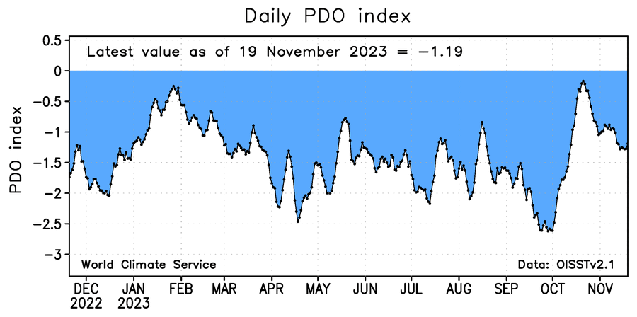
Not quite, but maybe it should have. PDO was positive that winter, but came after a triple nina -PDO just like this year. QBO was positive though. Solar max, too (we’re close to it now).
- 1,295 replies
-
- 2
-

-
- wishcasting
- almost winter
- (and 1 more)
-
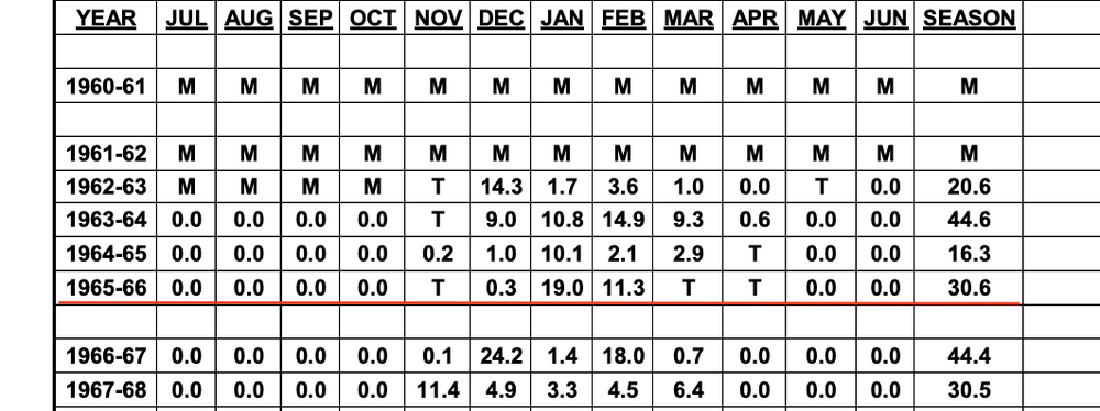
I think the nino will eventually win this battle royale. although Ji correctly pointed out 72-73 as an analog, it was east based. This nino is not. Besides 72-73 was near normal temp wise. Just bad luck we missed a blizzard to the south of us. The better analog in my opinion is 65-66. Also 2009-10 is not off the table either, though I’d want to see what the next MEI comes in… and what the MJO does into mid-late dec.
- 1,295 replies
-
- 2
-
-
- wishcasting
- almost winter
- (and 1 more)
-
1.2”
-
Yeah we’re losing the marginal events no question about that.
-
Yeah, 10 days before meteorological winter.
-
I know we're all rooting for PSU to get his first inch by December, but I think in an El Nino year with 65-66 being one of the top analogs, we have a bit more leeway. The first inch didn't happen until January in both IAD and BWI. So this may be an exception to the rule. Stay off the ledge until at least January 15. And then do whatever you want after that date if we don't see any snow by then... but do so at your risk! If you get hurt or worse, don't sue me.
- 1,295 replies
-
- 3
-
-
- wishcasting
- almost winter
- (and 1 more)
-
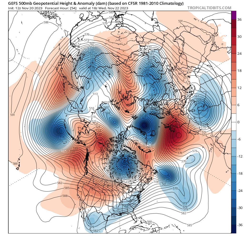
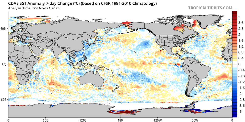
Great sign if centered east of the dateline. That should be the driver instead of the MC forcing we've seen in the past several years.
-
At least the STJ is there.
- 1,295 replies
-
- 2
-
-
- wishcasting
- almost winter
- (and 1 more)
-
0.8" now, heavier rain
-
Although we may see a milder spell first half of december, the STJ is there. Nino is starting to flex.
- 1,295 replies
-
- 6
-
-
- wishcasting
- almost winter
- (and 1 more)
-
0.4” so far, mod rain
-
Or they could juice snowfall totals if just cold enough.
-
I may have called the nino peak too early, definitely coming in higher now than October. At least this will shift the forcing east of the dateline, with cooling over the MC. (Yes we’re seeing the MC burp a little bit, but I don’t see that lasting) PDO remains a bit stubborn, but I stand by my assessment that nino will win overall.
-
Temp was 38 when rain started falling. 2 months later, this would be a thump to rain event
-
Yeah, he’ll be fine. He’s turning over a new leaf. Right, Ji?
- 1,295 replies
-
- 3
-
-
- wishcasting
- almost winter
- (and 1 more)
-
We need this
-
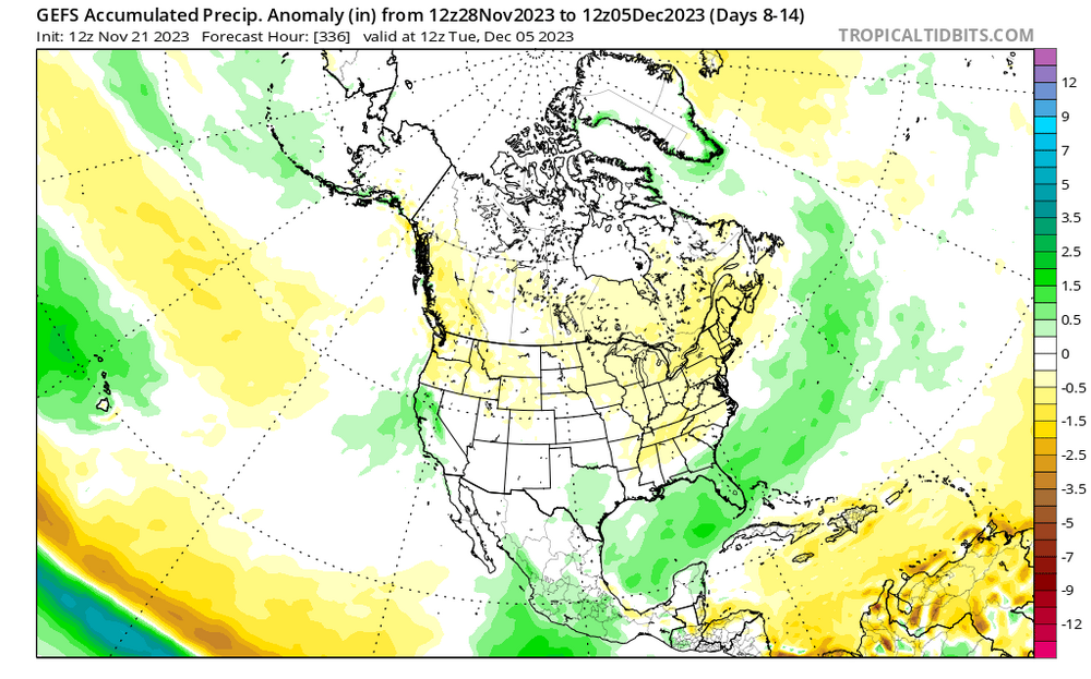
And if we're going to get MC forcing or 4-6 MJO, I'd rather get that now into mid-Dec, so then it circles over into 7-8-1-2 and sets us up nicely. Plus that second wind by this nino should also overpower the -PDO
-
I thought you know better than not to feed the trolls...and Twitter is full of em
-
36/30 (not that I'm expecting anything)
-
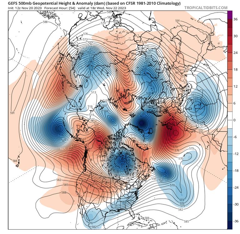
Looks cold and dry and transient though. Still all over the place from run to run
-
PDO appears to be bottoming out again locally. New aleutian low taking place in the short term with strong ridging over the west. I wouldn’t be surprised to see the PDO come back up, and the recent nino3.4 rise will also support the PDO rise. (I may have been wrong about the nino peaking in November, but it’s too soon to tell whether this is a OND peak or a NDJ peak)
-
Nice. Wonder how that’ll evolve. Maybe that EC trough turns into a 50/50 while the wave off the west coast undercuts the pna to give us an overrunning event. But that’s wishcasting at this range.
- 1,295 replies
-
- 2
-
-
- wishcasting
- almost winter
- (and 1 more)
-
I wonder if the 2-3.9” gap is due to sampling, or is actually an artifact of a front-loaded La Nina winter.
-
I wonder what the results will look like if the BWI dataset is used instead. Much longer record than IAD and better siting than DCA. I could do it, but I’m researched-out after doing my outlook. Even thinking next time I do an outlook or project future winters, I’ll use BWI data instead. Snowfall is so similar between BWI and IAD, these two often can be interchanged