HKY_WX
-
Posts
3,246 -
Joined
-
Last visited
Content Type
Profiles
Blogs
Forums
American Weather
Media Demo
Store
Gallery
Everything posted by HKY_WX
-
Trend is pretty clear on the shortwave out west. It's slower every run and further west. This run is basically a Miller B Snow to Icestorm
-
Agree with this. That shortwave will likely decide the fate of the RN/SN line and where it sets up. The orientation will be more SW to NE with more phasing as opposed to a March 1980 murphy to manteo I40 type storm.
-
This is just a rough guess at this point. No specifics. Given we're talking about primarily Polar Jet driven Upper Low with some STJ moisture tap, it's certainly possible snow could be farther south into GA/SC. Especially on the backend.
-
Thx brotha. Here's my prelim thoughts. HP orientation favors Ice over upstate SC and southern NC. I think the gefs has a good handle thus far on the setup.
-
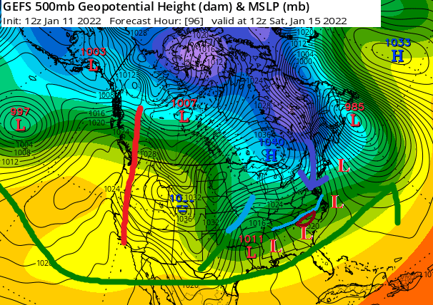
Been watching this pattern since the models started showing PNA ridge/split flow setup midweek last week. There's reason to be optimistic given the setup. If you look at the GFS ensemble mean 500mb pattern at day 4 from 12z, that pattern will produce a major winter storm in the southeast/southern mid-Atlantic probably 9 out of 10 times. Of course we can always screw it up lol.
-
Wind is next level this morning
-
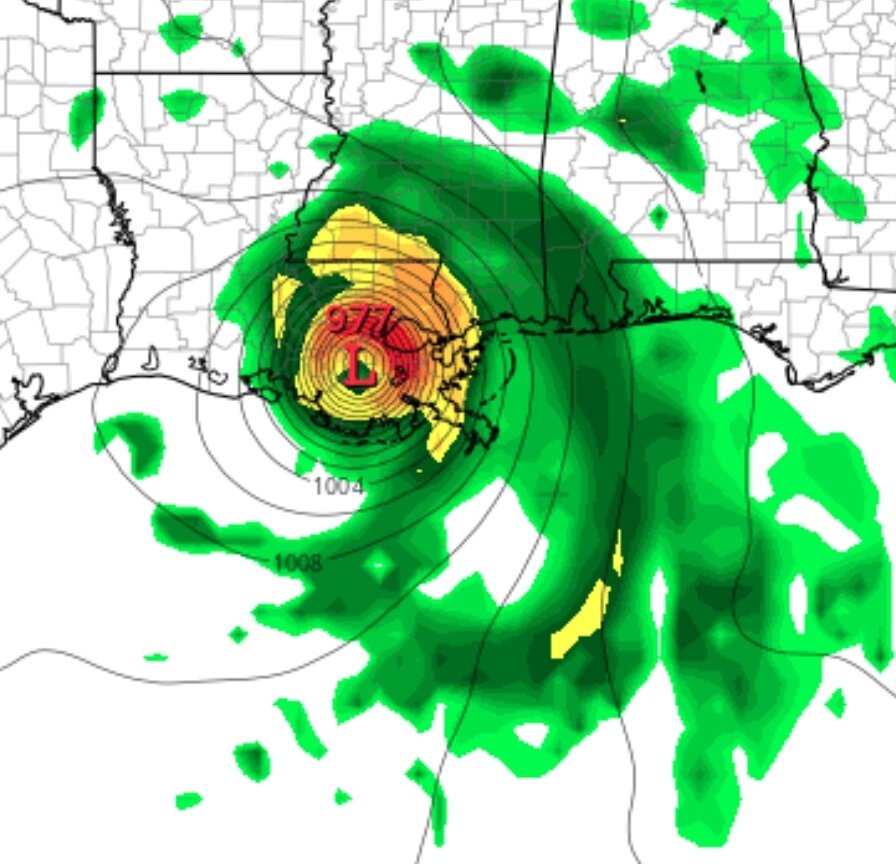
This storm will likely permanently alter the state map of SE Louisiana. Some of these marshes will now be part of the GOM
-
Normally the hallmark of a poleward turn. It's starting to feel the weakness in the ridge.
-
What I'm thinking
-
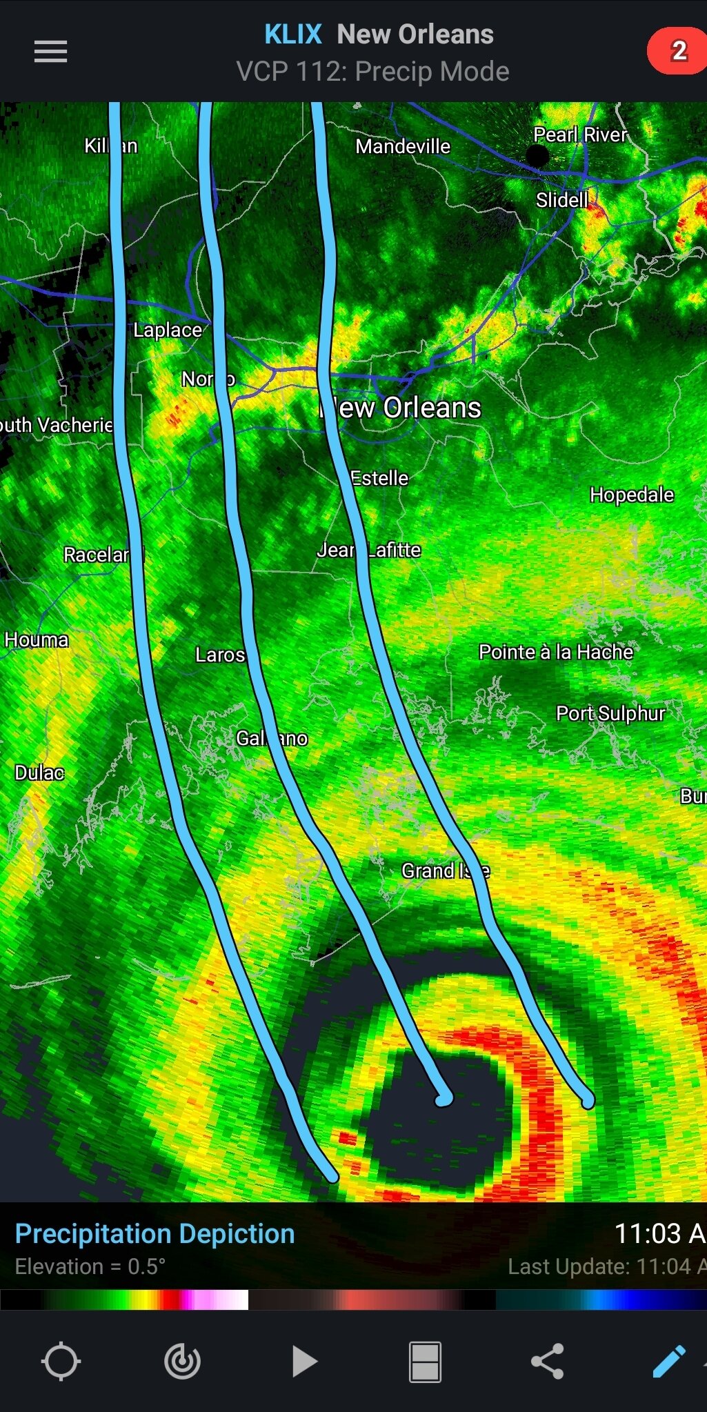
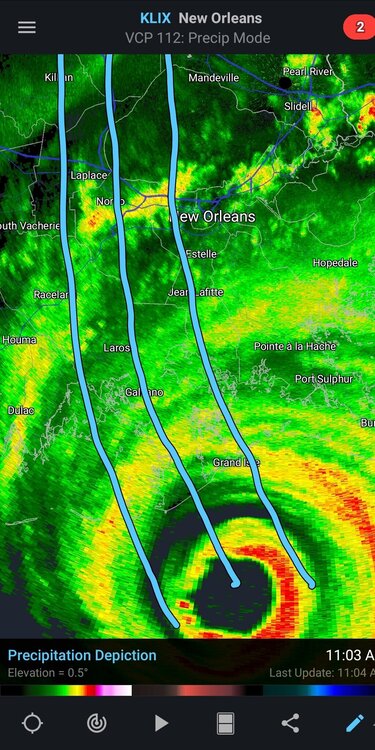
Looks to me, the eye will head up hwy 1 and scrap the west side of lake pontchartrain.
-
I guess they wanted to test their swimming skills. Can't think of another reason to stay on a remote island in LA with a Cat 4/5 approaching. They get the darwin seal of approval.
-
Gfs is a devastating run. Even slows it down w the turn
-
Yikes
-
Pretty significant jump again. Considering the timeframe. Def puts western parts of New Orleans in the eyewall
-
Looking pretty bad azz now
-
Getting lightning in the NW eyewall now.
-
It's been a long time since I've seen a sat loop of a strengthening Hurricane with such a low shear environment as Ida. There's nothing remotely close to it to impede intensification
-
The rapid intensification could be overhyped if it doesnt materialize (even though it likely will). From a weather perspective, it could be overhyped. From a life/property perspective you have a point.
-
No 2 storms are ever the same and that's the beauty of wx/forecasting. Ultimately the next 12 to 18 hours and any RI will prob be what determines if this goes down as one of the greats or overhyped.
-
I think I'd evacuate the other direction
-
Good points. But who knows what's in store intensity wise tonight and tomorrow.
-
Euro tracks it just west of lake pontchartrain now. Lawd help those folks
-
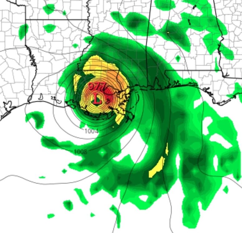
Euro and gfs ticked east at 12z. To me, this is Prob the most important 36 hours of hurricane watching since 05. A storm this size moving in this direction is going to pile up sooo much water in La and even MS. This is the storm slosh models were invented for.
-
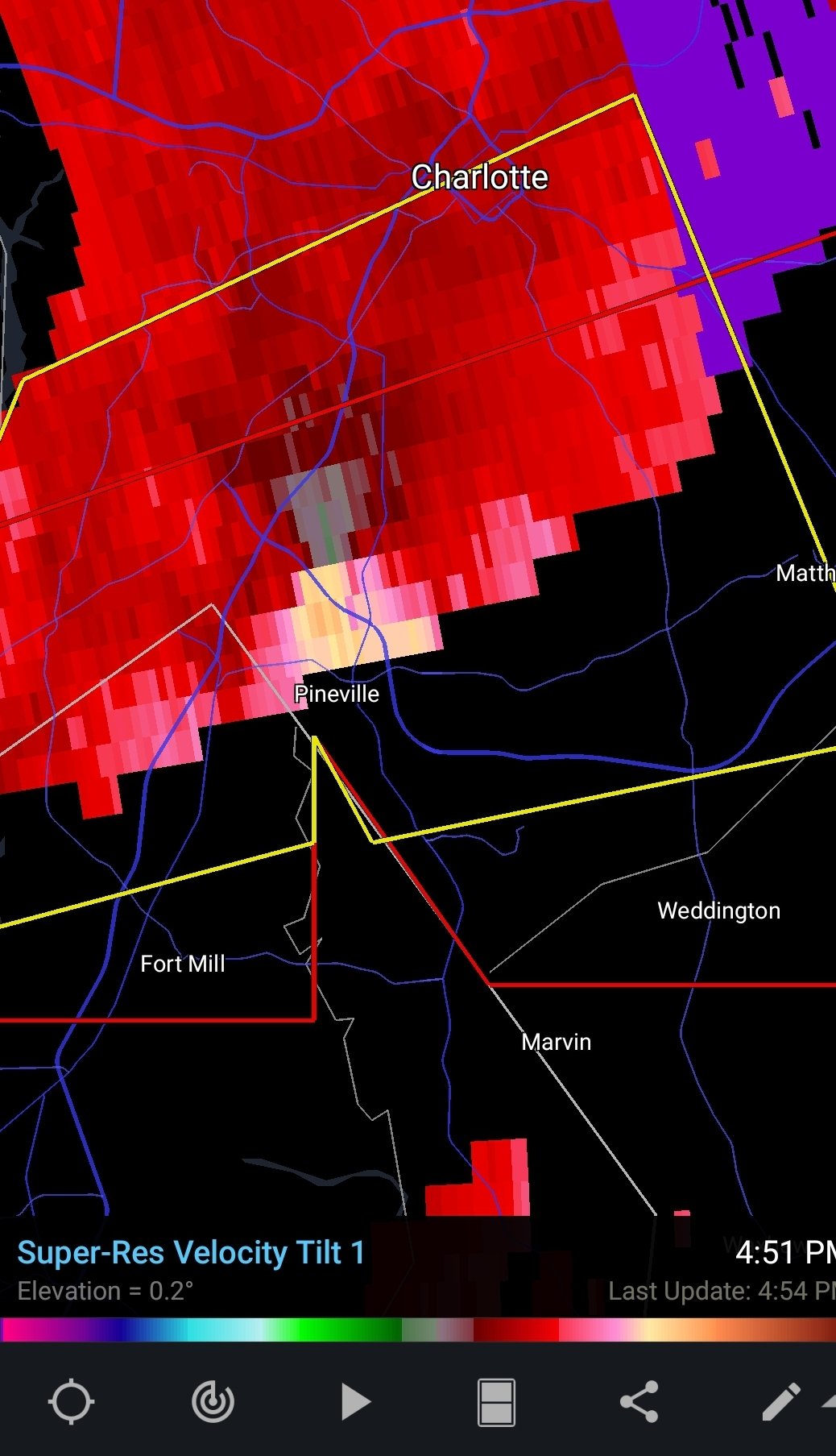
Havent seen any funnel cloud or tog reports yet for the charlotte cell
-
Tightening up